Captain Cook is a census-designated place (CDP) in Hawaiʻi County, Hawaiʻi, in the United States, located in the District of South Kona. The community, within the land division of Kealakekua, is so named because the post office for the area was located in the Captain Cook Coffee Co. during the early 1900s. As of the 2010 census the CDP population was 3,429, up from 3,206 at the 2000 census. As of March 2022, a resolution was under consideration to rename the town to “Kawa’aloa”, meaning “long landing place”.
| Name: | Captain Cook CDP |
|---|---|
| LSAD Code: | 57 |
| LSAD Description: | CDP (suffix) |
| State: | Hawaii |
| County: | Hawaii County |
| Elevation: | 1,250 ft (381 m) |
| Total Area: | 12.86 sq mi (33.30 km²) |
| Land Area: | 12.86 sq mi (33.30 km²) |
| Water Area: | 0.00 sq mi (0.00 km²) |
| Total Population: | 3,253 |
| Population Density: | 253.03/sq mi (97.70/km²) |
| ZIP code: | 96704 |
| Area code: | 808 |
| FIPS code: | 1503850 |
| GNISfeature ID: | 0358717 |
Online Interactive Map
Click on ![]() to view map in "full screen" mode.
to view map in "full screen" mode.
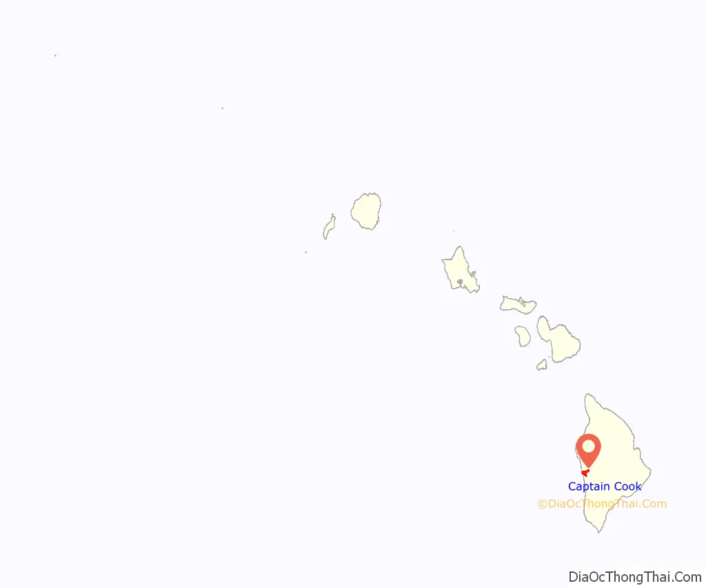
Captain Cook location map. Where is Captain Cook CDP?
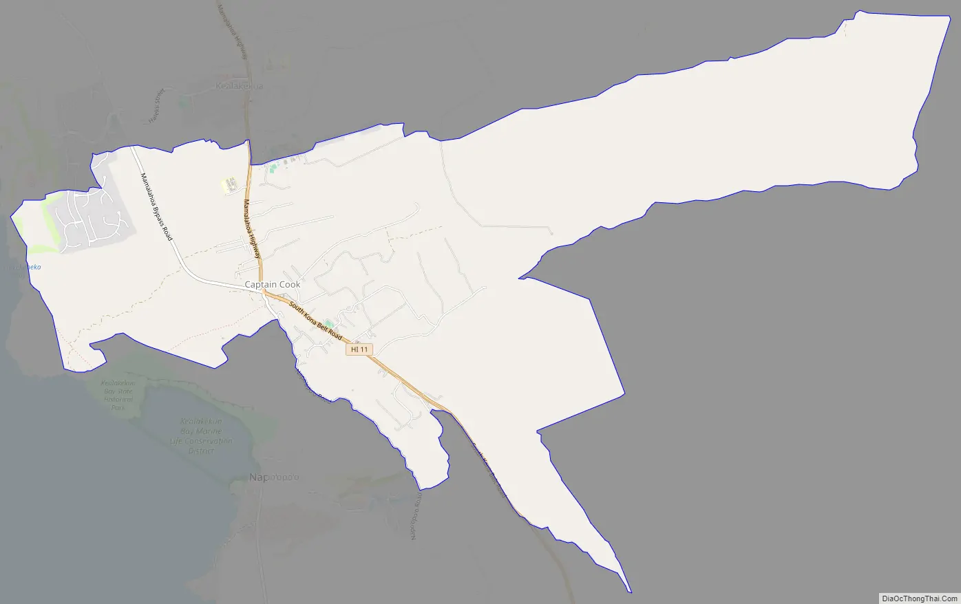
Captain Cook Road Map
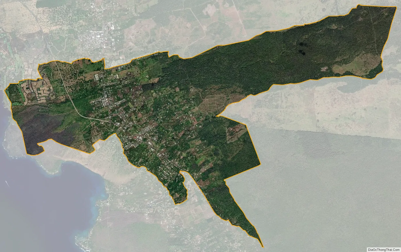
Captain Cook city Satellite Map
Geography
Captain Cook is located on the west side of the island of Hawaii at 19°29′54″N 155°54′15″W / 19.49833°N 155.90417°W / 19.49833; -155.90417 (19.498211, -155.904275). It is bordered to the north by Kealakekua and to the south by Honaunau-Napoopoo. Hawaii Route 11, part of the Hawaii Belt Road, passes through the community, leading north 12 miles (19 km) to Kailua-Kona and south 47 miles (76 km) to Naalehu. Hawaii Route 160 diverges from Route 11 in Captain Cook, leading south by a winding road 4 miles (6 km) to Napoopoo on Kealakekua Bay.
According to the United States Census Bureau, the Captain Cook CDP has a total area of 12.9 square miles (33.3 km), all of it land.
Most of Captain Cook lies between the 800-foot (240 m) and 2,000-foot (610 m) elevation, which makes it ideal as a coffee-growing region. It sits on the top of an ancient fault which created the famous Kealakekua Bay. Prior to the 1960s, most of Captain Cook was part of the vast Kealakekua Ranch, founded in the 1850s by English immigrant Henry Nicholas Greenwell.
See also
Map of Hawaii State and its subdivision: Map of other states:- Alabama
- Alaska
- Arizona
- Arkansas
- California
- Colorado
- Connecticut
- Delaware
- District of Columbia
- Florida
- Georgia
- Hawaii
- Idaho
- Illinois
- Indiana
- Iowa
- Kansas
- Kentucky
- Louisiana
- Maine
- Maryland
- Massachusetts
- Michigan
- Minnesota
- Mississippi
- Missouri
- Montana
- Nebraska
- Nevada
- New Hampshire
- New Jersey
- New Mexico
- New York
- North Carolina
- North Dakota
- Ohio
- Oklahoma
- Oregon
- Pennsylvania
- Rhode Island
- South Carolina
- South Dakota
- Tennessee
- Texas
- Utah
- Vermont
- Virginia
- Washington
- West Virginia
- Wisconsin
- Wyoming


