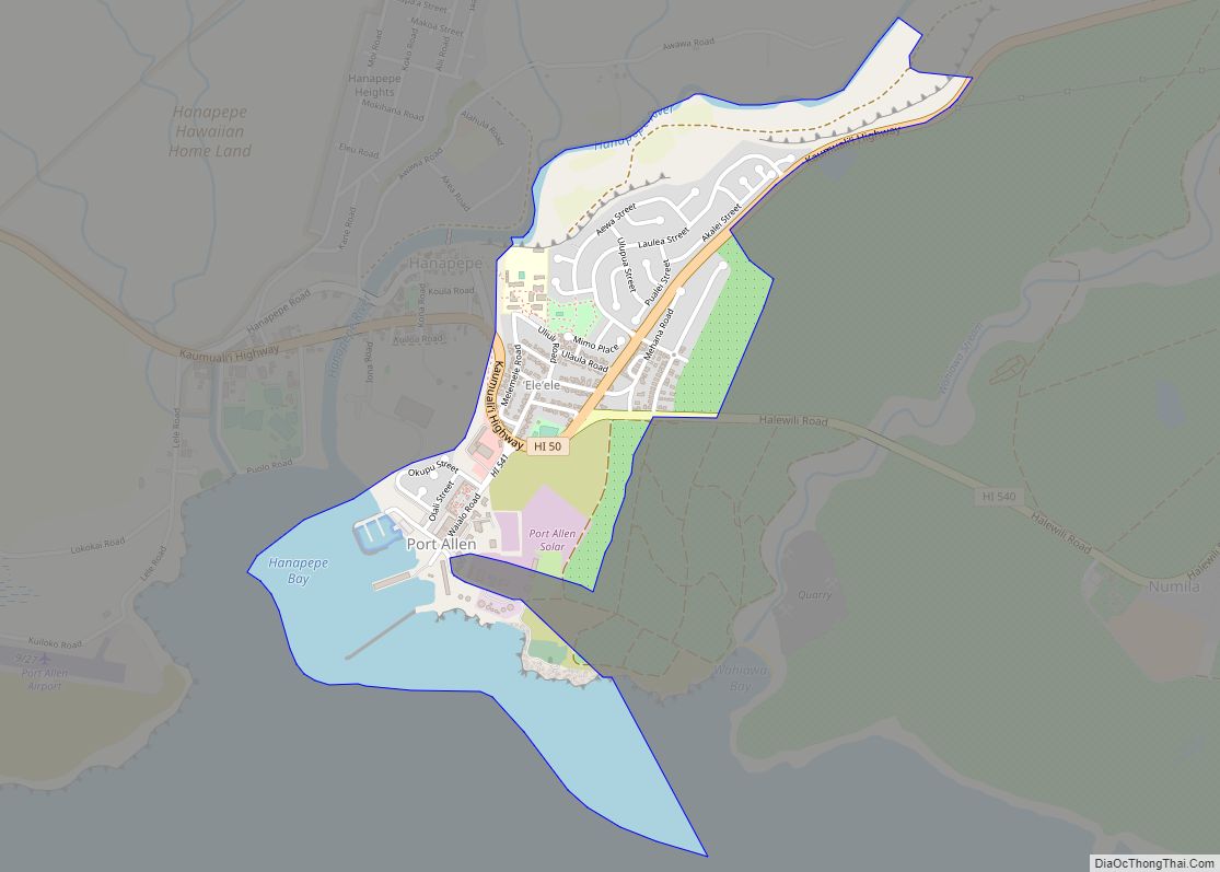
ʻEleʻele (literally, “black” or “black water” in Hawaiian) is a census-designated place (CDP) on the island of Kauaʻi in Kauaʻi County, Hawaiʻi, United States, with the ZIP code of 96705. Glass Beach, that is made of sea glass, is a local attraction. The population was 2,515 at the 2020 census, up from 2,040 at the 2000 census.
| Name: | Eleele CDP |
|---|---|
| LSAD Code: | 57 |
| LSAD Description: | CDP (suffix) |
| State: | Hawaii |
| County: | Kauai County |
| Elevation: | 23 ft (7 m) |
| Total Area: | 1.08 sq mi (2.81 km²) |
| Land Area: | 0.78 sq mi (2.01 km²) |
| Water Area: | 0.31 sq mi (0.80 km²) |
| Total Population: | 2,515 |
| Population Density: | 3,245.16/sq mi (1,252.71/km²) |
| ZIP code: | 96705 |
| Area code: | 808 |
| FIPS code: | 1507000 |
| GNISfeature ID: | 0358794 |
Online Interactive Map
Click on ![]() to view map in "full screen" mode.
to view map in "full screen" mode.
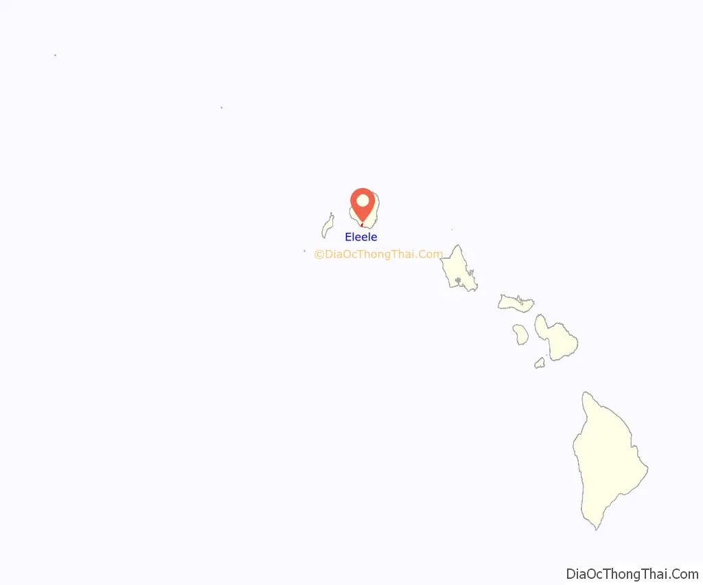
Eleele location map. Where is Eleele CDP?
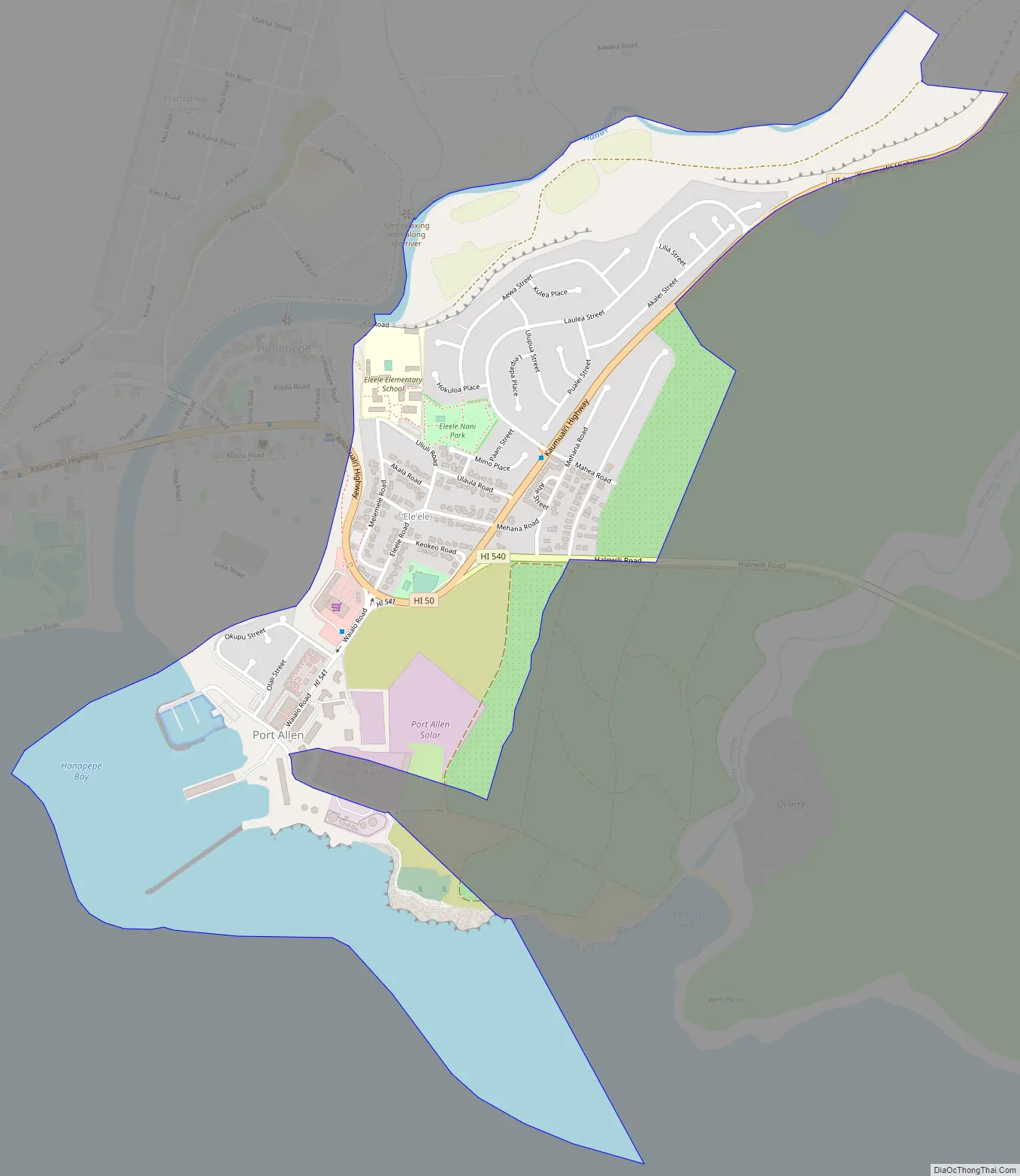
Eleele Road Map
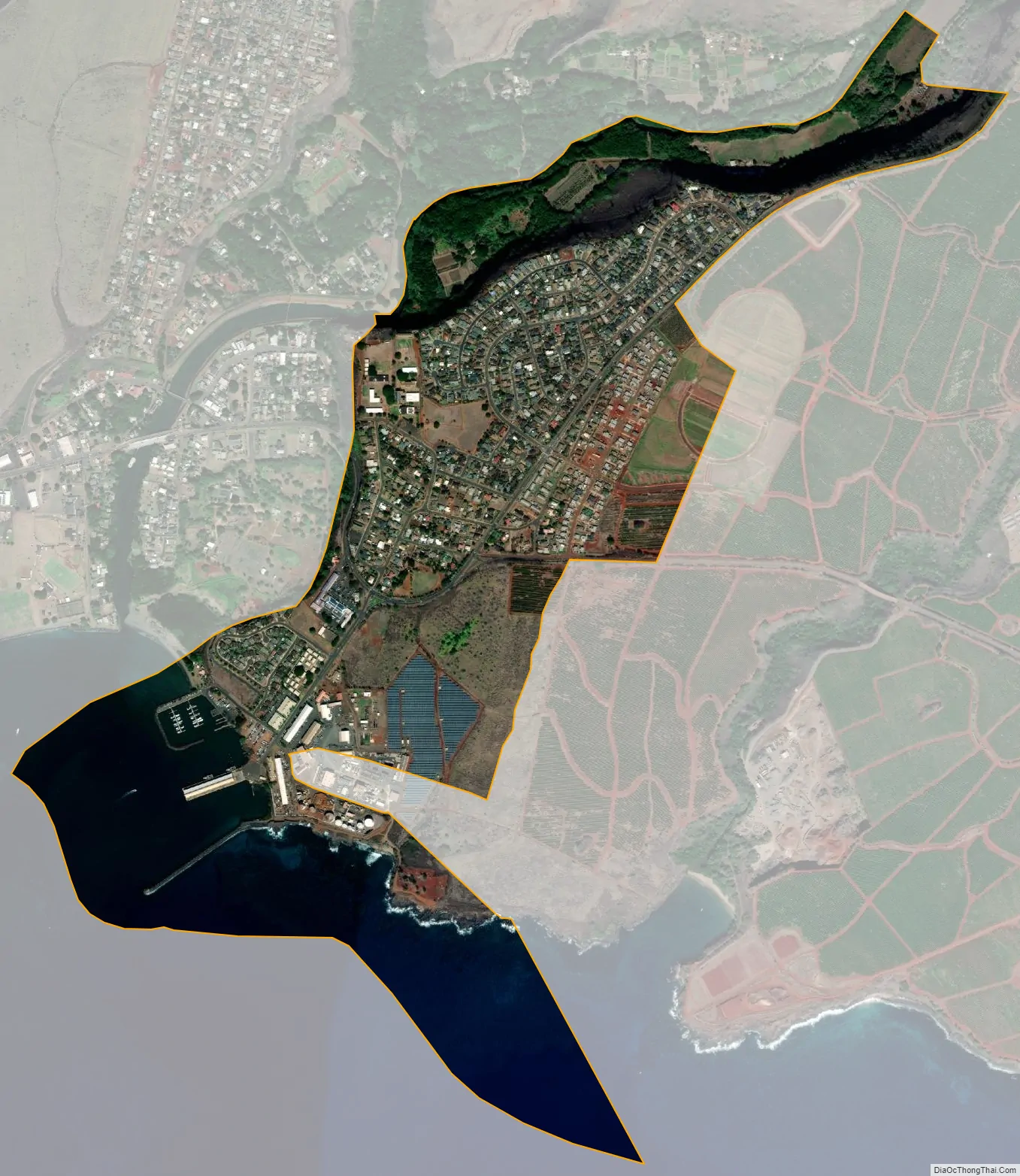
Eleele city Satellite Map
Geography
ʻEleʻele is located on the south side of the island of Kauai at 21°54′38″N 159°35′4″W / 21.91056°N 159.58444°W / 21.91056; -159.58444 (21.910489, -159.584330). It is bordered to the west by Hanapepe, with the Hanapēpē River forming the boundary between the two communities. Hawaii Route 50 passes through Eleele, leading east 4 miles (6 km) to Kalaheo and west 2 miles (3 km) to Kaumakani. Lihue is 17 miles (27 km) to the east via Route 50.
According to the United States Census Bureau, the CDP has a total area of 1.1 square miles (2.8 km), of which 0.77 square miles (2.0 km) are land and 0.3 square miles (0.8 km), or 28.56%, are water. The water area consists of the east side of Hanapepe Bay.
See also
Map of Hawaii State and its subdivision: Map of other states:- Alabama
- Alaska
- Arizona
- Arkansas
- California
- Colorado
- Connecticut
- Delaware
- District of Columbia
- Florida
- Georgia
- Hawaii
- Idaho
- Illinois
- Indiana
- Iowa
- Kansas
- Kentucky
- Louisiana
- Maine
- Maryland
- Massachusetts
- Michigan
- Minnesota
- Mississippi
- Missouri
- Montana
- Nebraska
- Nevada
- New Hampshire
- New Jersey
- New Mexico
- New York
- North Carolina
- North Dakota
- Ohio
- Oklahoma
- Oregon
- Pennsylvania
- Rhode Island
- South Carolina
- South Dakota
- Tennessee
- Texas
- Utah
- Vermont
- Virginia
- Washington
- West Virginia
- Wisconsin
- Wyoming