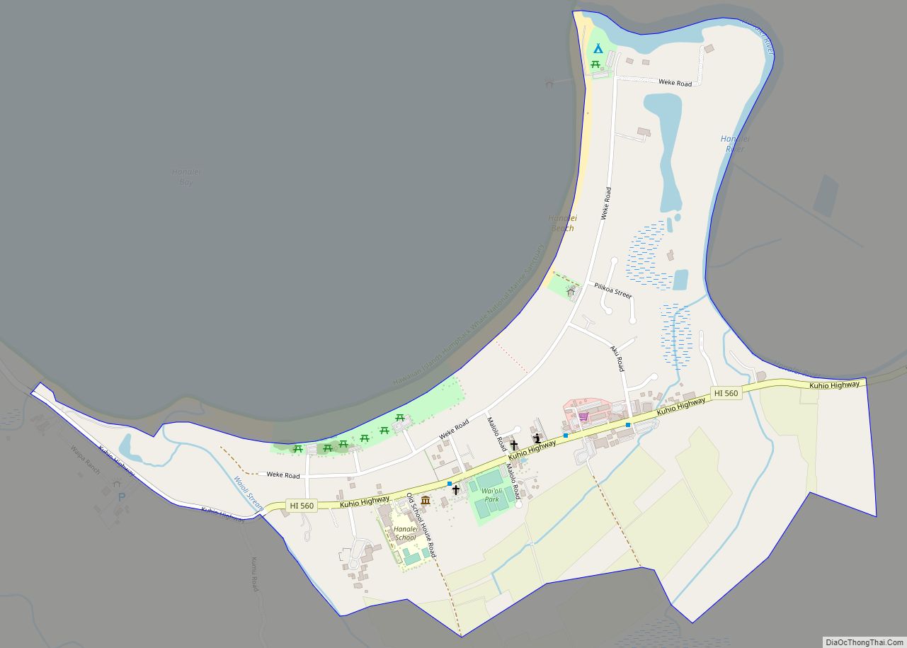
Hanalei is a census-designated place (CDP) in Kauaʻi County, Hawaii, United States. The population was estimated at 299 as of 2019. Hanalei means “lei making” in Hawaiian. Alternatively, the name Hanalei also means “crescent bay” and may be indicative of the shape of Hanalei Bay. Hanalei can also be translated as lei valley, referring to the rainbows that color the valley and encircle Hanalei like a wreath.
| Name: | Hanalei CDP |
|---|---|
| LSAD Code: | 57 |
| LSAD Description: | CDP (suffix) |
| State: | Hawaii |
| County: | Kauai County |
| Elevation: | 0 ft (0 m) |
| Total Area: | 0.72 sq mi (1.86 km²) |
| Land Area: | 0.68 sq mi (1.75 km²) |
| Water Area: | 0.04 sq mi (0.10 km²) |
| Total Population: | 444 |
| Population Density: | 655.83/sq mi (253.14/km²) |
| ZIP code: | 96714 |
| Area code: | 808 |
| FIPS code: | 1511500 |
| GNISfeature ID: | 0359039 |
Online Interactive Map
Click on ![]() to view map in "full screen" mode.
to view map in "full screen" mode.
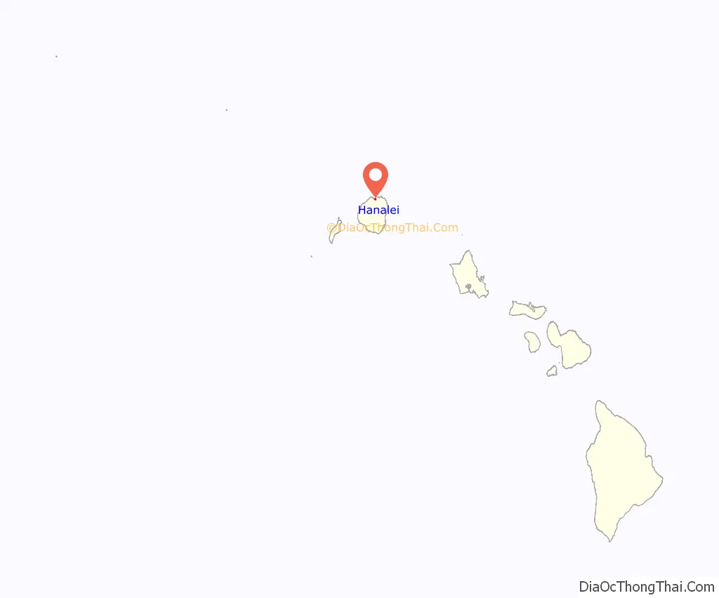
Hanalei location map. Where is Hanalei CDP?
History
Hanalei was well-populated in ancient times with a thriving native population that produced a bountiful supply of food from land to sea. Hanalei’s earliest residents grew large amounts of taro, bananas, breadfruit, sweet potato, yams, and coconuts. As foreigners started discovering Hawai’i and taking up residence in the islands, they brought in new agricultural ventures. During the first half of the 1800s Hanalei was supplying bountiful resources of mulberry leaves, coffee, tobacco, cotton, rice, sugarcane, citrus fruits, peaches, pineapples, bananas, dates, tamarinds, guava, potatoes, plantains, cabbage, lettuce and other products.
Hawaiian Royalty
Hanalei was visited by many members of the Royal Hawaiian family in the 1800s. King Kamehameha II took a 42-day voyage to Kauai in 1821. King Kamehameha III visited Hanalei in 1852. King Kamehameha IV visited Hanalei in 1856 with Queen Emma, and visited again with their young son Prince Albert. Their visit later inspired Hanalei plantation owner R.C Wyllie to name his growing estate Princeville.
Princess Ruth came to Hanalei in 1867 with her two poodles and picnicked on the Hanalei River. King Kalakaua also visited Hanalei Bay in 1874, and was greeted with a 21-gun salute fired from improvised cannons built from the Ohia Lehua trees.
Imperial Russia
In the early 19th century Russians were present here. In 1815 the German physician and agent of the Russian-American Company, Georg Anton Schäffer, came to the Hawaiian islands to retrieve goods seized by Kaumualiʻi, chief of Kauai island. On arrival he became involved with internal Hawaiian politics, and Kaumualiʻi planning and manipulating to reclaim his own kingdom of Kauai from Kamehameha I with the help of the Russian Empire. Kaumualiʻi signed a “treaty” granting Tsar Alexander I protectorate over Kauai. Briefly in 1817, Fort Elizabeth, near the Waimea River, and two other Russian forts near Hanalei were part of the tsarist Russian America.
1900s
In the early 1900s, nearly every square inch of Hanalei’s coastal plain was covered with rice fields. The first rice farmers were Chinese, followed by the Japanese, Filipinos, Portuguese and other ethnic groups, many of whom were former sugarcane workers who had finished their contracts with plantations. The rice farmers built homes, schools, stores, rice mills, churches or temples, and raised their families in Hanalei. Many descendants of the farmers and plantation workers still reside in Hanalei today.
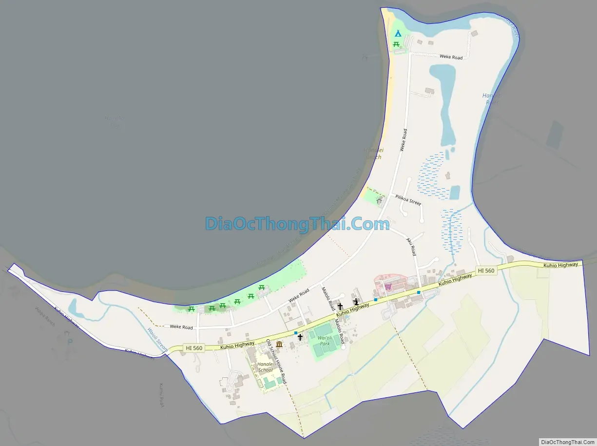
Hanalei Road Map
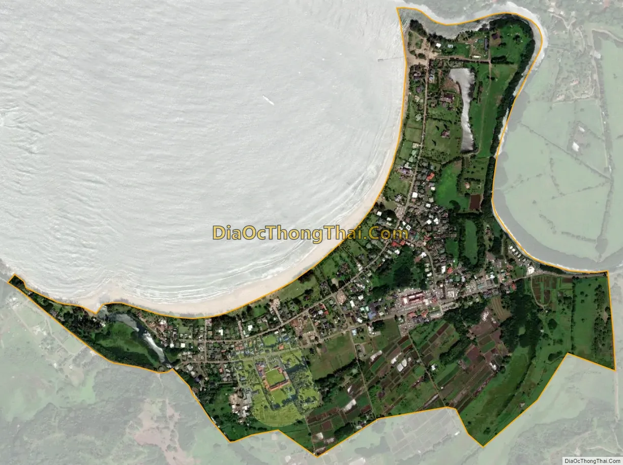
Hanalei city Satellite Map
Geography
Hanalei is located at 22°12′24″N 159°30′3″W / 22.20667°N 159.50083°W / 22.20667; -159.50083 (22.206653, -159.500713), near the mouth of the Hanalei River on the north shore of the island of Kauai. It is bordered to the east by Princeville.
According to the United States Census Bureau, the CDP has a total area of 0.71 square miles (1.84 km), of which 0.65 square miles (1.69 km) are land and 0.058 square miles (0.15 km) are water. The total area is 8.17% water.
See also
Map of Hawaii State and its subdivision: Map of other states:- Alabama
- Alaska
- Arizona
- Arkansas
- California
- Colorado
- Connecticut
- Delaware
- District of Columbia
- Florida
- Georgia
- Hawaii
- Idaho
- Illinois
- Indiana
- Iowa
- Kansas
- Kentucky
- Louisiana
- Maine
- Maryland
- Massachusetts
- Michigan
- Minnesota
- Mississippi
- Missouri
- Montana
- Nebraska
- Nevada
- New Hampshire
- New Jersey
- New Mexico
- New York
- North Carolina
- North Dakota
- Ohio
- Oklahoma
- Oregon
- Pennsylvania
- Rhode Island
- South Carolina
- South Dakota
- Tennessee
- Texas
- Utah
- Vermont
- Virginia
- Washington
- West Virginia
- Wisconsin
- Wyoming