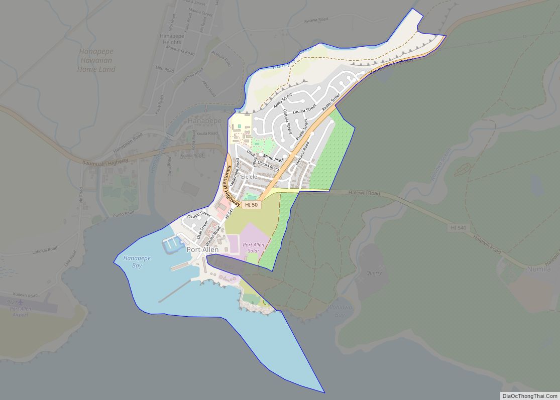
Hanapepe or Hanapēpē is a historic, unincorporated community in Kauai County, Hawaii, United States. The name means “crushed bay” in Hawaiian, which may refer to landslides in the area. For statistical purposes, the United States Census Bureau has defined Hanapepe as a census-designated place (CDP). The population was 2,678 at the 2020 census, up from 2,153 at the 2000 census.
| Name: | Hanapepe CDP |
|---|---|
| LSAD Code: | 57 |
| LSAD Description: | CDP (suffix) |
| State: | Hawaii |
| County: | Kauai County |
| Elevation: | 92 ft (28 m) |
| Total Area: | 1.03 sq mi (2.67 km²) |
| Land Area: | 0.93 sq mi (2.42 km²) |
| Water Area: | 0.10 sq mi (0.25 km²) |
| Total Population: | 2,678 |
| Population Density: | 2,867.24/sq mi (1,106.84/km²) |
| ZIP code: | 96716 |
| Area code: | 808 |
| FIPS code: | 1511800 |
| GNISfeature ID: | 0359058 |
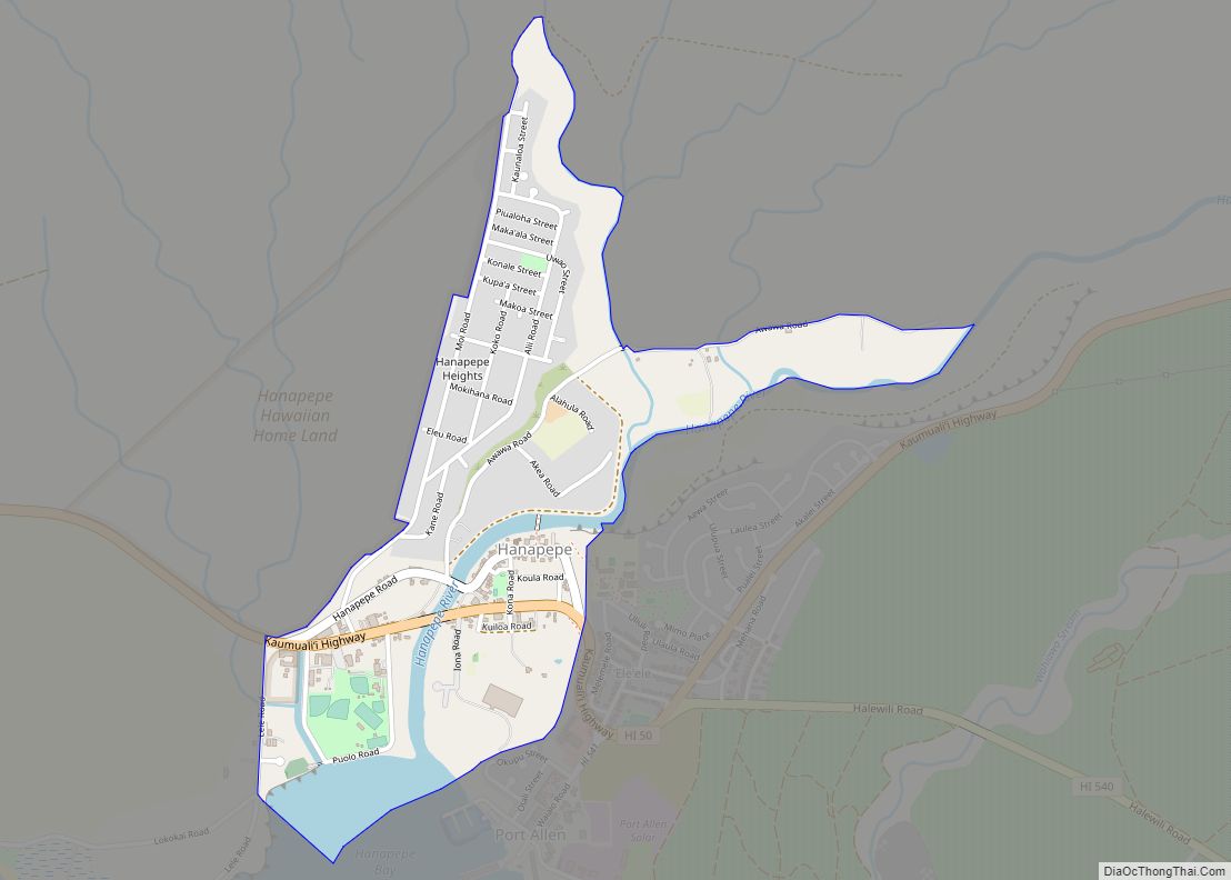
Online Interactive Map
Click on ![]() to view map in "full screen" mode.
to view map in "full screen" mode.
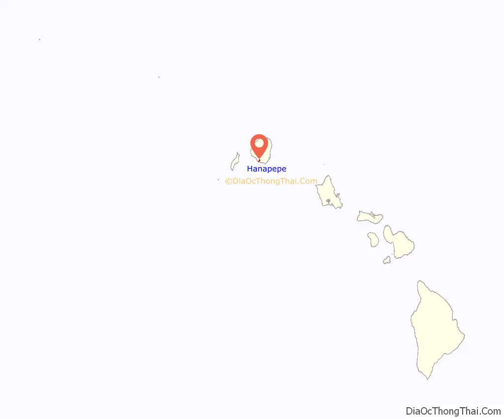
Hanapepe location map. Where is Hanapepe CDP?
History
Hanapepe was one of the locations visited by the United States Exploring Expedition under Charles Wilkes; the expedition arrived in Hawaii in late September 1840 and spent some time in the islands.
It is one of the few towns on the island that was not created by the sugarcane plantations. In 1924, an armed labor dispute involving sugar workers occurred, ending in the Hanapepe massacre.
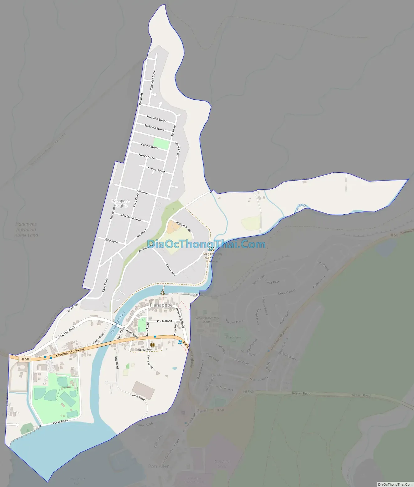
Hanapepe Road Map
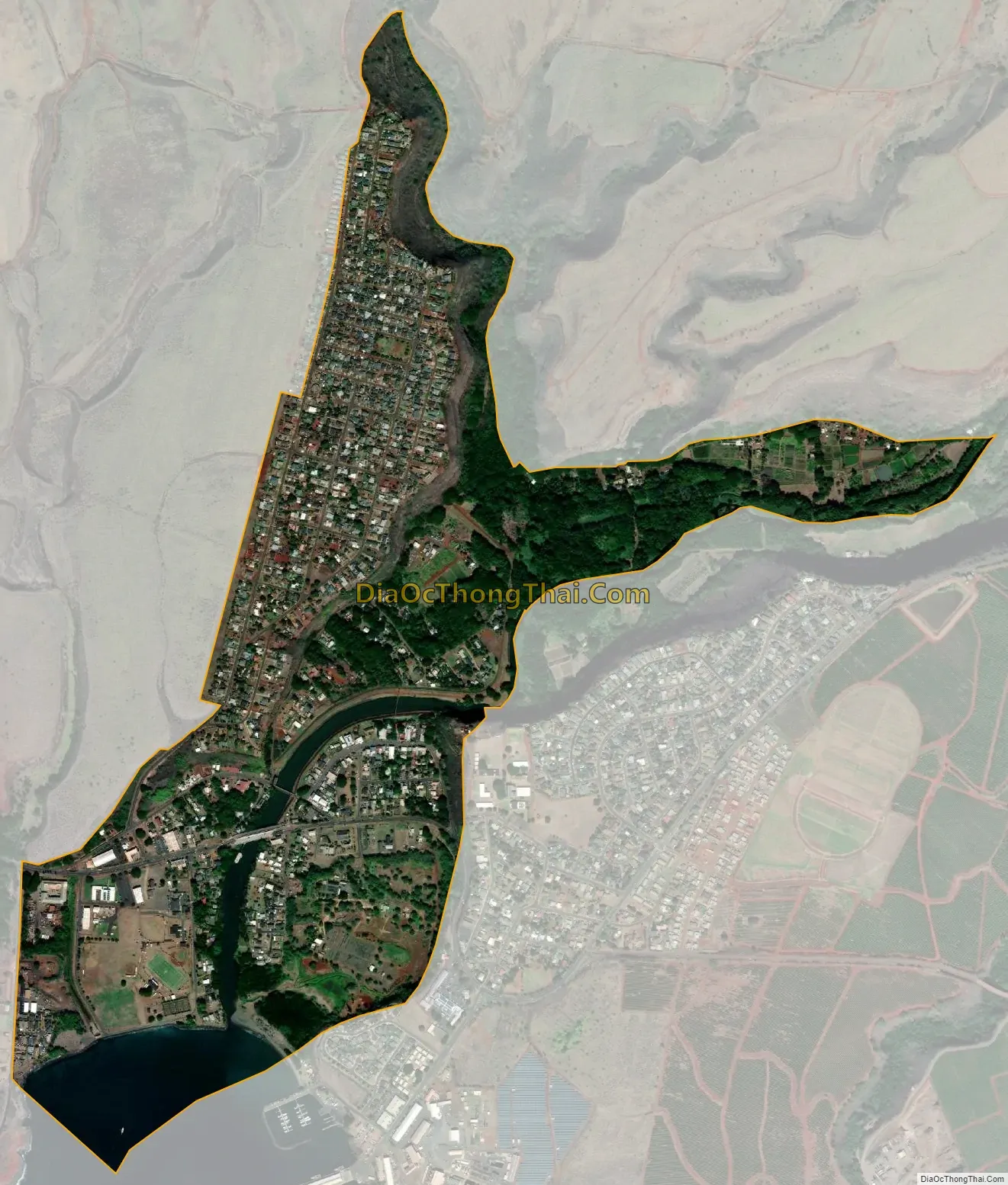
Hanapepe city Satellite Map
Geography
Hanapepe is located on the southern side of the island of Kauai. It is bordered to the east, across the Hanapēpē River and Hanapepe Bay, by the community of Eleele. Hawaii Route 50 passes through the southern part of Hanapepe, leading east 17 miles (27 km) to Lihue and northwest 6 miles (10 km) to Waimea.
For statistical purposes, the United States Census Bureau has defined Hanapepe as a census-designated place (CDP). The census definition of the area may not precisely correspond to local understanding of the area with the same name. The Hanapepe CDP has a total area of 1.0 square mile (2.6 km), of which 0.93 square miles (2.4 km) are land, and 0.1 square miles (0.2 km), or 9.43%, are water.
See also
Map of Hawaii State and its subdivision: Map of other states:- Alabama
- Alaska
- Arizona
- Arkansas
- California
- Colorado
- Connecticut
- Delaware
- District of Columbia
- Florida
- Georgia
- Hawaii
- Idaho
- Illinois
- Indiana
- Iowa
- Kansas
- Kentucky
- Louisiana
- Maine
- Maryland
- Massachusetts
- Michigan
- Minnesota
- Mississippi
- Missouri
- Montana
- Nebraska
- Nevada
- New Hampshire
- New Jersey
- New Mexico
- New York
- North Carolina
- North Dakota
- Ohio
- Oklahoma
- Oregon
- Pennsylvania
- Rhode Island
- South Carolina
- South Dakota
- Tennessee
- Texas
- Utah
- Vermont
- Virginia
- Washington
- West Virginia
- Wisconsin
- Wyoming