Holualoa (Hawaiian: Hōlualoa) is a census-designated place (CDP) in Hawaii County, Hawaii, United States. The population was 8,538 at the 2010 census, up from 6,107 at the 2000 census.
Holualoa’s boundaries were altered significantly for the 2020 census. The western portion of the CDP near the coast became part of the neighboring Kailua-Kona CDP, while the eastern portion of Kailua-Kona became part of Holualua. This reduced Holualoa’s population to 2,994.
Harold Sakata better known for his portrayal of the villain Oddjob in the 1964 James Bond film Goldfinger was born here in 1920 as Toshiyuki Sakata.
| Name: | Holualoa CDP |
|---|---|
| LSAD Code: | 57 |
| LSAD Description: | CDP (suffix) |
| State: | Hawaii |
| County: | Hawaii County |
| Elevation: | 320 ft (100 m) |
| Total Area: | 35.11 sq mi (90.93 km²) |
| Land Area: | 35.10 sq mi (90.92 km²) |
| Water Area: | 0.01 sq mi (0.02 km²) |
| Total Population: | 2,994 |
| Population Density: | 85.29/sq mi (32.93/km²) |
| ZIP code: | 96725 |
| Area code: | 808 |
| FIPS code: | 1515700 |
| GNISfeature ID: | 359249 |
Online Interactive Map
Click on ![]() to view map in "full screen" mode.
to view map in "full screen" mode.
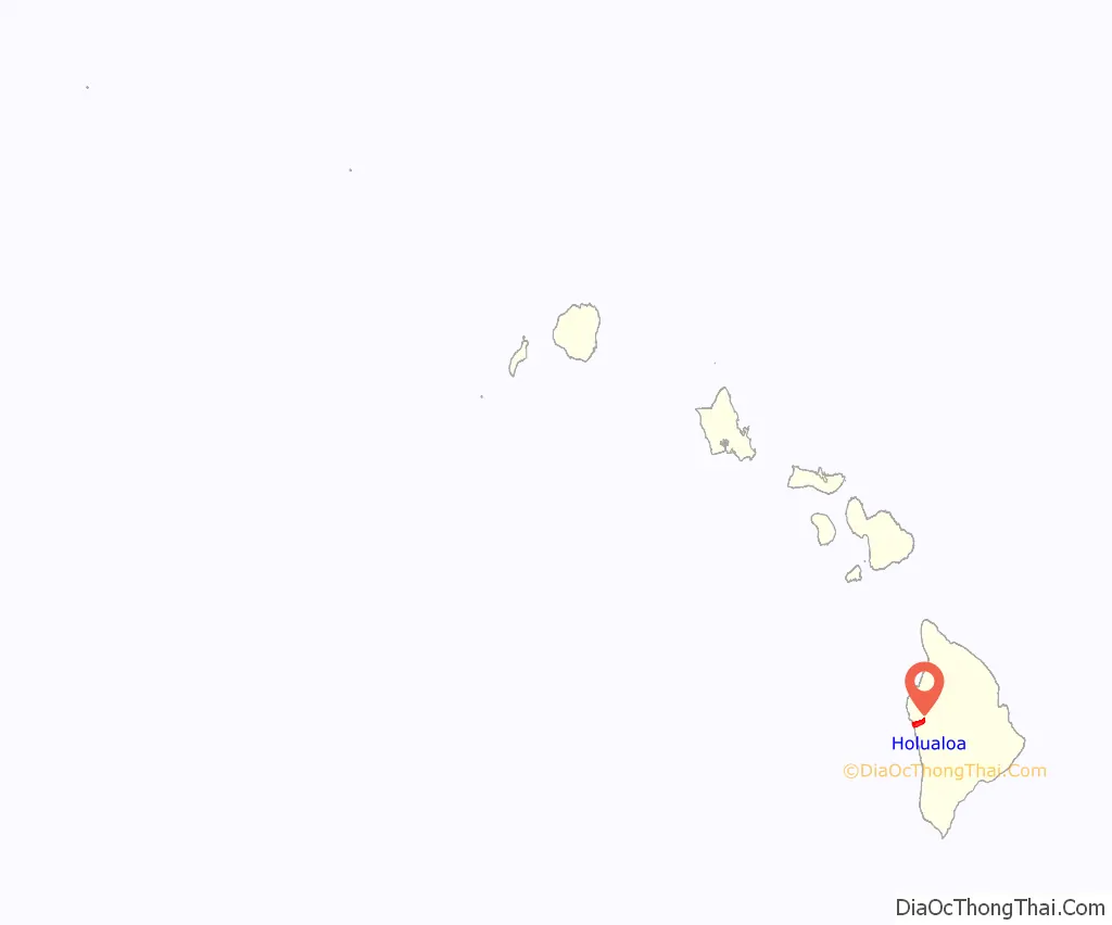
Holualoa location map. Where is Holualoa CDP?
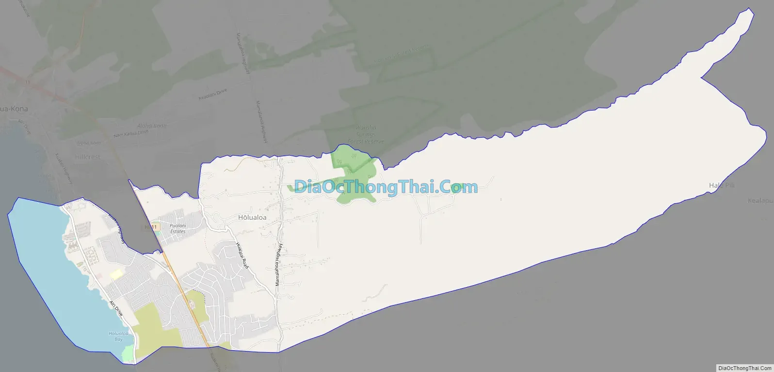
Holualoa Road Map
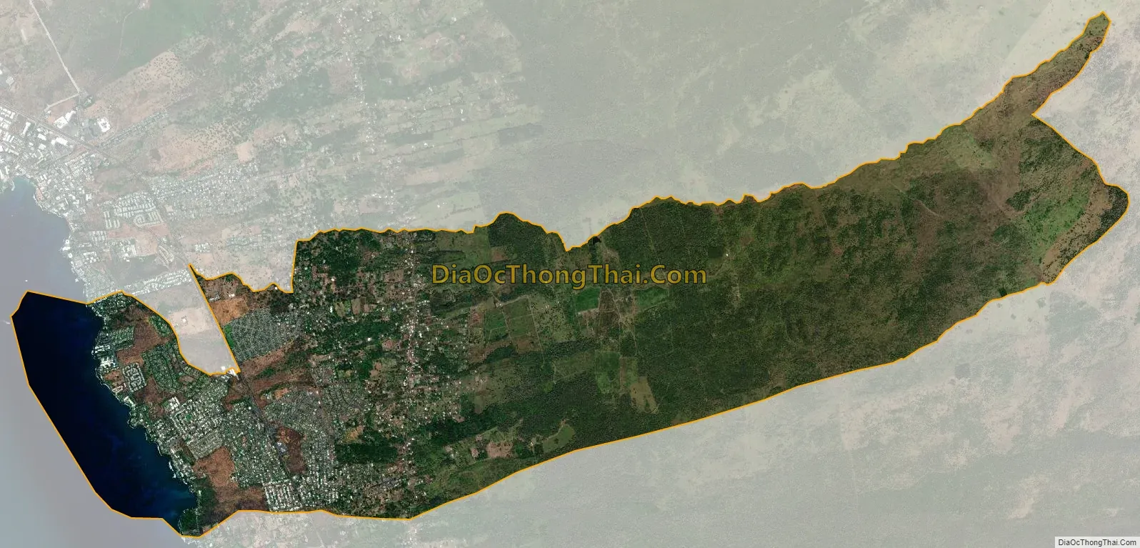
Holualoa city Satellite Map
Geography
Holualoa is located on the west side of the island of Hawaii at 19°36′59″N 155°58′06″W / 19.616353°N 155.968278°W / 19.616353; -155.968278. It is bordered by Kailua to the north, Honalo and Kahaluu-Keauhou to the south, and the Pacific Ocean to the west. Hawaii Route 11 is the main highway through the community, running north–south, and Hawaii Route 180 runs parallel to it farther inland.
According to the United States Census Bureau, the CDP has a total area of 14.4 square miles (37.2 km), of which 13.2 square miles (34.2 km) are land and 1.2 square miles (3.0 km), or 7.99%, are water.
See also
Map of Hawaii State and its subdivision: Map of other states:- Alabama
- Alaska
- Arizona
- Arkansas
- California
- Colorado
- Connecticut
- Delaware
- District of Columbia
- Florida
- Georgia
- Hawaii
- Idaho
- Illinois
- Indiana
- Iowa
- Kansas
- Kentucky
- Louisiana
- Maine
- Maryland
- Massachusetts
- Michigan
- Minnesota
- Mississippi
- Missouri
- Montana
- Nebraska
- Nevada
- New Hampshire
- New Jersey
- New Mexico
- New York
- North Carolina
- North Dakota
- Ohio
- Oklahoma
- Oregon
- Pennsylvania
- Rhode Island
- South Carolina
- South Dakota
- Tennessee
- Texas
- Utah
- Vermont
- Virginia
- Washington
- West Virginia
- Wisconsin
- Wyoming


