Honalo is a census-designated place (CDP) in Hawaiʻi County, Hawaiʻi, United States. The population was 2,423 at the 2010 census, up from 1,987 at the 2000 census.
| Name: | Honalo CDP |
|---|---|
| LSAD Code: | 57 |
| LSAD Description: | CDP (suffix) |
| State: | Hawaii |
| County: | Hawaii County |
| Elevation: | 1,391 ft (424 m) |
| Total Area: | 27.17 sq mi (70.38 km²) |
| Land Area: | 27.17 sq mi (70.38 km²) |
| Water Area: | 0.00 sq mi (0.00 km²) |
| Total Population: | 996 |
| Population Density: | 36.65/sq mi (14.15/km²) |
| Area code: | 808 |
| FIPS code: | 1516000 |
| GNISfeature ID: | 0359266 |
Online Interactive Map
Click on ![]() to view map in "full screen" mode.
to view map in "full screen" mode.
Honalo location map. Where is Honalo CDP?

History
The Daifukuji Soto Zen Mission was built in Honalo in 1921.
Honalo Road Map

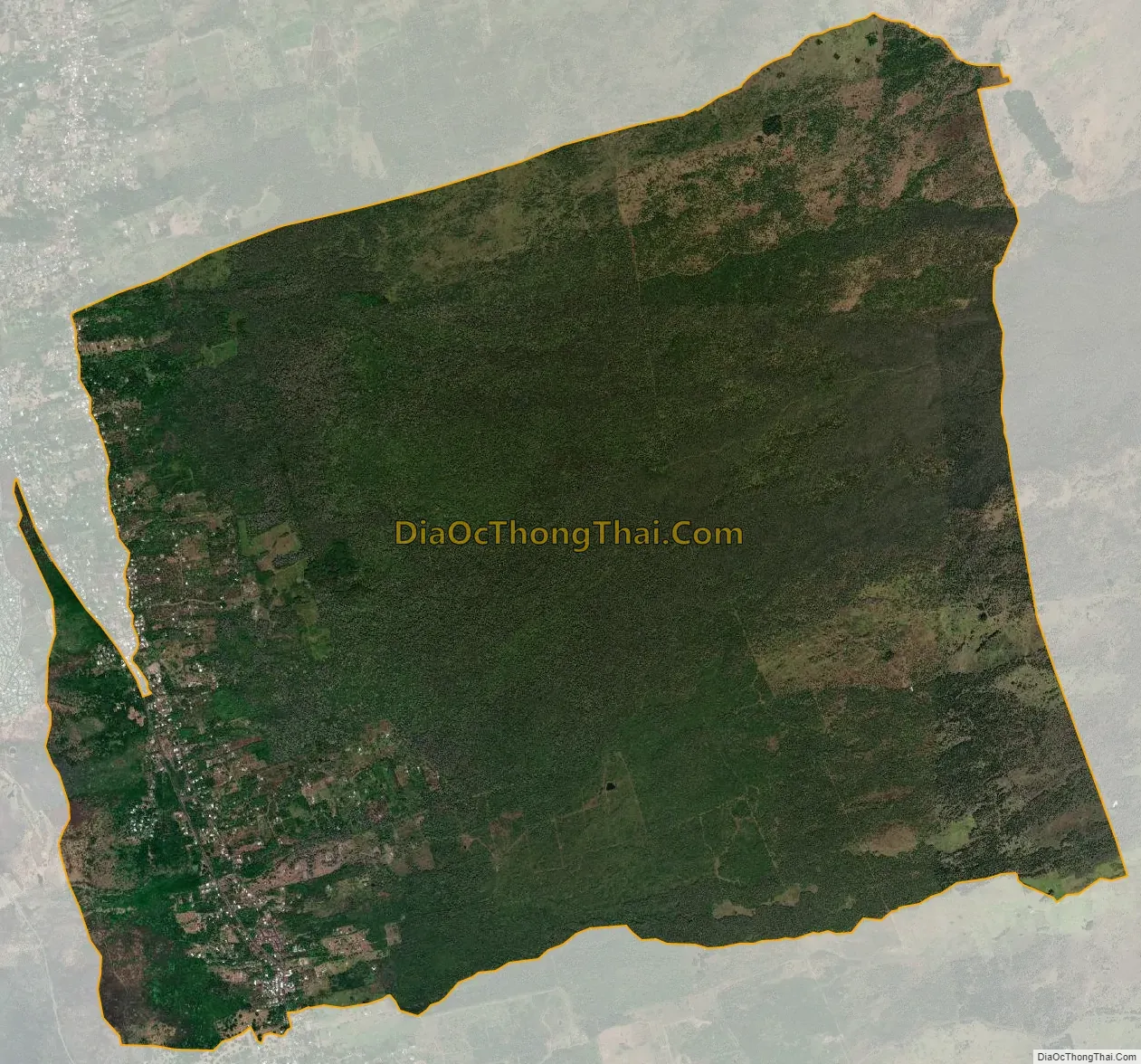
Honalo city Satellite Map
Geography
Honalo is located on the western side of the island of Hawaii at 19°33′34″N 155°55′47″W / 19.55944°N 155.92972°W / 19.55944; -155.92972 (19.559309, -155.929832). It is bordered to the north by Holualoa, to the south by Kealakekua, and to the west by Kahaluu-Keauhou. Hawaii Route 11 runs through western part of the community, leading north 7 miles (11 km) to Kailua-Kona and south 51 miles (82 km) to Naalehu. Hawaii Route 180 is a secondary route that branches off Route 11 in Honalo and runs to the east of it.
According to the United States Census Bureau, the Honalo CDP has a total area of 29.6 square miles (76.6 km), all of it land.
See also
Map of Hawaii State and its subdivision: Map of other states:- Alabama
- Alaska
- Arizona
- Arkansas
- California
- Colorado
- Connecticut
- Delaware
- District of Columbia
- Florida
- Georgia
- Hawaii
- Idaho
- Illinois
- Indiana
- Iowa
- Kansas
- Kentucky
- Louisiana
- Maine
- Maryland
- Massachusetts
- Michigan
- Minnesota
- Mississippi
- Missouri
- Montana
- Nebraska
- Nevada
- New Hampshire
- New Jersey
- New Mexico
- New York
- North Carolina
- North Dakota
- Ohio
- Oklahoma
- Oregon
- Pennsylvania
- Rhode Island
- South Carolina
- South Dakota
- Tennessee
- Texas
- Utah
- Vermont
- Virginia
- Washington
- West Virginia
- Wisconsin
- Wyoming


