Honokaʻa is a census-designated place (CDP) in the Hamakua District of Hawaiʻi County, Hawaiʻi, United States. The population was 2,699 at the 2020 census.
| Name: | Honokaa CDP |
|---|---|
| LSAD Code: | 57 |
| LSAD Description: | CDP (suffix) |
| State: | Hawaii |
| County: | Hawaii County |
| Elevation: | 994 ft (303 m) |
| Total Area: | 2.11 sq mi (5.45 km²) |
| Land Area: | 2.11 sq mi (5.45 km²) |
| Water Area: | 0.00 sq mi (0.00 km²) |
| Total Population: | 2,699 |
| Population Density: | 1,281.58/sq mi (494.80/km²) |
| ZIP code: | 96727 |
| Area code: | 808 |
| FIPS code: | 1516450 |
| GNISfeature ID: | 0359281 |
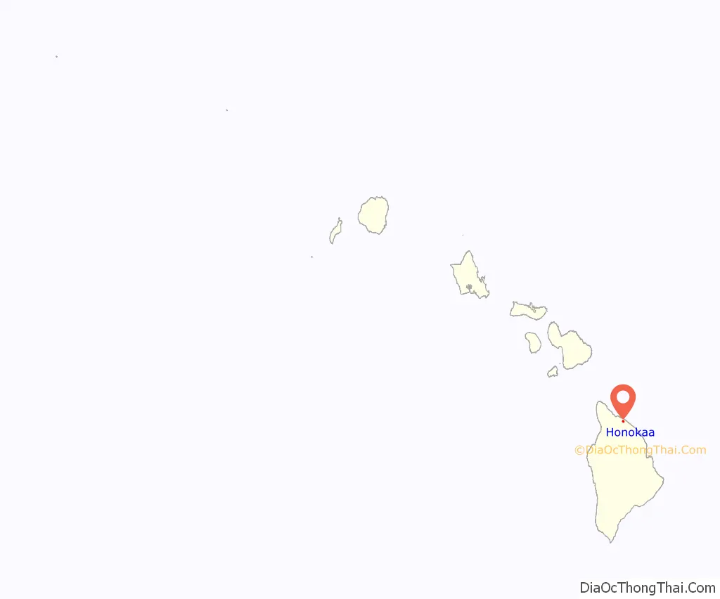
Online Interactive Map
Click on ![]() to view map in "full screen" mode.
to view map in "full screen" mode.
Honokaa location map. Where is Honokaa CDP?
History
Honokaʻa’s economy was based primarily on the sugar production of the Hāmākua Sugar Company from 1873 to 1994. With the closing of the Honokaʻa sugar production and the most recent staggered tourism, the local economy has been in decline. It has become increasingly a bedroom community for Hilo. As the gateway to the Hāmākua Coast, Honokaa provides the first unobstructed view of the Pacific Ocean traveling downslope from Waimea.
The Hāmākua Coast was the classic plantation community in the early 20th century, but since the closing of the Big Island’s sugar industry, the district has had to diversify its economy. Presently, with much of the district still zoned for agriculture, Hāmākua has seen rising prospects in other crops including pineapples, coffee, papaya, macadamia nuts, and tea.
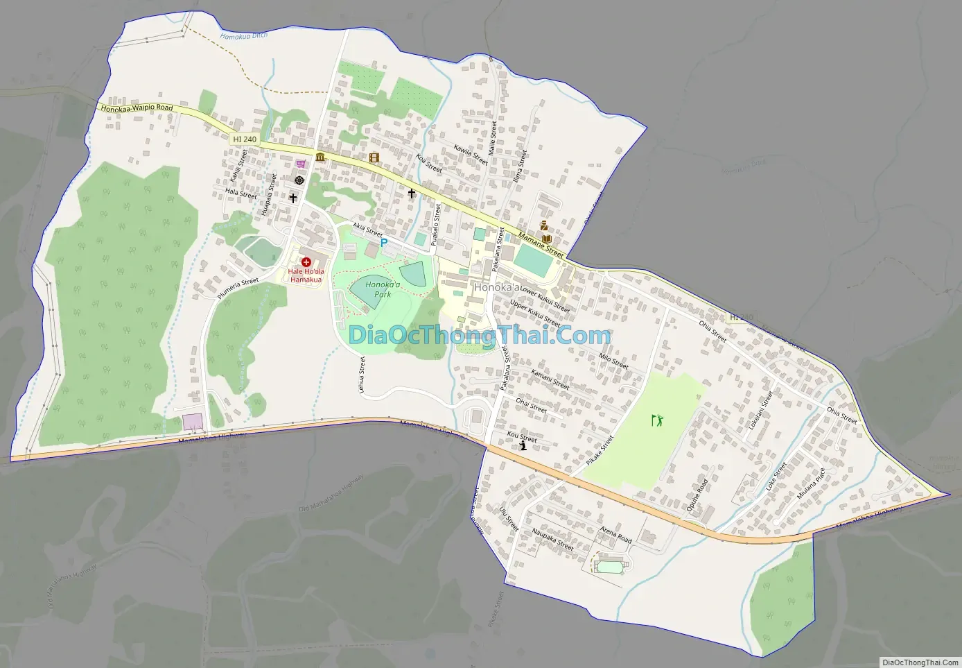
Honokaa Road Map
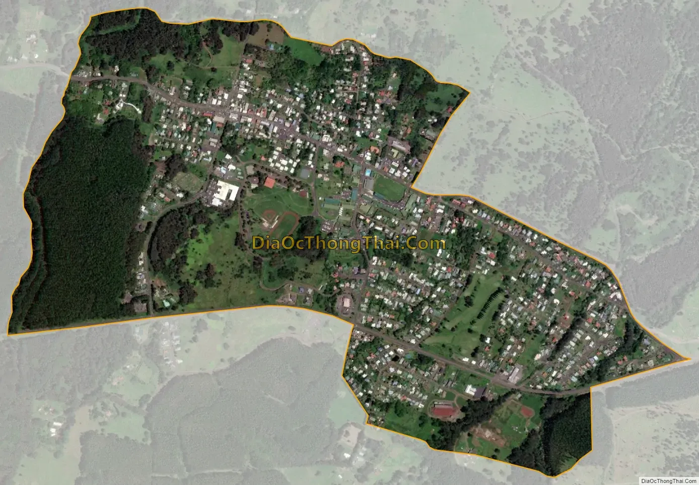
Honokaa city Satellite Map
Geography
Honokaʻa is located on the north side of the island of Hawaiʻi at 20°4′39″N 155°27′51″W / 20.07750°N 155.46417°W / 20.07750; -155.46417 (20.077617, -155.464074). Hawaii Route 19 runs through the southern part of the community, leading southeast 42 miles (68 km) to Hilo and west 14 miles (23 km) to Waimea. Hawaiʻi Route 240 branches off Route 19 and runs through the center of Honokaʻa, then continues west 8 miles (13 km) to its terminus at the Waipiʻo Valley lookout.
According to the United States Census Bureau, the CDP has a total area of 1.3 square miles (3.3 km), all of it land.
See also
Map of Hawaii State and its subdivision: Map of other states:- Alabama
- Alaska
- Arizona
- Arkansas
- California
- Colorado
- Connecticut
- Delaware
- District of Columbia
- Florida
- Georgia
- Hawaii
- Idaho
- Illinois
- Indiana
- Iowa
- Kansas
- Kentucky
- Louisiana
- Maine
- Maryland
- Massachusetts
- Michigan
- Minnesota
- Mississippi
- Missouri
- Montana
- Nebraska
- Nevada
- New Hampshire
- New Jersey
- New Mexico
- New York
- North Carolina
- North Dakota
- Ohio
- Oklahoma
- Oregon
- Pennsylvania
- Rhode Island
- South Carolina
- South Dakota
- Tennessee
- Texas
- Utah
- Vermont
- Virginia
- Washington
- West Virginia
- Wisconsin
- Wyoming


