Kahaluʻu-Keauhou is a census-designated place (CDP) in Hawaiʻi County, Hawaii, United States. The population was 3,549 at the 2010 census, up from 2,414 at the 2000 census.
| Name: | Kahaluu-Keauhou CDP |
|---|---|
| LSAD Code: | 57 |
| LSAD Description: | CDP (suffix) |
| State: | Hawaii |
| County: | Hawaii County |
| Elevation: | 100 ft (30 m) |
| Total Area: | 10.28 sq mi (26.63 km²) |
| Land Area: | 8.01 sq mi (20.74 km²) |
| Water Area: | 2.27 sq mi (5.89 km²) |
| Total Population: | 4,778 |
| Population Density: | 596.80/sq mi (230.43/km²) |
| Area code: | 808 |
| FIPS code: | 1521230 |
| GNISfeature ID: | 2414055 |
Online Interactive Map
Click on ![]() to view map in "full screen" mode.
to view map in "full screen" mode.
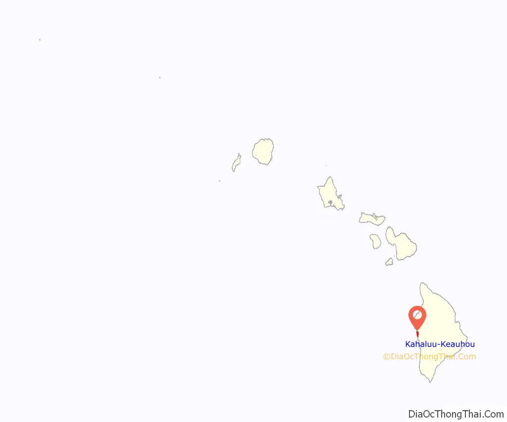
Kahaluu-Keauhou location map. Where is Kahaluu-Keauhou CDP?
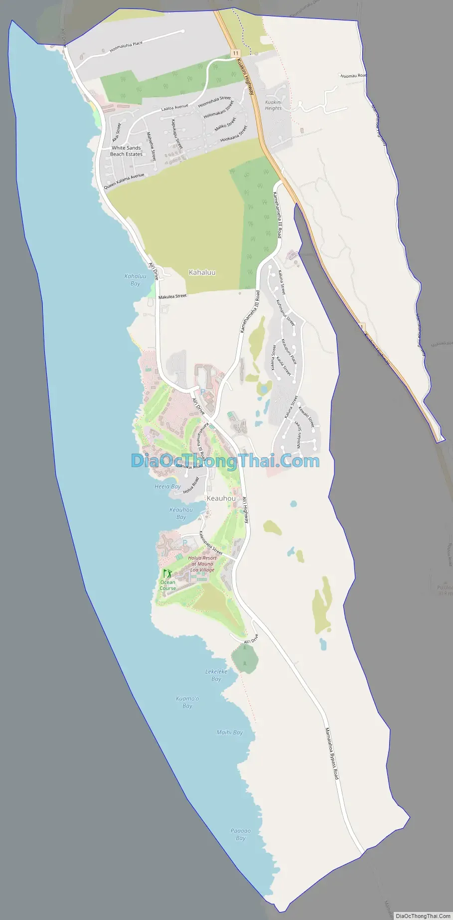
Kahaluu-Keauhou Road Map
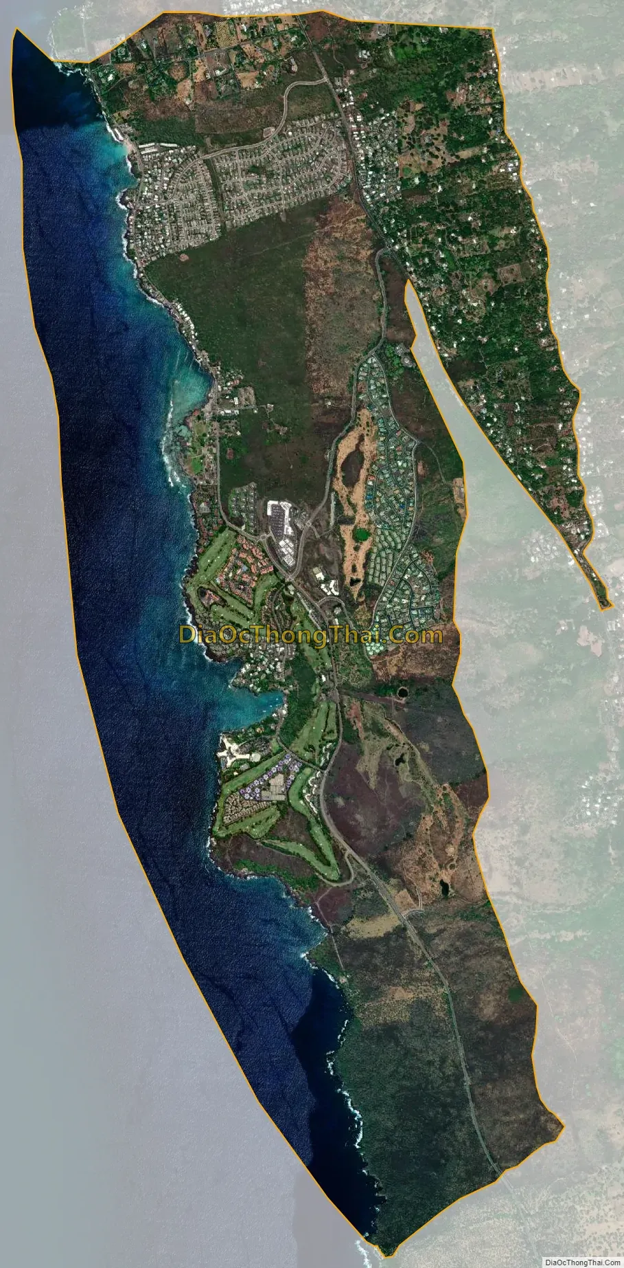
Kahaluu-Keauhou city Satellite Map
Geography
Kahaluʻu-Keauhou is located on the western side of the island of Hawaiʻi at 19°34′32″N 155°57′38″W / 19.57556°N 155.96056°W / 19.57556; -155.96056 (19.575554, -155.960522). It is bordered to the north by Holualoa, to the east by Honalo, and to the west by the Pacific Ocean. Kealakekua is 5 miles (8 km) to the south.
According to the United States Census Bureau, the Kahaluʻu-Keauhou CDP has a total area of 7.9 square miles (20.4 km), of which 5.6 square miles (14.5 km) are land and 2.3 square miles (5.9 km), or 28.89%, are water.
On the coast is the historic district of Kahaluʻu Bay.
See also
Map of Hawaii State and its subdivision: Map of other states:- Alabama
- Alaska
- Arizona
- Arkansas
- California
- Colorado
- Connecticut
- Delaware
- District of Columbia
- Florida
- Georgia
- Hawaii
- Idaho
- Illinois
- Indiana
- Iowa
- Kansas
- Kentucky
- Louisiana
- Maine
- Maryland
- Massachusetts
- Michigan
- Minnesota
- Mississippi
- Missouri
- Montana
- Nebraska
- Nevada
- New Hampshire
- New Jersey
- New Mexico
- New York
- North Carolina
- North Dakota
- Ohio
- Oklahoma
- Oregon
- Pennsylvania
- Rhode Island
- South Carolina
- South Dakota
- Tennessee
- Texas
- Utah
- Vermont
- Virginia
- Washington
- West Virginia
- Wisconsin
- Wyoming


