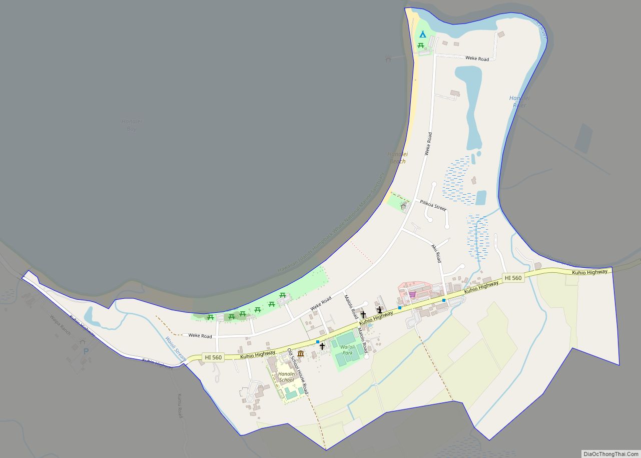
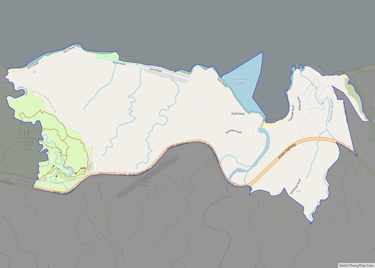
Kalihiwai (literally, “Kalihi with a stream” in Hawaiian where “kalihi” means “the edge”) is a census-designated place (CDP) in Kauaʻi County, Hawaiʻi, United States. The population was 361 at the 2020 census.
| Name: | Kalihiwai CDP |
|---|---|
| LSAD Code: | 57 |
| LSAD Description: | CDP (suffix) |
| State: | Hawaii |
| County: | Kauai County |
| Elevation: | 33 ft (10 m) |
| Total Area: | 2.77 sq mi (7.16 km²) |
| Land Area: | 2.64 sq mi (6.84 km²) |
| Water Area: | 0.12 sq mi (0.32 km²) |
| Total Population: | 361 |
| Population Density: | 136.64/sq mi (52.76/km²) |
| Area code: | 808 |
| FIPS code: | 1526750 |
| GNISfeature ID: | 0360149 |
Online Interactive Map
Click on ![]() to view map in "full screen" mode.
to view map in "full screen" mode.
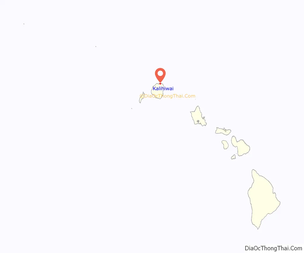
Kalihiwai location map. Where is Kalihiwai CDP?
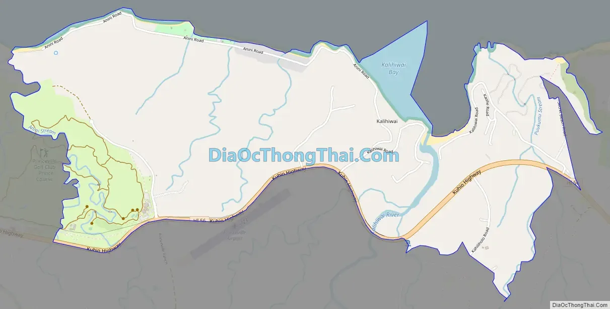
Kalihiwai Road Map
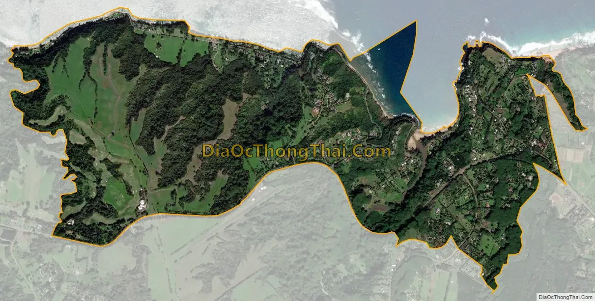
Kalihiwai city Satellite Map
Geography
Kalihiwai is located on the north shore of the island of Kauai at 22°12′59″N 159°25′7″W / 22.21639°N 159.41861°W / 22.21639; -159.41861 (22.216269, -159.418705). It is bordered to the east by Kilauea and to the west by Princeville. Hawaii Route 56 forms the southern edge of the community and leads southeast 17 miles (27 km) to Kapaa and west 5 miles (8 km) to Hanalei.
According to the United States Census Bureau, the Kalihiwai CDP has a total area of 2.8 square miles (7.2 km), of which 2.7 square miles (6.9 km) are land and 0.1 square miles (0.3 km), or 4.46%, are water.
See also
Map of Hawaii State and its subdivision: Map of other states:- Alabama
- Alaska
- Arizona
- Arkansas
- California
- Colorado
- Connecticut
- Delaware
- District of Columbia
- Florida
- Georgia
- Hawaii
- Idaho
- Illinois
- Indiana
- Iowa
- Kansas
- Kentucky
- Louisiana
- Maine
- Maryland
- Massachusetts
- Michigan
- Minnesota
- Mississippi
- Missouri
- Montana
- Nebraska
- Nevada
- New Hampshire
- New Jersey
- New Mexico
- New York
- North Carolina
- North Dakota
- Ohio
- Oklahoma
- Oregon
- Pennsylvania
- Rhode Island
- South Carolina
- South Dakota
- Tennessee
- Texas
- Utah
- Vermont
- Virginia
- Washington
- West Virginia
- Wisconsin
- Wyoming