Kealakekua is a census-designated place (CDP) in Hawaiʻi County, Hawaiʻi, United States. The population was 2,019 at the 2010 census, up from 1,645 at the 2000 census.
It was the subject of the 1933 popular song, “My Little Grass Shack in Kealakekua, Hawaii” by Bill Cogswell, Tommy Harrison and Johnny Noble, which became a Hawaiian music standard.
| Name: | Kealakekua CDP |
|---|---|
| LSAD Code: | 57 |
| LSAD Description: | CDP (suffix) |
| State: | Hawaii |
| County: | Hawaii County |
| Elevation: | 1,427 ft (435 m) |
| Total Area: | 10.00 sq mi (25.89 km²) |
| Land Area: | 10.00 sq mi (25.89 km²) |
| Water Area: | 0.00 sq mi (0.00 km²) |
| Total Population: | 2,307 |
| Population Density: | 230.75/sq mi (89.09/km²) |
| ZIP code: | 96750 |
| Area code: | 808 |
| FIPS code: | 1533950 |
| GNISfeature ID: | 0360942 |
Online Interactive Map
Click on ![]() to view map in "full screen" mode.
to view map in "full screen" mode.
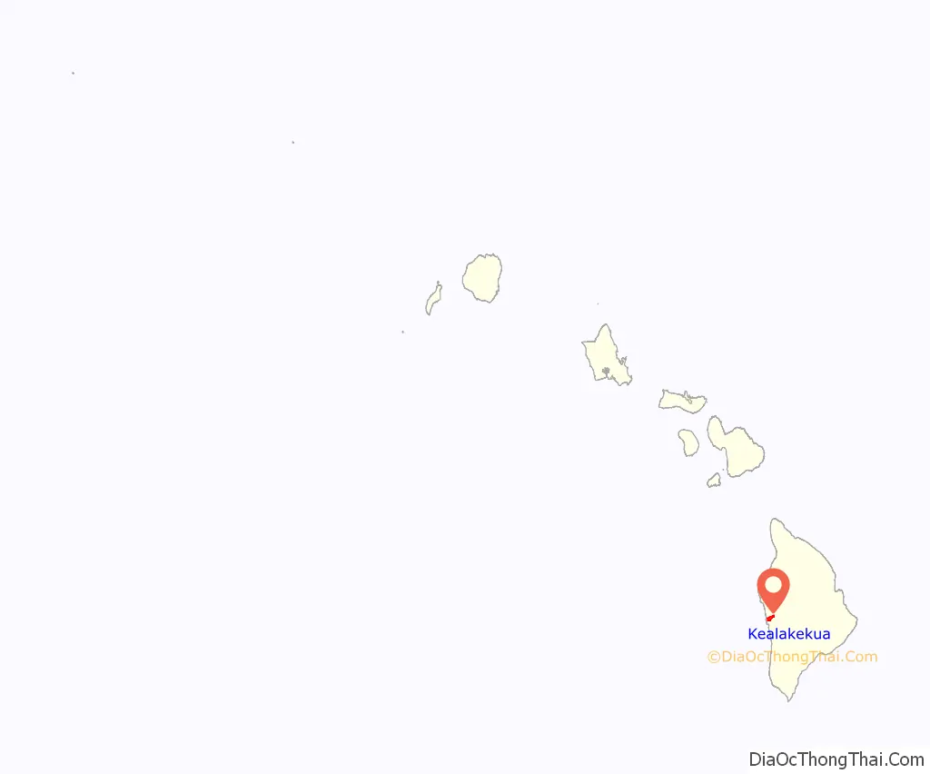
Kealakekua location map. Where is Kealakekua CDP?
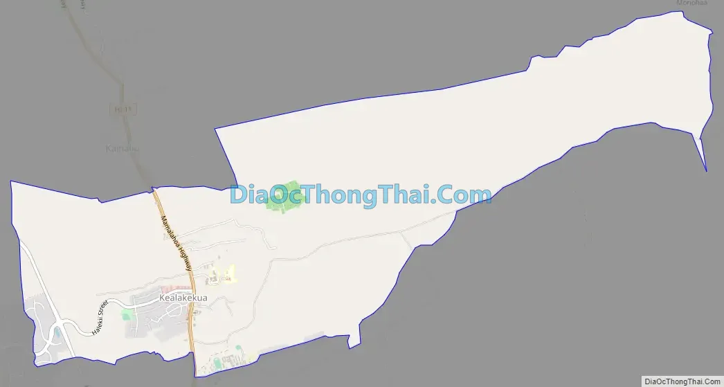
Kealakekua Road Map
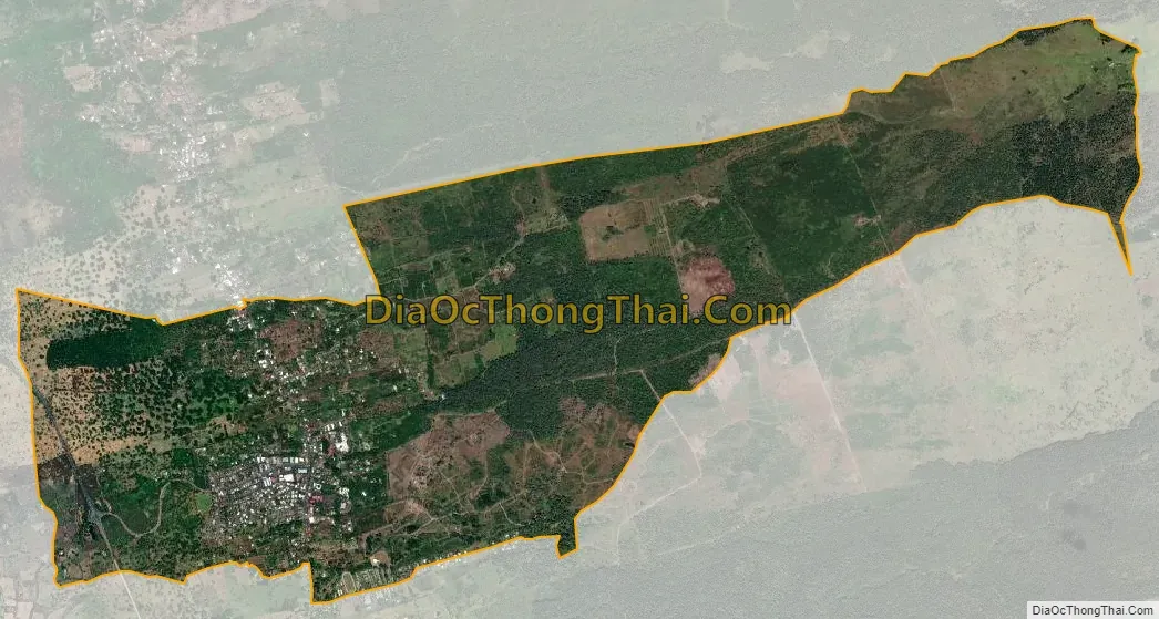
Kealakekua city Satellite Map
Geography
Kealakekua is located on the west side of the island of Hawaii at 19°31′35″N 155°55′22″W / 19.52639°N 155.92278°W / 19.52639; -155.92278 (19.526436, −155.922891). It is bordered to the north by Honalo and to the south by Captain Cook. Hawaii Route 11 is the main road through the community, leading north 10 miles (16 km) to Kailua-Kona and south 49 miles (79 km) to Naalehu.
According to the United States Census Bureau, the CDP has a total area of 7.2 square miles (18.7 km), all of it land.
See also
Map of Hawaii State and its subdivision: Map of other states:- Alabama
- Alaska
- Arizona
- Arkansas
- California
- Colorado
- Connecticut
- Delaware
- District of Columbia
- Florida
- Georgia
- Hawaii
- Idaho
- Illinois
- Indiana
- Iowa
- Kansas
- Kentucky
- Louisiana
- Maine
- Maryland
- Massachusetts
- Michigan
- Minnesota
- Mississippi
- Missouri
- Montana
- Nebraska
- Nevada
- New Hampshire
- New Jersey
- New Mexico
- New York
- North Carolina
- North Dakota
- Ohio
- Oklahoma
- Oregon
- Pennsylvania
- Rhode Island
- South Carolina
- South Dakota
- Tennessee
- Texas
- Utah
- Vermont
- Virginia
- Washington
- West Virginia
- Wisconsin
- Wyoming


