Kukuihaele is a census-designated place (CDP) in Hawaiʻi County, Hawaiʻi, United States. The population was 281 at the 2020 census.
| Name: | Kukuihaele CDP |
|---|---|
| LSAD Code: | 57 |
| LSAD Description: | CDP (suffix) |
| State: | Hawaii |
| County: | Hawaii County |
| Elevation: | 730 ft (185 m) |
| Total Area: | 2.29 sq mi (5.94 km²) |
| Land Area: | 1.71 sq mi (4.44 km²) |
| Water Area: | 0.58 sq mi (1.50 km²) |
| Total Population: | 281 |
| Population Density: | 164.04/sq mi (63.34/km²) |
| Area code: | 808 |
| FIPS code: | 1541000 |
| GNISfeature ID: | 0361536 |
Online Interactive Map
Click on ![]() to view map in "full screen" mode.
to view map in "full screen" mode.
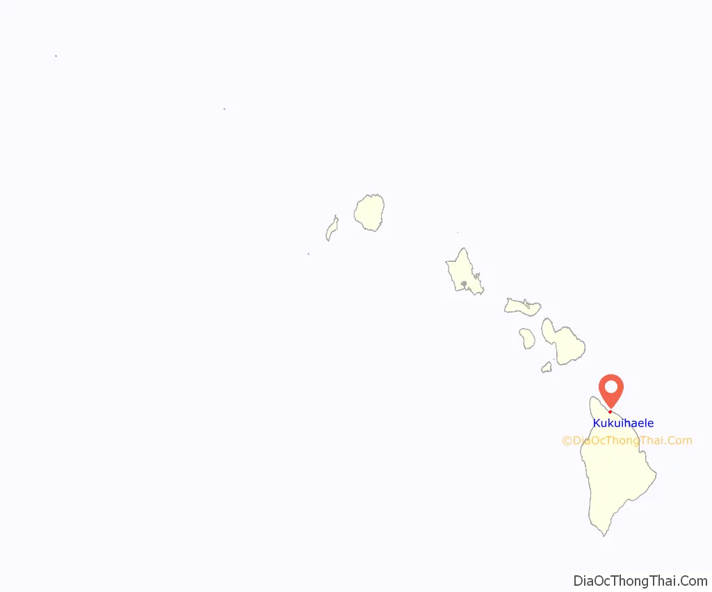
Kukuihaele location map. Where is Kukuihaele CDP?
History
Kukuihaele is the site of the original Hawaiian Island stand of cinchona trees, from which quinine is made. It was planted by David McHattie Forbes in the early 1900s.
Kukuihaele was known in ancient Hawaii as “the land of many heiau” (temples). During the migratory period of Hawaii, a healing priest (Kahuna la’au lapa’au) lived here and trained many to become healers. His name was, Kamakanui’ahailono. Most of the heiau, except for one, were destroyed by sugar planters.
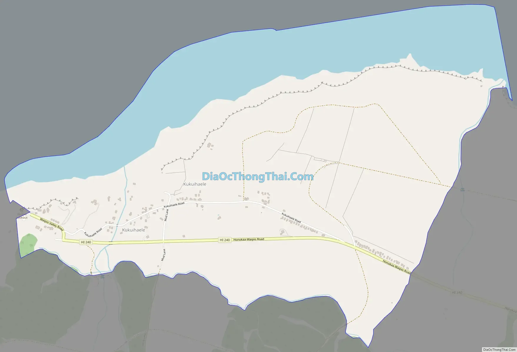
Kukuihaele Road Map
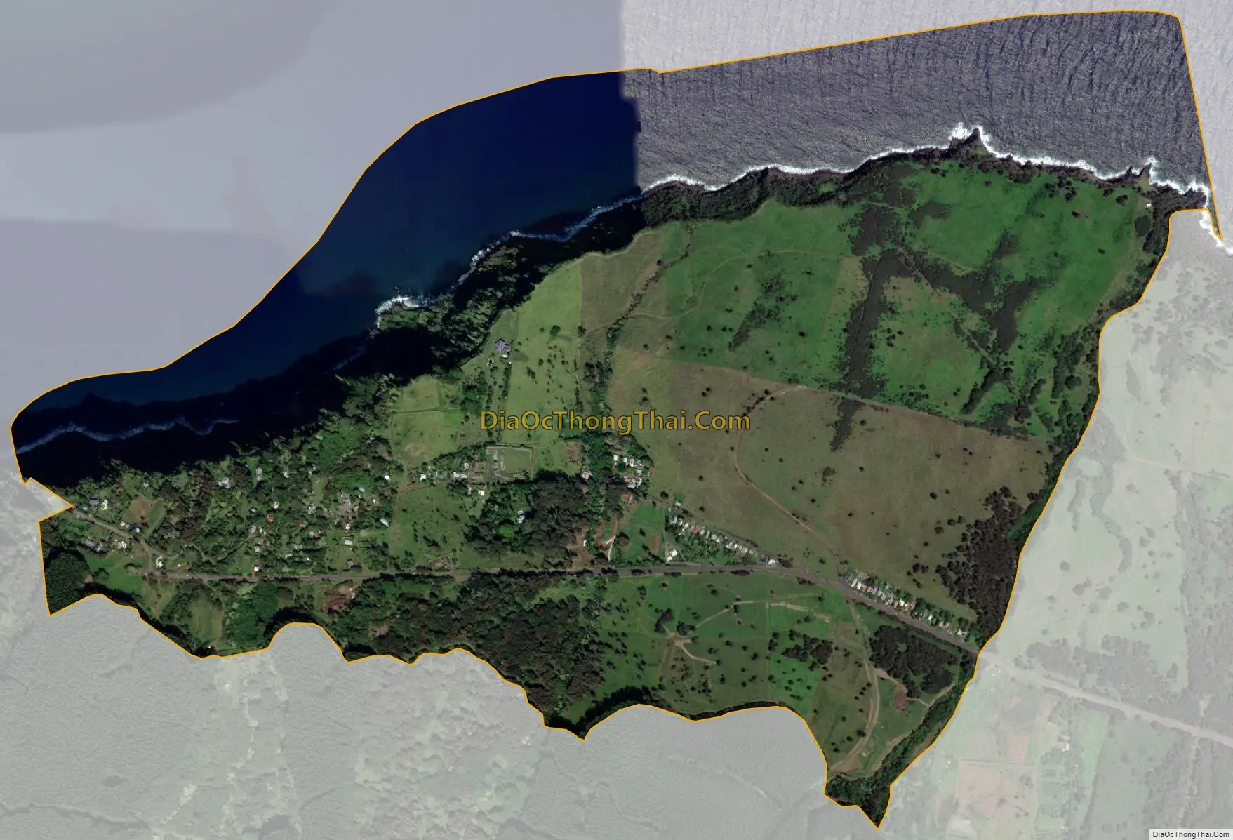
Kukuihaele city Satellite Map
Geography
Kukuihaele is located on the north side of the island of Hawaii at 20°7′10″N 155°34′16″W / 20.11944°N 155.57111°W / 20.11944; -155.57111 (20.119536, -155.571160). It sits at an elevation of 730 feet (220 m) atop cliffs overlooking Waipio Bay. Hawaii Route 240 passes through the southern part of the community, ending less than 1 mile (1.6 km) to the west at an overlook into the Waipio Valley, and leading east 7 miles (11 km) to Honokaa. Hilo is 50 miles (80 km) to the southeast.
According to the United States Census Bureau, the Kukuihaele CDP has a total area of 2.3 square miles (5.9 km), of which 1.7 square miles (4.4 km) are land and 0.58 square miles (1.5 km), or 25.30%, are water.
See also
Map of Hawaii State and its subdivision: Map of other states:- Alabama
- Alaska
- Arizona
- Arkansas
- California
- Colorado
- Connecticut
- Delaware
- District of Columbia
- Florida
- Georgia
- Hawaii
- Idaho
- Illinois
- Indiana
- Iowa
- Kansas
- Kentucky
- Louisiana
- Maine
- Maryland
- Massachusetts
- Michigan
- Minnesota
- Mississippi
- Missouri
- Montana
- Nebraska
- Nevada
- New Hampshire
- New Jersey
- New Mexico
- New York
- North Carolina
- North Dakota
- Ohio
- Oklahoma
- Oregon
- Pennsylvania
- Rhode Island
- South Carolina
- South Dakota
- Tennessee
- Texas
- Utah
- Vermont
- Virginia
- Washington
- West Virginia
- Wisconsin
- Wyoming


