Laupāhoehoe is a census-designated place (CDP) in Hawaiʻi County, Hawaii, United States, in the District of North Hilo. The population was 581 at the 2010 census, up from 473 at the 2000 census. The community’s name means “lava tip” and refers to the angular lava tip or cape formed by ancient pāhoehoe (smooth lava) flows which created the cape on which the community was built.
| Name: | Laupahoehoe CDP |
|---|---|
| LSAD Code: | 57 |
| LSAD Description: | CDP (suffix) |
| State: | Hawaii |
| County: | Hawaii County |
| Elevation: | 360 ft (110 m) |
| Total Area: | 3.49 sq mi (9.05 km²) |
| Land Area: | 3.24 sq mi (8.39 km²) |
| Water Area: | 0.25 sq mi (0.66 km²) |
| Total Population: | 1,147 |
| Population Density: | 353.90/sq mi (136.64/km²) |
| ZIP code: | 96764 |
| Area code: | 808 |
| FIPS code: | 1544150 |
| GNISfeature ID: | 0361749 |
Online Interactive Map
Click on ![]() to view map in "full screen" mode.
to view map in "full screen" mode.
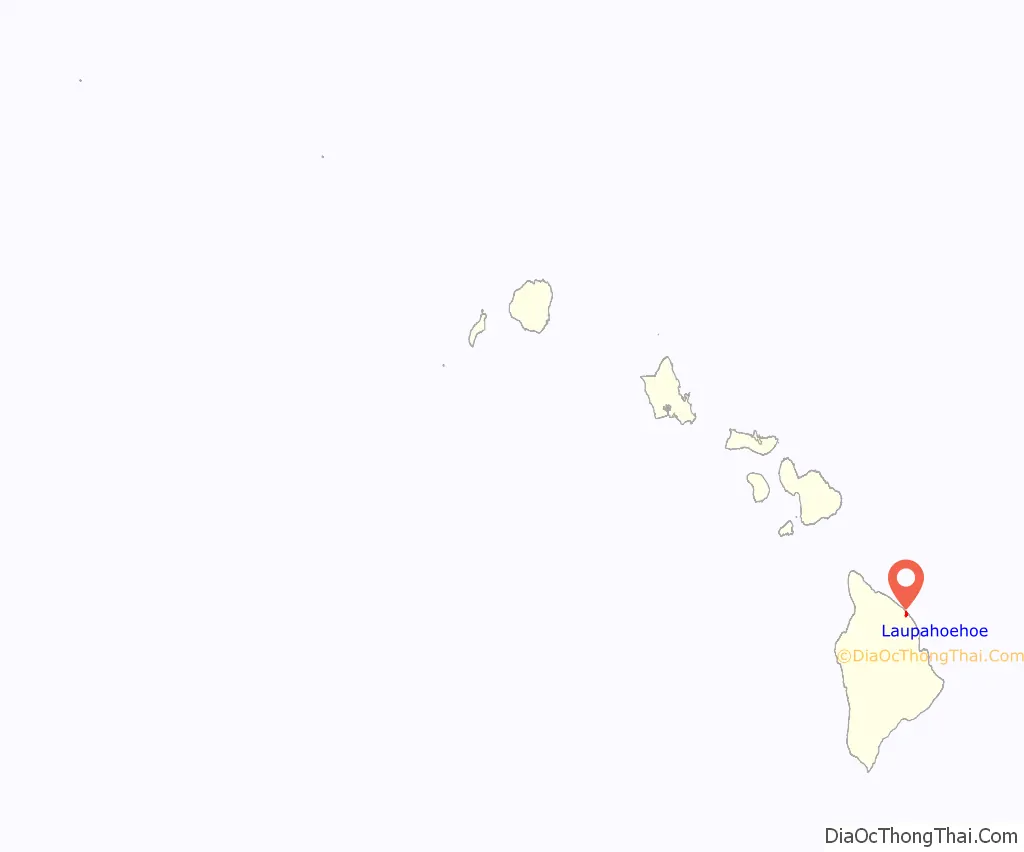
Laupahoehoe location map. Where is Laupahoehoe CDP?
History
On April 1, 1946, the Big Island of Hawaiʻi was struck by the so-called “April Fools Day tsunami”, originating from the Aleutian Islands earthquake. Approximately 160 people on the island were killed. While the greatest number of deaths occurred in Hilo, the school building at Laupāhoehoe was inundated, and twenty students and four teachers were drowned. A monument to the dead now stands on Laupāhoehoe Point.
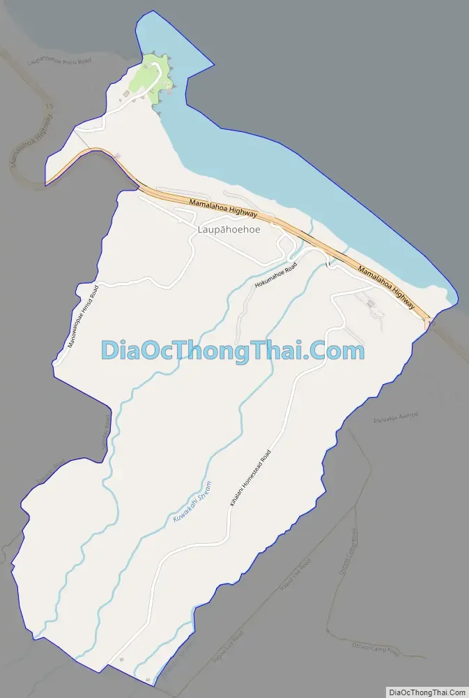
Laupahoehoe Road Map
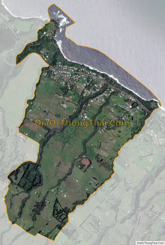
Laupahoehoe city Satellite Map
Geography
Laupāhoehoe is located on the northeast side of the island of Hawaii, at 19°59′5″N 155°14′10″W / 19.98472°N 155.23611°W / 19.98472; -155.23611 (19.983296, -155.235889). Hawaii Route 19 passes through the community, leading southeast 24 miles (39 km) to Hilo and west 32 miles (51 km) to Waimea.
According to the United States Census Bureau, the CDP has a total area of 2.4 square miles (6.2 km), of which 2.1 square miles (5.5 km) are land and 0.3 square miles (0.7 km), or 10.66%, are water.
Climate
See also
Map of Hawaii State and its subdivision: Map of other states:- Alabama
- Alaska
- Arizona
- Arkansas
- California
- Colorado
- Connecticut
- Delaware
- District of Columbia
- Florida
- Georgia
- Hawaii
- Idaho
- Illinois
- Indiana
- Iowa
- Kansas
- Kentucky
- Louisiana
- Maine
- Maryland
- Massachusetts
- Michigan
- Minnesota
- Mississippi
- Missouri
- Montana
- Nebraska
- Nevada
- New Hampshire
- New Jersey
- New Mexico
- New York
- North Carolina
- North Dakota
- Ohio
- Oklahoma
- Oregon
- Pennsylvania
- Rhode Island
- South Carolina
- South Dakota
- Tennessee
- Texas
- Utah
- Vermont
- Virginia
- Washington
- West Virginia
- Wisconsin
- Wyoming


