Leilani Estates is a census-designated place (CDP) in Hawaiʻi County, Hawaii, United States located in the District of Puna. The subdivision was formed in 1964. The population was 1,139 at the 2020 census, down from 1,560 at the 2010 census, and up from 1,046 at the 2000 census.
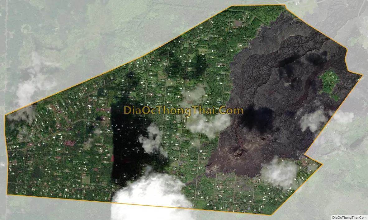
The 2018 lower Puna eruption of Kīlauea Volcano, which occurred within and around the subdivision, claimed many homes and displaced an unknown number of Leilani Estates residents. Accessing the entire resulting solid lava rock flow field has been prohibited, as per the Mayor’s 12/6/18 Emergency Proclamation, with fines up to $5,000 for violations. As of January 2019, in further effort to prevent the private subdivision from becoming a public attraction, the Leilani Community Association began enforcing regulations regarding no parking on private roads, no trespassing on private property, and no tours being conducted in the subdivision.
| Name: | Leilani Estates CDP |
|---|---|
| LSAD Code: | 57 |
| LSAD Description: | CDP (suffix) |
| State: | Hawaii |
| County: | Hawaii County |
| Elevation: | 771 ft (235 m) |
| Total Area: | 4.04 sq mi (10.45 km²) |
| Land Area: | 4.04 sq mi (10.45 km²) |
| Water Area: | 0.00 sq mi (0.00 km²) |
| Total Population: | 1,139 |
| Population Density: | 282.28/sq mi (109.00/km²) |
| Area code: | 808 |
| FIPS code: | 1544562 |
| GNISfeature ID: | 1852580 |
Online Interactive Map
Click on ![]() to view map in "full screen" mode.
to view map in "full screen" mode.
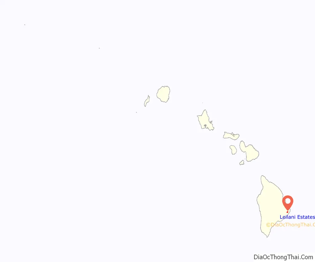
Leilani Estates location map. Where is Leilani Estates CDP?
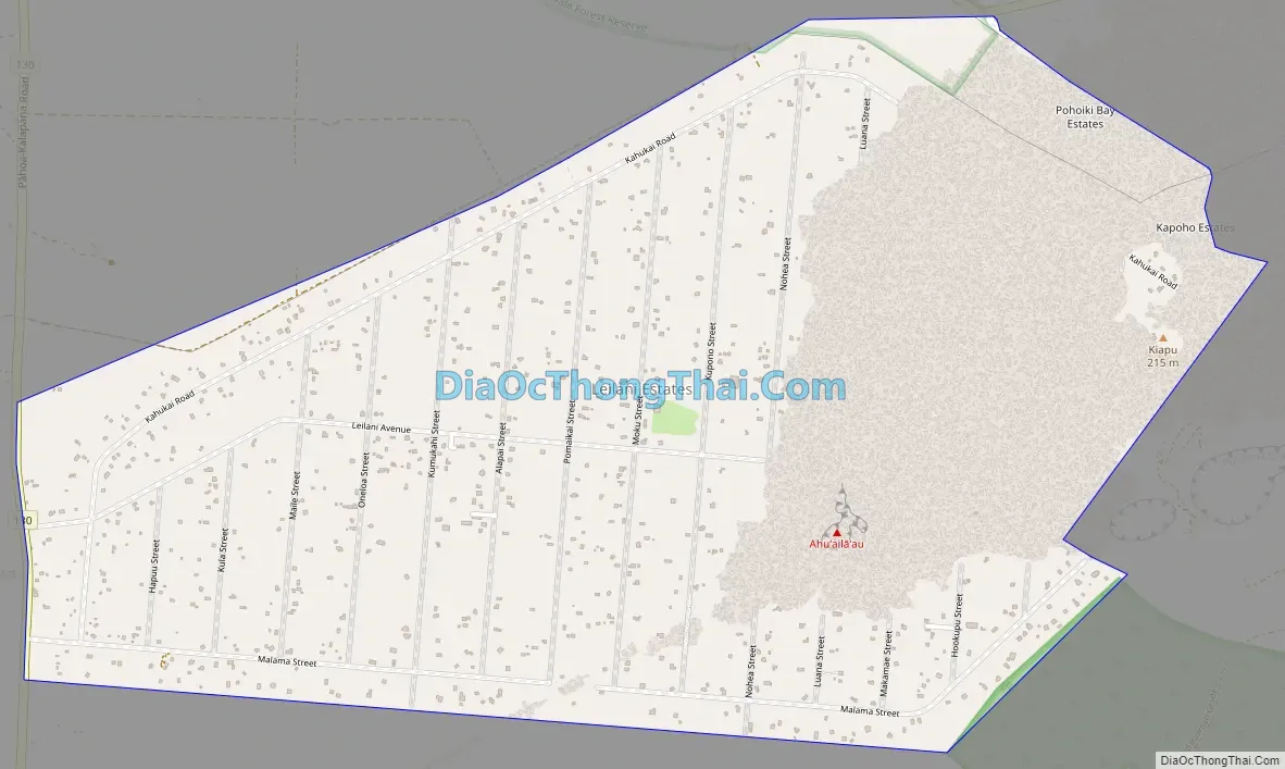
Leilani Estates Road Map
Leilani Estates city Satellite Map
Geography
Leilani Estates is located near the eastern tip of the island of Hawaii. It is 3 miles (5 km) south of Pāhoa and 23 miles (37 km) south of Hilo. It is bordered to the southeast by the Malama Kī Forest Reserve.
According to the United States Census Bureau, the CDP has a total area of 4.03 square miles (10.45 km), all of it land.
Leilani Estates is located directly on a stretch of the lower East Rift Zone of Kīlauea volcano, in lava flow hazard zone 1. Zone 1 includes the summit and rift zones of active volcanoes—new eruptive vents can spawn anywhere inside this zone. Approximately 10% or 50 square miles (100 km) out of the 500 square miles (1,000 km) of Puna have been covered by lava flows since 1790.
2018 eruption
Of the 24 total volcanic fissure vents that formed during the event, 14 erupted lava to varying degrees within Leilani Estates. ʻAhuʻailāʻau (initially designated Fissure 8) on Luana St. was the dominant vent that produced the most output of lava, with fountaining as high as 330 feet and flow front advancement as fast as 76m/hr as it reached the ocean miles below Leilani Estates. By the time the eruption ceased on August 9 of 2018, around 200 homes had been destroyed within the subdivision.
See also
Map of Hawaii State and its subdivision: Map of other states:- Alabama
- Alaska
- Arizona
- Arkansas
- California
- Colorado
- Connecticut
- Delaware
- District of Columbia
- Florida
- Georgia
- Hawaii
- Idaho
- Illinois
- Indiana
- Iowa
- Kansas
- Kentucky
- Louisiana
- Maine
- Maryland
- Massachusetts
- Michigan
- Minnesota
- Mississippi
- Missouri
- Montana
- Nebraska
- Nevada
- New Hampshire
- New Jersey
- New Mexico
- New York
- North Carolina
- North Dakota
- Ohio
- Oklahoma
- Oregon
- Pennsylvania
- Rhode Island
- South Carolina
- South Dakota
- Tennessee
- Texas
- Utah
- Vermont
- Virginia
- Washington
- West Virginia
- Wisconsin
- Wyoming


