Pāhoa (Hawaiian: Pāhoa) is a census-designated place (CDP) in the District of Puna in Hawai‘i County, Hawai‘i, United States. The population was 924 at the 2020 census. The population dropped by 1.8% from 945 in the 2010 census.
| Name: | Pahoa CDP |
|---|---|
| LSAD Code: | 57 |
| LSAD Description: | CDP (suffix) |
| State: | Hawaii |
| County: | Hawaii County |
| Elevation: | 655 ft (199.6 m) |
| Total Area: | 2.18 sq mi (5.64 km²) |
| Land Area: | 2.18 sq mi (5.64 km²) |
| Water Area: | 0.00 sq mi (0.00 km²) 0% |
| Total Population: | 924 |
| Population Density: | 424.24/sq mi (163.83/km²) |
| ZIP code: | 96778 |
| Area code: | 808 |
| FIPS code: | 1559900 |
Online Interactive Map
Click on ![]() to view map in "full screen" mode.
to view map in "full screen" mode.
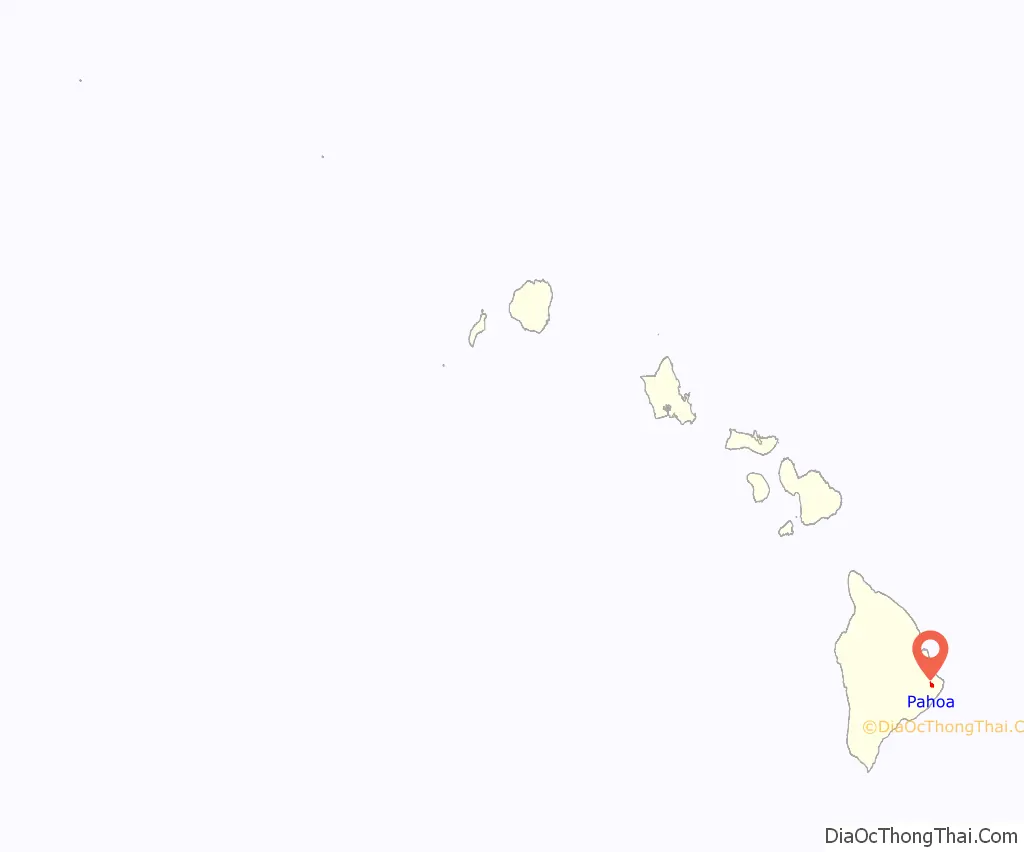
Pahoa location map. Where is Pahoa CDP?
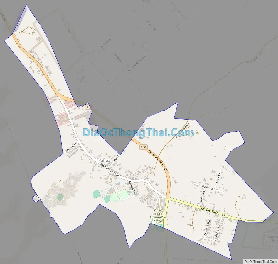
Pahoa Road Map
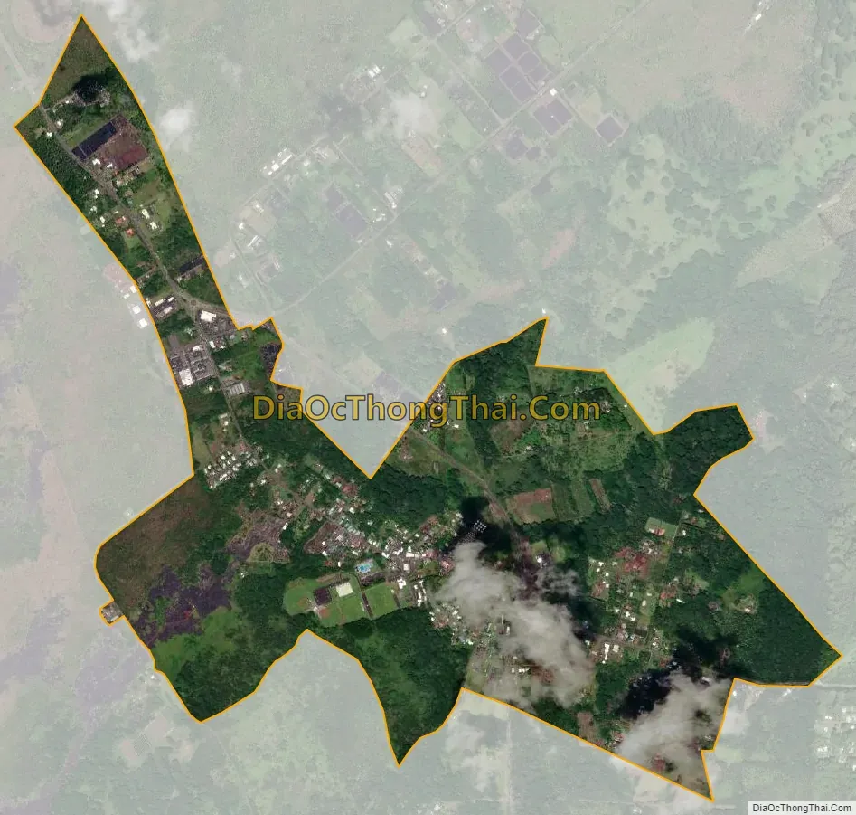
Pahoa city Satellite Map
Geography
According to the United States Census Bureau, the CDP has a total area of 2.3 square miles (6.0 km), all of it land. Soils underlying the Pāhoa area are volcanic in origin, deriving from the currently active Kīlauea Volcano (Earth Metrics Inc., 1986). Kīlauea is one of the Earth’s most active volcanoes, with the January 2006 eruption being the longest rift zone eruption in Kīlauea’s 200-year recorded history (Volcanology, 2007). The volcanic soils underlying Pāhoa are considered to have been generated by lava flows within the last 125 to 500 years. For example, the eruption of 1840 is known to have deposited a lava flow within 1.5 miles (2.4 km) of Pāhoa. Both Hawaii Route 130 and Hawaii Route 132 enter the town boundaries.
See also
Map of Hawaii State and its subdivision: Map of other states:- Alabama
- Alaska
- Arizona
- Arkansas
- California
- Colorado
- Connecticut
- Delaware
- District of Columbia
- Florida
- Georgia
- Hawaii
- Idaho
- Illinois
- Indiana
- Iowa
- Kansas
- Kentucky
- Louisiana
- Maine
- Maryland
- Massachusetts
- Michigan
- Minnesota
- Mississippi
- Missouri
- Montana
- Nebraska
- Nevada
- New Hampshire
- New Jersey
- New Mexico
- New York
- North Carolina
- North Dakota
- Ohio
- Oklahoma
- Oregon
- Pennsylvania
- Rhode Island
- South Carolina
- South Dakota
- Tennessee
- Texas
- Utah
- Vermont
- Virginia
- Washington
- West Virginia
- Wisconsin
- Wyoming


