Pākalā Village (literally, “the sun shines” in Hawaiian) is a census-designated place (CDP) in Kauaʻi County, Hawaiʻi, United States. The population was 286 at the 2020 census.
| Name: | Pakala Village CDP |
|---|---|
| LSAD Code: | 57 |
| LSAD Description: | CDP (suffix) |
| State: | Hawaii |
| County: | Kauai County |
| Elevation: | 40 ft (10 m) |
| Total Area: | 2.74 sq mi (7.09 km²) |
| Land Area: | 2.40 sq mi (6.20 km²) |
| Water Area: | 0.34 sq mi (0.89 km²) |
| Total Population: | 286 |
| Population Density: | 119.37/sq mi (46.09/km²) |
| Area code: | 808 |
| FIPS code: | 1560350 |
| GNISfeature ID: | 0362986 |
Online Interactive Map
Click on ![]() to view map in "full screen" mode.
to view map in "full screen" mode.
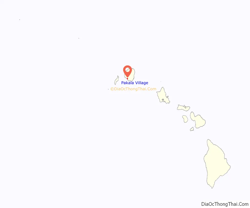
Pakala Village location map. Where is Pakala Village CDP?
History
Pākalā Village is also called “Pākalā Camp”, named for the temporary living quarters of plantation workers. Pākalā Camp consisted of employee and retiree housing for workers at the Gay & Robinson sugarcane plantation in the ahupuaʻa of Makaweli, the last remaining sugarcane plantation on Kauai. The plantation was managed by the Robinson family of Kauai and Niihau, who first arrived in Hawaii in 1863.
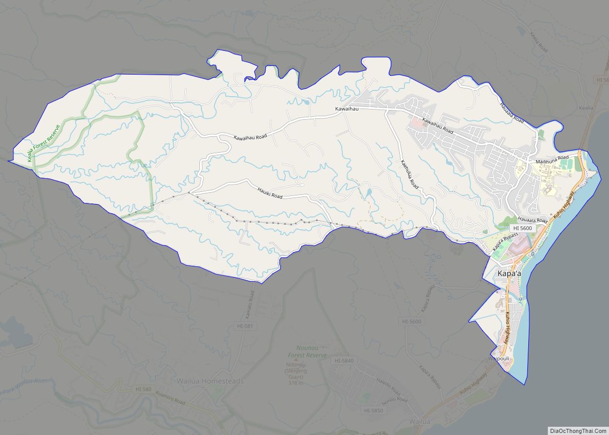
Pakala Village Road Map

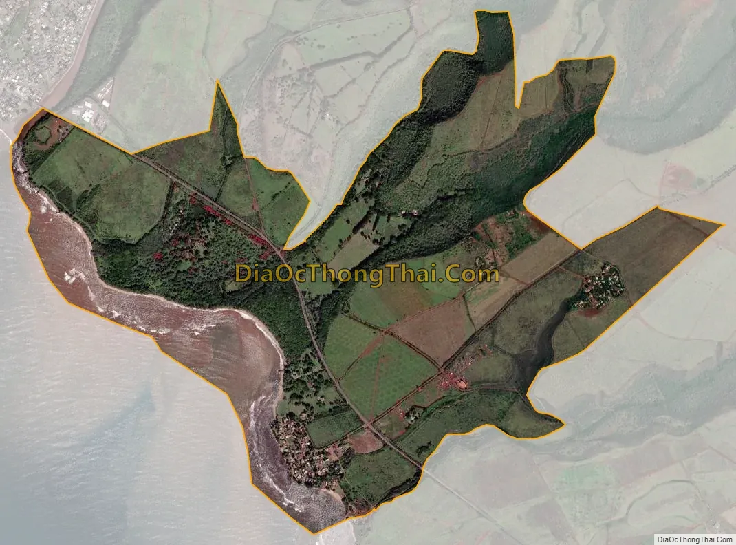
Pakala Village city Satellite Map
Geography
Pākalā Village is located on the southwest shore of the island of Kauai at 21°56′36″N 159°38′52″W / 21.94333°N 159.64778°W / 21.94333; -159.64778 (21.943221, -159.647658). It is bordered to the northwest by Waimea and to the southwest by the Pacific Ocean. The community of Pākalā Village is in the southwest part of the CDP, next to the Pacific. The CDP also includes the community of Kaawanui Village in the northeast. Hawaii Route 50 passes through the middle of the CDP, between the two settlements. The highway leads northwest 2 miles (3 km) into Waimea and southeast 1.5 miles (2.4 km) to Kaumakani.
According to the United States Census Bureau, the CDP has a total area of 2.7 square miles (7.1 km), of which 2.4 square miles (6.2 km) are land and 0.3 square miles (0.9 km), or 12.51%, are water. The CDP is served by the ZIP code 96769 and its post office is known as “Makaweli”.
See also
Map of Hawaii State and its subdivision: Map of other states:- Alabama
- Alaska
- Arizona
- Arkansas
- California
- Colorado
- Connecticut
- Delaware
- District of Columbia
- Florida
- Georgia
- Hawaii
- Idaho
- Illinois
- Indiana
- Iowa
- Kansas
- Kentucky
- Louisiana
- Maine
- Maryland
- Massachusetts
- Michigan
- Minnesota
- Mississippi
- Missouri
- Montana
- Nebraska
- Nevada
- New Hampshire
- New Jersey
- New Mexico
- New York
- North Carolina
- North Dakota
- Ohio
- Oklahoma
- Oregon
- Pennsylvania
- Rhode Island
- South Carolina
- South Dakota
- Tennessee
- Texas
- Utah
- Vermont
- Virginia
- Washington
- West Virginia
- Wisconsin
- Wyoming