Papaikou is a census-designated place (CDP) in Hawaii County, Hawaii, United States, and is a few miles north of the county seat, Hilo. The population of Papaikou was 1,314 at the 2010 census, down from 1,414 at the 2000 census.
| Name: | Papaikou CDP |
|---|---|
| LSAD Code: | 57 |
| LSAD Description: | CDP (suffix) |
| State: | Hawaii |
| County: | Hawaii County |
| Elevation: | 236 ft (72 m) |
| Total Area: | 2.17 sq mi (5.62 km²) |
| Land Area: | 1.45 sq mi (3.77 km²) |
| Water Area: | 0.71 sq mi (1.85 km²) |
| Total Population: | 1,166 |
| Population Density: | 801.93/sq mi (309.65/km²) |
| ZIP code: | 96781 |
| Area code: | 808 |
| FIPS code: | 1561550 |
| GNISfeature ID: | 0363121 |
Online Interactive Map
Click on ![]() to view map in "full screen" mode.
to view map in "full screen" mode.
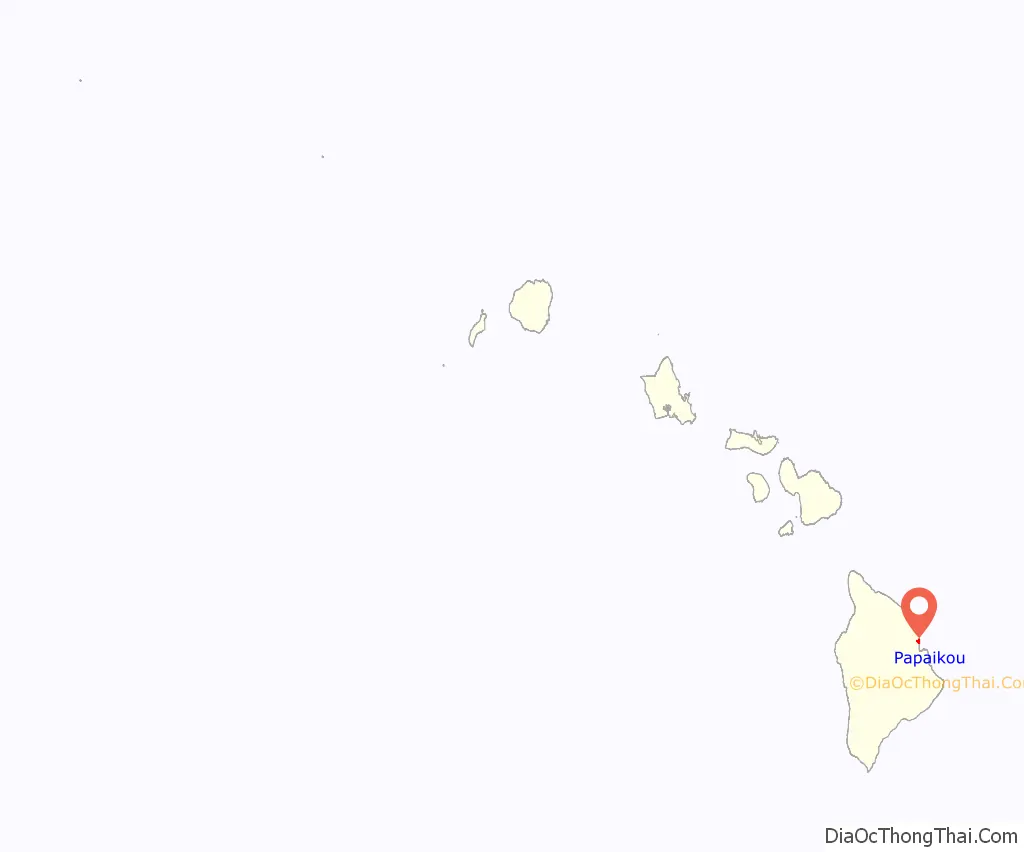
Papaikou location map. Where is Papaikou CDP?
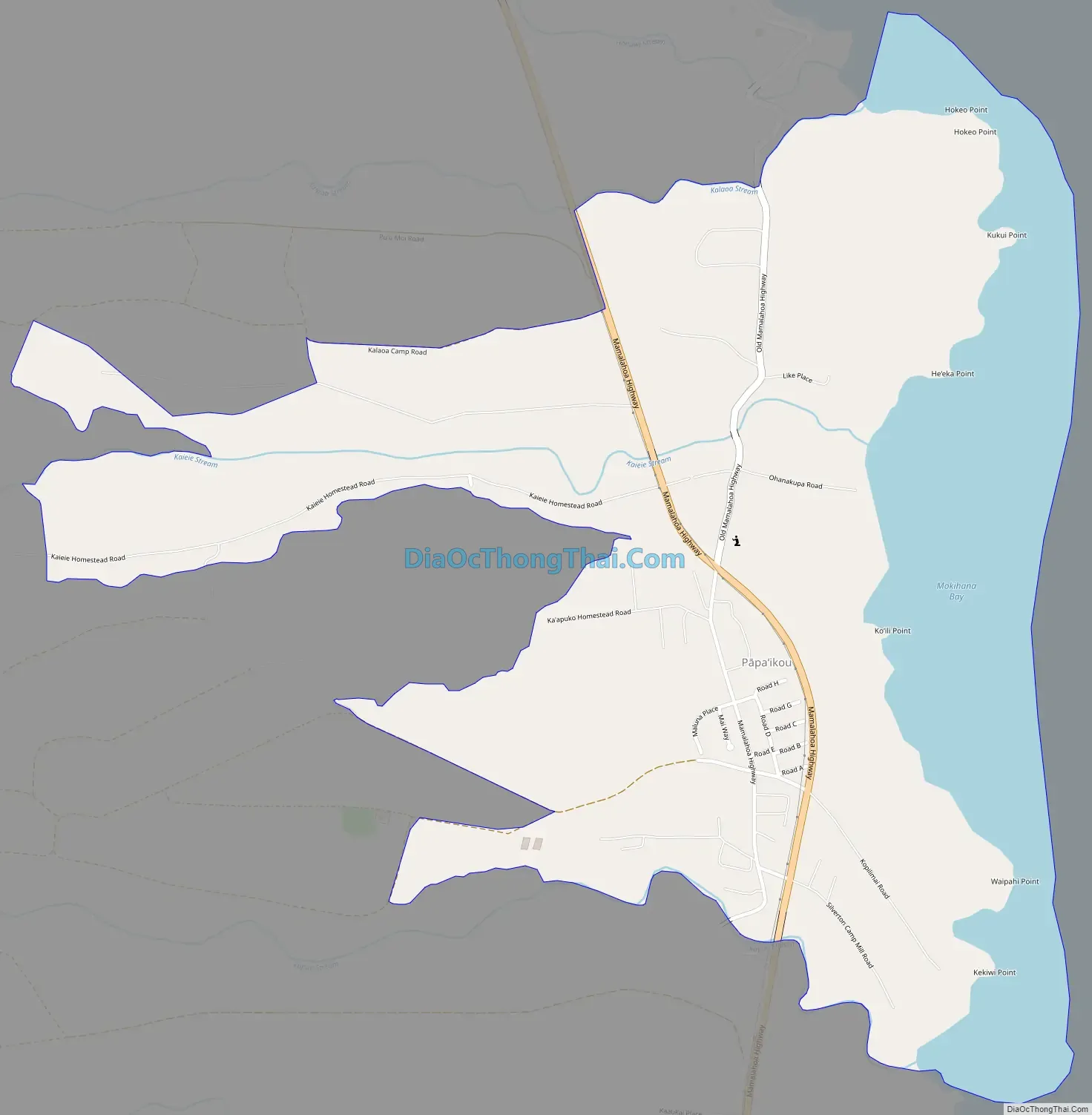
Papaikou Road Map
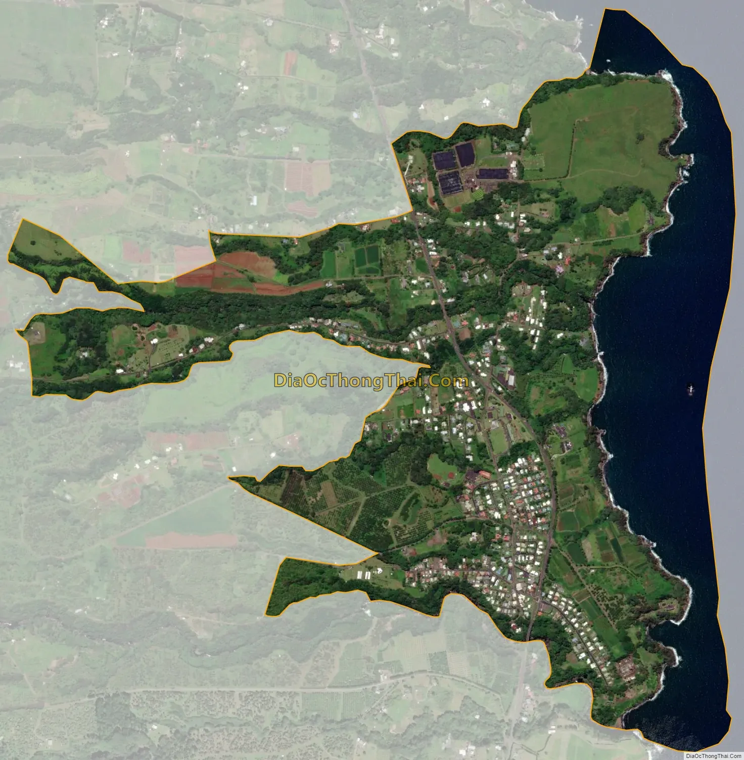
Papaikou city Satellite Map
Geography
Papaikou is located on the east side of the island of Hawaii at 19°47′38″N 155°5′48″W / 19.79389°N 155.09667°W / 19.79389; -155.09667 (19.794022, -155.096531). Hawaii Route 19 passes through the community, leading south 5 miles (8 km) to Hilo and northwest 37 miles (60 km) to Honokaa.
According to the United States Census Bureau, the Papaikou CDP has a total area of 1.9 square miles (4.9 km), of which 1.4 square miles (3.7 km) are land and 0.42 square miles (1.1 km), or 23.03%, are water. The CDP borders the Pacific Ocean from Hokeo Point in the north to Kekiwi Point in the south.
See also
Map of Hawaii State and its subdivision: Map of other states:- Alabama
- Alaska
- Arizona
- Arkansas
- California
- Colorado
- Connecticut
- Delaware
- District of Columbia
- Florida
- Georgia
- Hawaii
- Idaho
- Illinois
- Indiana
- Iowa
- Kansas
- Kentucky
- Louisiana
- Maine
- Maryland
- Massachusetts
- Michigan
- Minnesota
- Mississippi
- Missouri
- Montana
- Nebraska
- Nevada
- New Hampshire
- New Jersey
- New Mexico
- New York
- North Carolina
- North Dakota
- Ohio
- Oklahoma
- Oregon
- Pennsylvania
- Rhode Island
- South Carolina
- South Dakota
- Tennessee
- Texas
- Utah
- Vermont
- Virginia
- Washington
- West Virginia
- Wisconsin
- Wyoming


