Volcano is a census-designated place (CDP) in Hawaii County, Hawaii, United States located in the District of Puna with a small portion of the CDP in the District of Kaʻū. The population was 2,575 at the 2010 census, up from 2,231 at the 2000 census.
| Name: | Volcano CDP |
|---|---|
| LSAD Code: | 57 |
| LSAD Description: | CDP (suffix) |
| State: | Hawaii |
| County: | Hawaii County |
| Elevation: | 3,750 ft (1,143 m) |
| Total Area: | 58.6 sq mi (151.7 km²) |
| Land Area: | 58.6 sq mi (151.7 km²) |
| Water Area: | 0.0 sq mi (0.0 km²) |
| Total Population: | 2,575 |
| Population Density: | 44/sq mi (17.0/km²) |
| ZIP code: | 96785 |
| Area code: | 808 |
| FIPS code: | 1572350 |
| GNISfeature ID: | 0364402 |
Online Interactive Map
Click on ![]() to view map in "full screen" mode.
to view map in "full screen" mode.
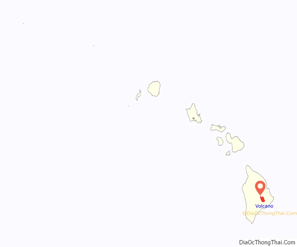
Volcano location map. Where is Volcano CDP?
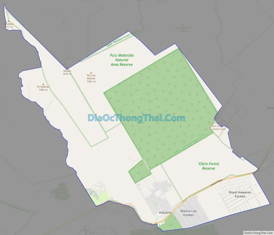
Volcano Road Map
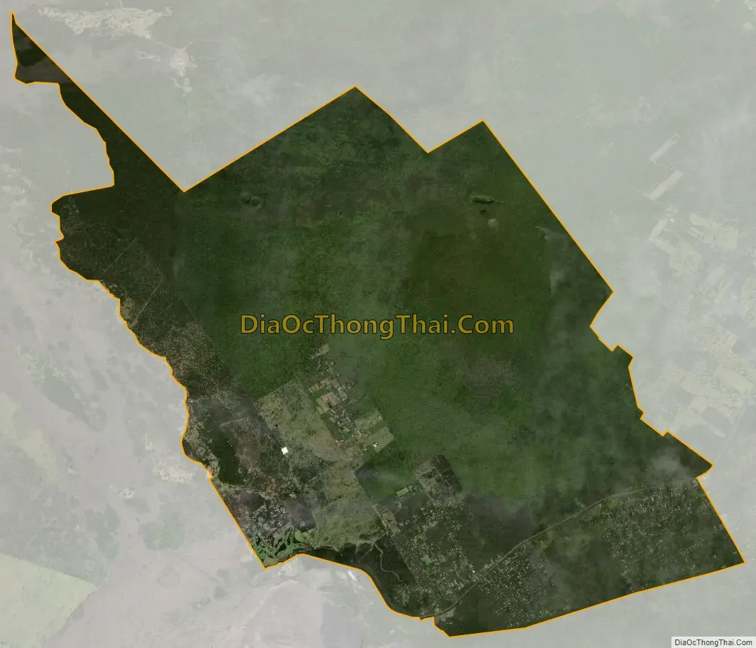
Volcano city Satellite Map
Geography
Volcano is located on the east side of the island of Hawaiʻi, on the border of Hawaii Volcanoes National Park and near the northeast rim of Kīlauea’s summit caldera.
According to the United States Census Bureau, the CDP has a total area of 58.6 square miles (151.7 km), all of it land. Hawaii Route 11 passes through the southern part of the community, leading northeast 27 miles (43 km) to Hilo and southwest 37 miles (60 km) to Nāʻālehu.
Owing to its altitude, ranging from below 2,800 feet (850 m) in the southeast to over 6,200 feet (1,900 m) at its uninhabited northern end, Volcano features a subtropical highland climate (Köppen Cfb), with relatively uniform temperatures and abundant rainfall throughout the year, although rainfall is concentrated during the months of November through April.
See also
Map of Hawaii State and its subdivision: Map of other states:- Alabama
- Alaska
- Arizona
- Arkansas
- California
- Colorado
- Connecticut
- Delaware
- District of Columbia
- Florida
- Georgia
- Hawaii
- Idaho
- Illinois
- Indiana
- Iowa
- Kansas
- Kentucky
- Louisiana
- Maine
- Maryland
- Massachusetts
- Michigan
- Minnesota
- Mississippi
- Missouri
- Montana
- Nebraska
- Nevada
- New Hampshire
- New Jersey
- New Mexico
- New York
- North Carolina
- North Dakota
- Ohio
- Oklahoma
- Oregon
- Pennsylvania
- Rhode Island
- South Carolina
- South Dakota
- Tennessee
- Texas
- Utah
- Vermont
- Virginia
- Washington
- West Virginia
- Wisconsin
- Wyoming


