Mooresville is a town located in the southwestern section of Iredell County, North Carolina, United States, and is a part of the fast-growing Charlotte metropolitan area. The population was 50,193 at the 2020 United States Census, making it the largest municipality in Iredell County. It is located approximately 25 miles (40 km) north of Charlotte.
Mooresville is best known as the home of many NASCAR racing teams and drivers, along with an IndyCar team and its drivers, as well as racing technology suppliers, which has earned the town the nickname “Race City USA”. Also located in Mooresville is the corporate headquarters of Lowe’s Corporation and Universal Technical Institute’s NASCAR Technical Institute.
| Name: | Mooresville town |
|---|---|
| LSAD Code: | 43 |
| LSAD Description: | town (suffix) |
| State: | North Carolina |
| County: | Iredell County |
| Elevation: | 925 ft (282 m) |
| Total Area: | 26.58 sq mi (68.84 km²) |
| Land Area: | 26.51 sq mi (68.66 km²) |
| Water Area: | 0.07 sq mi (0.17 km²) |
| Total Population: | 50,193 |
| Population Density: | 1,893.29/sq mi (731.00/km²) |
| ZIP code: | 28115, 28117 |
| Area code: | 704, 980 |
| FIPS code: | 3744220 |
| GNISfeature ID: | 0990209 |
| Website: | www.mooresvillenc.gov |
Online Interactive Map
Click on ![]() to view map in "full screen" mode.
to view map in "full screen" mode.
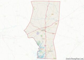
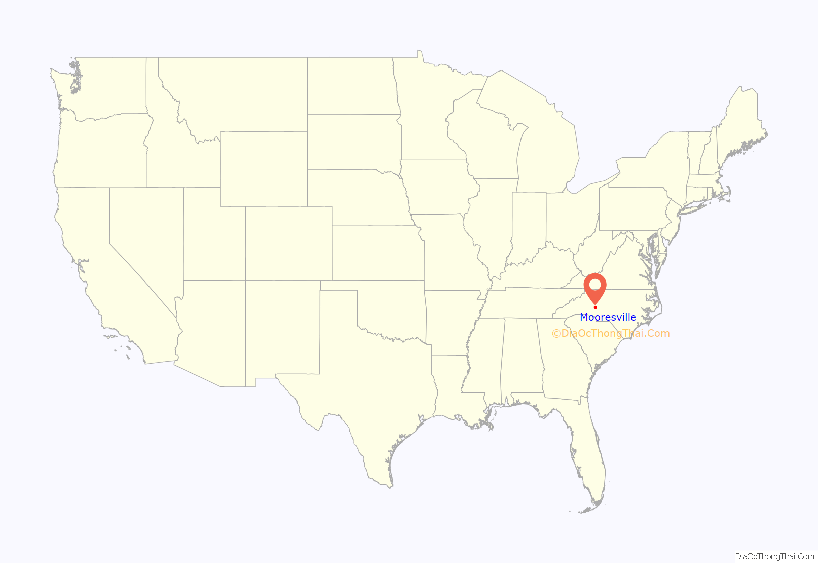
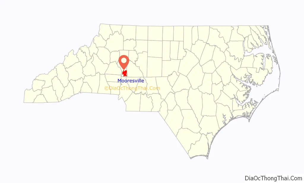
Mooresville location map. Where is Mooresville town?
History
The area that would develop into the town of Mooresville was originally settled by English, German, and Scots-Irish families who moved into the area from nearby Rowan County, as well as from Virginia, Pennsylvania, and elsewhere. Many were seeking new lands on which to establish farms. Many of the early families such as the Wilsons, Davidsons, Cowans, Sherrills, Torrances, and others came to the area as early as the mid-1700s. They formed small communities that eventually grew into the community known as “Deep Well”, which took its name from a large natural well that was found in the area.
Many of these families established large farms, primarily of cotton, which grew into small plantations by the 1850s. Major Rufus Reid was the most prominent planter in the area, enslaving 81 African Americans on over 2,000 acres (810 ha) of land. His property was known as Mount Mourne Plantation, named after the Mourne Mountains of County Down in Northern Ireland. Several other historic plantation homes are set in the area as well, including the Johnson-Neel House, the Cornelius House, Forest Dell Plantation, and the colonial era Belmont Plantation.
In 1856, a railroad was placed on a ridge that crossed the land of a local farmer by the name of John Franklin Moore. A small-scale planter, Moore set up a depot on his land, and encouraged others to help establish a small village on the location in the late 1850s. The little village, known as “Moore’s Siding”, was born. The Civil War hampered developments, with the railroad tracks being removed to aid the Confederate efforts in Virginia. After the war, the tracks were returned, and Moore’s Siding slowly began to prosper.
Shortly after the Civil War, John Franklin Moore saw the need for the village to incorporate into a town. The town was incorporated as Mooresville in 1873. Moore helped to establish the first brick factory in Mooresville, and built some of the first brick buildings on Main Street. He died in 1877, and his wife, Rachel Summrow Moore, continued the development of the town.
In 1883 the railroad lines were run back through the town with the addition of a new depot. The railroad brought growth to the town, which continued with the addition of the first water plant in the early 1890s, the establishment of a library in 1899, a phone company in 1893 and the first of many textile mills in 1900.
In 1938, artist Alicia Weincek painted the mural North Carolina Cotton Industry in the town’s post office, having won a WPA competition for the commissioned work.
The Mooresville Moors were a minor league baseball team who played in the Class D North Carolina State League from 1937 to 1942. The league ceased operations for two seasons due to World War II but was reorganized in 1945.
Selma Burke, a prominent sculptor during the Harlem Renaissance who was born and raised in Mooresville, created the bust of President Franklin D. Roosevelt for the Four Freedoms plaque on the Recorder of Deeds building in Washington, D.C. The bust would later be used for the image on the United States dime.
On December 11, 2014, Duke Energy, to repair a rusted, leaking pipe, received approval from North Carolina to dump coal ash (containing arsenic, lead, thallium and mercury, among other heavy metals) from the Marshall Steam Station 10 miles (16 km) west of Mooresville into Lake Norman.
On October 3, 2015, Duke reported that a sinkhole had formed at the base of the Marshall Steam Station dam on Lake Norman. The Department of Environmental Quality (DEQ) says Duke placed a liner in the hole and filled it with crushed stone.
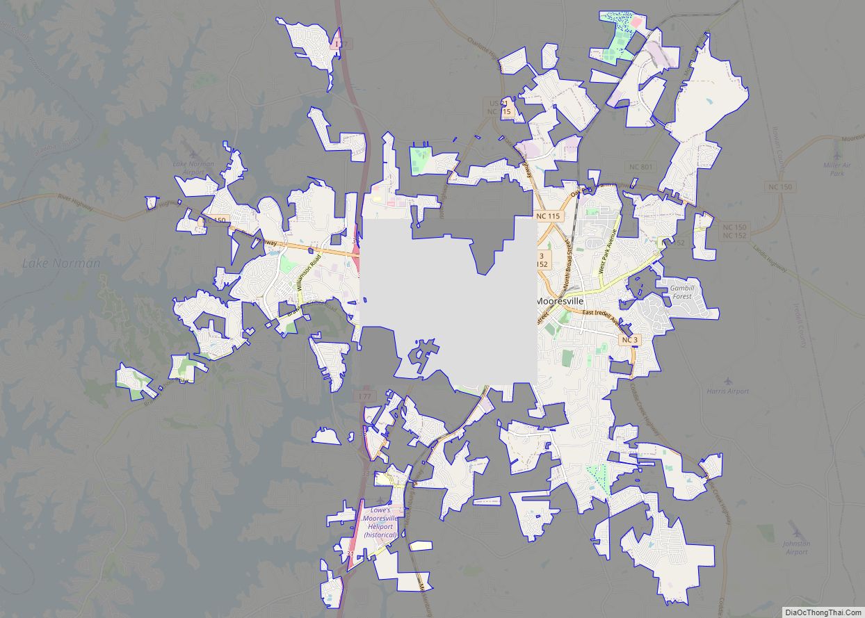
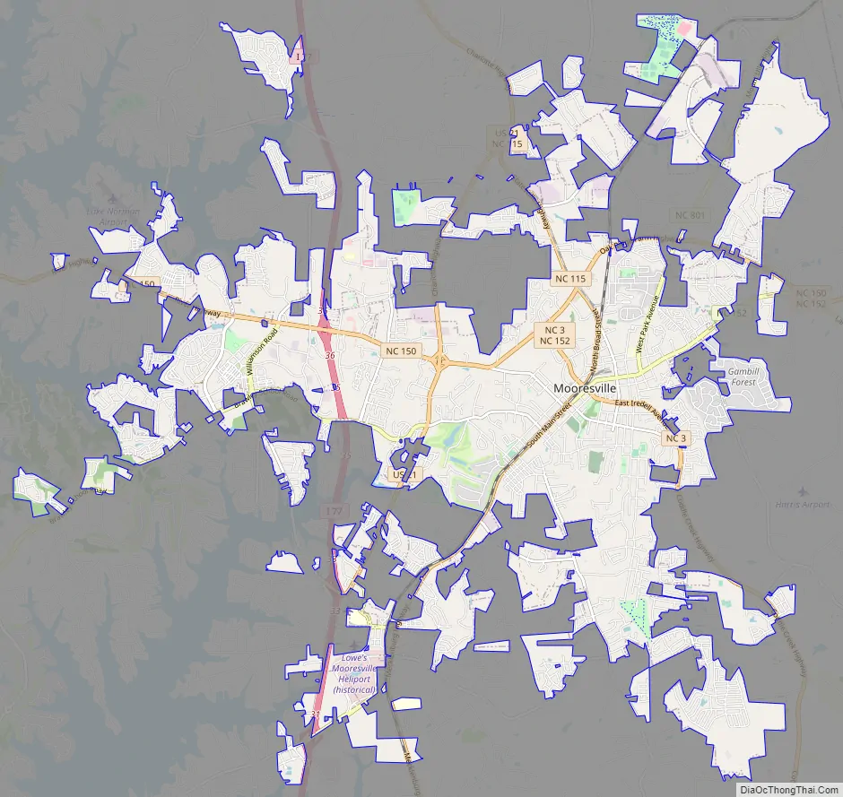
Mooresville Road Map
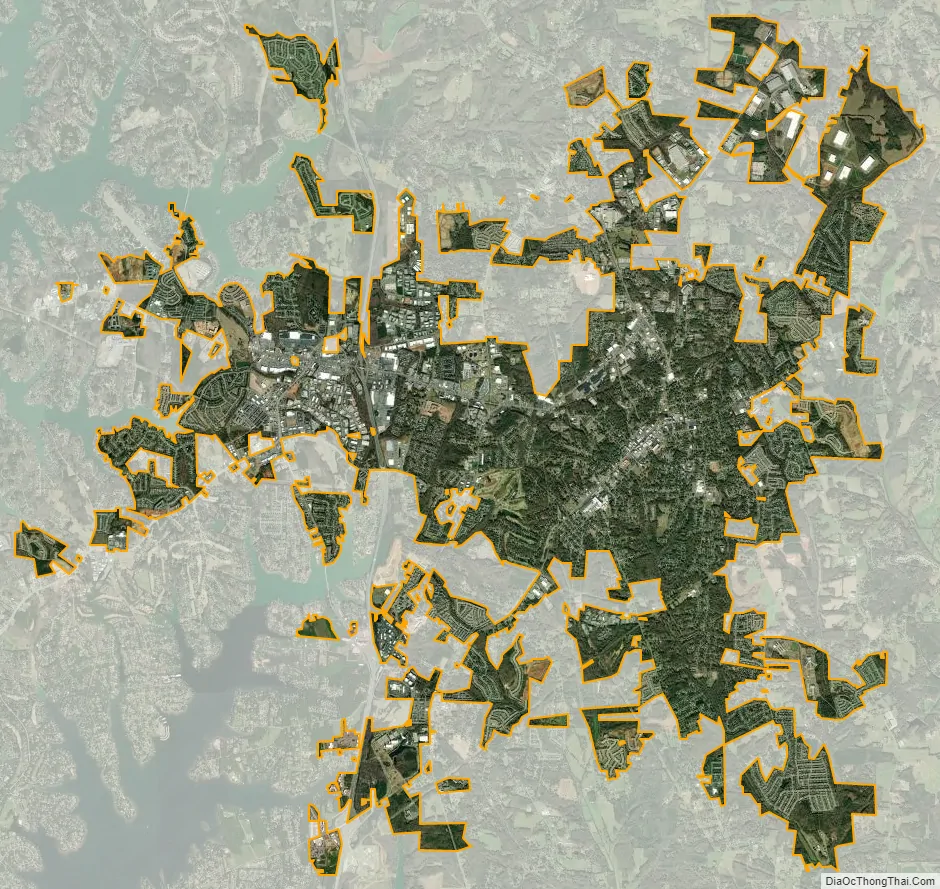
Mooresville city Satellite Map
Geography
Mooresville is located in southern Iredell County at 35°35′4″N 80°49′13″W / 35.58444°N 80.82028°W / 35.58444; -80.82028 (35.584337, −80.820139). Interstate 77 passes through the western side of the town, with access from Exits 31 through 36. I-77 leads south to the South Carolina border and north to the Virginia line. Statesville, just to the north, is the county seat. Lake Norman, on the Catawba River, is 3 to 8 miles (5 to 13 km) west of the town center. Mooresville is located 27 miles (43 km) north of Charlotte and 16 miles (26 km) south of Statesville.
According to the United States Census Bureau, Mooresville has a total area of 21.0 square miles (54.3 km), of which 20.9 square miles (54.2 km) are land and 0.04 square miles (0.1 km), or 0.24%, are water.
See also
Map of North Carolina State and its subdivision:- Alamance
- Alexander
- Alleghany
- Anson
- Ashe
- Avery
- Beaufort
- Bertie
- Bladen
- Brunswick
- Buncombe
- Burke
- Cabarrus
- Caldwell
- Camden
- Carteret
- Caswell
- Catawba
- Chatham
- Cherokee
- Chowan
- Clay
- Cleveland
- Columbus
- Craven
- Cumberland
- Currituck
- Dare
- Davidson
- Davie
- Duplin
- Durham
- Edgecombe
- Forsyth
- Franklin
- Gaston
- Gates
- Graham
- Granville
- Greene
- Guilford
- Halifax
- Harnett
- Haywood
- Henderson
- Hertford
- Hoke
- Hyde
- Iredell
- Jackson
- Johnston
- Jones
- Lee
- Lenoir
- Lincoln
- Macon
- Madison
- Martin
- McDowell
- Mecklenburg
- Mitchell
- Montgomery
- Moore
- Nash
- New Hanover
- Northampton
- Onslow
- Orange
- Pamlico
- Pasquotank
- Pender
- Perquimans
- Person
- Pitt
- Polk
- Randolph
- Richmond
- Robeson
- Rockingham
- Rowan
- Rutherford
- Sampson
- Scotland
- Stanly
- Stokes
- Surry
- Swain
- Transylvania
- Tyrrell
- Union
- Vance
- Wake
- Warren
- Washington
- Watauga
- Wayne
- Wilkes
- Wilson
- Yadkin
- Yancey
- Alabama
- Alaska
- Arizona
- Arkansas
- California
- Colorado
- Connecticut
- Delaware
- District of Columbia
- Florida
- Georgia
- Hawaii
- Idaho
- Illinois
- Indiana
- Iowa
- Kansas
- Kentucky
- Louisiana
- Maine
- Maryland
- Massachusetts
- Michigan
- Minnesota
- Mississippi
- Missouri
- Montana
- Nebraska
- Nevada
- New Hampshire
- New Jersey
- New Mexico
- New York
- North Carolina
- North Dakota
- Ohio
- Oklahoma
- Oregon
- Pennsylvania
- Rhode Island
- South Carolina
- South Dakota
- Tennessee
- Texas
- Utah
- Vermont
- Virginia
- Washington
- West Virginia
- Wisconsin
- Wyoming