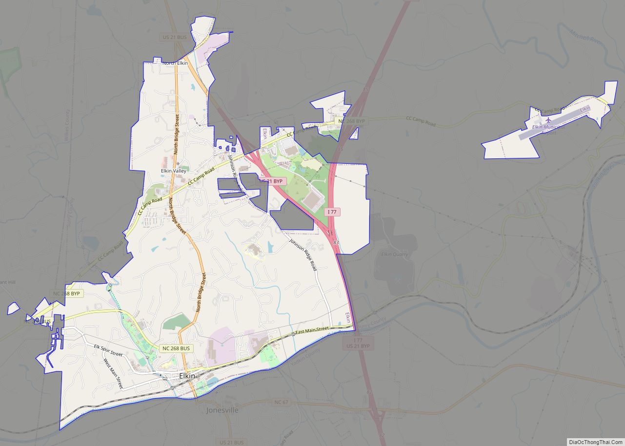
Elkin is a town in Surry and Wilkes counties in the U.S. state of North Carolina, along the Yadkin River. Elkin shares its name with the surrounding township of Elkin Township. The population was 4,083 at the 2020 census.
| Name: | Elkin town |
|---|---|
| LSAD Code: | 43 |
| LSAD Description: | town (suffix) |
| State: | North Carolina |
| County: | Surry County, Wilkes County |
| Incorporated: | March 5, 1889 |
| Elevation: | 906 ft (276 m) |
| Total Area: | 6.88 sq mi (17.81 km²) |
| Land Area: | 6.79 sq mi (17.59 km²) |
| Water Area: | 0.09 sq mi (0.22 km²) |
| Total Population: | 4,122 |
| Population Density: | 607.07/sq mi (234.39/km²) |
| ZIP code: | 28621 |
| Area code: | 336 |
| FIPS code: | 3720620 |
| GNISfeature ID: | 0984711 |
| Website: | www.elkinnc.org |
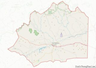
Online Interactive Map
Click on ![]() to view map in "full screen" mode.
to view map in "full screen" mode.
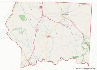
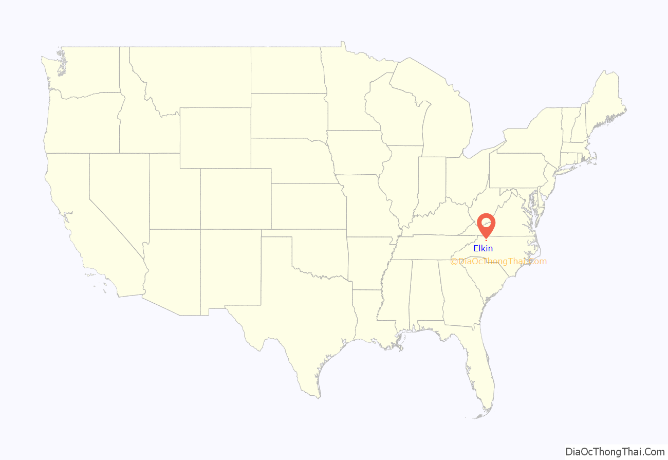
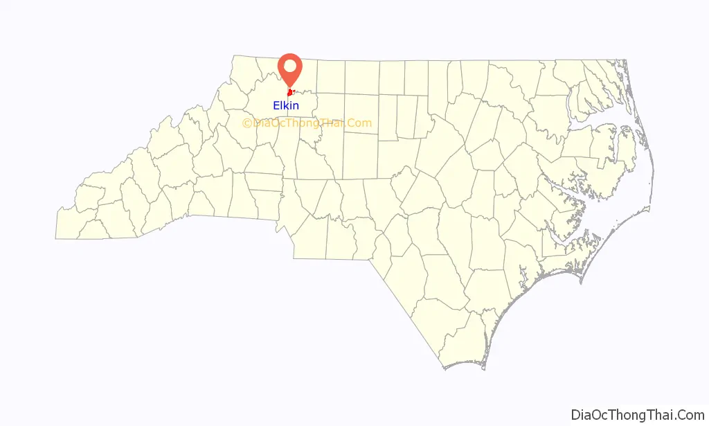
Elkin location map. Where is Elkin town?
History
The flowing together of the Yadkin River and Big Elkin Creek has drawn people to the area of what is now Elkin since the coming of the Paleo-Indians 10,000 years ago. The Sioux Indians settled along the Yadkin River as early as 500 BC. The first English colonists came in the mid-eighteenth century along with some colonists from Ireland. Cherokee Indians were also in the area, although the Cherokees had been active in the French and Indian War, they had joined in treaties with the English in 1763, followed by the events of the American Revolution.
Alexander Chatham opened a small woolen mill in 1877 that grew to become Elkin’s largest industry for many decades, The Chatham Manufacturing Company. Along with other mills in the area it has dwindled. The Northwestern North Carolina Railroad arrived in 1890; the town was ready to take the opportunities the railroad brought for commercial and industrial expansion. Its strategic location near the Yadkin River and the Big Elkin Creek and as a stop on the railroad caused prosperity that produced brick stores, many industries, and fine houses.
The beginning of industry with the cotton mill, the Civil War involvement, the coming of the railroad, the town’s coping with the depression of the Thirties, and the two world wars heavily influenced the town’s development. Chatham Manufacturing was famous for making World War II wool blankets for soldiers. There is a Civil War marker on West Main Street across from the Elkin Library.
The Elkin Municipal Park was the location during the Revolutionary War of a mustering field. Troops gathered to march on the Overmountain Victory Trail towards Wilkesboro then on to Morganton, NC, before they headed south to victory. There is a viewing site along Hwy 268, just west of the Rec Center that tells the story on an information panel.
Cedar Point, Downtown Elkin Historic District, Gwyn Avenue-Bridge Street Historic District, and the Hugh Chatham Memorial Hospital, (former) are listed on the National Register of Historic Places.
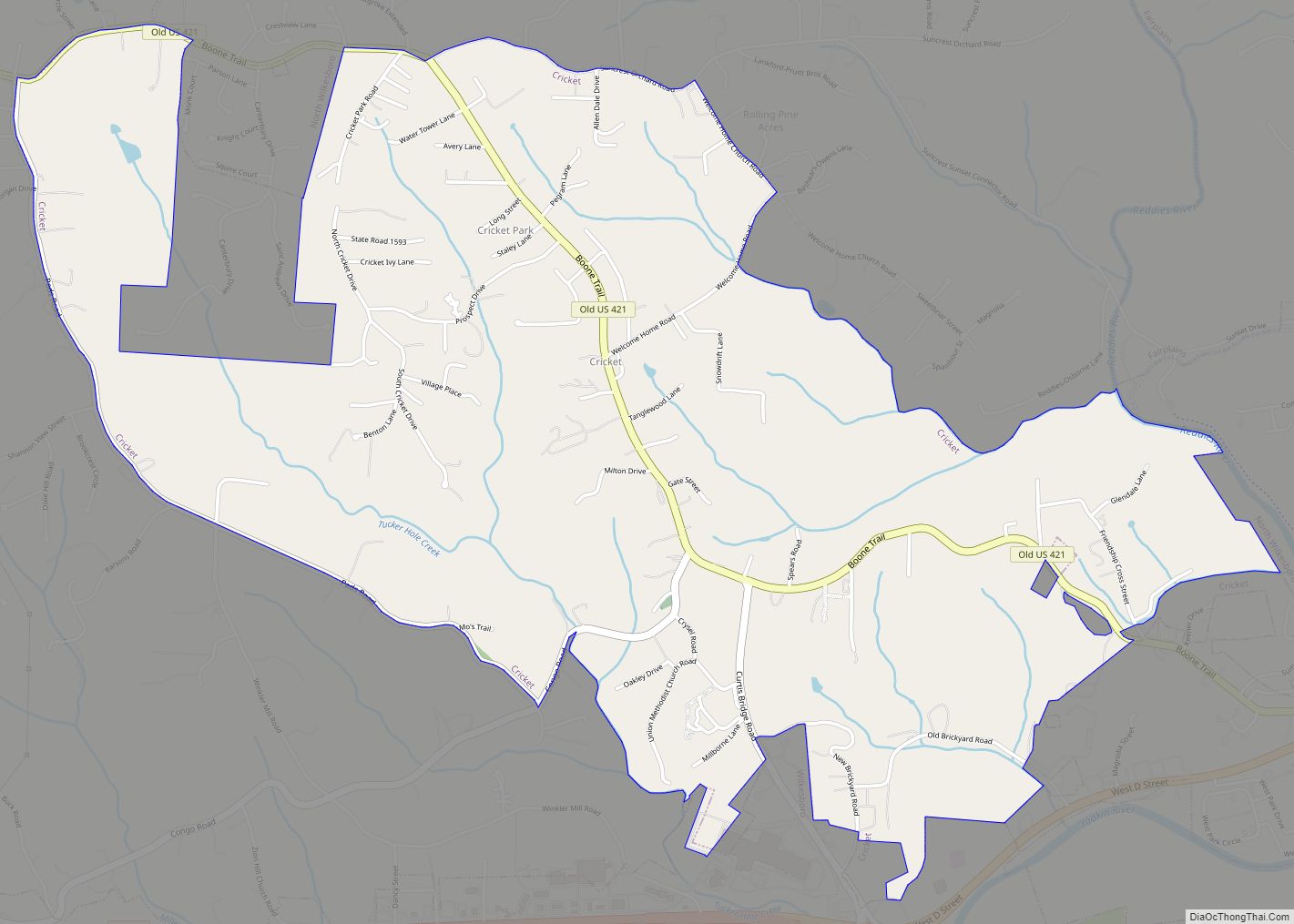
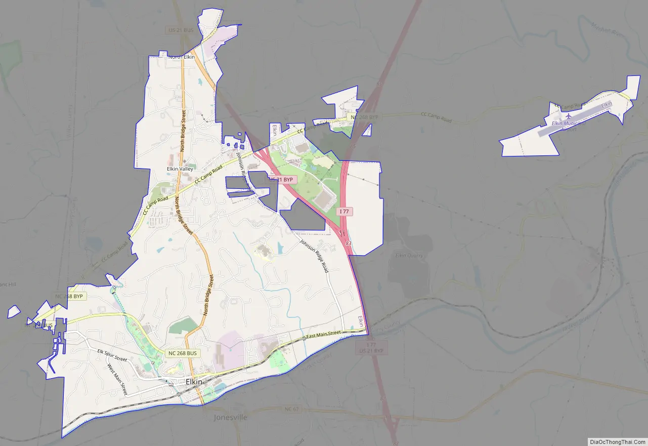
Elkin Road Map
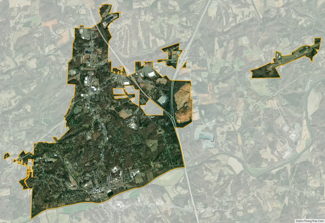
Elkin city Satellite Map
Geography
Elkin is located at 36°15′28″N 80°51′5″W / 36.25778°N 80.85139°W / 36.25778; -80.85139 (36.257709, -80.851296).
According to the United States Census Bureau, the town has a total area of 6.3 square miles (16.4 km), of which 6.2 square miles (16.2 km) is land and 0.1 square mile (0.2 km) (1.10%) is water.
Elkin is approximately 15 minutes south of Stone Mountain State Park, and 20 minutes from the entrance of the Blue Ridge Parkway off Hwy 21 (heading towards Sparta). Elkin enjoys mild weather patterns and extremely clean air. Its downtown is also situated along the Yadkin River, and offers a paddlers boat ramp and small camp site. Six local outfitters provide supplies for anyone interested in floating on the Yadkin to or from Elkin.
There are also numerous vineyards in the Yadkin Valley area (over 40 in and around Elkin), and the Yadkin Valley Wine Festival is held each May at the Elkin Municipal Park, which is situated along Big Elkin Creek, a tributary of the Yadkin River. Elkin is centrally located in the Yadkin Valley Wine Region (a certified American Viticulture Area). Elkin has also has two microbreweries and hosts a craft brewery festival each fall in called The Big Elkin Brewfest. It is held in the Municipal Park, which was a mustering field during the American Revolution. Elkin was the easternmost encampment along Overmountain Victory Trail and there a marker at the park, near the recreation center, along Hwy 268.
Trails are abundant in Elkin, including the Overmountain Victory Trail, the North Carolina Mountains to Sea Trail, and the Yadkin River State Park ‘Blue’ Trail. Elkin is considered an official Trail Town as the NC MST is now directed into downtown Elkin along Main St. A local volunteer group (elkinvalleytrails.org) is responsible for grooming over 24 miles of the trail from Elkin to Stone Mountain State Park. The group are working on the E&A Rail Trail, which boasts mountain bike trails, walking trails, and trout fishing, all beginning at the Elkin Municipal Park, and there is even a golf cart rental at the Rec Center for handicapped individuals who would like to enjoy the trails.
See also
Map of North Carolina State and its subdivision:- Alamance
- Alexander
- Alleghany
- Anson
- Ashe
- Avery
- Beaufort
- Bertie
- Bladen
- Brunswick
- Buncombe
- Burke
- Cabarrus
- Caldwell
- Camden
- Carteret
- Caswell
- Catawba
- Chatham
- Cherokee
- Chowan
- Clay
- Cleveland
- Columbus
- Craven
- Cumberland
- Currituck
- Dare
- Davidson
- Davie
- Duplin
- Durham
- Edgecombe
- Forsyth
- Franklin
- Gaston
- Gates
- Graham
- Granville
- Greene
- Guilford
- Halifax
- Harnett
- Haywood
- Henderson
- Hertford
- Hoke
- Hyde
- Iredell
- Jackson
- Johnston
- Jones
- Lee
- Lenoir
- Lincoln
- Macon
- Madison
- Martin
- McDowell
- Mecklenburg
- Mitchell
- Montgomery
- Moore
- Nash
- New Hanover
- Northampton
- Onslow
- Orange
- Pamlico
- Pasquotank
- Pender
- Perquimans
- Person
- Pitt
- Polk
- Randolph
- Richmond
- Robeson
- Rockingham
- Rowan
- Rutherford
- Sampson
- Scotland
- Stanly
- Stokes
- Surry
- Swain
- Transylvania
- Tyrrell
- Union
- Vance
- Wake
- Warren
- Washington
- Watauga
- Wayne
- Wilkes
- Wilson
- Yadkin
- Yancey
- Alabama
- Alaska
- Arizona
- Arkansas
- California
- Colorado
- Connecticut
- Delaware
- District of Columbia
- Florida
- Georgia
- Hawaii
- Idaho
- Illinois
- Indiana
- Iowa
- Kansas
- Kentucky
- Louisiana
- Maine
- Maryland
- Massachusetts
- Michigan
- Minnesota
- Mississippi
- Missouri
- Montana
- Nebraska
- Nevada
- New Hampshire
- New Jersey
- New Mexico
- New York
- North Carolina
- North Dakota
- Ohio
- Oklahoma
- Oregon
- Pennsylvania
- Rhode Island
- South Carolina
- South Dakota
- Tennessee
- Texas
- Utah
- Vermont
- Virginia
- Washington
- West Virginia
- Wisconsin
- Wyoming