Statesville is a city in and the county seat of Iredell County, North Carolina, United States, and it is part of the Charlotte metropolitan area. Statesville was established in 1789 by an act of the North Carolina Legislature. The population was 28,419 at the time of the 2020 census.
| Name: | Statesville city |
|---|---|
| LSAD Code: | 25 |
| LSAD Description: | city (suffix) |
| State: | North Carolina |
| County: | Iredell County |
| Elevation: | 919 ft (280 m) |
| Total Area: | 25.44 sq mi (65.88 km²) |
| Land Area: | 25.32 sq mi (65.59 km²) |
| Water Area: | 0.11 sq mi (0.29 km²) |
| Total Population: | 28,419 |
| Population Density: | 1,122.17/sq mi (433.28/km²) |
| Area code: | 704, 980 |
| FIPS code: | 3764740 |
| GNISfeature ID: | 0995438 |
| Website: | www.statesvillenc.net |
Online Interactive Map
Click on ![]() to view map in "full screen" mode.
to view map in "full screen" mode.
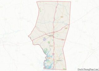
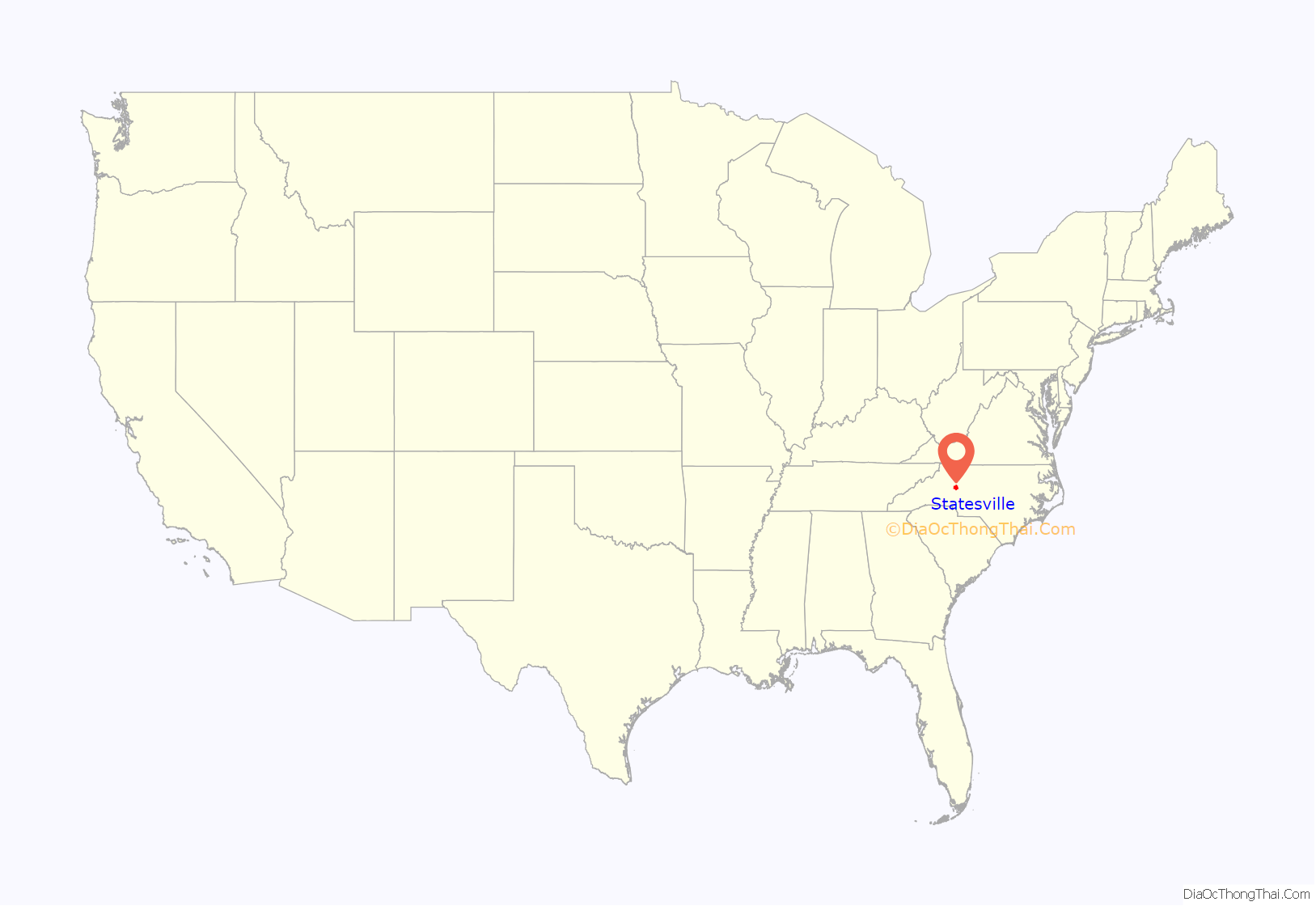
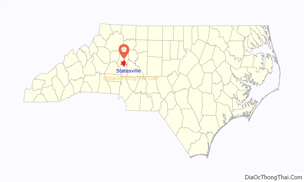
Statesville location map. Where is Statesville city?
History
In 1753, Scots-Irish Presbyterians and German Lutherans, who had originally settled in Pennsylvania, began arriving in what would become Statesville in 1789 to plant crops in the fertile soil where game and water were also plentiful. The settlement, known as Fourth Creek Congregation, was named for the freshwater stream running to the north of the present-day city center, the fourth creek west of the neighboring settlement of Salisbury. The center of the settlement was a log cabin where the Presbyterians worshiped and where the First Presbyterian Church is located today.
In 1755, colonial governor Arthur Dobbs authorized the construction of the colony’s frontier fort, which was located approximately 3 miles (5 km) due north of the Fourth Creek settlement. Built and garrisoned by North Carolina provincial soldiers, Fort Dobbs defended British North America’s western frontier in the colony of North Carolina during the French and Indian War and Anglo-Cherokee War. Fort Dobbs combined the functions of a military barracks, fortification, refuge for settlers, provisioning depot and center for negotiations with Native Americans.
The state legislature divided Rowan County in 1788, and the new county was named “Iredell” for James Iredell, associate justice of the first Supreme Court during the presidency of George Washington.
One year later, the legislature selected a spot for the county seat. The Fourth Creek Congregation was chosen, and the settlement became known as “Statesville”. The 1800 US Census lists the town as “States Ville”, which was later combined as “Statesville”. In 1800, there were 95 inhabitants in “States Ville”, including 68 free white persons and 27 slaves.
As early as 1833, Statesville’s leaders began laying track for railroads to connect the Piedmont area of North Carolina with the rest of the country.
By 1858, Statesville was growing rapidly and soon afterward began leading the state in the production of tobacco and tobacco products, the manufacture and blending of whiskey, and became a large distribution center for roots and herbs.
On August 27, 1891, a passenger train derailed on a 300-foot-long (91 m) bridge, and seven cars fell down. About 30 people died in the accident.
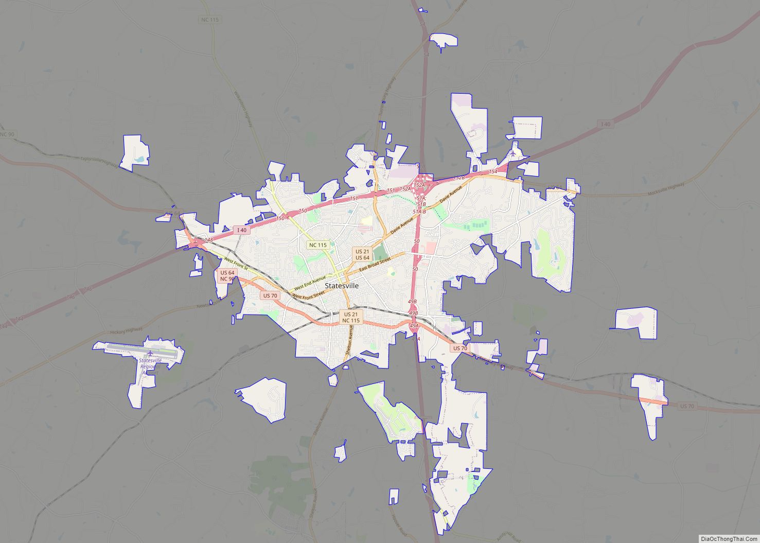
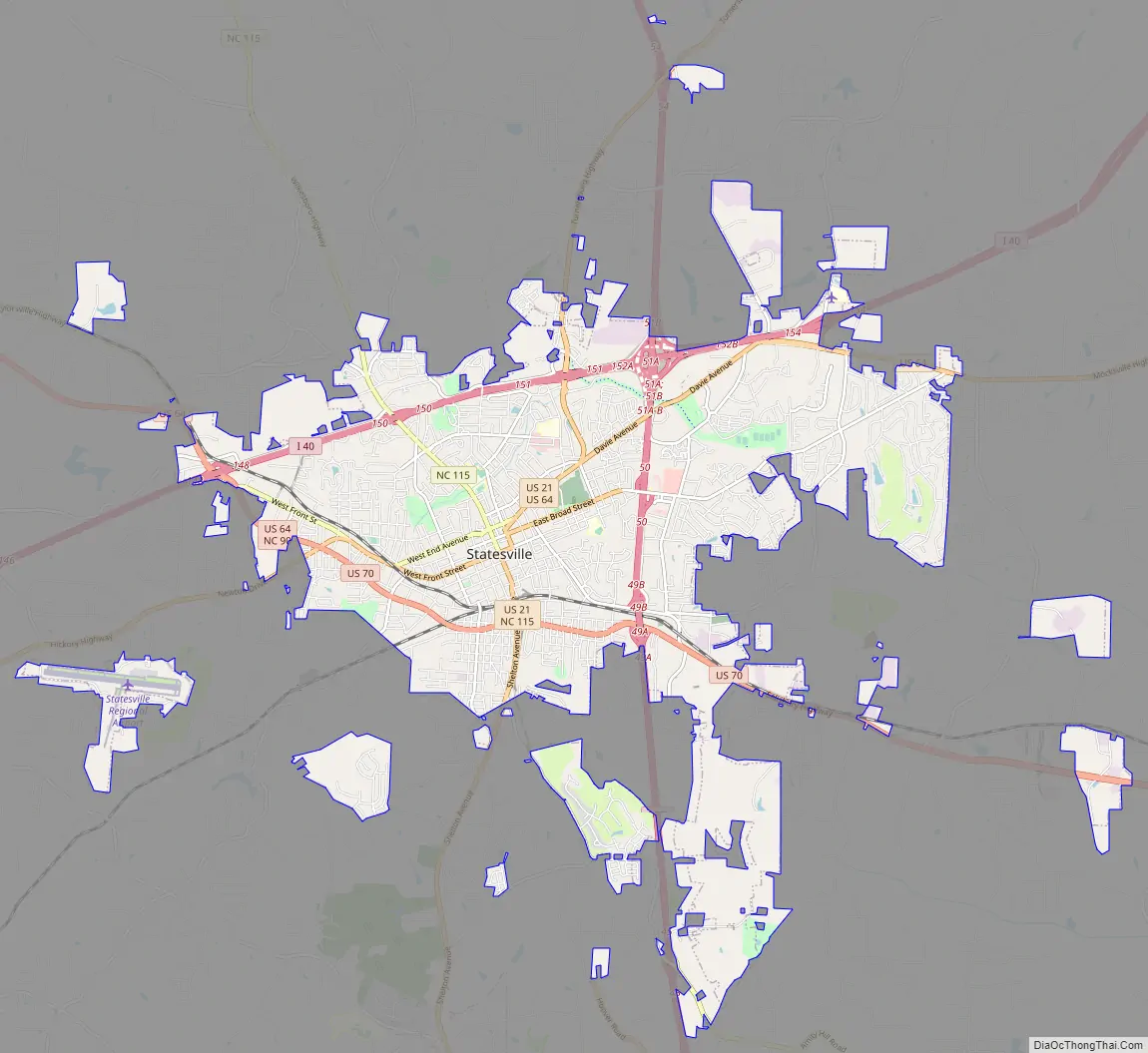
Statesville Road Map
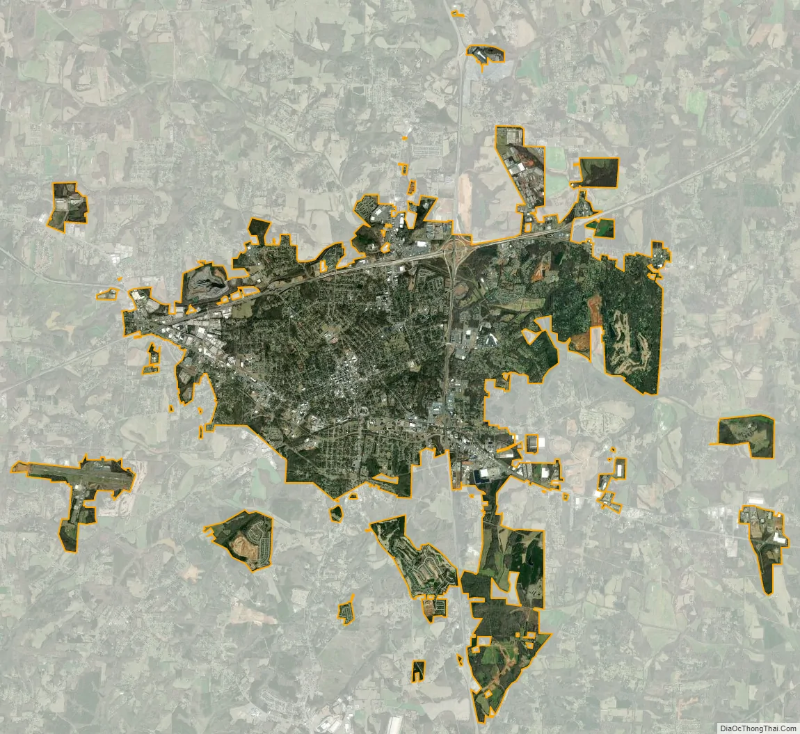
Statesville city Satellite Map
Geography
Statesville is in central Iredell County, in the western part of the Piedmont region of North Carolina.
According to the U.S. Census Bureau, Statesville has a total area of 24.4 square miles (63.1 km), of which 24.2 square miles (62.8 km) are land and 0.1 square miles (0.3 km), or 0.48%, are water. The north side of Statesville is drained by Fourth Creek, while the south side is drained by Third Creek. Both creeks flow east, joining just before reaching the South Yadkin River near Cooleemee.
Climate
Statesville has a humid subtropical climate (Cfa) like most of the state of North Carolina, although its higher elevation leads to cooler temperatures than much of the Piedmont. Summers are generally hot and humid, with mild nights, while winters are usually cool with chilly nights and sporadic snowfall. Severe thunderstorms can be an issue during summer, with wind speeds of 60 mph and even gusts of 95 mph being recorded during these storms.
See also
Map of North Carolina State and its subdivision:- Alamance
- Alexander
- Alleghany
- Anson
- Ashe
- Avery
- Beaufort
- Bertie
- Bladen
- Brunswick
- Buncombe
- Burke
- Cabarrus
- Caldwell
- Camden
- Carteret
- Caswell
- Catawba
- Chatham
- Cherokee
- Chowan
- Clay
- Cleveland
- Columbus
- Craven
- Cumberland
- Currituck
- Dare
- Davidson
- Davie
- Duplin
- Durham
- Edgecombe
- Forsyth
- Franklin
- Gaston
- Gates
- Graham
- Granville
- Greene
- Guilford
- Halifax
- Harnett
- Haywood
- Henderson
- Hertford
- Hoke
- Hyde
- Iredell
- Jackson
- Johnston
- Jones
- Lee
- Lenoir
- Lincoln
- Macon
- Madison
- Martin
- McDowell
- Mecklenburg
- Mitchell
- Montgomery
- Moore
- Nash
- New Hanover
- Northampton
- Onslow
- Orange
- Pamlico
- Pasquotank
- Pender
- Perquimans
- Person
- Pitt
- Polk
- Randolph
- Richmond
- Robeson
- Rockingham
- Rowan
- Rutherford
- Sampson
- Scotland
- Stanly
- Stokes
- Surry
- Swain
- Transylvania
- Tyrrell
- Union
- Vance
- Wake
- Warren
- Washington
- Watauga
- Wayne
- Wilkes
- Wilson
- Yadkin
- Yancey
- Alabama
- Alaska
- Arizona
- Arkansas
- California
- Colorado
- Connecticut
- Delaware
- District of Columbia
- Florida
- Georgia
- Hawaii
- Idaho
- Illinois
- Indiana
- Iowa
- Kansas
- Kentucky
- Louisiana
- Maine
- Maryland
- Massachusetts
- Michigan
- Minnesota
- Mississippi
- Missouri
- Montana
- Nebraska
- Nevada
- New Hampshire
- New Jersey
- New Mexico
- New York
- North Carolina
- North Dakota
- Ohio
- Oklahoma
- Oregon
- Pennsylvania
- Rhode Island
- South Carolina
- South Dakota
- Tennessee
- Texas
- Utah
- Vermont
- Virginia
- Washington
- West Virginia
- Wisconsin
- Wyoming