Mitchellville is an upper-class majority African-American unincorporated area and census-designated place (CDP) in Prince George’s County, Maryland, United States. Per the 2020 census, the population was 11,136.
| Name: | Mitchellville CDP |
|---|---|
| LSAD Code: | 57 |
| LSAD Description: | CDP (suffix) |
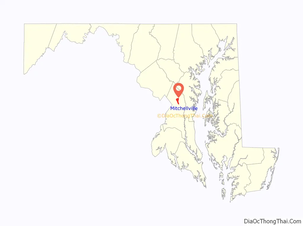
| State: | Maryland |
| County: | Prince George’s County |
| Elevation: | 105 ft (32 m) |
| Total Area: | 4.96 sq mi (12.84 km²) |
| Land Area: | 4.94 sq mi (12.79 km²) |
| Water Area: | 0.02 sq mi (0.05 km²) |
| Total Population: | 11,136 |
| Population Density: | 2,255.62/sq mi (870.88/km²) |
| ZIP code: | 20716, 20717, 20721, 20720 |
| Area code: | 301, 240 |
| FIPS code: | 2452975 |
| GNISfeature ID: | 0597758 |
Online Interactive Map
Click on ![]() to view map in "full screen" mode.
to view map in "full screen" mode.
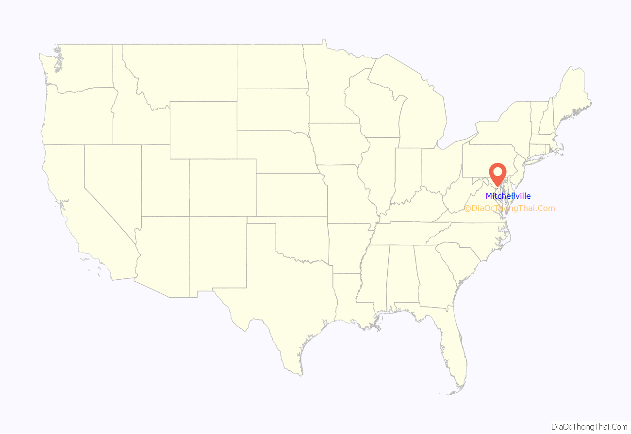
Mitchellville location map. Where is Mitchellville CDP?
History
Mitchellville was named for John Mitchell (1788–1862), who owned Essington Hall, the plantation that encompassed much of the area. He and his wife Mary Lanham are buried in the Mitchell Family Cemetery on Mitchellville and Mount Oak Road. This location is now South Bowie, and the Bowie CDP 08775 An 1878 G.M. Hopkins Atlas shows “Mitchellville P.O.” near the same corner of what is today Mitchellville and Mount Oak Road. In its original cataloging the name and place “Mitchellville”, the USGS used the railroad guide “Mitchellville (Mulliki’n) G. S. Owensville sheet Mitchellville P. G. 614 Mulliken R.’R. Guide, 314.” as a basis in its decision card documentation where a Mullikin/Mitchellville railroad stop served also as the post office. This is also seen in other historic maps
As of 2010, the Census designated place (“CDP”) Mitchellville is no longer encompassing of the original Mitchellville, location of the old Essington Hall, but is drawn one CDP tract over on the west of the Woodmore CDP.
Also, see “Woodmore” for common historical information
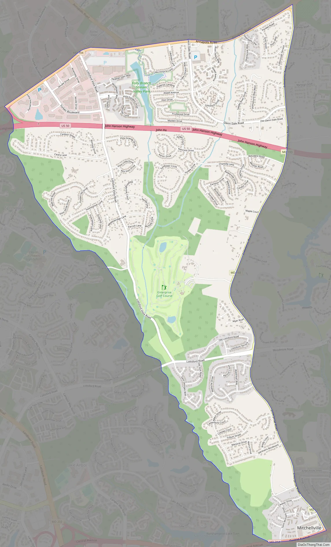
Mitchellville Road Map
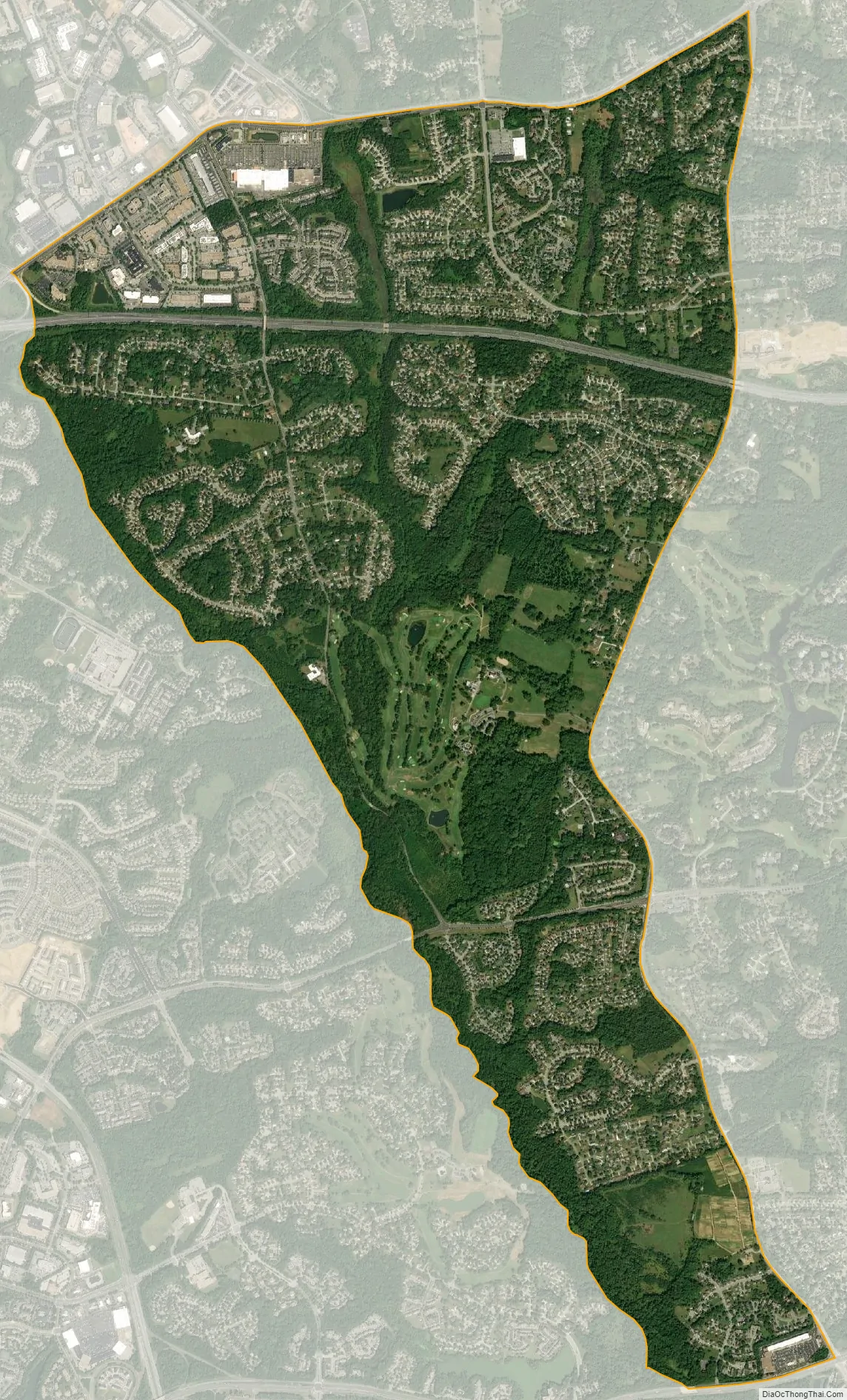
Mitchellville city Satellite Map
Geography
Mitchellville is located at 38°56′29″N 76°48′49″W / 38.941300°N 76.813616°W / 38.941300; -76.813616.
According to the United States Census Bureau, the CDP has a total area of 5.0 square miles (13 km), all land.
See also
Map of Maryland State and its subdivision: Map of other states:- Alabama
- Alaska
- Arizona
- Arkansas
- California
- Colorado
- Connecticut
- Delaware
- District of Columbia
- Florida
- Georgia
- Hawaii
- Idaho
- Illinois
- Indiana
- Iowa
- Kansas
- Kentucky
- Louisiana
- Maine
- Maryland
- Massachusetts
- Michigan
- Minnesota
- Mississippi
- Missouri
- Montana
- Nebraska
- Nevada
- New Hampshire
- New Jersey
- New Mexico
- New York
- North Carolina
- North Dakota
- Ohio
- Oklahoma
- Oregon
- Pennsylvania
- Rhode Island
- South Carolina
- South Dakota
- Tennessee
- Texas
- Utah
- Vermont
- Virginia
- Washington
- West Virginia
- Wisconsin
- Wyoming


