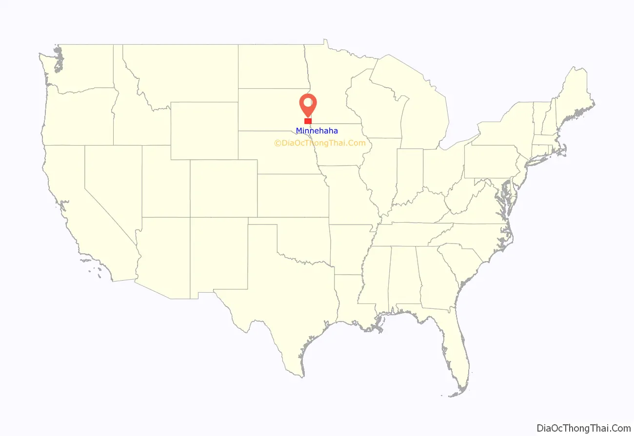
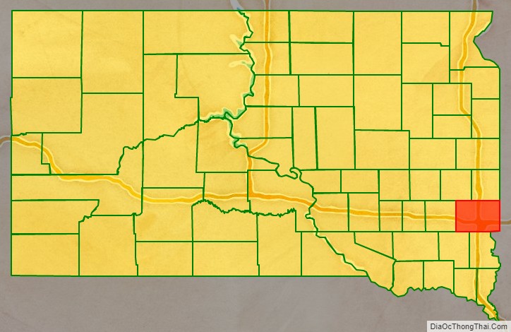
Minnehaha County is a county on the eastern border of the state of South Dakota. As of the 2020 census, the population was 197,214, making it the state’s most populous county. It contains over 20% of the state’s population. Its county seat is Sioux Falls, South Dakota’s largest city. The county was created in 1862 and organized in 1868. Its name was derived from the Sioux word Mnihaha, meaning “rapid water,” or “waterfall” (often incorrectly translated as “laughing water”).
Minnehaha County is part of the Sioux Falls Metropolitan Statistical Area, the state’s largest.
| Name: | Minnehaha County |
|---|---|
| FIPS code: | 46-099 |
| State: | South Dakota |
| Founded: | 1862 |
| Named for: | “rapid water” |
| Seat: | Sioux Falls |
| Largest city: | Sioux Falls |
| Total Area: | 814 sq mi (2,110 km²) |
| Land Area: | 807 sq mi (2,090 km²) |
| Total Population: | 197,214 |
| Population Density: | 239/sq mi (92/km²) |
| Time zone: | UTC−6 (Central) |
| Summer Time Zone (DST): | UTC−5 (CDT) |
| Website: | www.minnehahacounty.org |
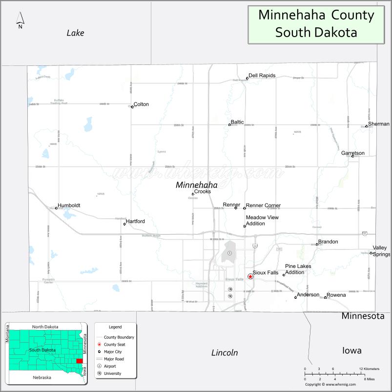
Minnehaha County location map. Where is Minnehaha County?
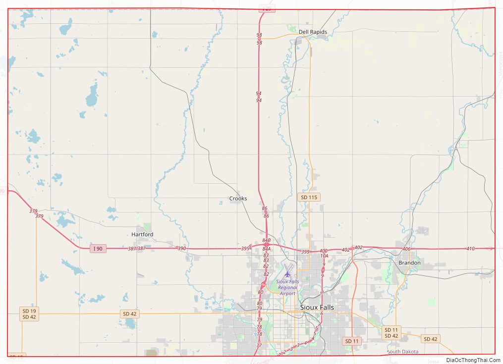
Minnehaha County Road Map
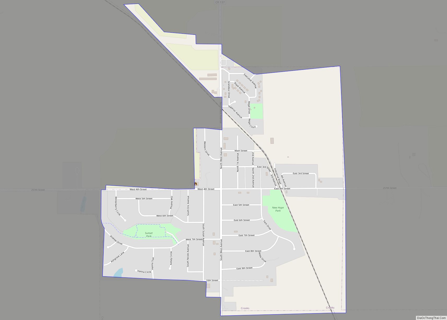
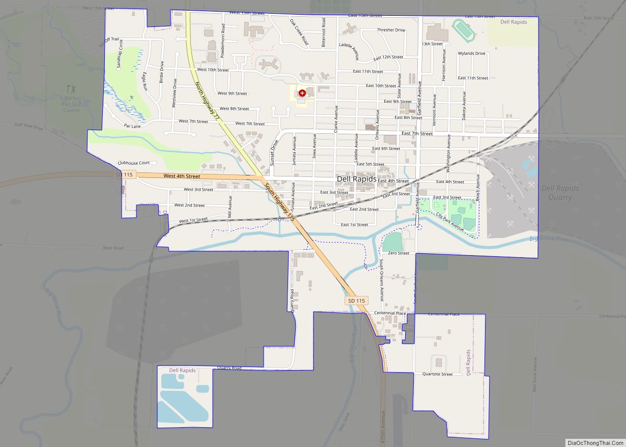
Geography
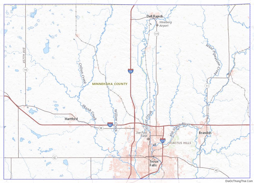
Minnehaha County lies on the east side of South Dakota. Its eastern boundary abuts Minnesota as well as the northern and western boundaries of Iowa. The Big Sioux River flows south-southeast through the east central part of the county. Its terrain consists of rolling hills, devoted to agriculture except around built-up areas, and dotted with lakes and ponds in its western portion. Its terrain generally slopes southward, and the east and west edges slope to the river valley through the center of the county. Its highest point is in the northwest corner, at 1,752′ (534m) ASL.
Minnehaha County has an area of 814 square miles (2,110 km), of which 807 square miles (2,090 km) is land and 6.7 square miles (17 km) (0.8%) is water.
Major highways
- I-29
- I-29 BL
- I-90
- I-90 BS
- I-229
- Interstate 229 Dwtn.
- South Dakota Highway 11
- South Dakota Highway 19
- South Dakota Highway 38
- South Dakota Highway 42
- South Dakota Highway 115
Airports
- Sioux Falls Regional Airport (FSD)
- Wheelborg Landing Field, a small airport in Dell Rapids
Adjacent counties
- Moody County – north
- Pipestone County, Minnesota – northeast
- Rock County, Minnesota – east
- Lyon County, Iowa – southeast
- Lincoln County – south
- Turner County – southwest
- McCook County – west
- Lake County – northwest
Protected areas
- Beaver Creek State Recreation Area
- Big Sioux State Recreation Area
- Diamond Lake State Game Production Area
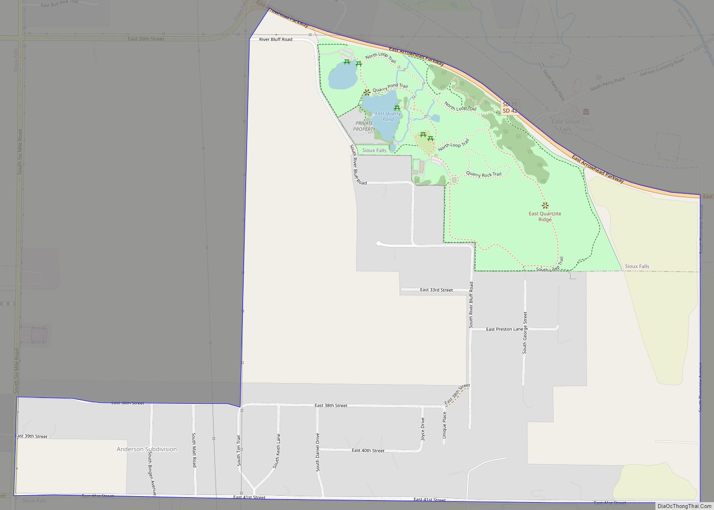
- Falls Park
- Island Lake State Game Production Area (part)
- Palisades State Park
- Pederson State Game Production Area
- Scott Lake State Game Production Area
- Twin Lakes State Game Production Area
- Wall Lake State Lakeside Use Area
Lakes, rivers and streams
- Beaver Creek
- Beaver Lake
- Big Sioux River
- Buffalo Lake
- Clear Lake
- Covell Lake
- Diamond Lake
- Fenstrman Slough
- Grass Lake
- Island Lake (partial)
- Lake Lorane
- Loss Lake
- Lost Lake
- Rehfeldt Slough
- Scott Lake
- Skunk Creek
- Split Rock Creek
- Twin Lake
- Wall Lake
Minnehaha County Topographic Map
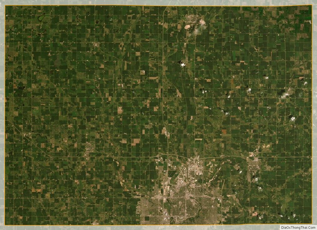
Minnehaha County Satellite Map
Minnehaha County Outline Map