Dell Rapids is a city in Minnehaha County, South Dakota, United States. The population was 3,996 at the 2020 census. It is known as “The Little City with the Big Attractions.”
The city took its name from the Dells of the Wisconsin River, which were likened to the local rapids on the Big Sioux River.
| Name: | Dell Rapids city |
|---|---|
| LSAD Code: | 25 |
| LSAD Description: | city (suffix) |
| State: | South Dakota |
| County: | Minnehaha County |
| Founded: | 1871 |
| Incorporated: | 1888 |
| Elevation: | 1,509 ft (460 m) |
| Total Area: | 2.32 sq mi (6.02 km²) |
| Land Area: | 2.25 sq mi (5.84 km²) |
| Water Area: | 0.07 sq mi (0.18 km²) |
| Total Population: | 3,996 |
| Population Density: | 1,772.85/sq mi (684.39/km²) |
| ZIP code: | 57022 |
| Area code: | 605 |
| FIPS code: | 4615980 |
| GNISfeature ID: | 1265635 |
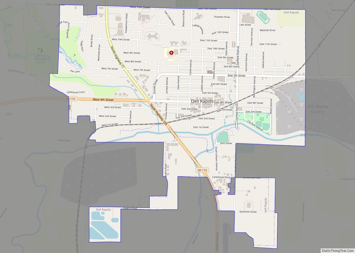
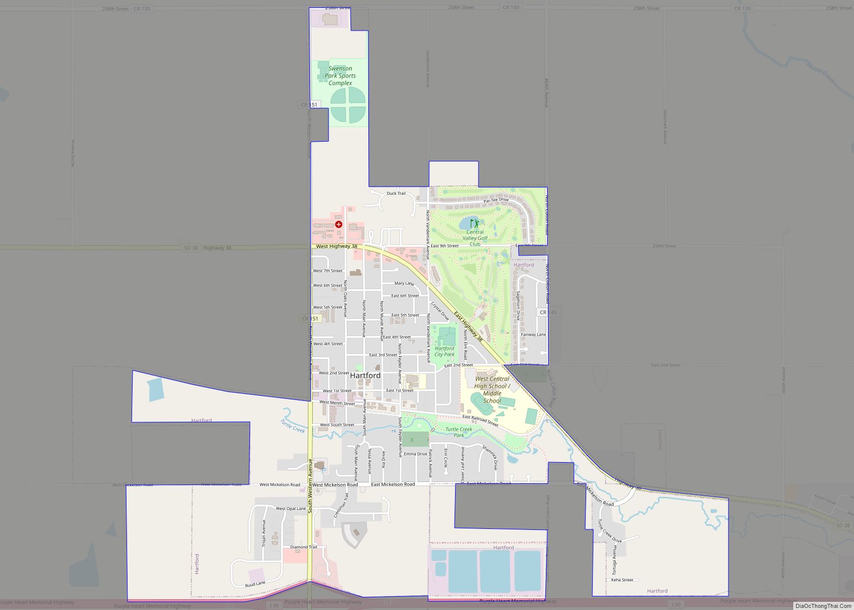
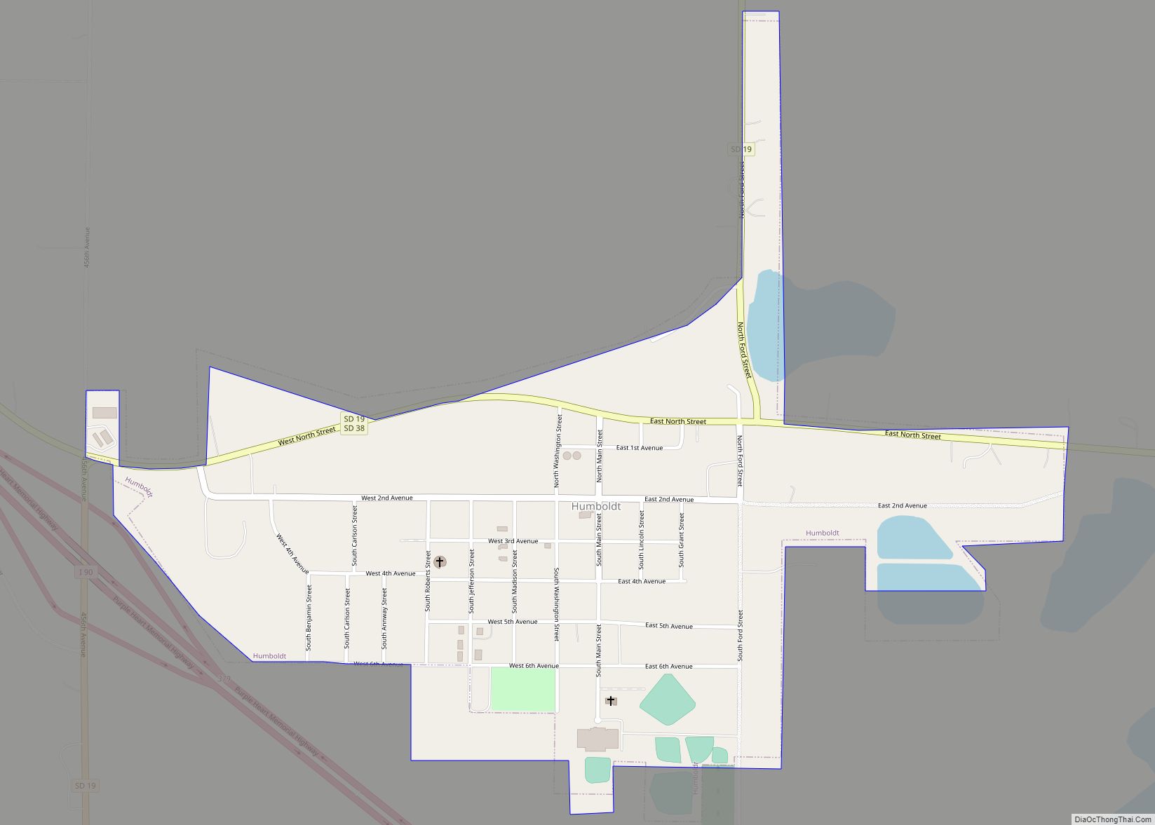
Online Interactive Map
Click on ![]() to view map in "full screen" mode.
to view map in "full screen" mode.
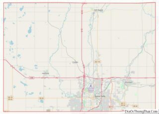
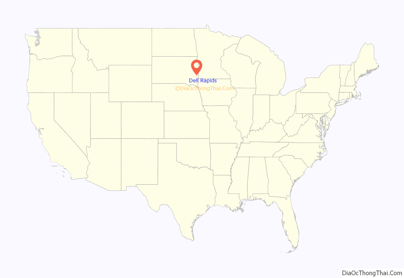
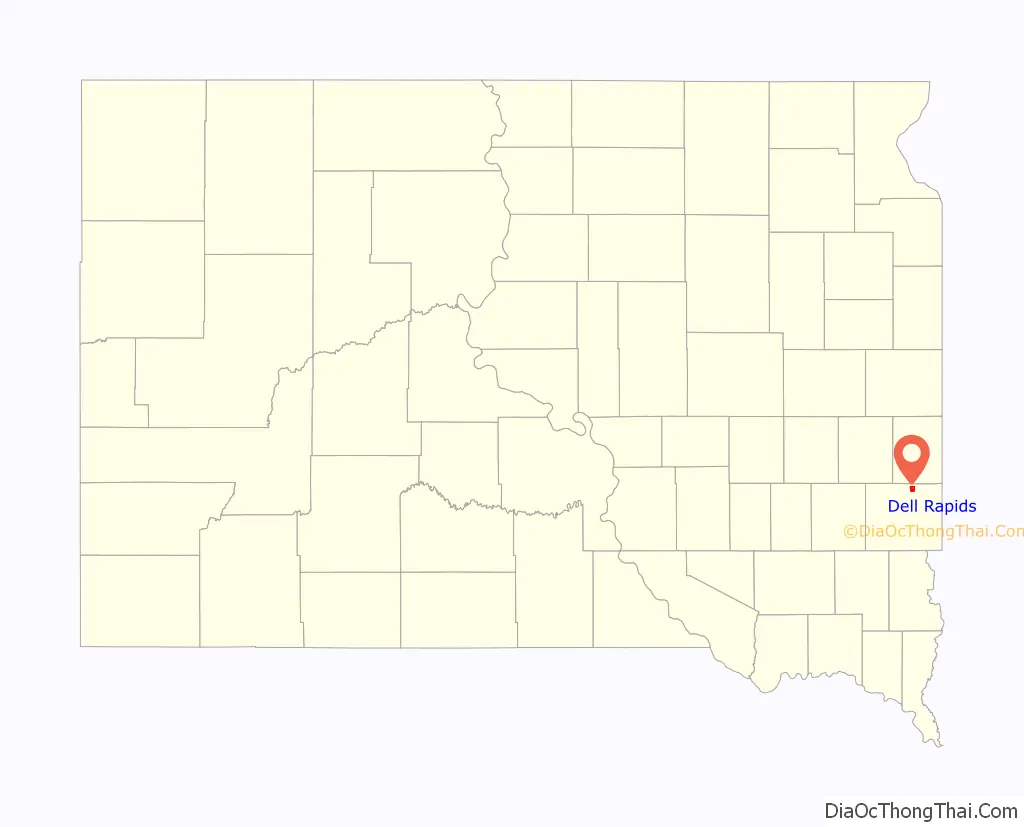
Dell Rapids location map. Where is Dell Rapids city?
History
Dell Rapids was originally named Dell City, but was renamed after the rapids of the Big Sioux River. After a fire broke out on the main street and burned most of the town, it was rebuilt out of Sioux Quartzite, a common rock in the area. The Chicago, Milwaukee, and Saint Paul Railroad built a railroad into the area, reaching Dell Rapids from Egan in 1881. Two large Sioux Quartzite quarries owned by LG Everist are operated via this rail line, which is now operated by LG’s subsidiary, the D&I Railroad. The community celebrates its heritage with the annual “Quarry Days” in July, and in June, the city hosts “Cootie Days”, where rides and games are set up and available in the city’s park.
Dell Rapids Road Map

Dell Rapids city Satellite Map

Geography
Dell Rapids is located at 43°49′30″N 96°42′40″W / 43.82500°N 96.71111°W / 43.82500; -96.71111 (43.824883, -96.711158), along the Big Sioux River.
According to the United States Census Bureau, the city has an area of 2.09 square miles (5.41 km), of which 2.03 square miles (5.26 km) is land and 0.06 square miles (0.16 km) is water.
Dell Rapids has the ZIP code 57022 and the FIPS place code 15980.
See also
Map of South Dakota State and its subdivision:- Aurora
- Beadle
- Bennett
- Bon Homme
- Brookings
- Brown
- Brule
- Buffalo
- Butte
- Campbell
- Charles Mix
- Clark
- Clay
- Codington
- Corson
- Custer
- Davison
- Day
- Deuel
- Dewey
- Douglas
- Edmunds
- Fall River
- Faulk
- Grant
- Gregory
- Haakon
- Hamlin
- Hand
- Hanson
- Harding
- Hughes
- Hutchinson
- Hyde
- Jackson
- Jerauld
- Jones
- Kingsbury
- Lake
- Lawrence
- Lincoln
- Lyman
- Marshall
- McCook
- McPherson
- Meade
- Mellette
- Miner
- Minnehaha
- Moody
- Pennington
- Perkins
- Potter
- Roberts
- Sanborn
- Shannon
- Spink
- Stanley
- Sully
- Todd
- Tripp
- Turner
- Union
- Walworth
- Yankton
- Ziebach
- Alabama
- Alaska
- Arizona
- Arkansas
- California
- Colorado
- Connecticut
- Delaware
- District of Columbia
- Florida
- Georgia
- Hawaii
- Idaho
- Illinois
- Indiana
- Iowa
- Kansas
- Kentucky
- Louisiana
- Maine
- Maryland
- Massachusetts
- Michigan
- Minnesota
- Mississippi
- Missouri
- Montana
- Nebraska
- Nevada
- New Hampshire
- New Jersey
- New Mexico
- New York
- North Carolina
- North Dakota
- Ohio
- Oklahoma
- Oregon
- Pennsylvania
- Rhode Island
- South Carolina
- South Dakota
- Tennessee
- Texas
- Utah
- Vermont
- Virginia
- Washington
- West Virginia
- Wisconsin
- Wyoming