Napa County (/ˈnæpə/ (listen)) is a county north of San Pablo Bay located in the northern portion of the U.S. state of California. As of the 2020 census, the population was 138,019. The county seat is the City of Napa. Napa County was one of the original counties of California, created in 1850 at the time of statehood. Parts of the county’s territory were given to Lake County in 1861.
Napa County comprises the Napa, CA Metropolitan Statistical Area, which is also included in the San Jose–San Francisco–Oakland, CA Combined Statistical Area. It is one of four North Bay counties.
Napa County, once the producer of many different crops, is known today for its regional wine industry, rising to the first rank of wine regions with France by local wineries Stag’s Leap Wine Cellars and Chateau Montelena winning the “Judgment of Paris” in 1976.
| Name: | Napa County |
|---|---|
| FIPS code: | 06-055 |
| State: | California |
| Founded: | February 18, 1850 |
| Named for: | The city of Napa |
| Seat: | Napa |
| Largest city: | Napa |
| Total Area: | 789 sq mi (2,040 km²) |
| Land Area: | 748 sq mi (1,940 km²) |
| Total Population: | 138,019 |
| Population Density: | 185/sq mi (71/km²) |
| Time zone: | UTC−8 (Pacific Time Zone) |
| Summer Time Zone (DST): | UTC−7 (Pacific Daylight Time) |
| Website: | www.countyofnapa.org |
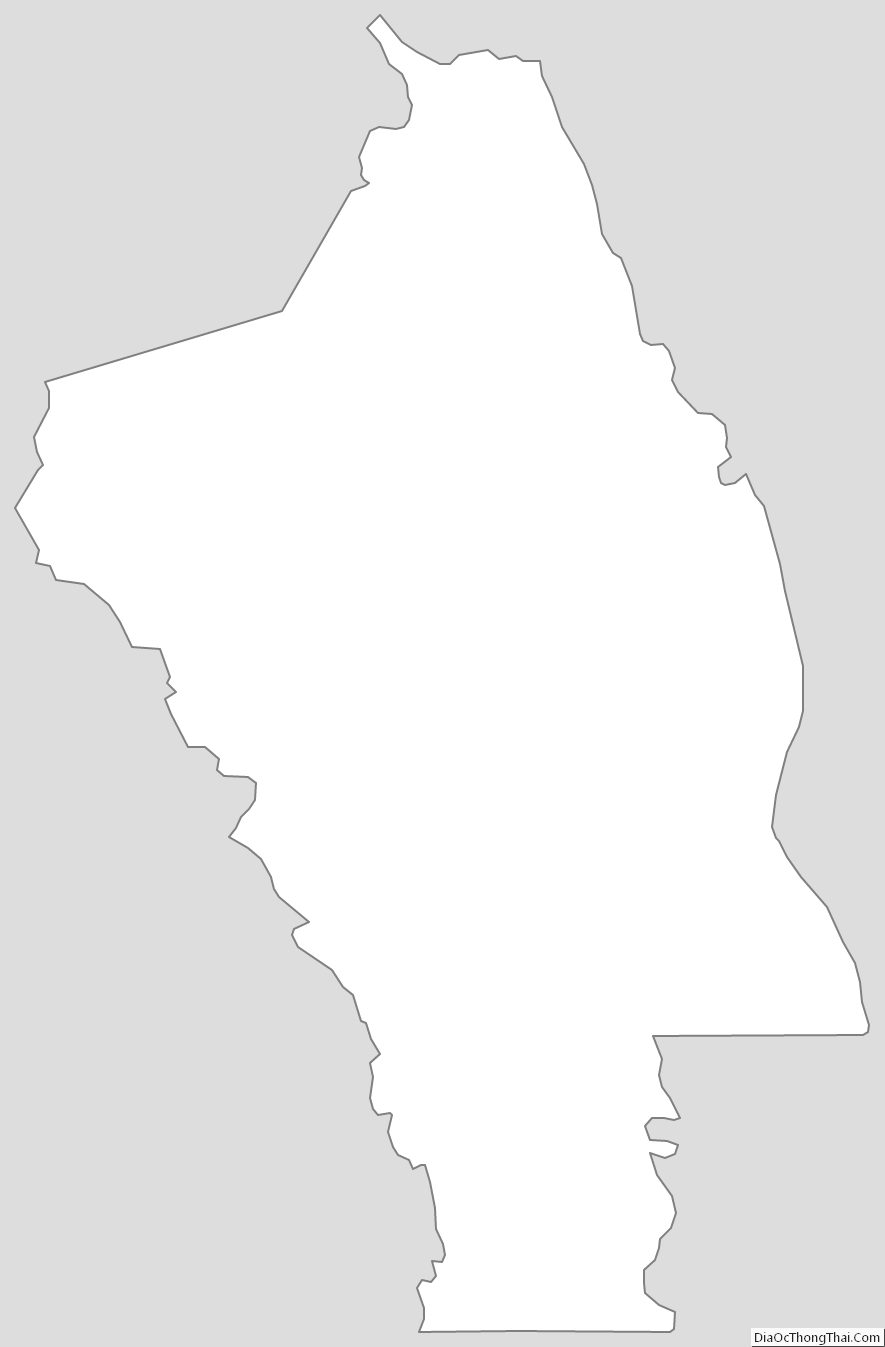
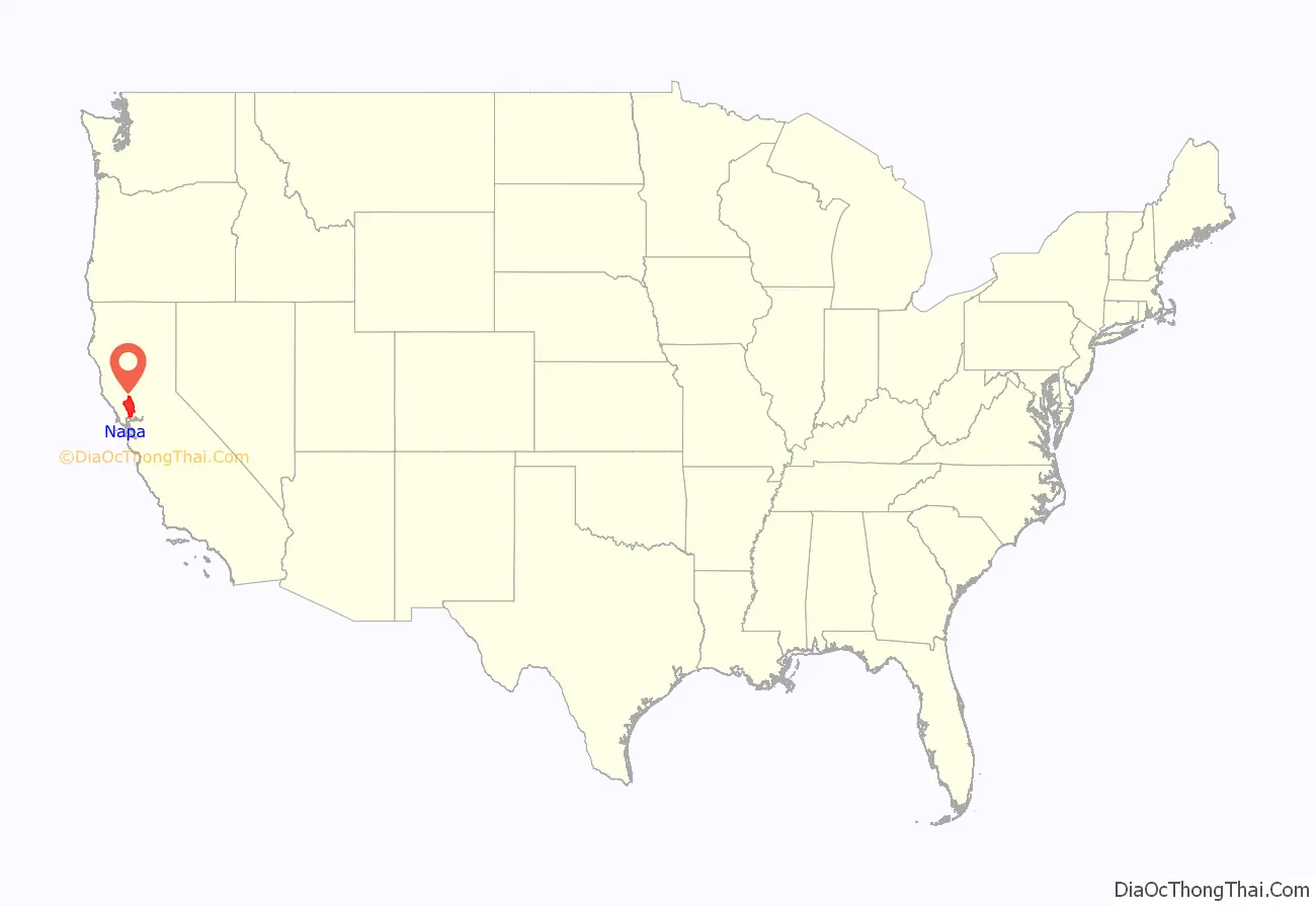
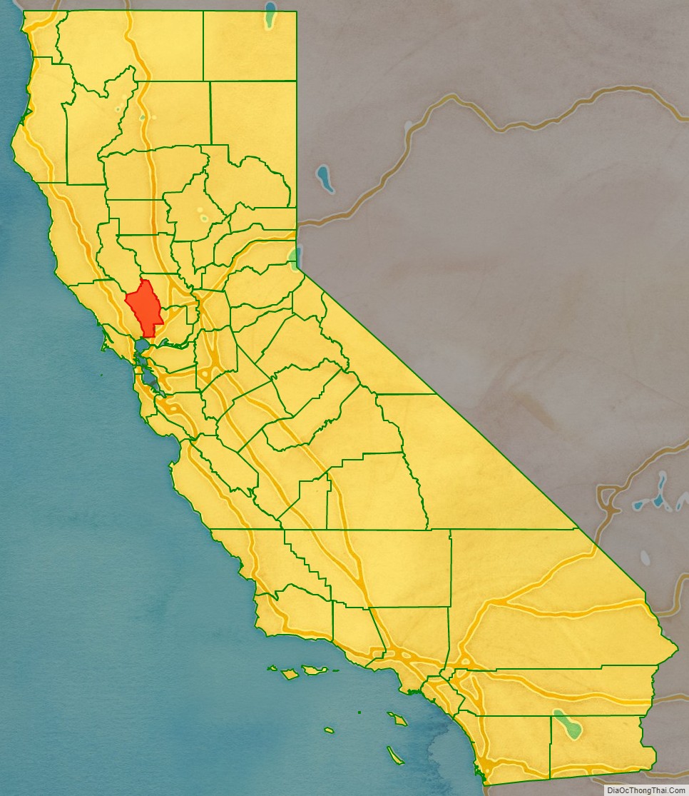
Napa County location map. Where is Napa County?
History
Prehistory–18th century
In prehistoric times, the valley was inhabited by the Patwin Native Americans, with possible habitation by Wappo tribes in the northwestern foothills. Most villages are thought to have been constructed near the floodplains of watercourses that drain the valley. Their food consisted of wild roots, acorns, small animals, earthworms, grasshoppers, and bread made from crushed California buckeye kernels. In winter they would construct huts made of tree branches. In summer they camped near rivers and streams. In winter months, they were half-clad in wild animal skins and at other times they wore no clothing. The maximum prehistoric population is thought not to have exceeded 5000 persons.
In 1776, a fort was erected by the Spanish Governor, Felipe de Neve a short distance northwest of Napa, on an elevated plateau. Russians from Sonoma County’s Fort Ross grazed cattle and sheep in the Napa Valley in the early 19th century and in 1841 a survey party from the fort placed a plaque on the summit of Mount Saint Helena.
Early 19th century
Francis Castro and Father Jose Altimura were the first Europeans to explore the Napa Valley, in 1823. When the first white settlers arrived in the early 1830s, there were six tribes in the valley speaking different dialects and they were often at war with each other. The Mayacomos tribe lived in the area where Calistoga was founded. The Callajomans were in the area near where the town of St. Helena now stands. Further south, the Kymus dwelt in the middle part of the valley. The Napa and Ulcus tribes occupied part of the area where the City of Napa now exists while the Soscol tribe occupied the portion that now makes up the southern end of the valley. Many of the native peoples died during a smallpox epidemic in 1838. Settlers also killed several over claims of cattle theft.
During the era between 1836 and 1846, when California was a province of independent Mexico, the following 13 ranchos were granted in Napa County:
- Carne Humana
- Catacula
- Caymus
- Chimiles
- Entre Napa
- La Jota
- Las Putas
- Locoallomi
- Napa
- Tulucay
- Yajome
- Huichica
- Mallacomes
George C. Yount was an early settler in Napa County and is believed to be the first Anglo-Saxon resident in the county. In 1836 Yount obtained the Mexican grant Rancho Caymus where he built what is said to be the first log house in California. Soon afterward, he built a sawmill and grain mill, and was the first person to plant a vineyard in the county. Following Yount’s death in 1865 at age 71, the town of Yountville was named in his honor.
Following his marriage to General Vallejo’s niece Maria Guadalupe Soberanes, Edward Turner Bale became a citizen of Mexico and was granted Rancho Carne Humana in the northern end of the valley. Bale completed building the Bale Grist Mill a few miles north of St. Helena in 1846. Colonel Joseph B. Chiles a guide for one of the earliest immigrant trains to California, was granted Rancho Catacula in 1844.
The Town of Napa was founded on Rancho Entre Napa by Nathan Coombs in 1847.
Following the event of the Mexican–American War, Bear Flag Revolt in 1846 and the Mexican Cession in 1848, settlers were granted deeds from the original ranchos during the 1850s through 1870s. To this day, a number of streets and landmarks around the valley reflect the names of these ranchos and original grantees.
Late 19th century
Napa County was formed and became one of the original California counties when the state became part of the United States in 1850.
Descendants of George Yount and Captain Edward Bale played key roles in the early development of Napa County. Yount’s granddaughter Elizabeth Yount married Thomas Rutherford in 1864. The couple received as a wedding gift from George Yount, land in the area of the valley now known as Rutherford. Rutherford established himself as a serious grower and producer of fine wines in the following years. Bale’s oldest daughter Lolita married the seaman Louis Bruck. When Bale died in 1848, Bruck became the executor of the will for the family. He was elected the first mayor of Napa City when incorporated in 1872. Charles Krug, a fellow Prussian compatriot and pioneer viticulturalist at Sonoma, married Lolita’s younger sister Caroline with a dowry that included land near the Bale mill. Krug then moved north of St. Helena to establish the valley’s first commercial winery.
John Patchett opened the first commercial winery in the county in 1859. The vineyard and wine cellar were in an area now in the city limits of Napa. After working as a winemaker for Patchett, Charles Krug founded his own winery in St. Helena 1861.
The county’s population began to grow in the mid-century as pioneers, prospectors, and entrepreneurs moved in and set up residence. During this period, settlers primarily raised cattle and farmed grain and fruit crops. Mineral mining also played a role in the economics of the county. In 1858 the great silver rush began in Napa Valley, and miners flocked to the eastern hills. While gold was being prospected in other areas of the state in the 1850s, Napa County became a center for silver and quicksilver mining. In the 1860s, mining carried on, on a large scale, with quicksilver mines operating in many areas of Napa County.
In 1866 John Lawley established a toll road from Calistoga over Mount Saint Helena to Lake County.
Robert Louis Stevenson’s book The Silverado Squatters provides a snapshot of life and insight into some of the characters that lived around the valley during the later part of the 19th century. Stevenson, accompanied by his new bride Fanny Vandegrift and her 12-year-old son from a previous marriage, Lloyd Osbourne, spent the late spring and early summer of 1880 honeymooning in an abandoned bunk house at a played-out mine near the summit of Mount Saint Helena. In the book, Stevenson’s descriptive writing style documented his ventures in the area and profiled several of the early pioneers who played a role in shaping the region’s commerce and society. Stevenson’s book also brought attention to the various spas and hot springs in the county. From Calistoga to Æetna Springs in Pope Valley to Soda Springs Resort a few miles east of Napa, tourists of the late 19th and early 20th centuries made the county their destination much the same as modern day tourists. The resorts became very popular with San Franciscans anxious to escape the cold and foggy weather that often plagues the city to enjoy the warmer climate Napa County offered.
In the mid-1880s, entrepreneur Samuel Brannan purchased land in the northern end of the valley at the foot of Mount Saint Helena and founded Calistoga. He began developing it as a resort town taking advantage of or the area’s numerous mineral hot springs. He also founded the Napa Valley Railroad Company in 1864 to bring tourists to Calistoga from San Francisco ferry boats that docked in Vallejo. Brannan’s railroad venture failed and was sold at a foreclosure sale in 1869. The railroad eventually came under the ownership of Southern Pacific Railroad late in the 19th century.
The Veterans Home of California Yountville was established in Yountville in 1884 by the San Francisco chapter of the Grand Army of the Republic. The State of California assumed administration of the Home in 1897.
20th and 21st centuries
By the end of the 1900s, farmers had planted over 500,000 fruit and nut trees in the county, especially plums and pears. This helped to soften the blows to the agricultural economy caused by the phylloxera infestation in the county’s vineyards and upcoming prohibition that crippled the wine industry, but resulted in a boom for shipping grapes to immigrant, home winemakers across the country.
During World War II, the Basalt Rock Company located south of the City of Napa on the Napa River, built 3 dozen salvage rescue tugs for the United States Navy. German prisoners of war were housed in a Camp Beale satellite prisoner of war camp near Yountville. The prisoners were utilized to supplement a dwindled able bodied agricultural labor force caused by the needs of the American war effort.
Following the war, several new small and medium size businesses began operating in the County. A large majority of these businesses were related to the wine industry and tourism. Agriculture in the county remained very diverse until late in the 20th century when wine grapes again became the primary focus. While vineyards were planted on well over 90% of the agricultural land in the county, by the end of the 20th century, modern day farmers have recently begun exploring the possibility of raising other food crops in order to again diversify and take advantage of growing conditions.
At 3:20 a.m. on August 24, 2014, the area was struck by a magnitude 6.0 earthquake centered 3.7 miles (6.0 km) northwest of the city of American Canyon.
In October 2017, parts of the county were affected by wildfires.
From June to July 2018, the County Fire affected a small part of Napa County after crossing over from Yolo County, California.
In October 2019, heavy smoke and unscheduled black outs by Pacific Gas and Electric Company of up to 20,000 customers affected the county due to fierce winds and threats from the Kincade Fire.
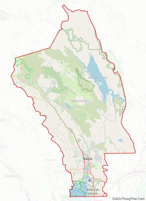
Napa County Road Map
Geography
According to the U.S. Census Bureau, the county has a total area of 789 square miles (2,040 km), of which 748 square miles (1,940 km) is land and 40 square miles (100 km) (5.1%) is water.
Napa is warmer in the summer than Sonoma County, to the west, or Santa Barbara County, a wine-producing county in southern California. Thus, the Napa wineries favor varietals such as Cabernet Sauvignon, while Pinot noir and Chardonnay are more the specialty of Sonoma and Santa Barbara wineries. At the north end of Napa County, in the Mayacamas Mountains, lies Mount Saint Helena, the Bay Area’s second tallest peak at 4,344 feet (1,323 m) and home to Robert Louis Stevenson State Park; Snell Valley is also situated in northern Napa County; the Missimer Wildflower Preserve is within Snell Valley. On the west side of the Napa Valley is Hood Mountain, elevation 2,750 feet (838 m).
Napa County is home to a variety of flora and fauna including numerous rare and endangered species such as Tiburon Indian paintbrush and Contra Costa goldfields.
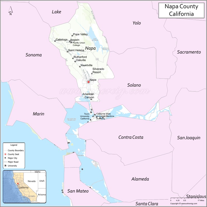
Adjacent counties
- Lake County – northwest
- Yolo County – northeast
- Solano County – east
- Sonoma County – west
National protected area
- San Pablo Bay National Wildlife Refuge (part)
Rivers and creeks
- Napa River
- Milliken Creek
- Putah Creek
Lakes, marshes and reservoirs
- East Napa Reservoir
- East Side Reservoir
- Fiege Reservoir
- Lake Berryessa
- Lake Hennessey
- Lake Marie
- Lake Orville
- Lake Whitehead
- Milliken Reservoir
- Napa Sonoma Marsh
- Rector Reservoir
- West Napa Reservoir
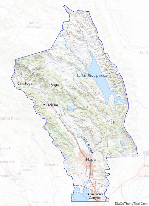
Napa County Topographic Map
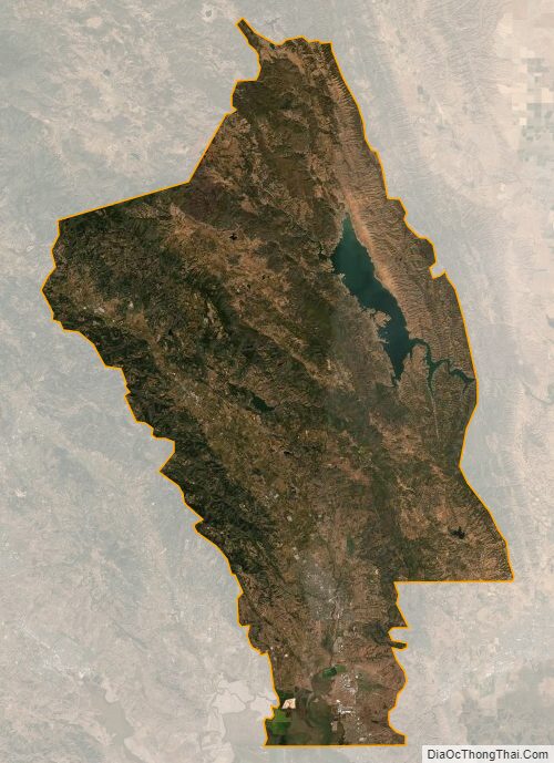
Napa County Satellite Map
Napa County Outline Map