Asbury Park (/æzbɛri/) is a beachfront city located on the Jersey Shore in Monmouth County in the U.S. state of New Jersey. It is part of the New York metropolitan area.
As of the 2020 United States census, the city’s population was 15,188, a decrease of 928 (−5.8%) from the 2010 census count of 16,116, which in turn reflected a decline of 814 (−4.8%) from the 16,930 counted in the 2000 census.
In 2022, Asbury Park’s beach was named one of the best in the world by Money and one of the best in the country by Travel + Leisure.
Asbury Park was originally incorporated as a borough by an act of the New Jersey Legislature on March 26, 1874, from portions of Ocean Township. The borough was reincorporated on February 28, 1893. Asbury Park was incorporated as a city, its current type of government, as of March 25, 1897.
| Name: | Asbury Park city |
|---|---|
| LSAD Code: | 25 |
| LSAD Description: | city (suffix) |
| State: | New Jersey |
| County: | Monmouth County |
| Incorporated: | March 26, 1874 (as borough) |
| Elevation: | 16 ft (5 m) |
| Total Area: | 1.61 sq mi (4.17 km²) |
| Land Area: | 1.43 sq mi (3.70 km²) |
| Water Area: | 0.18 sq mi (0.47 km²) 11.18% |
| Total Population: | 15,188 |
| Population Density: | 10,628.4/sq mi (4,103.6/km²) |
| FIPS code: | 3401960 |
| GNISfeature ID: | 0885141 |
| Website: | www.cityofasburypark.com |
Online Interactive Map
Click on ![]() to view map in "full screen" mode.
to view map in "full screen" mode.
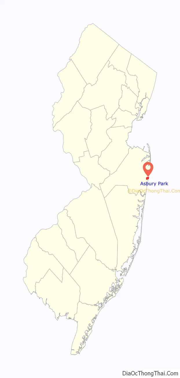
Asbury Park location map. Where is Asbury Park city?

History
Early years
A seaside community, Asbury Park is located on New Jersey’s central coast. Developed in 1871 as a residential resort by New York brush manufacturer James A. Bradley, the city was named for Francis Asbury, the first American bishop of the Methodist Episcopal Church in the United States. The founding of Ocean Grove in 1869, a Methodist camp meeting to the south, encouraged the development of Asbury Park and led to its being a “dry town.”
Bradley was active in the development of much of the city’s infrastructure, and despite his preference for gas light, he allowed the Atlantic Coast Electric Company (precursor to today’s Jersey Central Power & Light Co.) to offer electric service. Along the waterfront, Bradley installed the Asbury Park Boardwalk, an orchestra pavilion, public changing rooms, and a pier at the south end of that boardwalk. Such success attracted other businessmen. In 1888, Ernest Schnitzler built the Palace Merry-Go-Round on the southwest corner of Lake Avenue and Kingsley Street, the cornerstone of what would become the Palace Amusements complex; other attractions followed. During these early decades in Asbury Park, a number of grand hotels were built, including the Plaza Hotel.
Uriah White, an Asbury Park pioneer, installed the first artesian well water system. As many as 600,000 people a year vacationed in Asbury Park during the summer season in the early years, riding the New York and Long Branch Railroad from New York City and Philadelphia to enjoy the mile-and-a-quarter stretch of oceanfront Asbury Park. By 1912, The New York Times estimated that the summer population could reach 200,000.
The country by the sea destination experienced several key periods of popularity. The first notable era was the 1890s, marked by a housing growth, examples of which can still be found today in a full range of Victorian architecture. Coinciding with the nationwide trend in retail shopping, Asbury Park’s downtown flourished during this period and well into the 20th century.
1920s and modern development
In the 1920s, Paramount Theatre and Convention Hall complex, the Casino Arena and Carousel House, and two handsome red-brick pavilions were built in the Asbury Boardwalk area. Beaux Arts architect Warren Whitney of New York was the designer. He had also been hired to design the Berkeley-Carteret Hotel located diagonally across from the theater and hall. At the same time, Asbury Park constructed a state-of-the-art high school overlooking Deal Lake.
On September 8, 1934, the wreck of the ocean liner SS Morro Castle, which caught fire and burned, beached itself near the city just yards away from the Asbury Park Convention Hall; the city capitalized on the event, turning the wreck into a tourist attraction.
In 1935, the newly founded Securities and Exchange Commission called Asbury Park’s Mayor Clarence F. Hetrick to testify about $6 million in “beach improvement bonds” that had gone into default. At the same time, the SEC also inquired about rental rates on the beach front and why the mayor reduced the lease of a bathhouse from $85,000 to $40,000, among many other discrepancies that could have offset debt. The interests of Asbury Park’s bond investors led Senator Frank Durand (Monmouth County) to add a last-minute “Beach Commission” amendment to a municipal debt bill in the New Jersey legislature. When the bill became law, it ceded control of the Asbury Park beach to Governor Harold Hoffman and a governor’s commission. The city of Asbury Park sued to restore control of the beach to the municipal council, but the New Jersey Court of Errors and Appeals (until 1947, the state’s highest court) upheld the validity of the law in 1937. When Durand pressed New Jersey’s legislature to extend the state’s control of Asbury Park’s beach in 1938, the lower house staged a walk out and the Senate soon adjourned, a disruption that also prevented a vote for funding New Jersey’s participation in the 1939 New York World’s Fair. In December 1938, the court returned control of the beach to the municipal council under the proviso that a bond repayment agreement was created; Asbury Park was the only beach in New Jersey affected by the Beach Commission law.
In 1943, the New York Yankees held their spring training in Asbury Park instead of Florida. This was because rail transport had to be conserved during the war, and Major League Baseball’s Spring Training was limited to an area east of the Mississippi River and north of the Ohio River.
With the opening of the Garden State Parkway in 1947, Asbury Park saw the travel market change as fewer vacationers took trains to the seashore. While the Asbury Park exit on the Parkway opened in 1956 and provided a means for drivers to reach Asbury Park more easily, additional exits further south allowed drivers access to new alternative vacation destinations, particularly on Long Beach Island.
In the decades that followed the war, surrounding farm communities gave way to tracts of suburban houses, encouraging the city’s middle-class blacks as well as whites to move into newer houses with spacious yards.
With the above-mentioned change in the travel market, prompted by the opening of the Garden State Parkway in 1947 and the opening of Monmouth Mall 10 miles (16 km) away in Eatontown in 1960, Asbury Park’s downtown became less of an attraction to shoppers. Office parks built outside the city resulted in the relocation of accountants, dentists, doctors, lawyers, and other professionals. Moreover, the opening of Great Adventure (on July 1, 1974), a combination theme park and drive-through safari located on a lake in Jackson Township—and close to a New Jersey Turnpike exit—proved to be stiff competition for a mile-long stretch of aging boardwalk amusements.
Riots that broke out in the city on July 4, 1970, resulted in the destruction of aging buildings along Springwood Avenue, one of three main east–west corridors into Asbury Park and the central shopping and entertainment district for those living in the city’s southwest quadrant. Many of those city blocks have yet to be redeveloped into the 21st century.
Although it was placed on the National Register of Historic Places, Palace Amusements was closed in 1988 and was demolished in 2004 despite attempts to save it. The complex had featured the famous face of Tillie, a symbol of the Jersey Shore.
In 1990, the carousel at the Casino Pier was sold to Family Kingdom Amusement Park in Myrtle Beach, South Carolina, where it continues to operate.
21st century
From 2002 onward, the rest of Asbury Park has been in the midst of a cultural, political, and economic revival, including a burgeoning industry of local and national artists. Its dilapidated downtown district is undergoing revitalization while most of the nearly empty blocks that overlook the beach and boardwalk are slated for massive reconstruction. In 2005, the Casino’s walkway reopened, as did many of the boardwalk pavilions. In 2007, the eastern portion of the Casino building was demolished. There are plans to rebuild this portion to look much like the original; however, the interior will be dramatically different and may include a public market (as opposed to previously being an arena and skating rink). By 2020, the Casino building still remained unrestored and had no permanent use, although it had been used to host temporary art installations.
There has also been more of a resurgence of the downtown as well as the boardwalk, with the grand reopening of the historic Steinbach department store building, as well as the rehabilitation of Convention Hall and the Fifth Avenue Pavilion (previously home to one of the last remaining Howard Johnson’s restaurants). The historic Berkeley-Carteret Hotel, which is to be restored to four-star resort status, was acquired in 2007; the first residents moving into the newly constructed condominiums known as North Beach, the rehabilitation of Ocean Avenue, and the opening of national businesses on Asbury Avenue.
After Hurricane Sandy, Asbury Park was one of the few communities on the Jersey Shore to reopen successfully for the 2013 summer season. Most of the boardwalk had not been badly damaged by the massive hurricane. On Memorial Day Weekend 2013, Governor Chris Christie and President Barack Obama participated in an official ceremony before a crowd of 4,000, marking the reopening of Asbury Park and other parts of the Jersey Shore. The “Stronger Than The Storm” motto was emphasized at this ceremony.
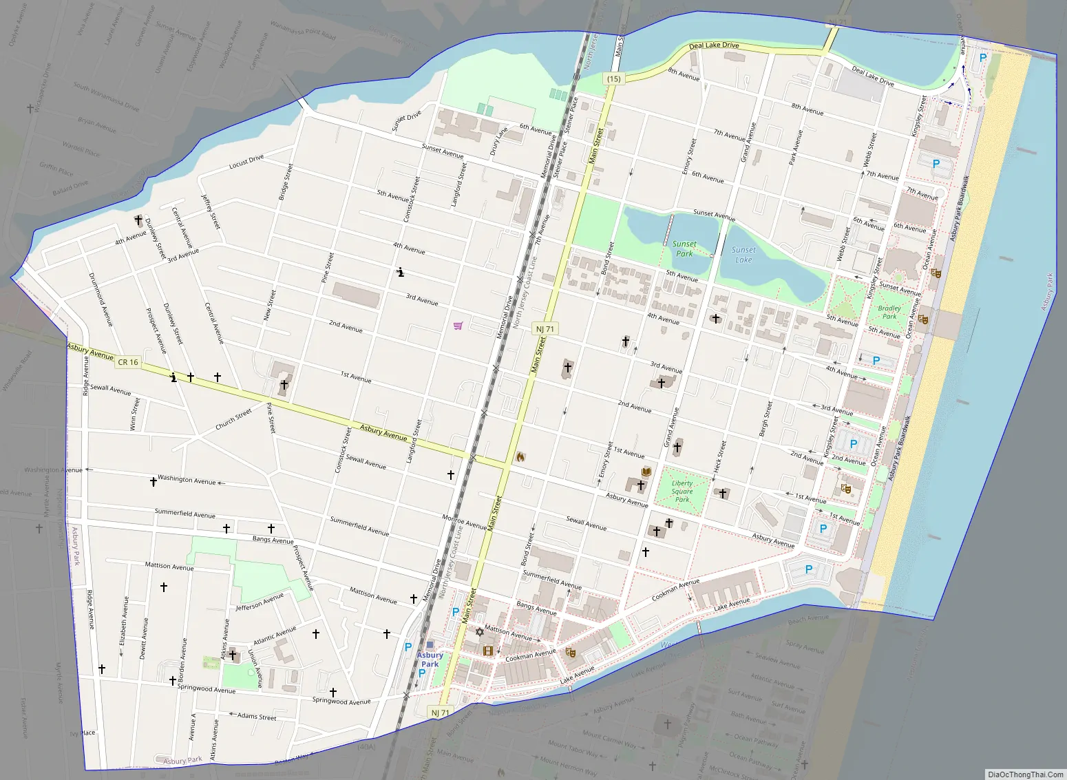
Asbury Park Road Map
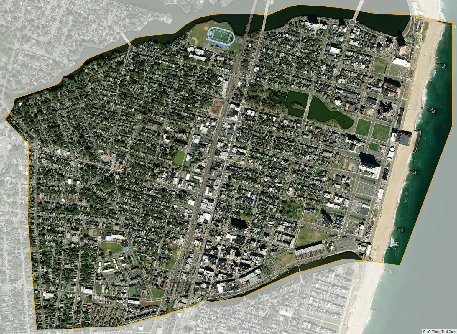
Asbury Park city Satellite Map
Geography
According to the United States Census Bureau, the city had a total area of 1.61 square miles (4.17 km), including 1.43 square miles (3.70 km) of land and 0.18 square miles (0.47 km) of water (11.18%).
Unincorporated communities, localities and place names located partially or completely within the city include North Asbury and Whitesville (located along the city’s border with Neptune Township).
The city borders the Monmouth County communities of Interlaken, Loch Arbour, Neptune Township, and Ocean Township.
Deal Lake covers 158 acres (64 ha) and is overseen by the Deal Lake Commission, which was established in 1974. Seven municipalities border the lake, accounting for 27 miles (43 km) of shoreline, also including Allenhurst, Deal, Interlaken, Loch Arbour, Neptune Township and Ocean Township.
See also
Map of New Jersey State and its subdivision: Map of other states:- Alabama
- Alaska
- Arizona
- Arkansas
- California
- Colorado
- Connecticut
- Delaware
- District of Columbia
- Florida
- Georgia
- Hawaii
- Idaho
- Illinois
- Indiana
- Iowa
- Kansas
- Kentucky
- Louisiana
- Maine
- Maryland
- Massachusetts
- Michigan
- Minnesota
- Mississippi
- Missouri
- Montana
- Nebraska
- Nevada
- New Hampshire
- New Jersey
- New Mexico
- New York
- North Carolina
- North Dakota
- Ohio
- Oklahoma
- Oregon
- Pennsylvania
- Rhode Island
- South Carolina
- South Dakota
- Tennessee
- Texas
- Utah
- Vermont
- Virginia
- Washington
- West Virginia
- Wisconsin
- Wyoming


