Madill is a city in and the county seat of Marshall County, Oklahoma, United States. It was named in honor of George Alexander Madill, an attorney for the St. Louis-San Francisco Railway. The population at the 2010 census was 3,770, an increase of 10.8 percent from 3,410 at the 2000 census. It is best known as the site of the annual National Sand Bass Festival. It is part of the Texoma region.
| Name: | Madill city |
|---|---|
| LSAD Code: | 25 |
| LSAD Description: | city (suffix) |
| State: | Oklahoma |
| County: | Marshall County |
| Elevation: | 787 ft (240 m) |
| Total Area: | 4.45 sq mi (11.53 km²) |
| Land Area: | 4.42 sq mi (11.44 km²) |
| Water Area: | 0.04 sq mi (0.09 km²) |
| Total Population: | 3,914 |
| Population Density: | 886.12/sq mi (342.11/km²) |
| ZIP code: | 73446 |
| Area code: | 580 |
| FIPS code: | 4045750 |
| GNISfeature ID: | 1095082 |
| Website: | cityofmadill.com |
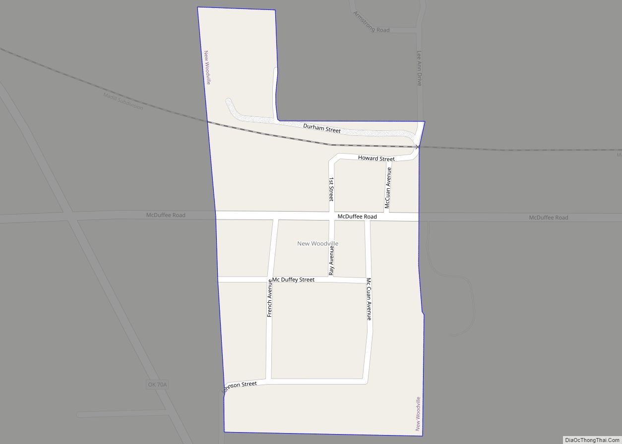
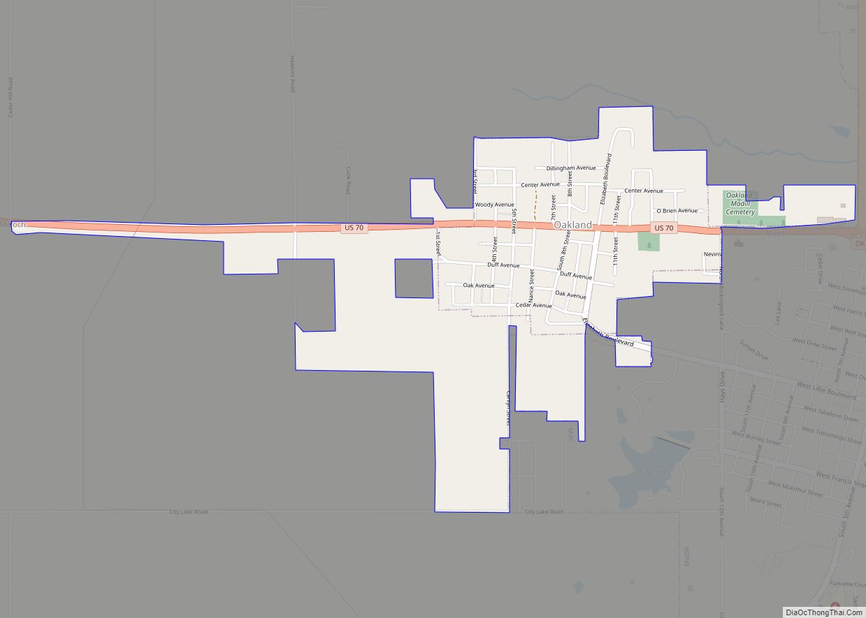
Online Interactive Map
Click on ![]() to view map in "full screen" mode.
to view map in "full screen" mode.
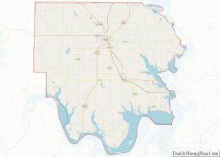
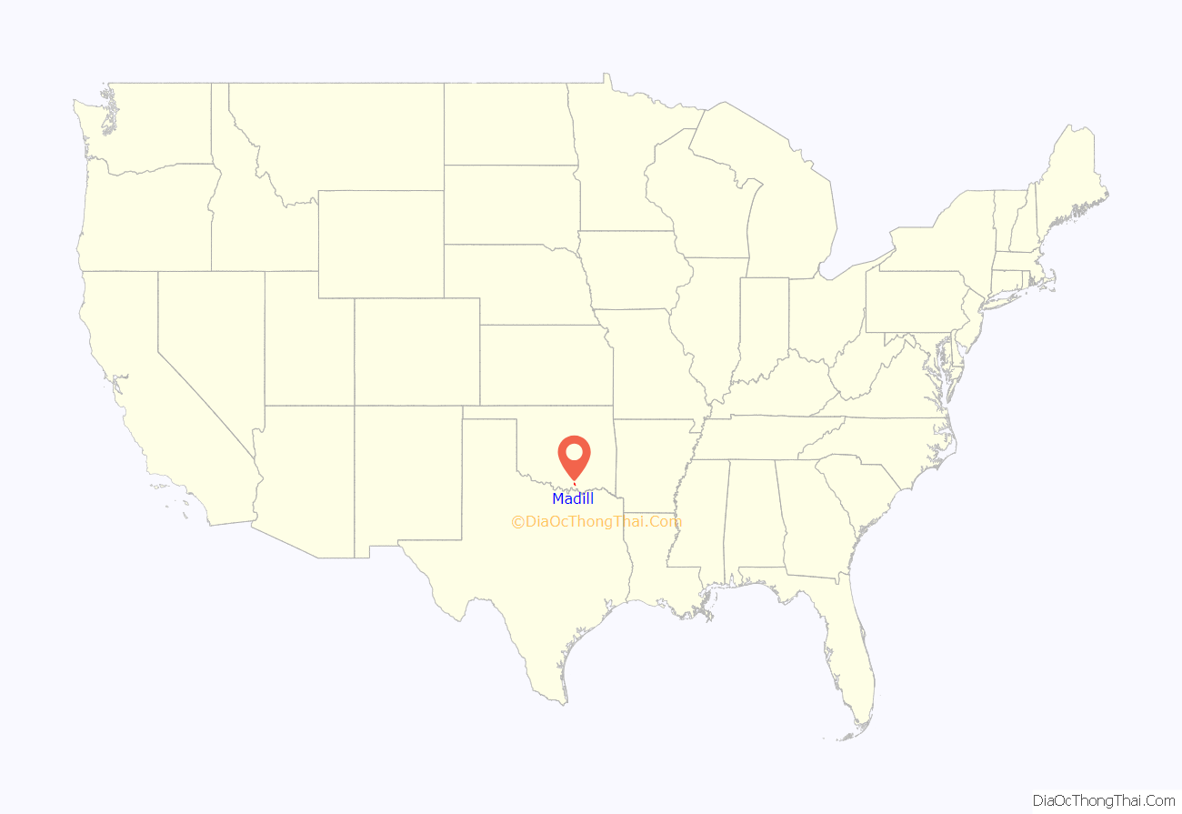
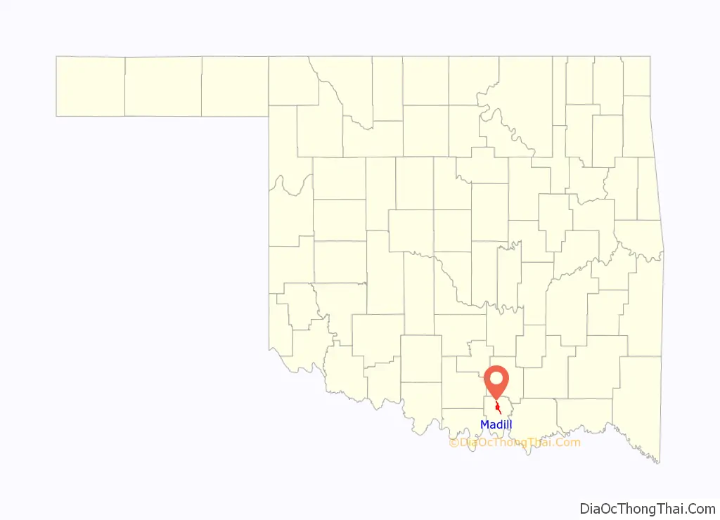
Madill location map. Where is Madill city?
History
Madill was founded in 1900 by William N. Taliaferro, who had settled in 1886, in what was then known as Pickens County, Chickasaw Nation, in the Indian Territory. Taliaferro owned a 600 acres (240 ha) farm and operated some ranches in the nearby town of Oakland, 2 miles (3.2 km) northwest of Madill. Oakland had been the area’s largest town, but the St. Louis, San Francisco and New Orleans Railroad building through the town caused Madill to grow and Oakland, two miles northwest, to decline. A post office was established at Madill on April 29, 1901, The city was chartered on September 12, 1902. The first public school opened in a four-room frame structure built on the south side of the town in 1903.
Farming and ranching became the town’s principal industries early in its history because the surrounding area was highly fertile and the railroad provided good transportation to markets. There were also mineral springs nearby, and an oil seep north of town. The Arbuckle oilfield was discovered in 1904, and experienced another boom in 1924. Pure Oil Company brought in a well east of town in 1939 and built a company town called Pure Camp to house the oilfield workers. Pure Camp was destroyed by a tornado and killed two people on April 2, 1957. The camp closed permanently in July, 1959. Madill was struck by another EF-2 tornado during the Tornado outbreak of April 22–23, 2020.
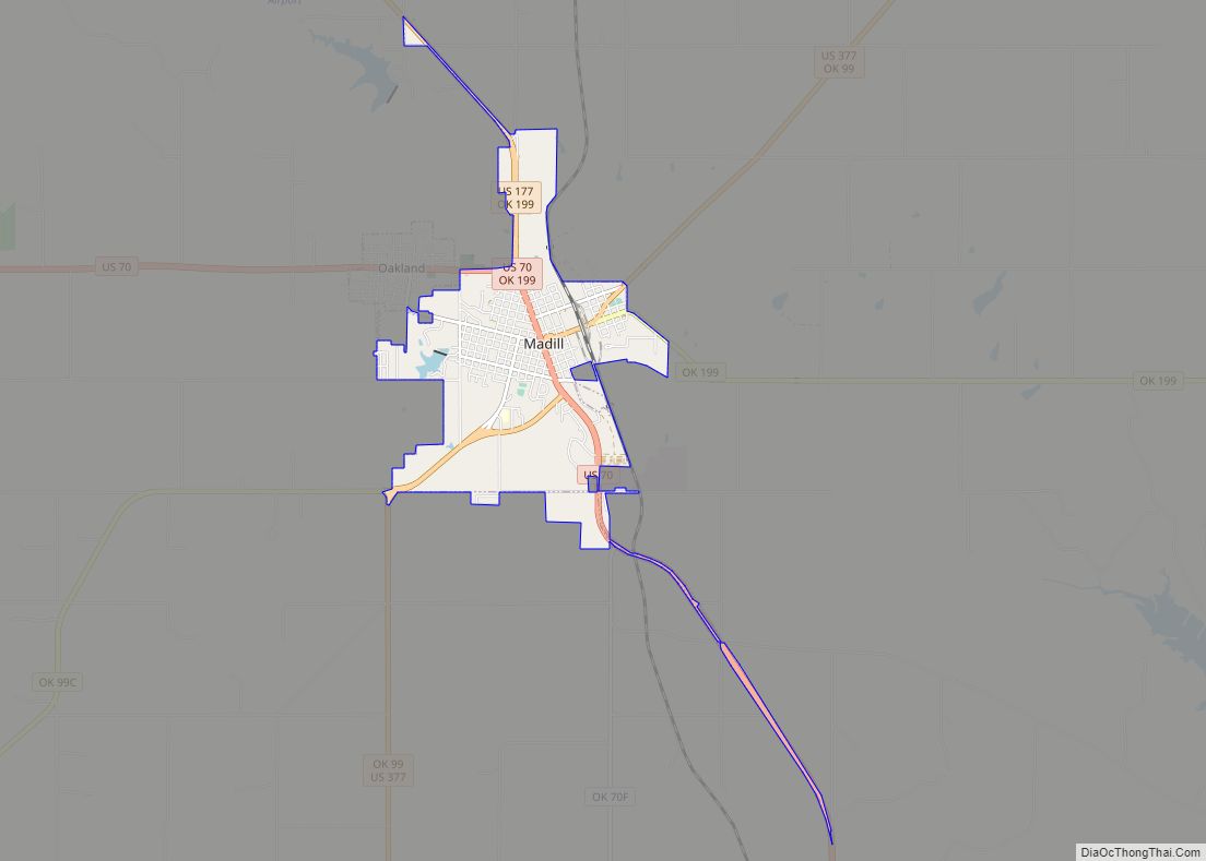
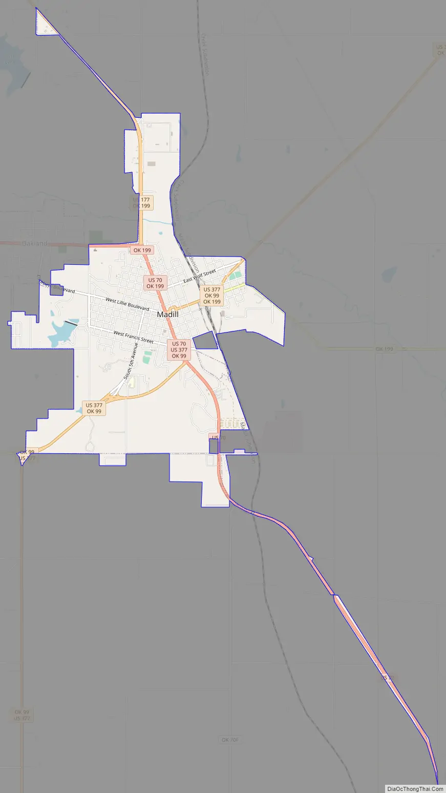
Madill Road Map
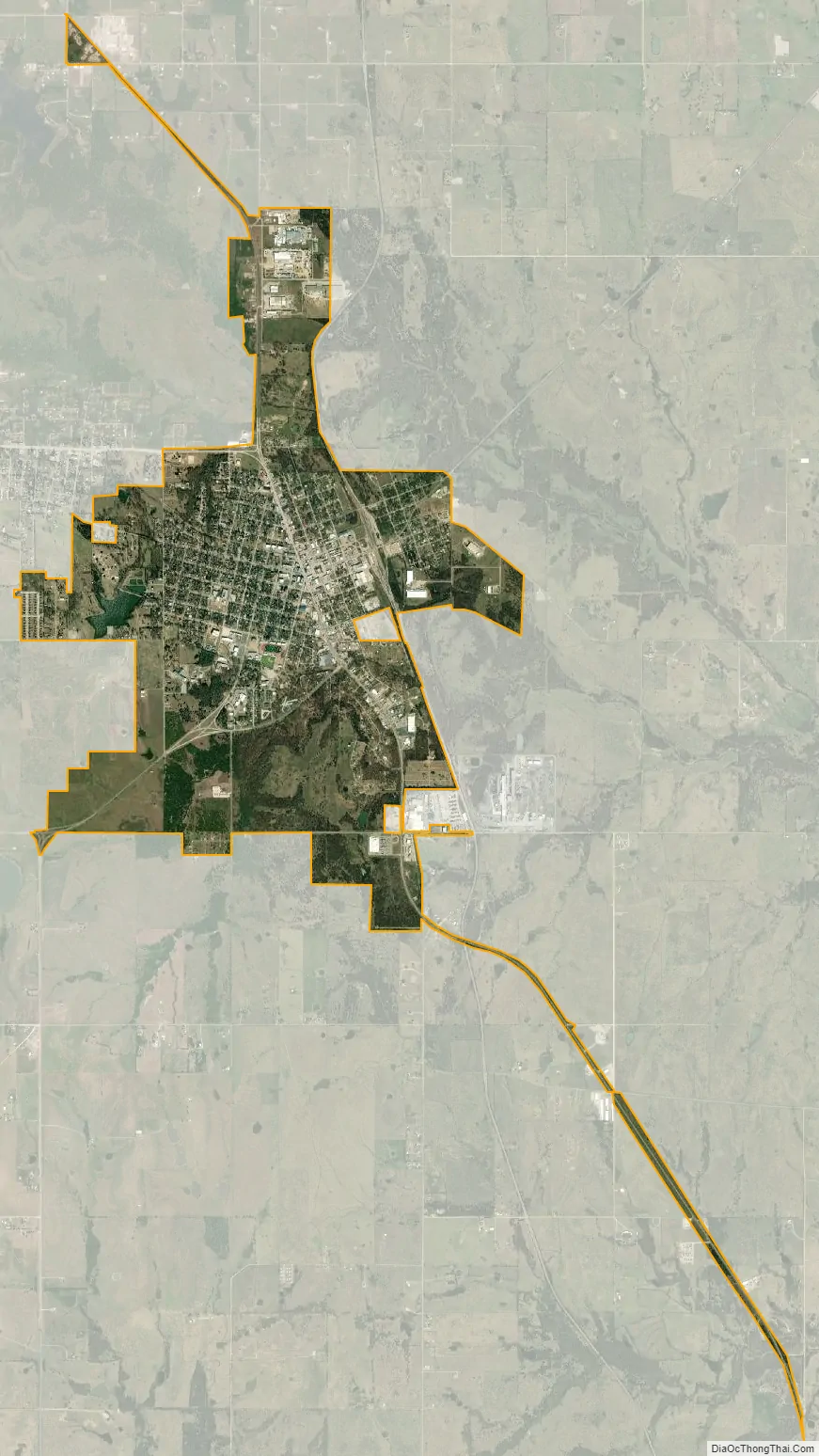
Madill city Satellite Map
Geography
Madill is located at 34°5′29″N 96°46′25″W / 34.09139°N 96.77361°W / 34.09139; -96.77361 (34.091261, -96.773565). According to the United States Census Bureau, the city has a total area of 2.9 square miles (7.5 km), of which 2.9 square miles (7.5 km) is land and 0.04 square miles (0.10 km) (1.37%) is water.
Madill is about 10 miles (16 km) north of Lake Texoma. It was originally named Kenlock.
Worth Hotel Building (2016)
United States Post Office (2016)
See also
Map of Oklahoma State and its subdivision:- Adair
- Alfalfa
- Atoka
- Beaver
- Beckham
- Blaine
- Bryan
- Caddo
- Canadian
- Carter
- Cherokee
- Choctaw
- Cimarron
- Cleveland
- Coal
- Comanche
- Cotton
- Craig
- Creek
- Custer
- Delaware
- Dewey
- Ellis
- Garfield
- Garvin
- Grady
- Grant
- Greer
- Harmon
- Harper
- Haskell
- Hughes
- Jackson
- Jefferson
- Johnston
- Kay
- Kingfisher
- Kiowa
- Latimer
- Le Flore
- Lincoln
- Logan
- Love
- Major
- Marshall
- Mayes
- McClain
- McCurtain
- McIntosh
- Murray
- Muskogee
- Noble
- Nowata
- Okfuskee
- Oklahoma
- Okmulgee
- Osage
- Ottawa
- Pawnee
- Payne
- Pittsburg
- Pontotoc
- Pottawatomie
- Pushmataha
- Roger Mills
- Rogers
- Seminole
- Sequoyah
- Stephens
- Texas
- Tillman
- Tulsa
- Wagoner
- Washington
- Washita
- Woods
- Woodward
- Alabama
- Alaska
- Arizona
- Arkansas
- California
- Colorado
- Connecticut
- Delaware
- District of Columbia
- Florida
- Georgia
- Hawaii
- Idaho
- Illinois
- Indiana
- Iowa
- Kansas
- Kentucky
- Louisiana
- Maine
- Maryland
- Massachusetts
- Michigan
- Minnesota
- Mississippi
- Missouri
- Montana
- Nebraska
- Nevada
- New Hampshire
- New Jersey
- New Mexico
- New York
- North Carolina
- North Dakota
- Ohio
- Oklahoma
- Oregon
- Pennsylvania
- Rhode Island
- South Carolina
- South Dakota
- Tennessee
- Texas
- Utah
- Vermont
- Virginia
- Washington
- West Virginia
- Wisconsin
- Wyoming