Purcell is a city in and the county seat of McClain County, Oklahoma, United States. As of the 2020 census, the city population was 6,651, a 13% increase from 2010.
Founded in 1887, Purcell was a railroad town named after Edward B. Purcell, who was an official with the Atchison, Topeka and Santa Fe Railway.
Purcell is often called the “Quarterhorse Capital of the World” and its official motto is “Heart of Oklahoma.” The city has registered trademarks on both titles.
| Name: | Purcell city |
|---|---|
| LSAD Code: | 25 |
| LSAD Description: | city (suffix) |
| State: | Oklahoma |
| County: | Cleveland County, McClain County |
| Incorporated: | 1898 |
| Elevation: | 1,099 ft (335 m) |
| Total Area: | 15.73 sq mi (40.75 km²) |
| Land Area: | 15.20 sq mi (39.36 km²) |
| Water Area: | 0.53 sq mi (1.38 km²) |
| Total Population: | 6,651 |
| Population Density: | 437.59/sq mi (168.96/km²) |
| ZIP code: | 73080 |
| Area code: | 405 |
| FIPS code: | 4061150 |
| GNISfeature ID: | 1096963 |
| Website: | www.cityofpurcell.com |
Online Interactive Map
Click on ![]() to view map in "full screen" mode.
to view map in "full screen" mode.
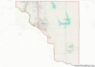
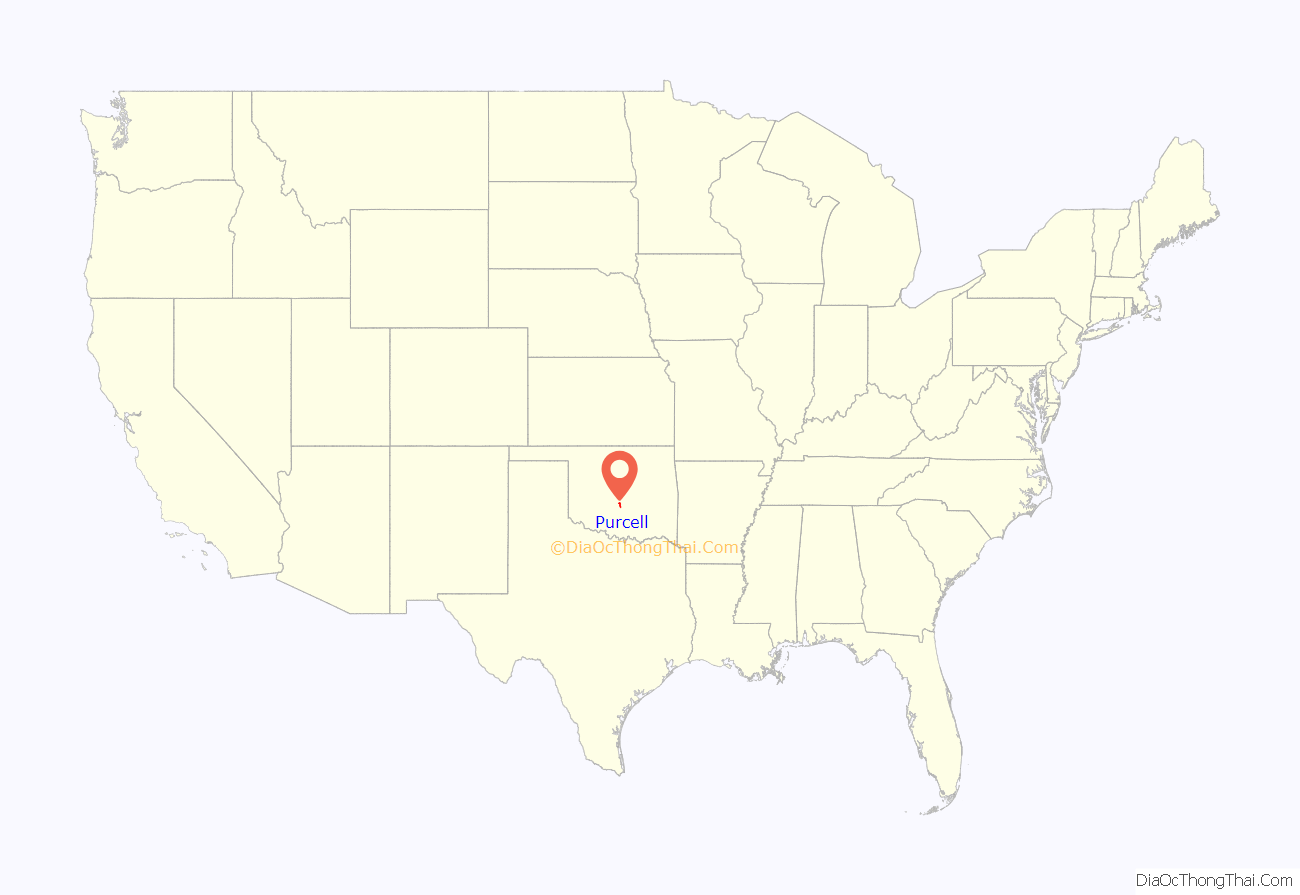
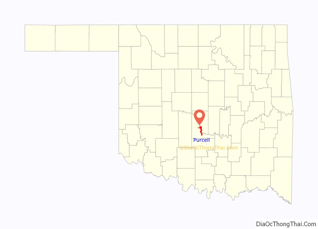
Purcell location map. Where is Purcell city?
History
Purcell was founded in 1887. It was named after Edward B. Purcell, a vice president of the Atchison, Topeka and Santa Fe Railroad (ATSF). Purcell was at the north end of the Gulf, Colorado and Santa Fe Railway, owned by the ATSF. Amtrak still serves the town with the Heartland Flyer at the station near the old Santa Fe depot.
Purcell was the only town on the border of the Unassigned Lands, and began attracting hopeful settlers even before the Land Rush of 1889. Town lots went on sale April 5, 1887, and a post office was established 16 days later. The Purcell Register, the town’s oldest newspaper, was established in 1887, and continued operating into the 21st Century. Residents elected the town’s first mayor, James Taylor Bradley, on August 13, 1895. The town was incorporated on October 3, 1898.
Located on the Canadian River, it was called the “Queen City of the Chickasaw Nation.” In 1895, one of the five district courts of the Chickasaw Nation was located in Purcell, with the first session opening November 18, 1895. The court house escaped destruction the next day, when a fire destroyed most of the buildings in the business district.
Construction of the Oklahoma Central Railway (OCR), which would connect the Lehigh coal mines with Chickasha, reached Purcell in March 1907. The OCR located its main yards, barns and most of its equipment in Purcell. Although the OCR went bankrupt in the following year, its assets were acquired by the ATSF.
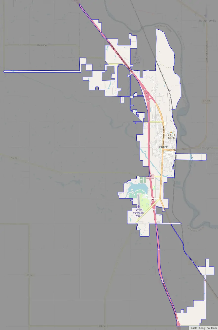
Purcell Road Map
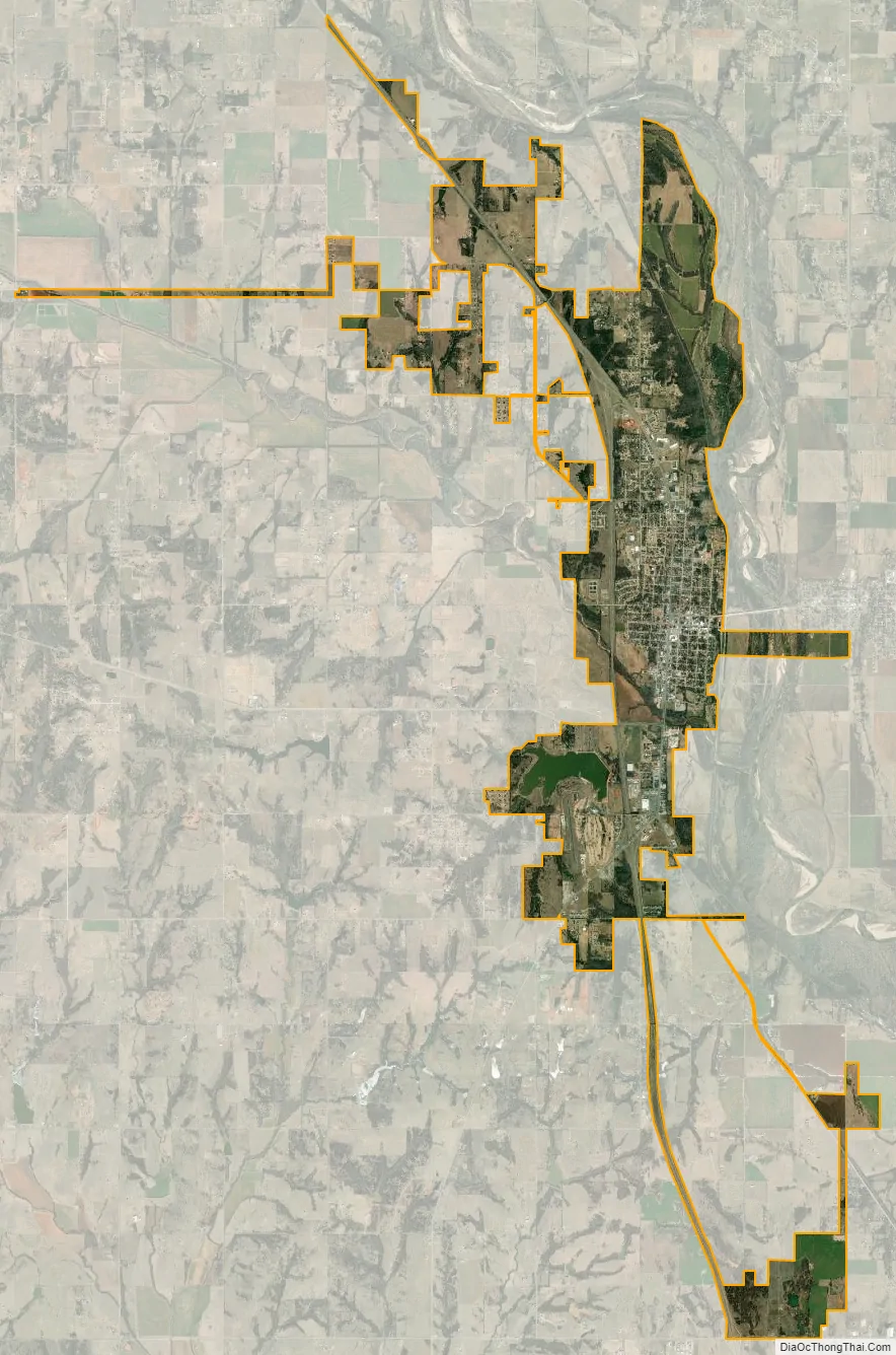
Purcell city Satellite Map
Geography
Purcell is within the Great Plains region, located at 35°1′3″N 97°22′10″W / 35.01750°N 97.36944°W / 35.01750; -97.36944 (35.017465, -97.369537). According to the U.S. Census Bureau, the city has a total area of 10.5 square miles (27.2 km), of which 10.1 square miles (26.1 km) is land and 0.46 square miles (1.2 km), or 4.33%, is water.
Purcell is located along the I-35 Corridor in the central part of the state, on a bluff overlooking the Canadian River valley within the Interior Plains region. It is 13 miles (21 km) south of Norman. The view from atop Purcell’s Red Hill offers a scenic glimpse at both the South Canadian River and the University of Oklahoma campus in neighboring Norman.
The central core of Purcell is located at the intersection of US-77 and OK-74/OK-39. Access to I-35 is at the north and south ends of the town.
Prior to the construction of I-35, this route of US-77 was the heavily traveled road from Oklahoma City to Dallas.
See also
Map of Oklahoma State and its subdivision:- Adair
- Alfalfa
- Atoka
- Beaver
- Beckham
- Blaine
- Bryan
- Caddo
- Canadian
- Carter
- Cherokee
- Choctaw
- Cimarron
- Cleveland
- Coal
- Comanche
- Cotton
- Craig
- Creek
- Custer
- Delaware
- Dewey
- Ellis
- Garfield
- Garvin
- Grady
- Grant
- Greer
- Harmon
- Harper
- Haskell
- Hughes
- Jackson
- Jefferson
- Johnston
- Kay
- Kingfisher
- Kiowa
- Latimer
- Le Flore
- Lincoln
- Logan
- Love
- Major
- Marshall
- Mayes
- McClain
- McCurtain
- McIntosh
- Murray
- Muskogee
- Noble
- Nowata
- Okfuskee
- Oklahoma
- Okmulgee
- Osage
- Ottawa
- Pawnee
- Payne
- Pittsburg
- Pontotoc
- Pottawatomie
- Pushmataha
- Roger Mills
- Rogers
- Seminole
- Sequoyah
- Stephens
- Texas
- Tillman
- Tulsa
- Wagoner
- Washington
- Washita
- Woods
- Woodward
- Alabama
- Alaska
- Arizona
- Arkansas
- California
- Colorado
- Connecticut
- Delaware
- District of Columbia
- Florida
- Georgia
- Hawaii
- Idaho
- Illinois
- Indiana
- Iowa
- Kansas
- Kentucky
- Louisiana
- Maine
- Maryland
- Massachusetts
- Michigan
- Minnesota
- Mississippi
- Missouri
- Montana
- Nebraska
- Nevada
- New Hampshire
- New Jersey
- New Mexico
- New York
- North Carolina
- North Dakota
- Ohio
- Oklahoma
- Oregon
- Pennsylvania
- Rhode Island
- South Carolina
- South Dakota
- Tennessee
- Texas
- Utah
- Vermont
- Virginia
- Washington
- West Virginia
- Wisconsin
- Wyoming