Sauk Centre is a city in Stearns County, Minnesota, United States. The population was 4,555 at the 2020 census. Sauk Centre is part of the St. Cloud Metropolitan Statistical Area.
Sauk Centre is the birthplace of Sinclair Lewis, a novelist and winner of the Nobel Prize in Literature. It inspired his fictional Gopher Prairie, the setting of Lewis’s 1920 novel Main Street. There are two sculptures of Lewis in Sauk Centre; one life size sculpture just outside the public library named after him and a bust, sculpted by Joseph Kiselewski, inside the library.
| Name: | Sauk Centre city |
|---|---|
| LSAD Code: | 25 |
| LSAD Description: | city (suffix) |
| State: | Minnesota |
| County: | Stearns County |
| Founded: | 1863 |
| Elevation: | 1,250 ft (381 m) |
| Total Area: | 4.08 sq mi (10.58 km²) |
| Land Area: | 4.08 sq mi (10.57 km²) |
| Water Area: | 0.00 sq mi (0.01 km²) |
| Total Population: | 4,555 |
| Population Density: | 1,116.15/sq mi (430.91/km²) |
| ZIP code: | 56378 |
| Area code: | 320 |
| FIPS code: | 2758648 |
| GNISfeature ID: | 0651233 |
| Website: | saukcentre.gov |
Online Interactive Map
Click on ![]() to view map in "full screen" mode.
to view map in "full screen" mode.
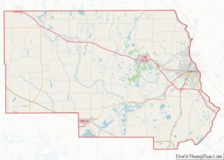
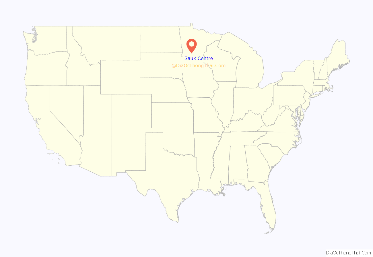
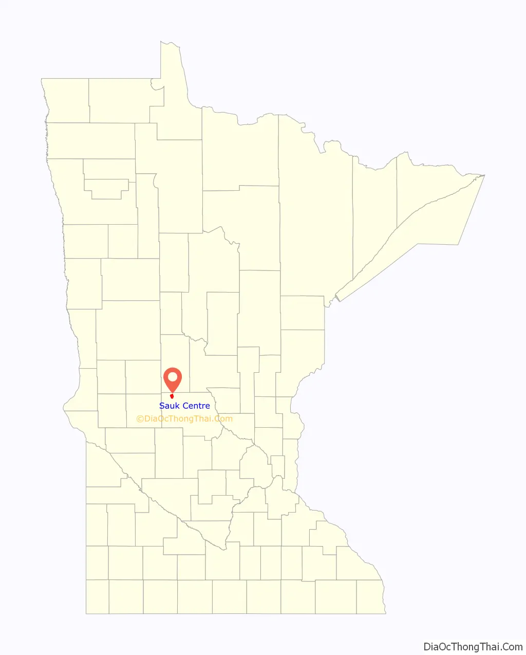
Sauk Centre location map. Where is Sauk Centre city?
History
The town was originally named by a lottery. The eight original town shareholders submitted suggestions for a name, and Sauk Centre was selected. The name was submitted by Alexander Moore, who originally bought and platted the town. Sauk refers to the many place names associated with the Sauk tribe (Sauk River, Sauk Rapids, Little Sauk, Osakis, etc). Centre (the British spelling of “center”) refers to the town’s central location between Sauk Rapids and Lake Osakis. When the Sauk Centre post office was established it used the spelling “Sauk Center”, until 1936 when the city won its fight to spell the name as Moore suggested. Local lore has it that five refugees from the Sauk tribe had been killed by settlers in an ambush on the shores of Lake Osakis 17 miles (27 km) away.
Sauk Centre contains the Sinclair Lewis Boyhood Home, a National Historic Landmark. Two other properties and a historic district are listed on the National Register of Historic Places: The Palmer House built in 1901 and expanded in 1916, the Minnesota Home School for Girls built 1911–1935, and the Original Main Street Historic District built 1920–1947.
Sauk Centre Road Map
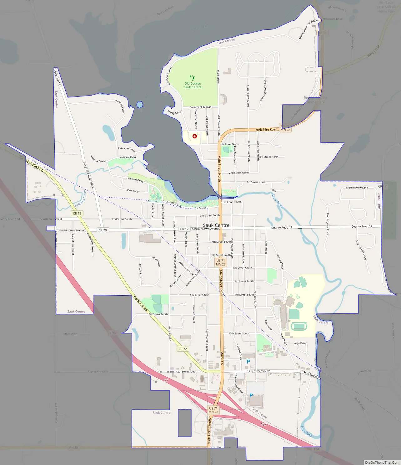
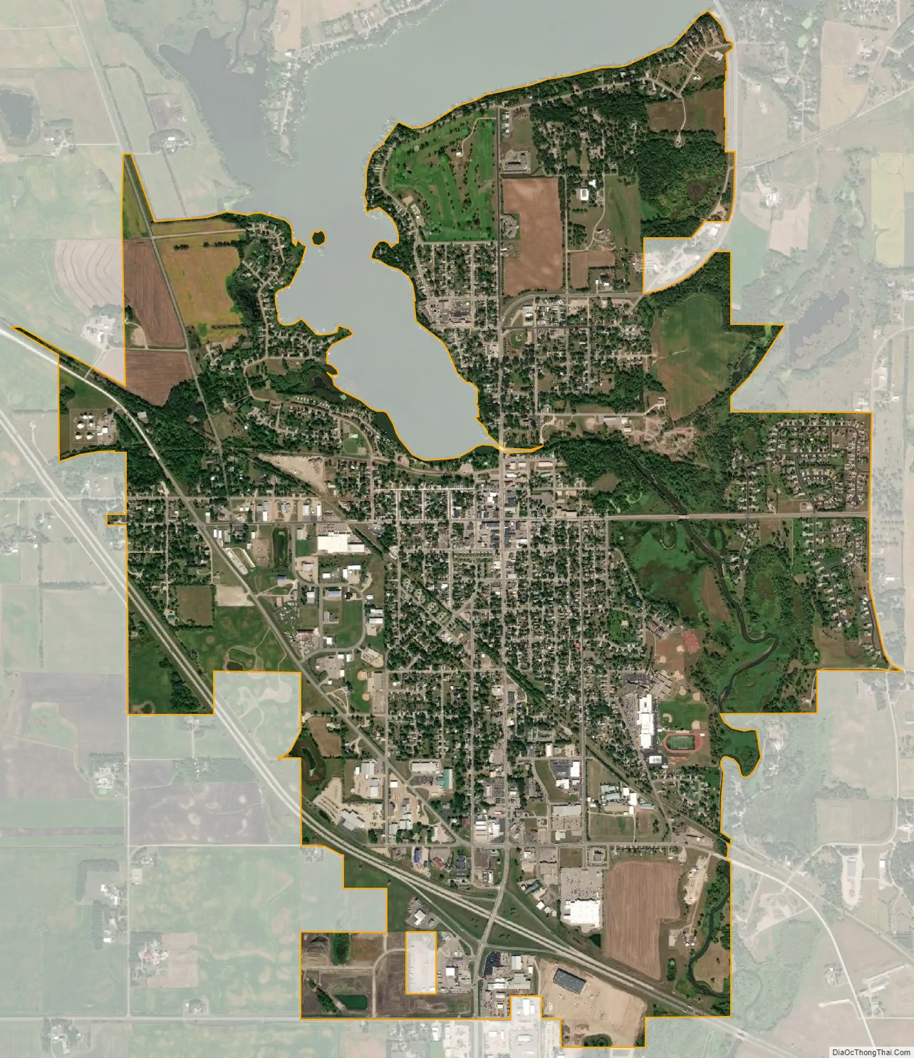
Sauk Centre city Satellite Map
Geography
According to the United States Census Bureau, the city has a total area of 4.25 square miles (11.01 km); 3.99 square miles (10.33 km) is land and 0.26 square miles (0.67 km) is water.
Sauk Centre is located along Interstate 94/U.S. Highway 52, U.S. Highway 71, and Minnesota State Highway 28. It is approximately 100 miles (160 km) northwest of the Minneapolis/Saint Paul metropolitan area.
The city is considered to be in the middle of the state. Sauk Lake and Sauk River are the most notable water features of the area. Fairy Lake and Lily Lake are located just outside of the city limits.
See also
Map of Minnesota State and its subdivision:- Aitkin
- Anoka
- Becker
- Beltrami
- Benton
- Big Stone
- Blue Earth
- Brown
- Carlton
- Carver
- Cass
- Chippewa
- Chisago
- Clay
- Clearwater
- Cook
- Cottonwood
- Crow Wing
- Dakota
- Dodge
- Douglas
- Faribault
- Fillmore
- Freeborn
- Goodhue
- Grant
- Hennepin
- Houston
- Hubbard
- Isanti
- Itasca
- Jackson
- Kanabec
- Kandiyohi
- Kittson
- Koochiching
- Lac qui Parle
- Lake
- Lake of the Woods
- Lake Superior
- Le Sueur
- Lincoln
- Lyon
- Mahnomen
- Marshall
- Martin
- McLeod
- Meeker
- Mille Lacs
- Morrison
- Mower
- Murray
- Nicollet
- Nobles
- Norman
- Olmsted
- Otter Tail
- Pennington
- Pine
- Pipestone
- Polk
- Pope
- Ramsey
- Red Lake
- Redwood
- Renville
- Rice
- Rock
- Roseau
- Saint Louis
- Scott
- Sherburne
- Sibley
- Stearns
- Steele
- Stevens
- Swift
- Todd
- Traverse
- Wabasha
- Wadena
- Waseca
- Washington
- Watonwan
- Wilkin
- Winona
- Wright
- Yellow Medicine
- Alabama
- Alaska
- Arizona
- Arkansas
- California
- Colorado
- Connecticut
- Delaware
- District of Columbia
- Florida
- Georgia
- Hawaii
- Idaho
- Illinois
- Indiana
- Iowa
- Kansas
- Kentucky
- Louisiana
- Maine
- Maryland
- Massachusetts
- Michigan
- Minnesota
- Mississippi
- Missouri
- Montana
- Nebraska
- Nevada
- New Hampshire
- New Jersey
- New Mexico
- New York
- North Carolina
- North Dakota
- Ohio
- Oklahoma
- Oregon
- Pennsylvania
- Rhode Island
- South Carolina
- South Dakota
- Tennessee
- Texas
- Utah
- Vermont
- Virginia
- Washington
- West Virginia
- Wisconsin
- Wyoming