Midvale is a city in Salt Lake County, Utah, United States. It is part of the Salt Lake City, Utah Metropolitan Statistical Area. Midvale’s population was 34,124 according to 2019 estimates from the U.S. Census Bureau.
Midvale is home to the Shops at Fort Union, located on the East side of the city and the Bingham Junction economic center, located on the west side of the city. Midvale is centrally located in the most populous county in Utah, with the direct interchange between I-15 and I-215 located in the middle of the city. Midvale is one of the few cities in Utah to be home to two direct TRAX lines.
| Name: | Midvale city |
|---|---|
| LSAD Code: | 25 |
| LSAD Description: | city (suffix) |
| State: | Utah |
| County: | Salt Lake County |
| Elevation: | 4,383 ft (1,336 m) |
| Total Area: | 5.91 sq mi (15.32 km²) |
| Land Area: | 5.91 sq mi (15.32 km²) |
| Water Area: | 0.00 sq mi (0.00 km²) |
| Total Population: | 27,964 |
| Population Density: | 5,770.04/sq mi (2,227.74/km²) |
| ZIP code: | 84047 |
| Area code: | 385, 801 |
| FIPS code: | 4949710 |
| GNISfeature ID: | 1430307 |
| Website: | http://www.midvalecity.org/ |
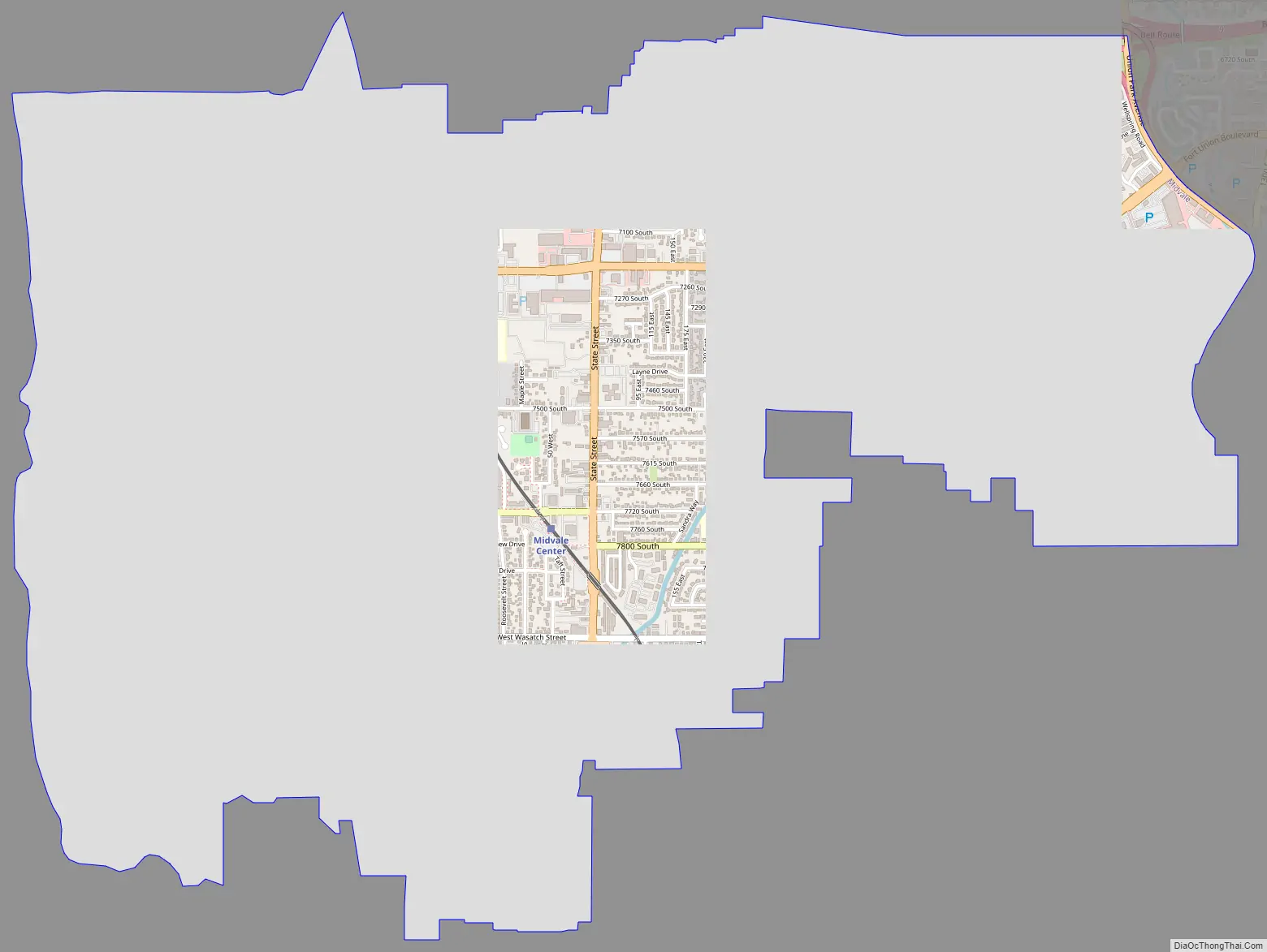
Online Interactive Map
Click on ![]() to view map in "full screen" mode.
to view map in "full screen" mode.
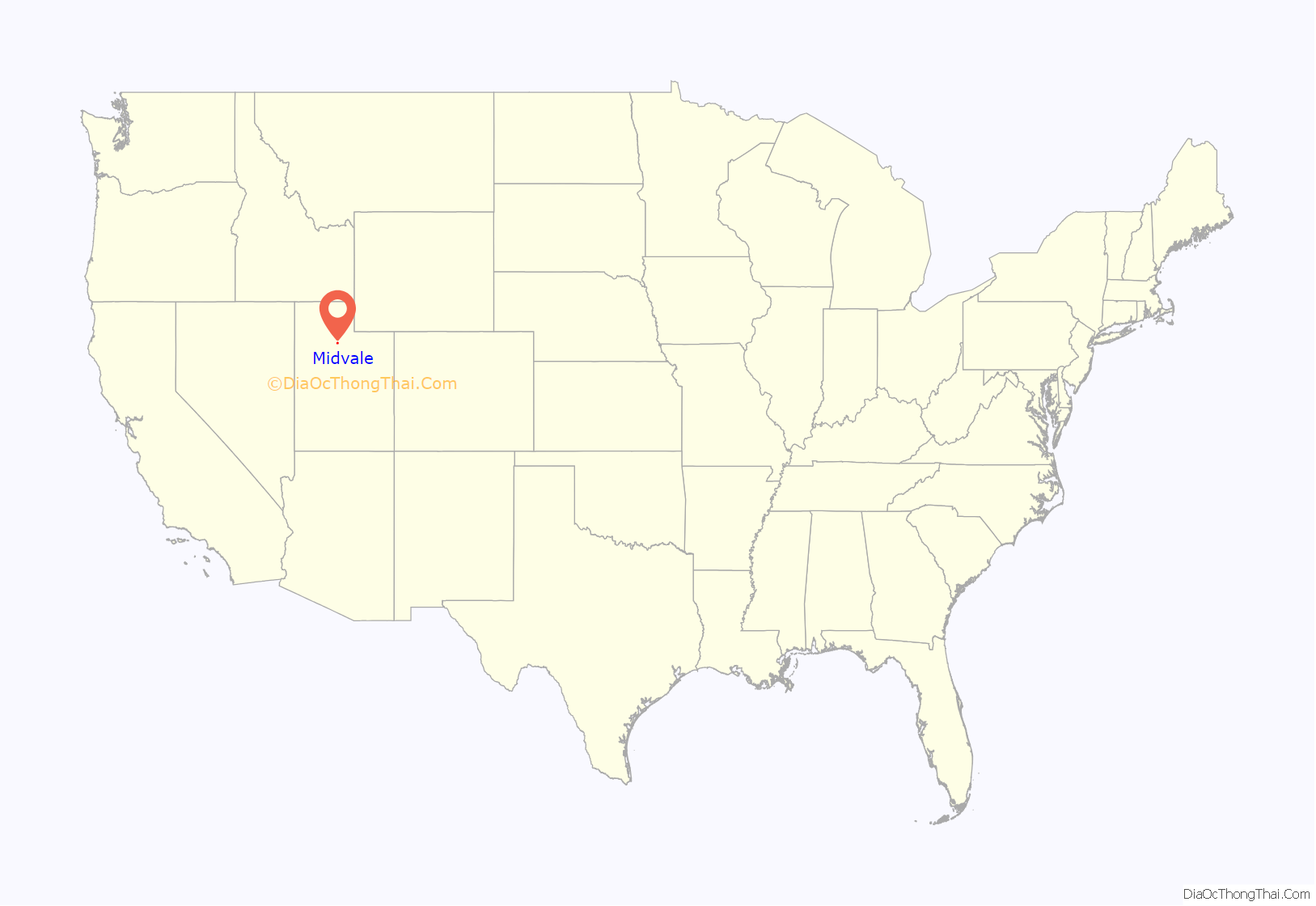
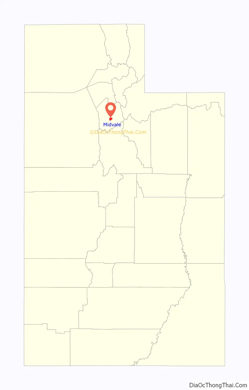
Midvale location map. Where is Midvale city?
History
Located in the central part of the Salt Lake Valley, and next to the Jordan River, Midvale was an early target for settlers in Utah. Permanent homes began as early as the 1850s, with one of the earliest homes still preserved today. The population grew quickly in the 1870s thanks to its central location, the use of railroad, and its connection to the mining in Bingham Canyon, the western area of present-day Midvale became an important industrial area for Utah. To support this growth, the eastern area of present-day Midvale provided agriculture and housing.
Incorporation
People in the area, presumably, started calling the area Midvale, due to its central location in the valley. In 1909 Midvale officially became a city and in the 1910 census had a population of 1,760.
Growth
Fort Union, historically Union, was an early settlement area on the eastern edge of present-day Midvale. When Midvale annexed the Fort Union Area, it brought an established housing population. However, it did not just provide the city with a much larger population base, it also brought the city the shops of Fort Union. The shops provide both shopping and office space for Midvale.
Bingham Junction, originally known as the Sharon Steel site, is on the western border of Midvale and is roughly 446 acres in size. The area originally started seeing economic development as early as 1871 as a slag site for mining, which operated as such until 1958. Upon testing, it appeared to have large amounts of lead, arsenic and heavy metals, rendering the property unusable. Through mediation, help from the EPA and other parties, the area underwent a major cleanup and restoration project that saw its name removed from the NPL in 2006.
Since Bingham Junction’s removal from the NPL, the area underwent major changes. It brought about thousands of new households to the city. In connection with the added residential, major corporations moved to the area, where Overstock, CHG, and Savage now use as their headquarters. Also other major companies have brought their operation to the area, including Marriott, Zagg and IHC. Entertainment followed with the first ever Top Golf in Utah resides in the Bingham Junction area. As other important shopping centers such as Winco and other dining options. The EPA now considers this a success story and estimates as of 2018 there are 56 on site businesses with at least 2,646 employees.
Bingham Junction is also home to a stop on the red line, that goes from the western edges of Salt Lake County to the University of Utah, Utah’s flagship university.
Following in the success of the Bingham Junction Area, the area known as Jordan Bluffs is beginning the early phase of similar redevelopment. Jordan Bluffs is situated south of Bingham Junction and was originally part of the Sharon Steel slag site. It compromises 351 acres in the south west region of Midvale.
Jordan Bluffs is in the beginning phases of redevelopment, but current proposals could see an additional 3,500 housing units and over 1,000,000 square feet of office space within the next ten years.
Midvale Road Map
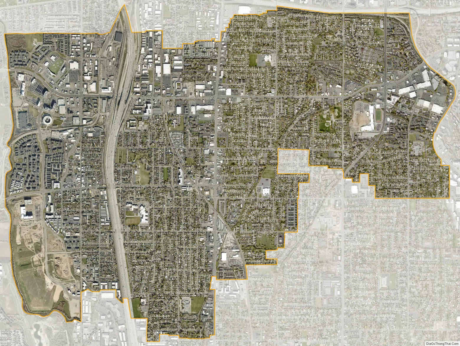
Midvale city Satellite Map
Geography
According to the United States Census Bureau, the city has a total area of 5.8 square miles (15.1 km), all land. The western border of Midvale is the Jordan River that flows down the center of the valley.
Climate
This climatic region is typified by large seasonal temperature differences, with warm to hot summers and cold winters. According to the Köppen Climate Classification system, Midvale has a humid continental climate, abbreviated “Dfb” on climate maps.
Under the Köppen climate classification, Sandy has a humid subtropical climate (Cfa) or a humid continental climate (Dfa) depending on which variant of the system is used.
See also
Map of Utah State and its subdivision: Map of other states:- Alabama
- Alaska
- Arizona
- Arkansas
- California
- Colorado
- Connecticut
- Delaware
- District of Columbia
- Florida
- Georgia
- Hawaii
- Idaho
- Illinois
- Indiana
- Iowa
- Kansas
- Kentucky
- Louisiana
- Maine
- Maryland
- Massachusetts
- Michigan
- Minnesota
- Mississippi
- Missouri
- Montana
- Nebraska
- Nevada
- New Hampshire
- New Jersey
- New Mexico
- New York
- North Carolina
- North Dakota
- Ohio
- Oklahoma
- Oregon
- Pennsylvania
- Rhode Island
- South Carolina
- South Dakota
- Tennessee
- Texas
- Utah
- Vermont
- Virginia
- Washington
- West Virginia
- Wisconsin
- Wyoming