Springdale is a town in Washington County, Utah, United States. The population was 529 at the 2010 census. It is located immediately outside the boundaries of Zion National Park, and is oriented around the resulting tourist industry. It was originally settled as a Mormon farming community in 1862 by evacuees from the flooding of nearby Northrop.
| Name: | Springdale town |
|---|---|
| LSAD Code: | 43 |
| LSAD Description: | town (suffix) |
| State: | Utah |
| County: | Washington County |
| Elevation: | 3,898 ft (1,188 m) |
| Total Area: | 4.62 sq mi (11.96 km²) |
| Land Area: | 4.62 sq mi (11.96 km²) |
| Water Area: | 0.00 sq mi (0.00 km²) |
| Total Population: | 529 |
| Population Density: | 136.24/sq mi (52.60/km²) |
| ZIP code: | 84767, 84779 |
| Area code: | 435 |
| FIPS code: | 4971840 |
| GNISfeature ID: | 1432867 |
Online Interactive Map
Click on ![]() to view map in "full screen" mode.
to view map in "full screen" mode.
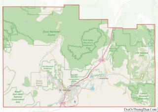
Springdale location map. Where is Springdale town?


History
The 1992 St. George earthquake destroyed three houses as well as above- and below-ground utilities, causing about US$1 million in damage. In the Balanced Rock Hills area of Springdale, a landslide covered part of Utah State Route 9, taking several hours to complete movement. The slide was about 1,600 feet (490 m) long and 3,600 feet (1,100 m) wide, contained boulders up to 20 feet (6.1 m) in diameter, with a total volume of 18,000,000 cubic yards (14,000,000 m) and total area of 4,400,400 square feet (408,810 m).
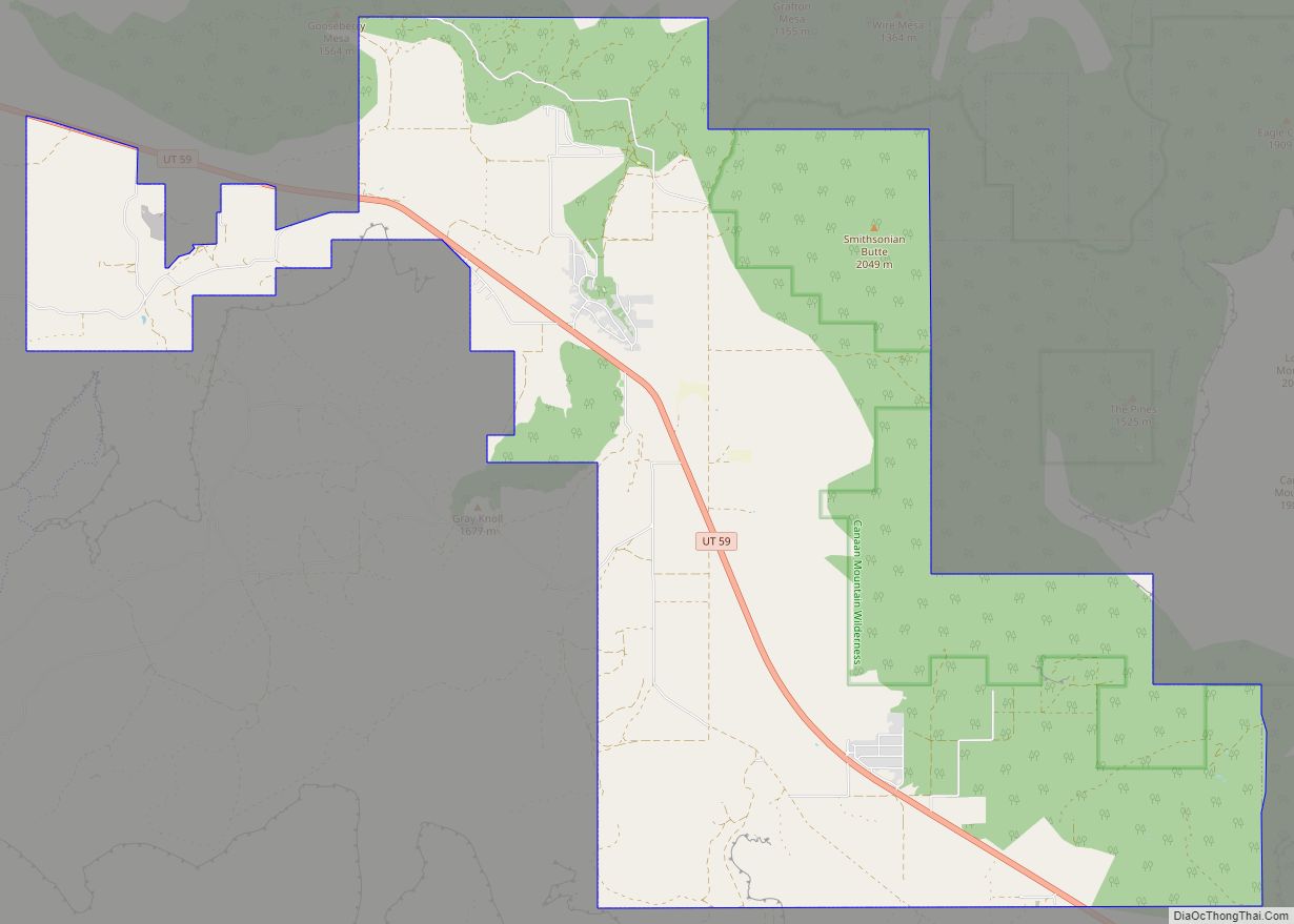
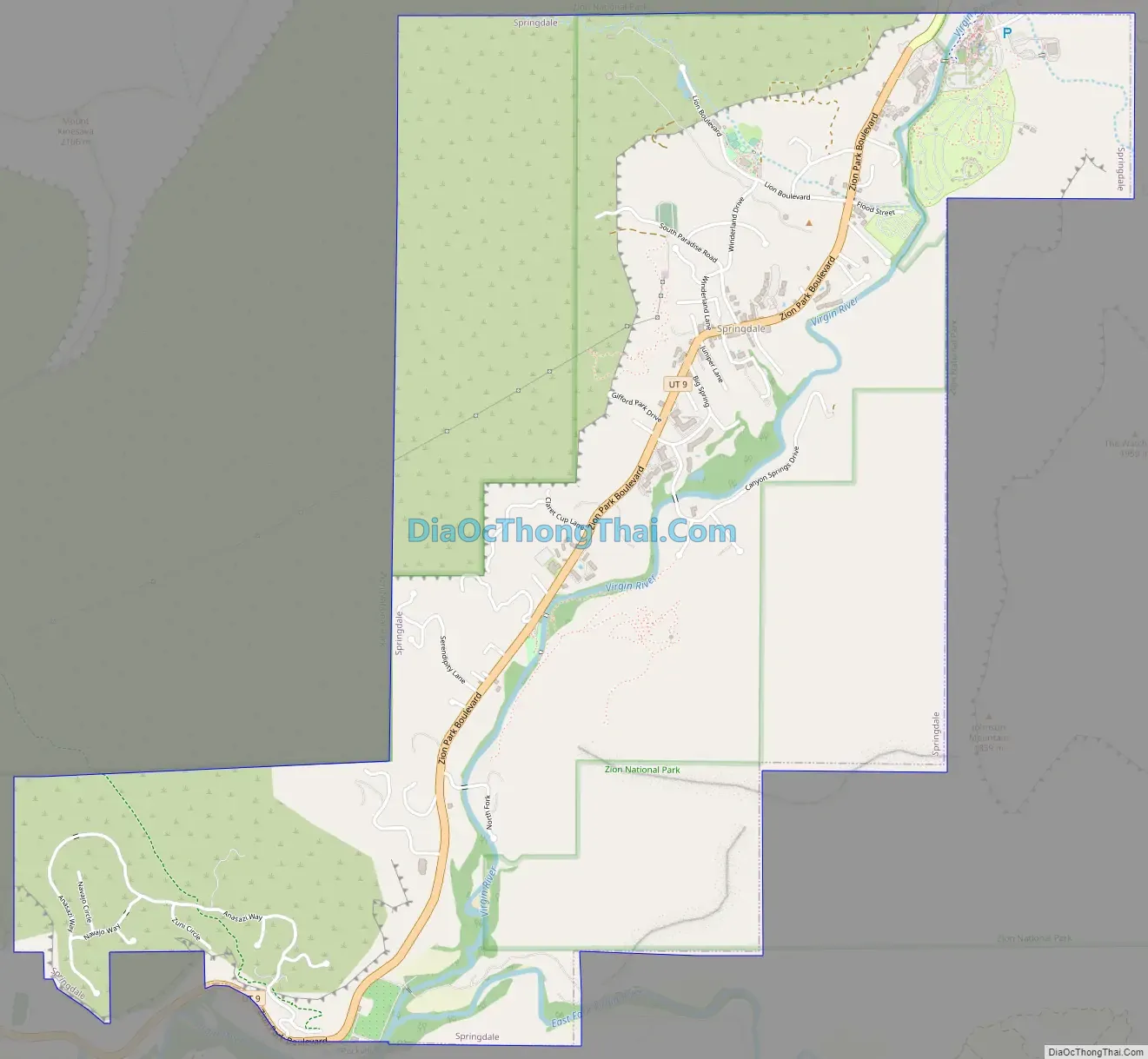
Springdale Road Map
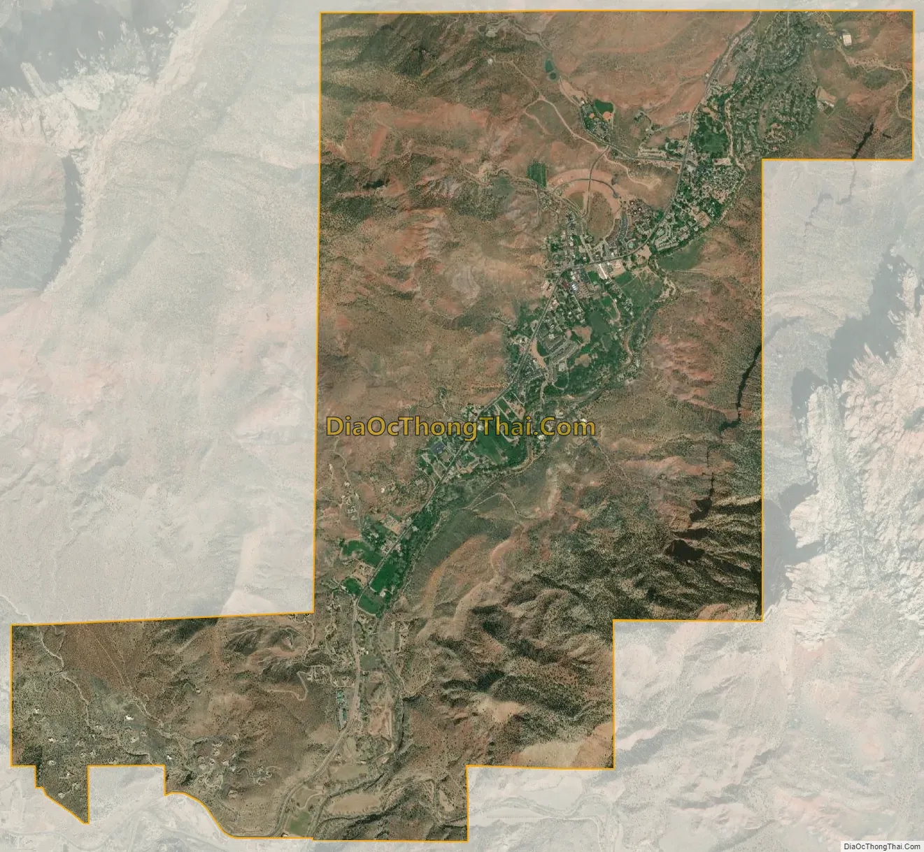
Springdale city Satellite Map
Geography
According to the United States Census Bureau, the town has a total area of 4.6 square miles (12.0 km), all land. Springdale is set in Zion Canyon with Mount Kinesava to the west, and The Watchman to the east. The North Fork Virgin River courses through town shortly before the confluence with the Virgin’s East Fork.
Springdale sits at the western edge of the Colorado Plateau, in the transition zone between the plateau, the Great Basin and the Mojave Desert.
See also
Map of Utah State and its subdivision: Map of other states:- Alabama
- Alaska
- Arizona
- Arkansas
- California
- Colorado
- Connecticut
- Delaware
- District of Columbia
- Florida
- Georgia
- Hawaii
- Idaho
- Illinois
- Indiana
- Iowa
- Kansas
- Kentucky
- Louisiana
- Maine
- Maryland
- Massachusetts
- Michigan
- Minnesota
- Mississippi
- Missouri
- Montana
- Nebraska
- Nevada
- New Hampshire
- New Jersey
- New Mexico
- New York
- North Carolina
- North Dakota
- Ohio
- Oklahoma
- Oregon
- Pennsylvania
- Rhode Island
- South Carolina
- South Dakota
- Tennessee
- Texas
- Utah
- Vermont
- Virginia
- Washington
- West Virginia
- Wisconsin
- Wyoming