Tooele (/tuːˈwɪlə/ too-WIL-ə) is a city in Tooele County in the U.S. state of Utah. The population was 35,742 at the 2020 census. It is the county seat of Tooele County. Located approximately 30 minutes southwest of Salt Lake City, Tooele is known for Tooele Army Depot, for its views of the nearby Oquirrh Mountains and the Great Salt Lake.
| Name: | Tooele city |
|---|---|
| LSAD Code: | 25 |
| LSAD Description: | city (suffix) |
| State: | Utah |
| County: | Tooele County |
| Elevation: | 5,050 ft (1,537 m) |
| Total Area: | 24.16 sq mi (62.57 km²) |
| Land Area: | 24.14 sq mi (62.52 km²) |
| Water Area: | 0.02 sq mi (0.04 km²) |
| Total Population: | 35,742 |
| Population Density: | 1,480.61/sq mi (571.69/km²) |
| ZIP code: | 84074 |
| Area code: | 435 |
| FIPS code: | 4976680 |
| GNISfeature ID: | 1433590 |
| Website: | tooelecity.org |
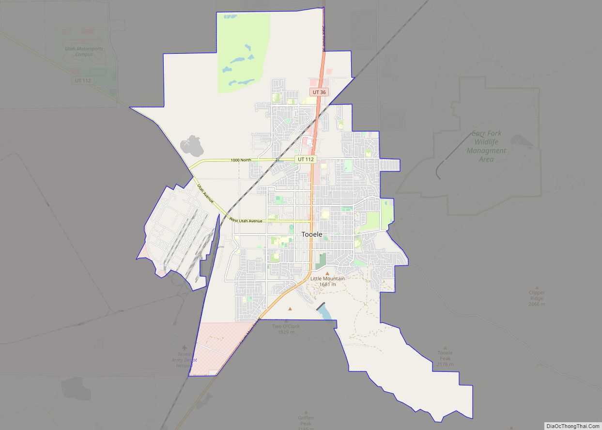
Online Interactive Map
Click on ![]() to view map in "full screen" mode.
to view map in "full screen" mode.
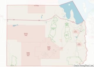
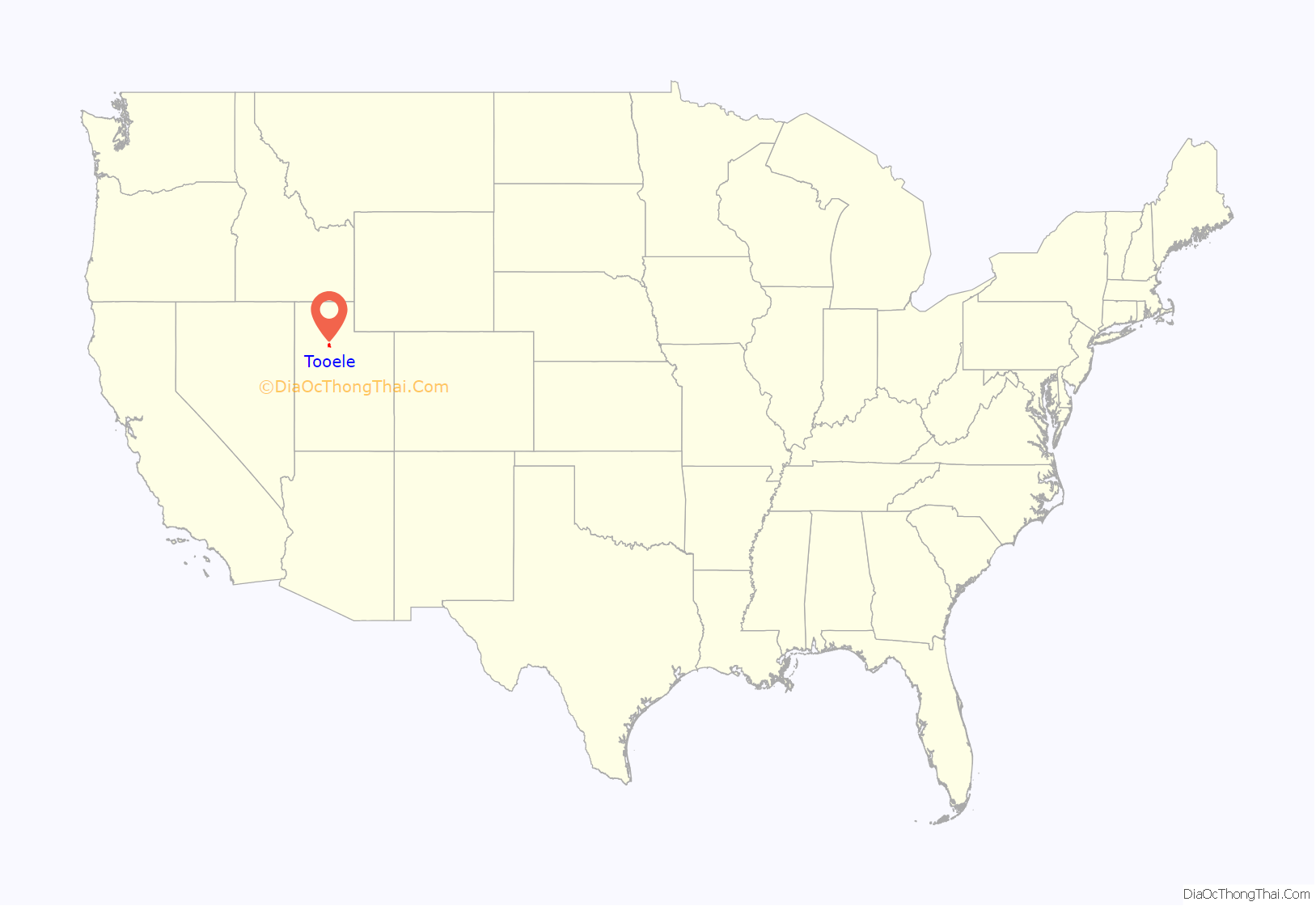
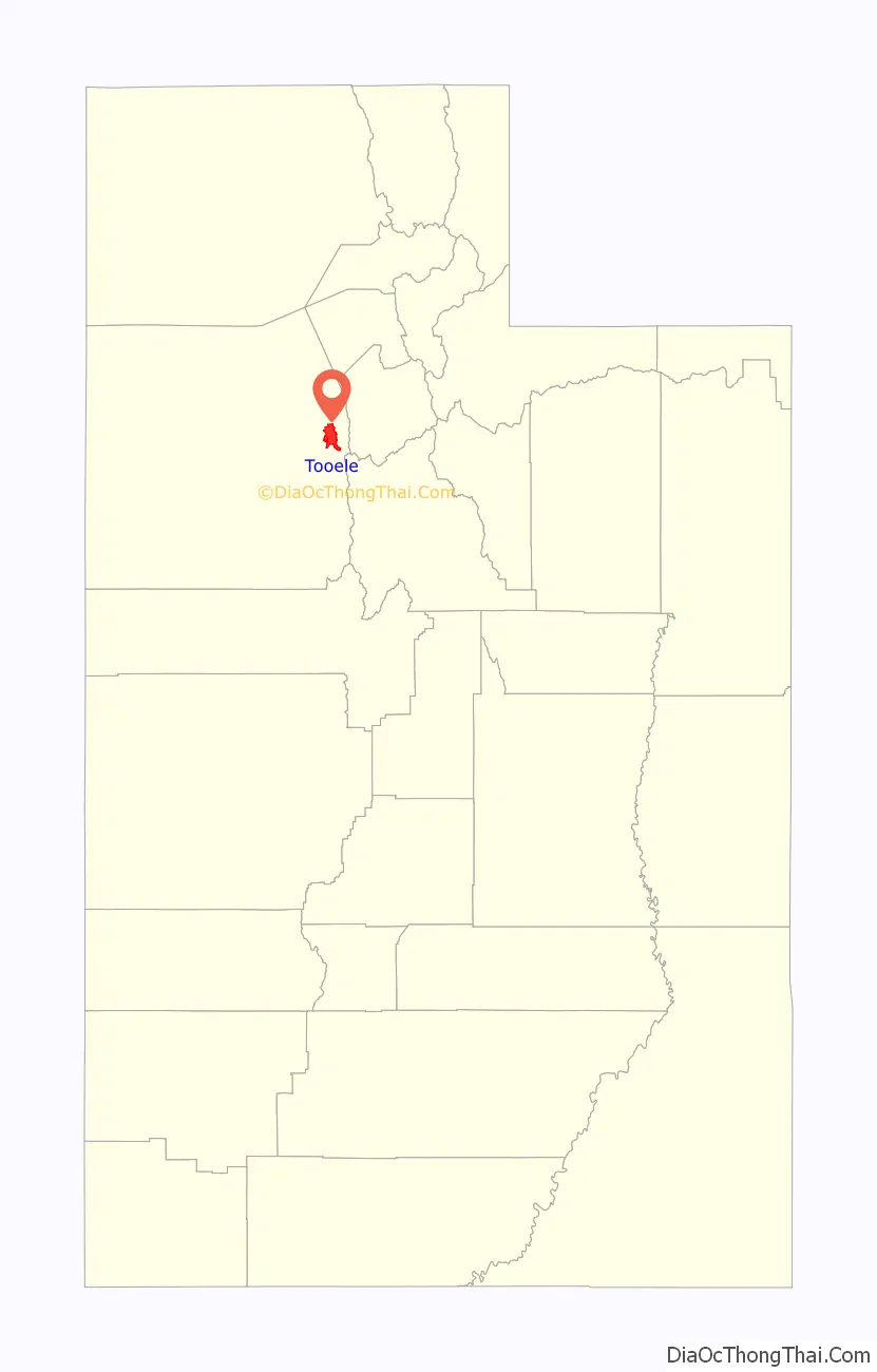
Tooele location map. Where is Tooele city?
History
The Tooele Valley was the traditional territory of the Tooele Valley Goshute, a band of the Goshute Shoshone. The ancient presence of humans in the area is attested by extensive archaeological work at the Danger Cave site, which confirms people were present and active by 9000 BP [7000 BC].
When Mormon pioneers entered the Great Salt Lake Valley in July 1847, it was covered with abundant tall grass. The Mormons first used the valley as wintering grounds for their herds. In September 1849, three families settled on a small stream south of present-day Tooele City. Other families slowly joined them, and by 1853 Tooele City Corporation was organized.
During the nineteenth century, the town was primarily an agricultural community; by the century’s end its population was about 1,200.
The 20th century brought more industrialization; in 1904 the Los Angeles and Salt Lake Railroad built a line through the city, and in 1909 the International Smelting and Refining Company smelter was built in Carr Fork/Pine Canyon east of the city . The Tooele Valley Railway, a seven-mile line, ran from the smelter west to the Union Pacific Railroad main line. This line brought ore from various area mines to the smelter; later a 20,000 ft aerial tramway was also used to transport ore from the mine to the smelter. By 1941 a 22,000 ft tunnel had been completed through the mountain, to move ore to the smelter entirely underground. The smelter began processing copper in 1910, with lead and zinc processing commencing in 1912. In 1946 the copper smelter ceased operation, the zinc operation halted in 1968, and the lead processing was halted in 1972. The entire site was demolished during 1972–74. However, consideration was being given during this latter period to extracting ore from Carr Fork Canyon, rather than relying on the ore from the east face of the mountain range. In 1969 the mining company began exploration drilling. In 1974 a copper mine and mill (“Carr Fork Operations”) was started; it began processing ore in 1979, and ran until 1981. The Tooele Valley Railway was used to haul away the scrap when the International smelter was torn down, and remained to serve the Pine Canyon mill. It was shut down and abandoned when the Pine Canyon “Carr Fork” mine and mill shut down; its last day of operation was 28 August 1982.
In the eastern section of Tooele, “New Town” was built for many of the 1,000 smelter workers. Families from the Balkans, Italy, Greece, and Asia Minor lived in this area and formed their own community. New Town included its own school, church, culture and numerous languages.
When World War II started, the federal government obtained 25,000 acres in the southwestern part of the Tooele Valley to establish an ordnance depot (“Tooele Ordnance Depot”).
In 1993 the scope and mission of the Tooele Army Depot (as the previous Ordnance Depot was now called) was reduced, and about 1,700 acres of its area including many buildings were annexed to Tooele City. The US Army conveyed 40 acres of land, including a newly constructed large-vehicle maintenance structure (“Consolidated Maintenance Facility”) to the City, who converted it into an industrial complex (“Utah Industrial Depot”, UID). In 2013 the UID was purchased by another company and is presently known as “Ninigret Depot.”
Tooele Road Map

Tooele city Satellite Map

Geography
According to the United States Census Bureau, the city has a total area of 21.2 square miles (54.8 km), of which 21.1 square miles (54.8 km) is land and 0.04 square miles (0.1 km) (0.09%) is water.
Tooele is located on the western slope of the Oquirrh Mountains in the Tooele Valley, the next valley west of the well-known Salt Lake Valley. Many popular camping and picnic areas surround the city.
Etymology
The unusual name for the town is thought by some to have evolved from an old Ute Indian word for tumbleweed. This is one of many unverified explanations, as the name’s usage predated the introduction of the Russian thistle to the United States.
Other explanations include that the name derives from a Native American chief, but controversy exists about whether such a chief existed. Others hypothesize that the name comes from “tuu-wɨɨta”, the Goshute word for “black bear”, or from “tule”, a Spanish word of Aztec origin meaning “bulrush.”
Climate
Tooele has a cold semi-arid climate type, which consists of dry, hot summers, and wet, cold winters. It is considered to be in the 13d ecoregion of Utah. (Köppen Bsk). The hottest temperature recorded in Tooele was 106 °F (41.1 °C) on July 30–31, 2000, while the coldest temperature recorded was −16 °F (−26.7 °C) on February 10, 1933 and December 23, 1990.
See also
Map of Utah State and its subdivision: Map of other states:- Alabama
- Alaska
- Arizona
- Arkansas
- California
- Colorado
- Connecticut
- Delaware
- District of Columbia
- Florida
- Georgia
- Hawaii
- Idaho
- Illinois
- Indiana
- Iowa
- Kansas
- Kentucky
- Louisiana
- Maine
- Maryland
- Massachusetts
- Michigan
- Minnesota
- Mississippi
- Missouri
- Montana
- Nebraska
- Nevada
- New Hampshire
- New Jersey
- New Mexico
- New York
- North Carolina
- North Dakota
- Ohio
- Oklahoma
- Oregon
- Pennsylvania
- Rhode Island
- South Carolina
- South Dakota
- Tennessee
- Texas
- Utah
- Vermont
- Virginia
- Washington
- West Virginia
- Wisconsin
- Wyoming