Gaston is a city in Washington County, Oregon, United States. Located between Forest Grove to the north and Yamhill to the south, the city straddles Oregon Route 47 and borders the Tualatin River. Named after railroad executive Joseph Gaston, its population was 637 as of the 2010 census.
| Name: | Gaston city |
|---|---|
| LSAD Code: | 25 |
| LSAD Description: | city (suffix) |
| State: | Oregon |
| County: | Washington County, Yamhill County |
| Incorporated: | 1914 |
| Elevation: | 300 ft (90 m) |
| Total Area: | 0.34 sq mi (0.88 km²) |
| Land Area: | 0.34 sq mi (0.88 km²) |
| Water Area: | 0.00 sq mi (0.00 km²) |
| Total Population: | 676 |
| Population Density: | 1,982.40/sq mi (764.43/km²) |
| ZIP code: | 97119 |
| Area code: | 503 and 971 |
| FIPS code: | 4128100 |
| GNISfeature ID: | 1157988 |
| Website: | http://www.cityofgaston.com |
Online Interactive Map
Click on ![]() to view map in "full screen" mode.
to view map in "full screen" mode.
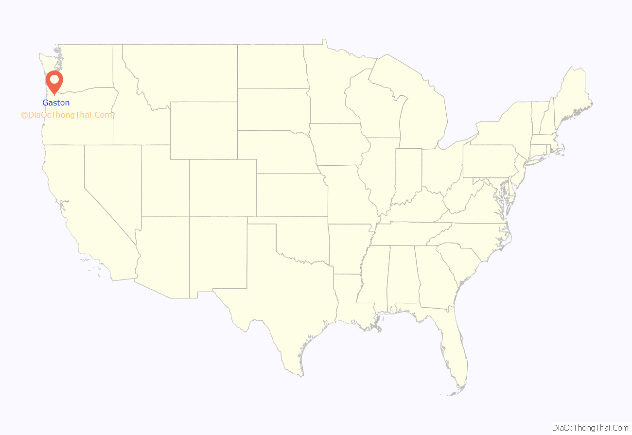
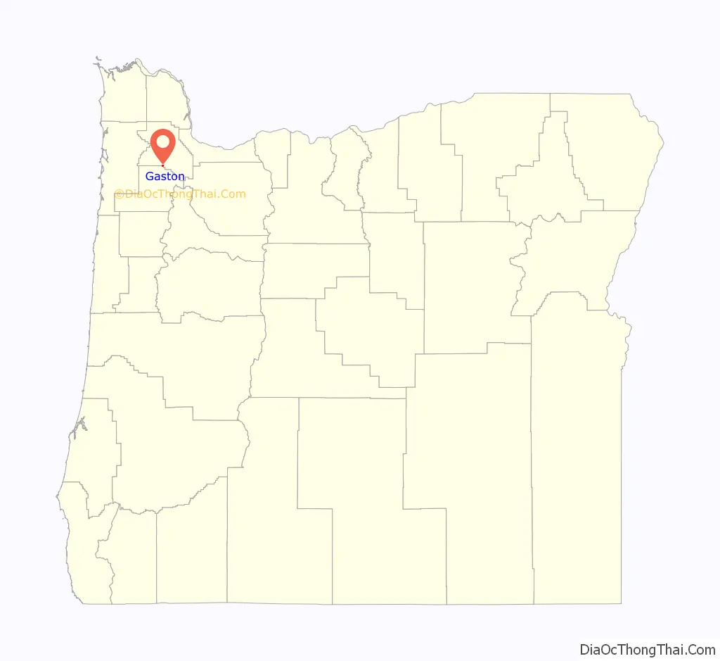
Gaston location map. Where is Gaston city?
History
The first known inhabitants of the Tualatin Valley were the Atfalati tribe, a subset of the Kalapuya ethnic group. Contact with Europeans in the late 1700s led to the spread of smallpox and other diseases, which devastated the Atfalati population. In 1851, due to population pressures from white settlers, surviving members of the tribe negotiated a treaty with the Oregon Territory ceding their ancestral lands throughout the Tualatin Valley to guarantee a small reservation on the banks of nearby Wapato Lake. This treaty was never ratified, and in the late 1850s, the U.S. government relocated the tribe to the Grand Ronde Reservation.
Large-scale American settlement of the region began in the 1850s, due to the Donation Land Claim Act, which granted land to white settlers who moved to the Oregon Territory before 1855. In the 1870s, the West Side Railroad was built from Hillsboro to Corvallis, cutting through this region. The community of Gaston developed from a railroad stop in 1872 to a commercial center, hosting a school, post office, hotel, and blacksmith shop. Due to legal disputes, Joseph Gaston left his position at the railroad and moved to the region in 1880. He spent the next sixteen years attempting to drain Wapato Lake for farmland.
The nearby community of Cherry Grove was founded in 1911 as a logging hub and briefly eclipsed Gaston. Gaston was formally incorporated in 1914. By 1916, the town possessed a general store, bank, and other enterprises. In early May 1935 workers at the Stimson Mill went on strike. On May 22, activists left the Labor Temple in Portland to support the strikers. The next morning Oregon governor Charles Martin ordered the state police and National Guard to protect the strikebreakers. Armed with gas grenades and machine guns, the military and police forces demanded the strikers leave or be shot. The strikers chose to disperse, averting a potential bloodbath.
New high school
In 1915 a new high school was built on the land Joseph Gaston had previously set aside for a school. That high school was in use through the 1986–87 school year, when it was condemned. The condemning of the building became a crucial local issue for the town, with residents split between merging with a nearby district (both Forest Grove or Yamhill were considered), and building a new high school. In the end, a new high school was built and Gaston retained its independent school system and with it a degree of local pride. Currently the Gaston School District is a full K–12 district, with 525 students total in 2007, and a single high school.
Modern expansion
The growing popularity of Portland and the Pacific Northwest in general has led to population growth throughout the region. Though too far from Portland to benefit much at first, recently Gaston has started to see new housing and an uptick in school registrations. The late 1980s brought a new fire station and the 1990s baseball/softball-oriented park. Just after 2000, a new post office was built on the edge of town. Thus far, the town has not been able to effectively capitalize on the local wine industry’s growing national and international recognition. In 2006, the mayoral candidate advocated obtaining state or federal funding to revitalize the commercial strip on Main Street which, in theory, could help the city capture some of the wine tourism dollars.
In 2008, the U.S. Fish and Wildlife Service began purchasing land in the Wapato Lake bed to reestablish the historic wetland.
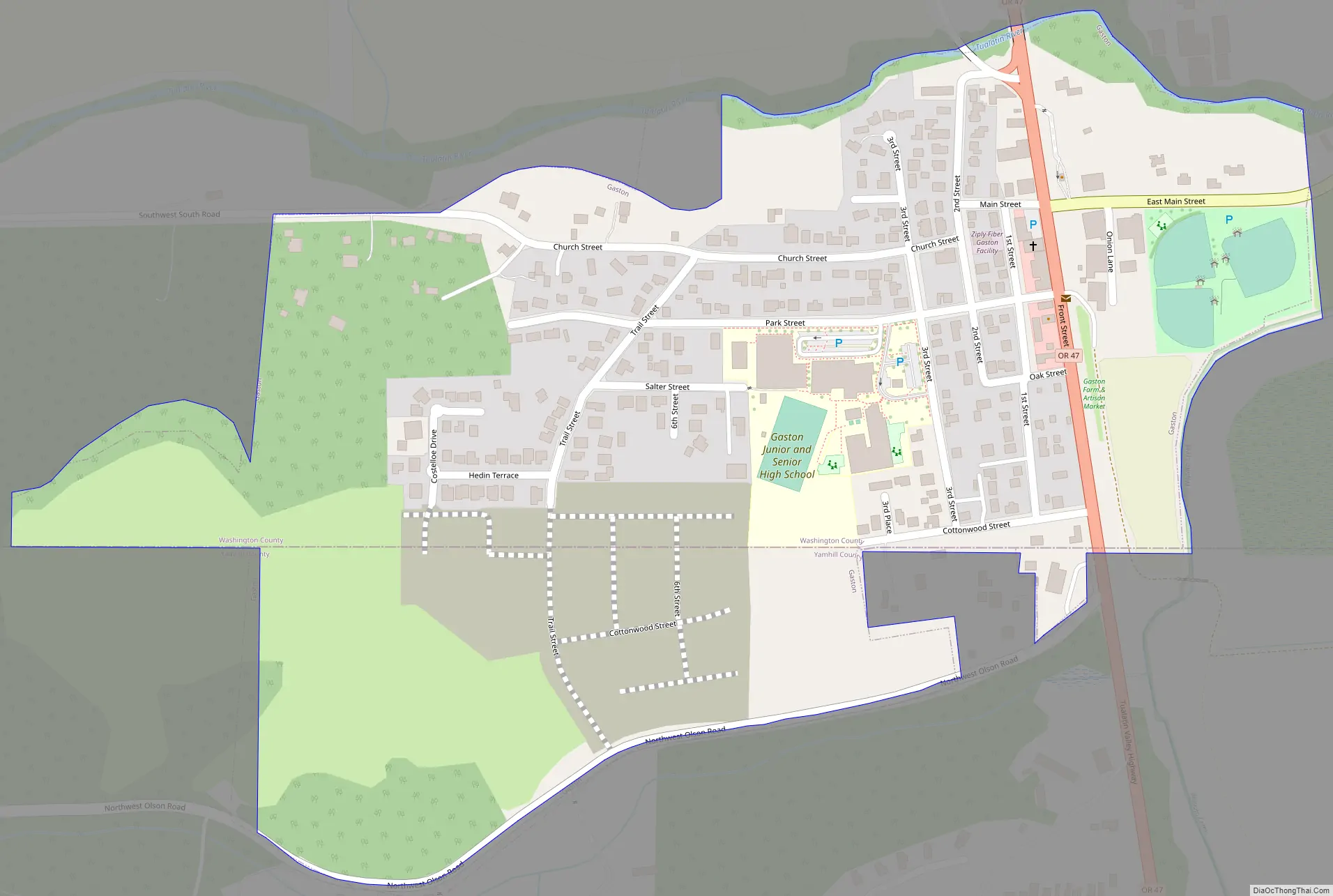
Gaston Road Map
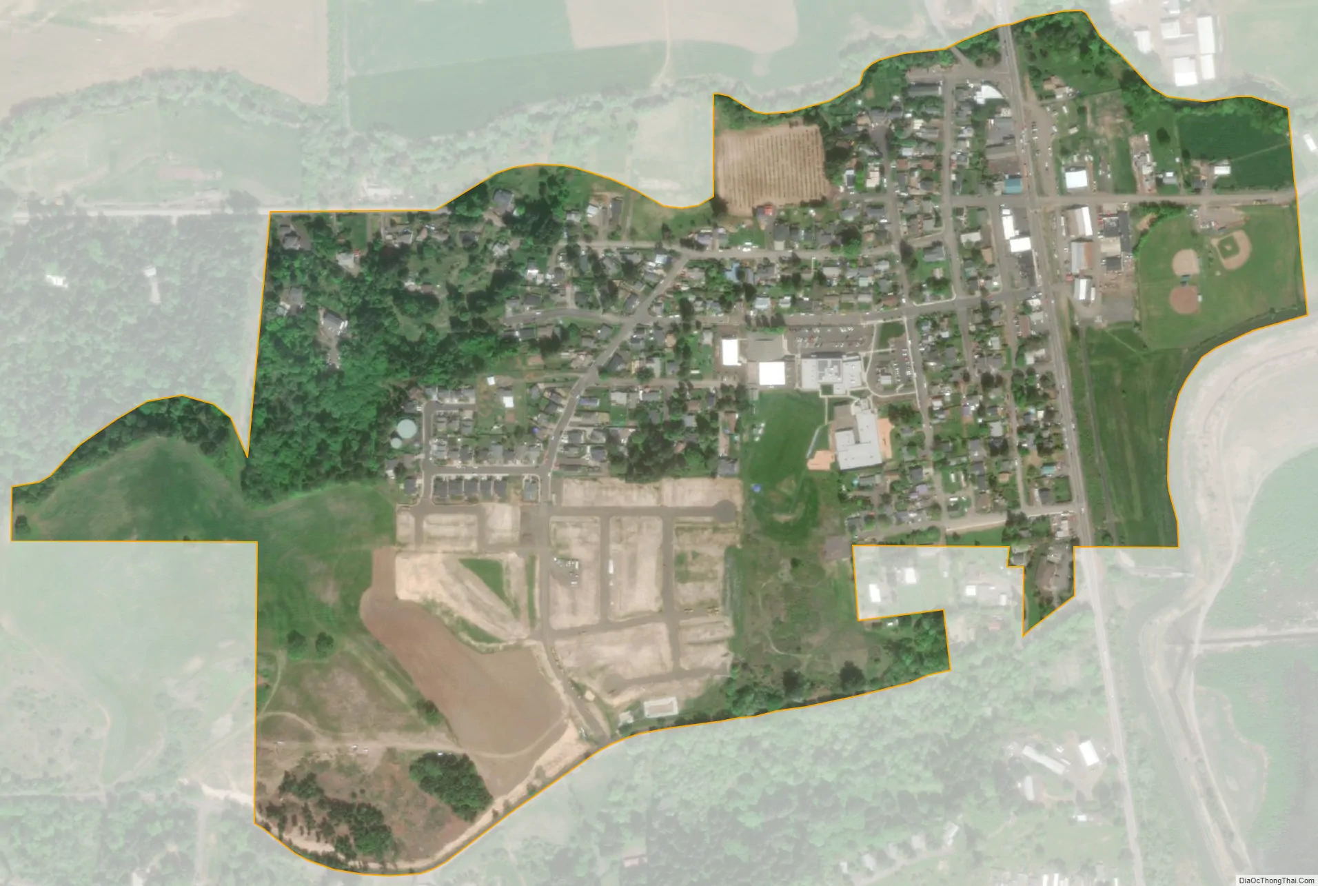
Gaston city Satellite Map
Geography
According to the United States Census Bureau, the city has a total area of 0.28 square miles (0.73 km), all land.
Climate
This region experiences warm (but not hot) and dry summers, with no average monthly temperatures above 71.6 °F (22.0 °C). According to the Köppen Climate Classification system, Gaston has a warm-summer Mediterranean climate, abbreviated “Csb” on climate maps.
See also
Map of Oregon State and its subdivision: Map of other states:- Alabama
- Alaska
- Arizona
- Arkansas
- California
- Colorado
- Connecticut
- Delaware
- District of Columbia
- Florida
- Georgia
- Hawaii
- Idaho
- Illinois
- Indiana
- Iowa
- Kansas
- Kentucky
- Louisiana
- Maine
- Maryland
- Massachusetts
- Michigan
- Minnesota
- Mississippi
- Missouri
- Montana
- Nebraska
- Nevada
- New Hampshire
- New Jersey
- New Mexico
- New York
- North Carolina
- North Dakota
- Ohio
- Oklahoma
- Oregon
- Pennsylvania
- Rhode Island
- South Carolina
- South Dakota
- Tennessee
- Texas
- Utah
- Vermont
- Virginia
- Washington
- West Virginia
- Wisconsin
- Wyoming