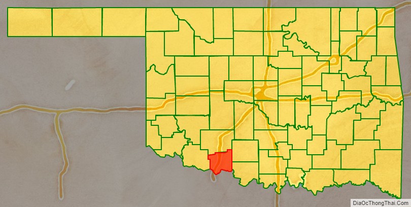
Cotton County is a county located in the U.S. state of Oklahoma. As of the 2010 census, the population was 6,193. Its county seat is Walters. When Oklahoma achieved statehood in 1907, the area which is now Cotton County fell within the boundaries of Comanche County. It was split off in 1912, becoming the last county created in Oklahoma; it was named for the county’s primary crop.
Cotton County is included in the Lawton, Oklahoma metropolitan area.
| Name: | Cotton County |
|---|---|
| FIPS code: | 40-033 |
| State: | Oklahoma |
| Founded: | 1912 |
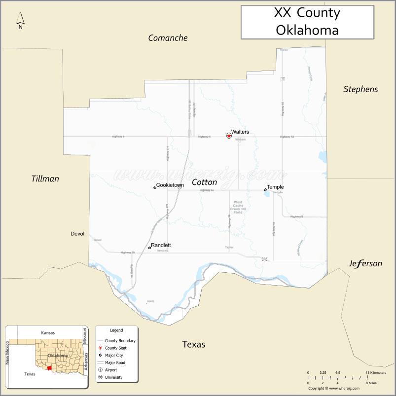
| Seat: | Walters |
| Largest city: | Walters |
| Total Area: | 642 sq mi (1,660 km²) |
| Land Area: | 633 sq mi (1,640 km²) |
| Total Population: | 6,193 |
| Population Density: | 9.8/sq mi (3.8/km²) |
| Time zone: | UTC−6 (Central) |
| Summer Time Zone (DST): | UTC−5 (CDT) |
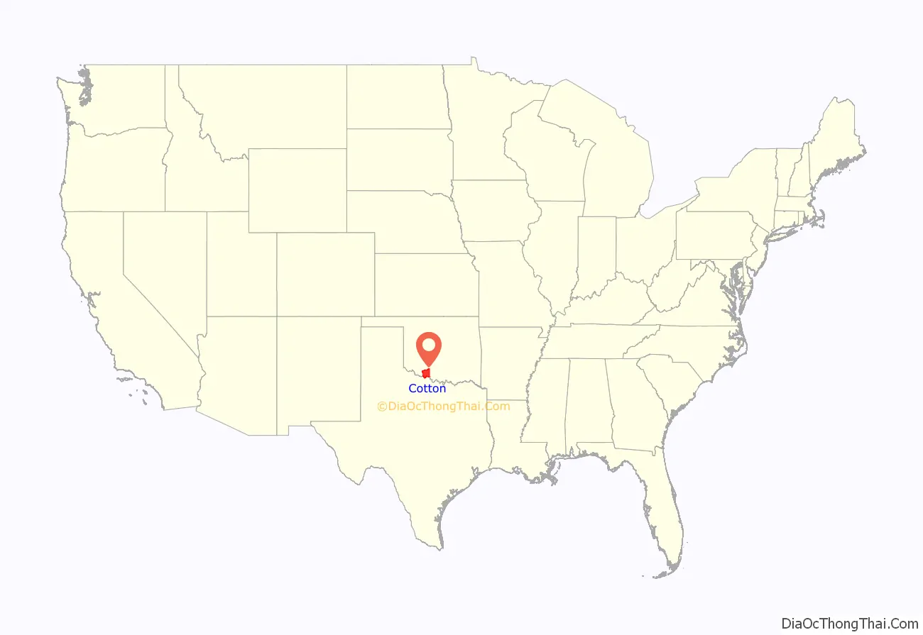
Cotton County location map. Where is Cotton County?
History
The eastern part of what is now Cotton County was opened to settlement by non-Native Americans by the 1901 Kiowa-Comanche-Apache Opening, which distributed land by a lottery system. In 1906, the remainder of the present county, then known as the Big Pasture was opened through a sealed bid process. Most of this territory became part of Comanche County at statehood in 1907.
In 1910, residents of the present Cotton County area tried to form a new county, named “Swanson County,” but this effort failed in 1911. Another effort in 1912 succeeded. This time, residents elected to split from Comanche County and name the new county “Cotton County,” for the primary crop in the region at the time. Randlett, Oklahoma was assigned as a temporary county seat, until a November 4, 1912 election made Walters, Oklahoma the permanent location.
Wheat became more prevalent than, and corn just as prevalent as, cotton as early as 1915. In 1934, corn had dwindled and winter wheat, cotton and oats had become the primary crops.
The county population has generally declined since 1920. In 1920, the population was 16,679. In 1930, it was 15,542. There was a brief increase in the late 1900s, but decline resumed in the 21st century.
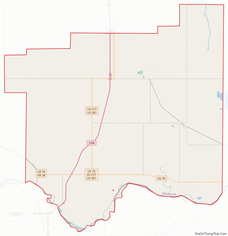
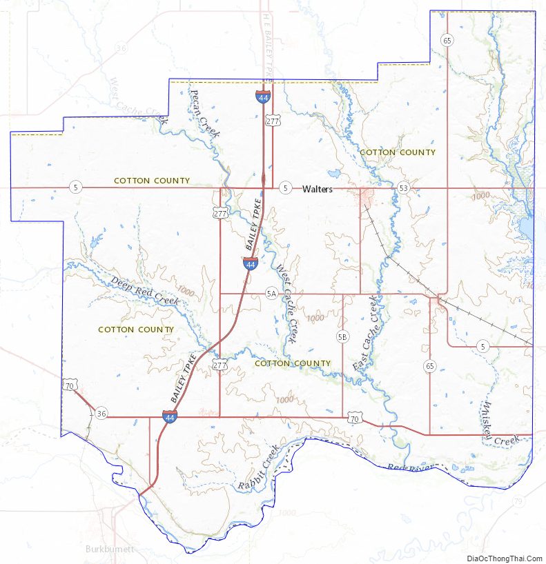
Cotton County Road Map
Geography
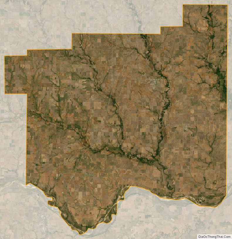
According to the U.S. Census Bureau, the county has a total area of 642 square miles (1,660 km), of which 633 square miles (1,640 km) is land and 9.3 square miles (24 km) (1.4%) is water.
The eastern portion of the county is in the Cross Timbers region. Its creeks and streams drain to the southeast into the Red River, which borders the county on the south.
Major highways
- Interstate 44
- H.E. Bailey Turnpike
- U.S. Highway 70
- U.S. Highway 277
- U.S. Highway 281
- State Highway 5
- State Highway 36
- State Highway 53
- State Highway 65
Adjacent counties
- Comanche County (north)
- Stephens County (northeast)
- Jefferson County (southeast)
- Clay County, Texas (south)
- Wichita County, Texas (southwest)
- Tillman County (west)
Cotton County Topographic Map
Cotton County Satellite Map
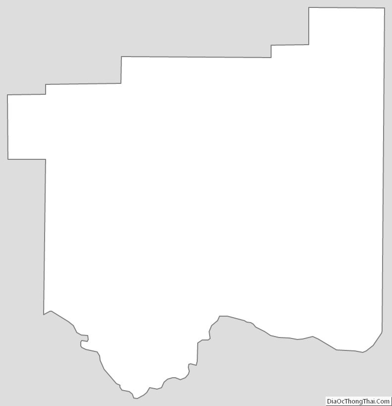
Cotton County Outline Map
See also
Map of Oklahoma State and its subdivision:- Adair
- Alfalfa
- Atoka
- Beaver
- Beckham
- Blaine
- Bryan
- Caddo
- Canadian
- Carter
- Cherokee
- Choctaw
- Cimarron
- Cleveland
- Coal
- Comanche
- Cotton
- Craig
- Creek
- Custer
- Delaware
- Dewey
- Ellis
- Garfield
- Garvin
- Grady
- Grant
- Greer
- Harmon
- Harper
- Haskell
- Hughes
- Jackson
- Jefferson
- Johnston
- Kay
- Kingfisher
- Kiowa
- Latimer
- Le Flore
- Lincoln
- Logan
- Love
- Major
- Marshall
- Mayes
- McClain
- McCurtain
- McIntosh
- Murray
- Muskogee
- Noble
- Nowata
- Okfuskee
- Oklahoma
- Okmulgee
- Osage
- Ottawa
- Pawnee
- Payne
- Pittsburg
- Pontotoc
- Pottawatomie
- Pushmataha
- Roger Mills
- Rogers
- Seminole
- Sequoyah
- Stephens
- Texas
- Tillman
- Tulsa
- Wagoner
- Washington
- Washita
- Woods
- Woodward
- Alabama
- Alaska
- Arizona
- Arkansas
- California
- Colorado
- Connecticut
- Delaware
- District of Columbia
- Florida
- Georgia
- Hawaii
- Idaho
- Illinois
- Indiana
- Iowa
- Kansas
- Kentucky
- Louisiana
- Maine
- Maryland
- Massachusetts
- Michigan
- Minnesota
- Mississippi
- Missouri
- Montana
- Nebraska
- Nevada
- New Hampshire
- New Jersey
- New Mexico
- New York
- North Carolina
- North Dakota
- Ohio
- Oklahoma
- Oregon
- Pennsylvania
- Rhode Island
- South Carolina
- South Dakota
- Tennessee
- Texas
- Utah
- Vermont
- Virginia
- Washington
- West Virginia
- Wisconsin
- Wyoming