| Name: | Dearborn County |
|---|---|
| FIPS code: | 18-029 |
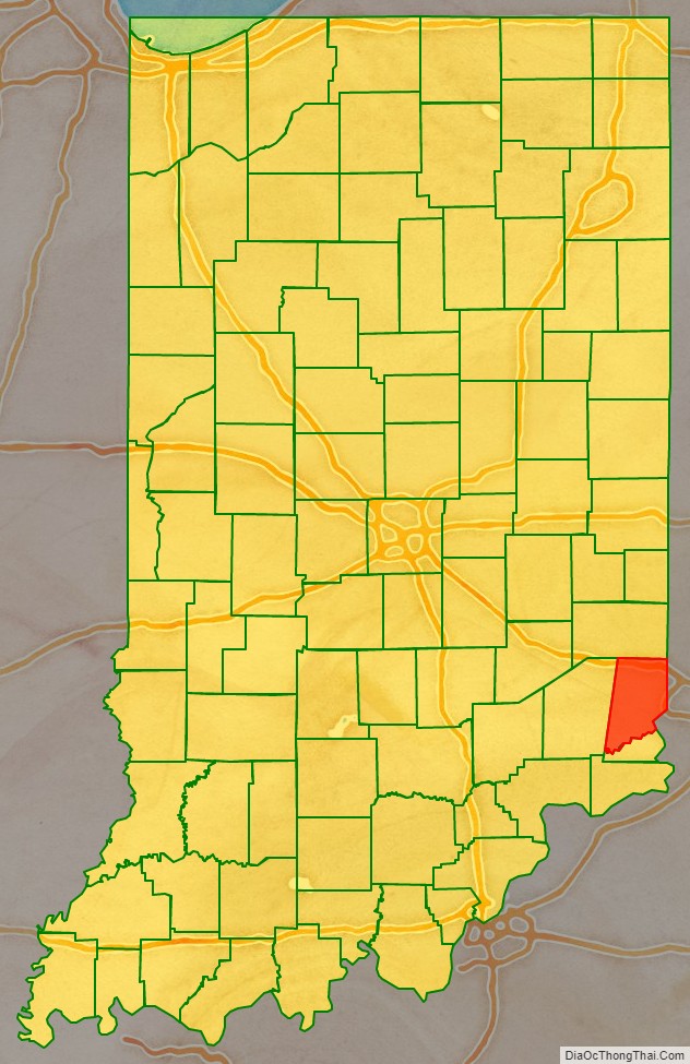
| State: | Indiana |
| Founded: | 1803 |
| Named for: | Dr. Henry Dearborn |
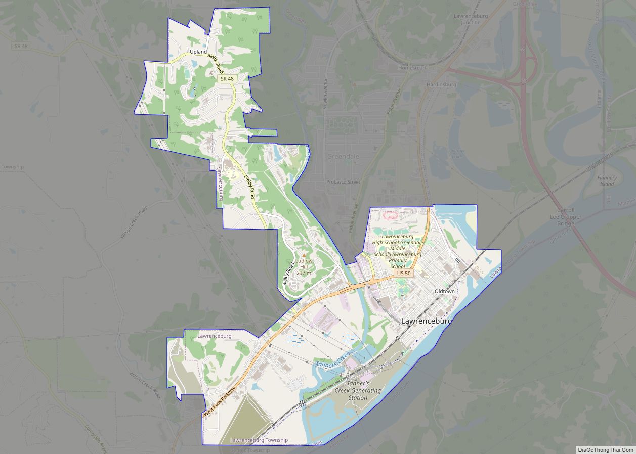
| Seat: | Lawrenceburg |
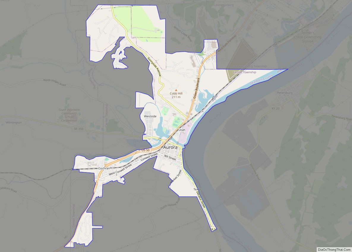
| Largest city: | Lawrenceburg |
| Total Area: | 307.42 sq mi (796.2 km²) |
| Land Area: | 305.03 sq mi (790.0 km²) |
| Total Population: | 50,679 |
| Population Density: | 164/sq mi (63/km²) |
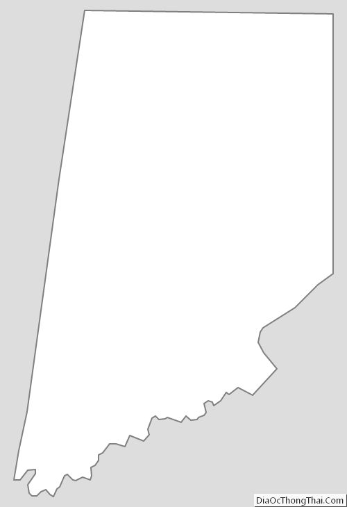
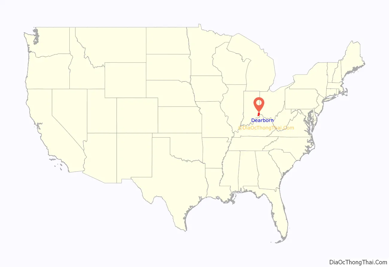
Dearborn County location map. Where is Dearborn County?
History
In 1803, following Ohio’s admission to the Union, a wedge, or pie shaped, remnant of the former Northwest Territory along Ohio’s southwestern border was ceded to Indiana Territory and organized as Dearborn County. It was named after Henry Dearborn who was U.S. Secretary of War at that time. Lawrenceburg was then designated as the county seat.
All or part of seven other present day counties were carved from the original county with the present boundaries being established in 1845. The region, nicknamed the “Gore”, slices through the present-day counties of Dearborn, Franklin, Ohio, Randolph, Switzerland, Union, Wayne and Fayette. Subdivision of Dearborn County began in 1811 with the formation of Franklin and Wayne Counties, followed by Switzerland in 1814.
Early growth in the region was centered on Lawrenceburg which became an important railroad junction connecting two of the regions major rail lines. A contention existed between the towns of Lawrenceburg and the mostly German-speaking immigrants that dominated Rising Sun over the favored status of Lawrenceburg as the county seat. The rivalry between the two towns was resolved in 1844 when the Indiana State legislature separated the portion of Dearborn County south of Laughery Creek and created the last and smallest Indiana county, county of Ohio on March 1, 1844, with Rising Sun designated as its county seat.
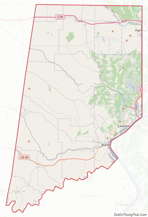
Dearborn County Road Map
Geography
According to the 2010 census, the county has a total area of 307.42 square miles (796.2 km), of which 305.03 square miles (790.0 km) (or 99.22%) is land and 2.38 square miles (6.2 km) (or 0.77%) is water. Part of the southeastern county line is formed by the Ohio River.
Dearborn County contains the Perfect North Slopes ski resort.
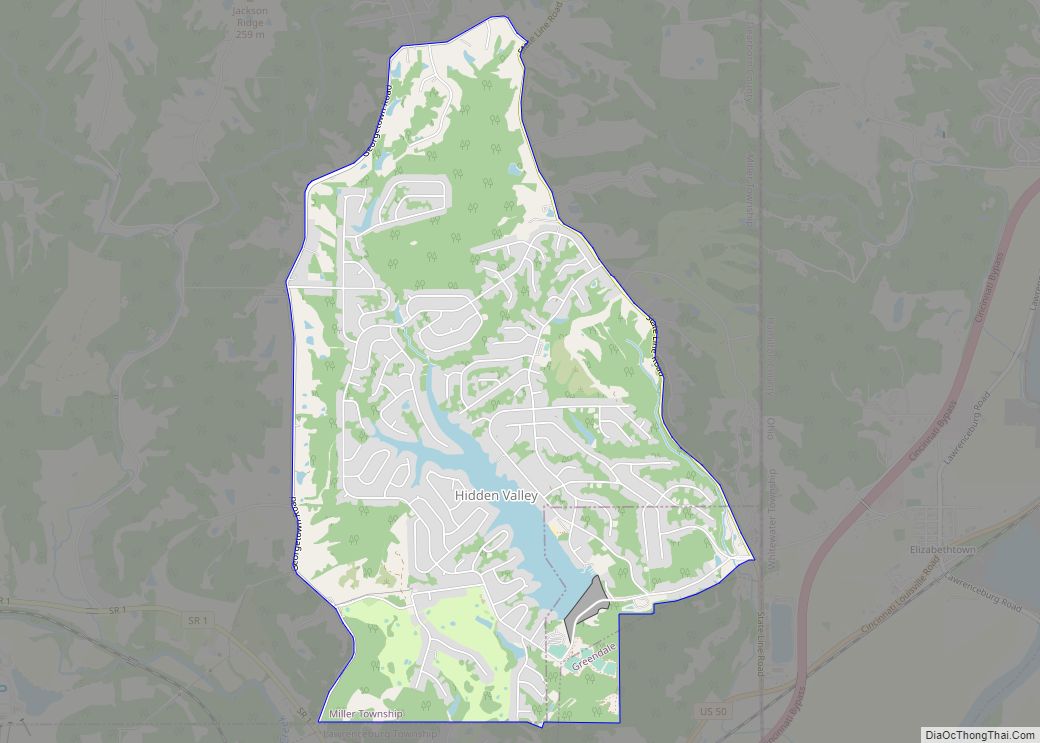
Cities
Towns
- Dillsboro
- Moores Hill
- Saint Leon
- West Harrison
Census-designated places
Other unincorporated communities
- Bonnell
- Braysville
- Chesterville
- Cochran
- Cold Springs
- Dover
- Farmers Retreat
- Guilford
- Hardinsburg
- Hubbells Corner
- Kyle
- Lawrenceburg Junction
- Lawrenceville
- Logan
- Manchester
- Mount Sinai
- New Alsace
- Sparta
- Weisburg
- Wilmington
- Wrights Corner
- Yorkville
Townships
- Caesar Creek
- Center
- Clay
- Harrison
- Hogan
- Jackson
- Kelso
- Lawrenceburg
- Logan
- Manchester
- Miller
- Sparta
- Washington
- York
Adjacent counties
- Franklin County (north)
- Butler County, Ohio (northeast)
- Hamilton County, Ohio (east)
- Boone County, Kentucky (southeast)
- Ohio County (south)
- Ripley County (west)
Climate
In recent years, average temperatures in Lawrenceburg have ranged from a low of 21 °F (−6 °C) in January to a high of 86 °F (30 °C) in July, although a record low of −27 °F (−33 °C) was recorded in January 1994 and a record high of 107 °F (42 °C) was recorded in July 1988. Average monthly precipitation ranged from 2.94 inches (75 mm) in September to 5.53 inches (140 mm) in May.
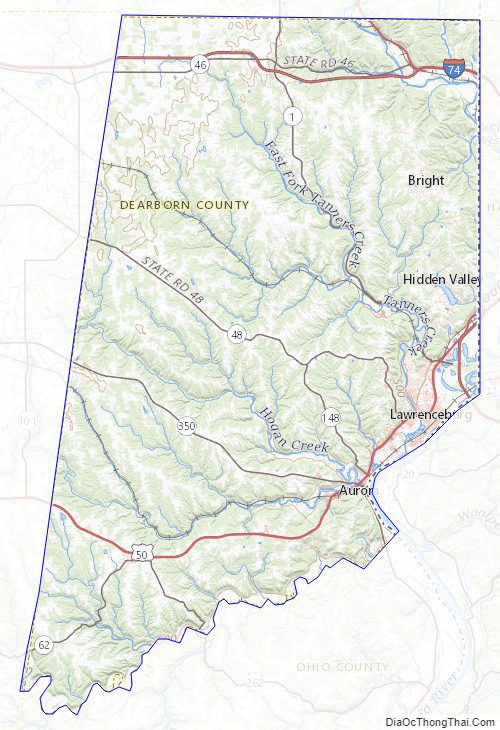
Dearborn County Topographic Map
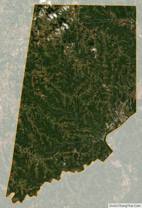
Dearborn County Satellite Map
Dearborn County Outline Map