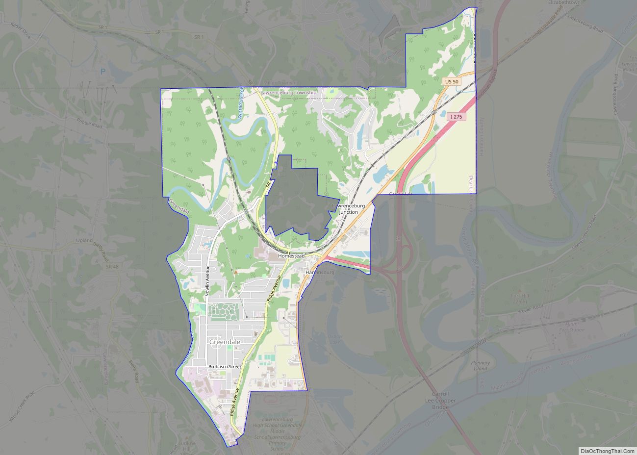
Lawrenceburg is a city in Dearborn County, Indiana, United States. The population was 5,042 at the 2010 census. The city is the county seat and largest city of Dearborn County. Lawrenceburg is in southeast Indiana, on the Ohio River west of Cincinnati.
| Name: | Lawrenceburg city |
|---|---|
| LSAD Code: | 25 |
| LSAD Description: | city (suffix) |
| State: | Indiana |
| County: | Dearborn County |
| Elevation: | 479 ft (146 m) |
| Total Area: | 5.55 sq mi (14.37 km²) |
| Land Area: | 5.29 sq mi (13.69 km²) |
| Water Area: | 0.26 sq mi (0.68 km²) 5.18% |
| Total Population: | 5,129 |
| Population Density: | 970.30/sq mi (374.67/km²) |
| ZIP code: | 47025 |
| Area code: | 812 |
| FIPS code: | 1842462 |
| GNISfeature ID: | 0437674 |
| Website: | lawrenceburg-in.com |
Online Interactive Map
Click on ![]() to view map in "full screen" mode.
to view map in "full screen" mode.
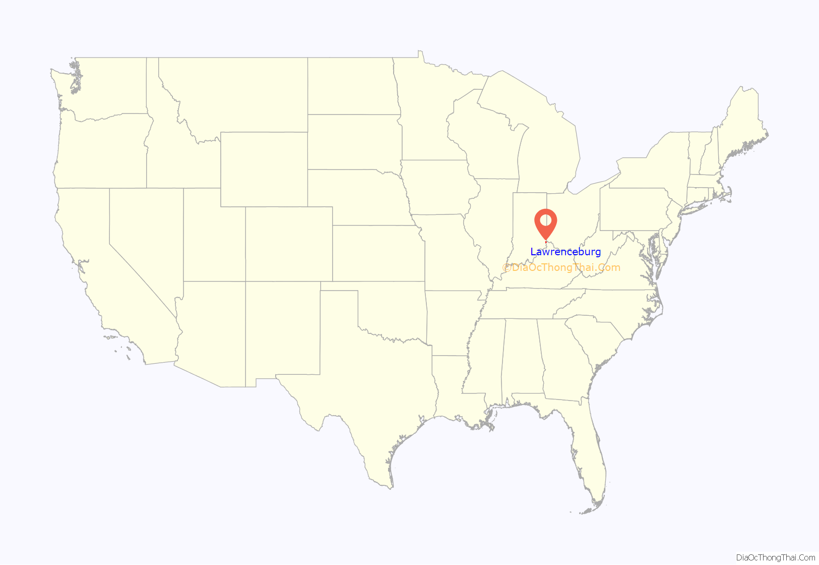
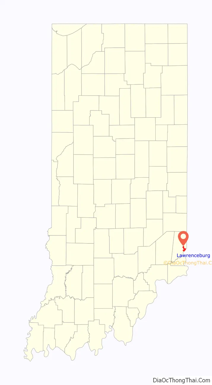
Lawrenceburg location map. Where is Lawrenceburg city?
History
Founded in 1802, Lawrenceburg was named for the maiden name of the wife of founder Samuel C. Vance.
In the 19th century, Lawrenceburg became an important trading center for riverboats on the Ohio River.
The Dearborn County Courthouse, Downtown Lawrenceburg Historic District, Hamline Chapel United Methodist Church, the Liberty Theatre, the Dunn Home, The Daniel S. Major House, and Vance-Tousey House are listed on the National Register of Historic Places.
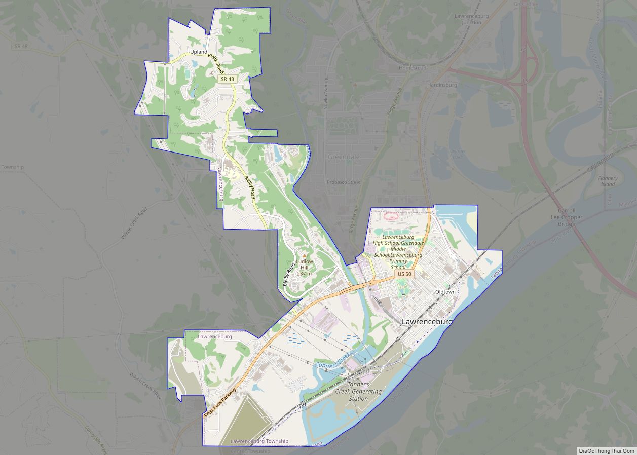
Lawrenceburg Road Map
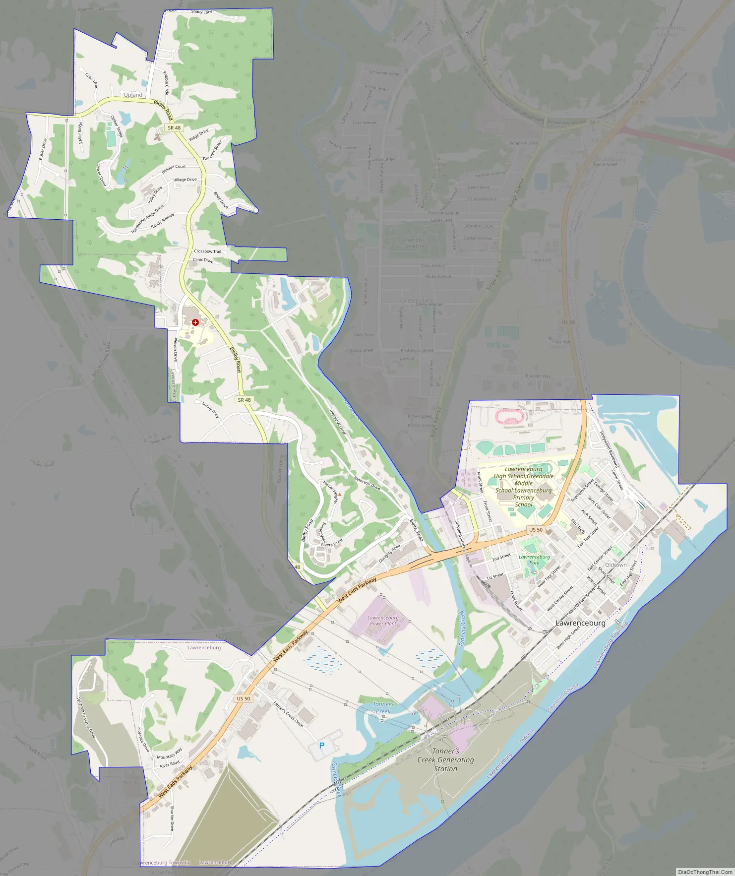
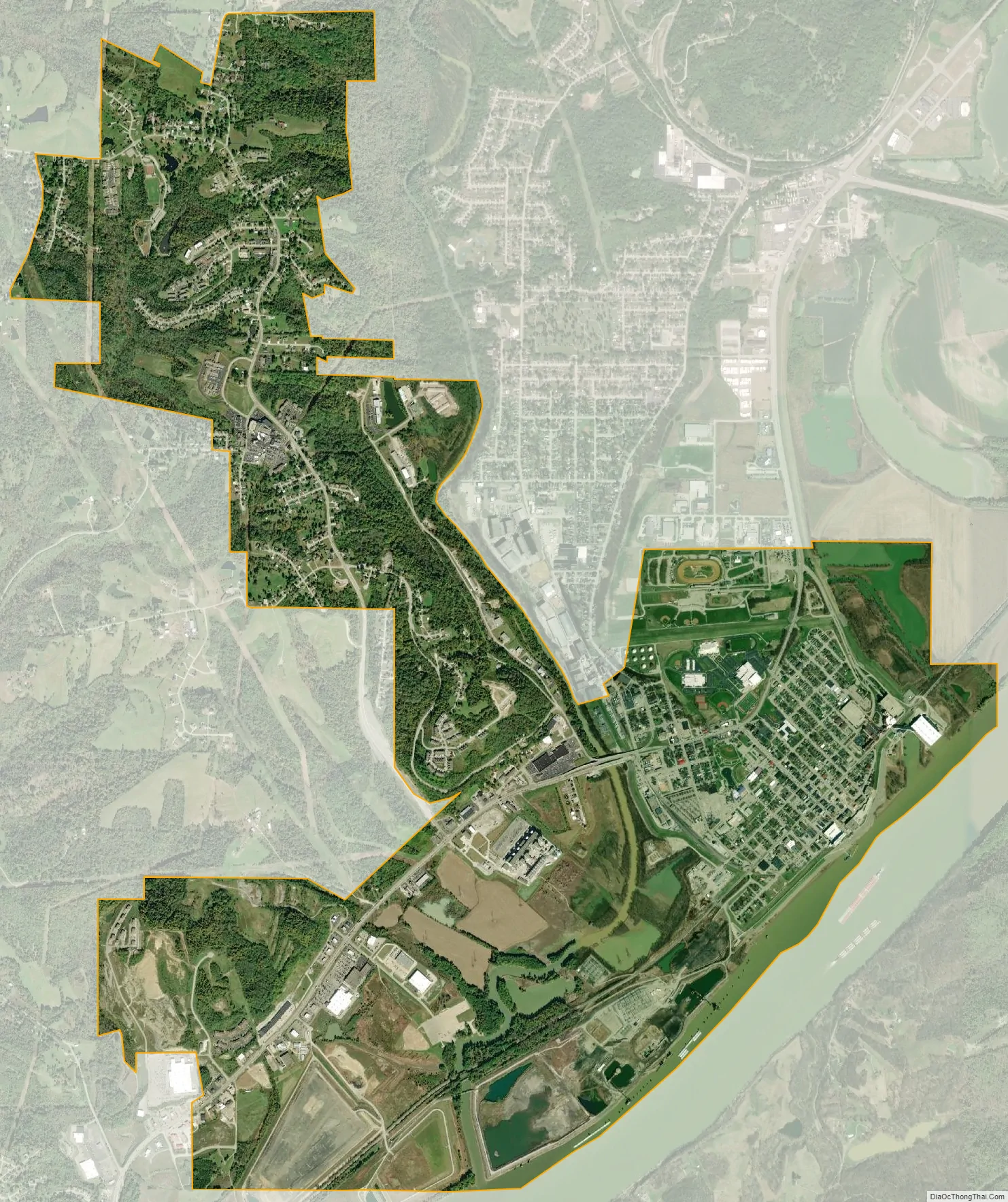
Lawrenceburg city Satellite Map
Geography
Lawrenceburg is located at 39°5′46″N 84°51′28″W / 39.09611°N 84.85778°W / 39.09611; -84.85778 (39.096015, -84.857783).
The City of Lawrenceburg is located in the Ohio River Valley and is situated on the banks of the Ohio River. Lawrenceburg is located on the west side of the Greater Cincinnati, Ohio tri-state metro area.
According to the 2010 census, Lawrenceburg has a total area of 5.21 square miles (13.49 km), of which 4.94 square miles (12.79 km) (or 94.82%) is land and 0.27 square miles (0.70 km) (or 5.18%) is water.
See also
Map of Indiana State and its subdivision:- Adams
- Allen
- Bartholomew
- Benton
- Blackford
- Boone
- Brown
- Carroll
- Cass
- Clark
- Clay
- Clinton
- Crawford
- Daviess
- De Kalb
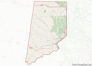
- Dearborn
- Decatur
- Delaware
- Dubois
- Elkhart
- Fayette
- Floyd
- Fountain
- Franklin
- Fulton
- Gibson
- Grant
- Greene
- Hamilton
- Hancock
- Harrison
- Hendricks
- Henry
- Howard
- Huntington
- Jackson
- Jasper
- Jay
- Jefferson
- Jennings
- Johnson
- Knox
- Kosciusko
- LaGrange
- Lake
- Lake Michigan
- LaPorte
- Lawrence
- Madison
- Marion
- Marshall
- Martin
- Miami
- Monroe
- Montgomery
- Morgan
- Newton
- Noble
- Ohio
- Orange
- Owen
- Parke
- Perry
- Pike
- Porter
- Posey
- Pulaski
- Putnam
- Randolph
- Ripley
- Rush
- Saint Joseph
- Scott
- Shelby
- Spencer
- Starke
- Steuben
- Sullivan
- Switzerland
- Tippecanoe
- Tipton
- Union
- Vanderburgh
- Vermillion
- Vigo
- Wabash
- Warren
- Warrick
- Washington
- Wayne
- Wells
- White
- Whitley
- Alabama
- Alaska
- Arizona
- Arkansas
- California
- Colorado
- Connecticut
- Delaware
- District of Columbia
- Florida
- Georgia
- Hawaii
- Idaho
- Illinois
- Indiana
- Iowa
- Kansas
- Kentucky
- Louisiana
- Maine
- Maryland
- Massachusetts
- Michigan
- Minnesota
- Mississippi
- Missouri
- Montana
- Nebraska
- Nevada
- New Hampshire
- New Jersey
- New Mexico
- New York
- North Carolina
- North Dakota
- Ohio
- Oklahoma
- Oregon
- Pennsylvania
- Rhode Island
- South Carolina
- South Dakota
- Tennessee
- Texas
- Utah
- Vermont
- Virginia
- Washington
- West Virginia
- Wisconsin
- Wyoming