Rising Sun is a city in Randolph Township and the county seat of Ohio County, Indiana, United States, along the Ohio River. It is also the only incorporated community in the county. The population of Rising Sun was 2,304 at the 2010 census.
| Name: | Rising Sun city |
|---|---|
| LSAD Code: | 25 |
| LSAD Description: | city (suffix) |
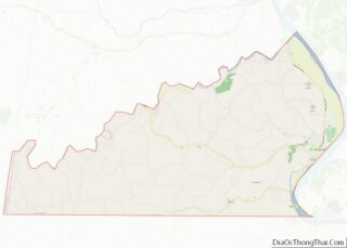
| State: | Indiana |
| County: | Ohio County |
| Elevation: | 502 ft (153 m) |
| Total Area: | 1.63 sq mi (4.23 km²) |
| Land Area: | 1.50 sq mi (3.89 km²) |
| Water Area: | 0.13 sq mi (0.34 km²) 7.64% |
| Total Population: | 2,248 |
| Population Density: | 1,496.67/sq mi (577.81/km²) |
| ZIP code: | 47040 |
| Area code: | 812 |
| FIPS code: | 1864674 |
| GNISfeature ID: | 449718 |
| Website: | www.cityofrisingsun.com |
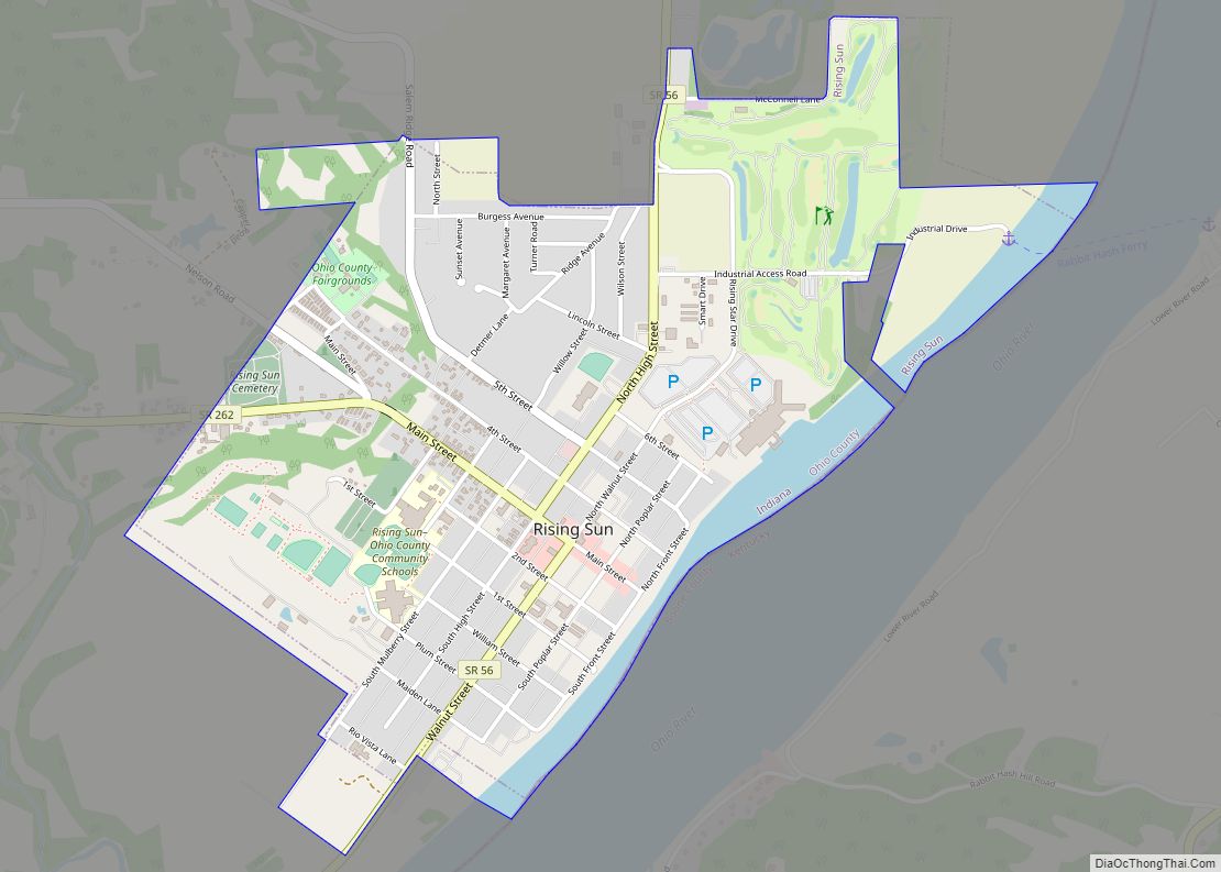
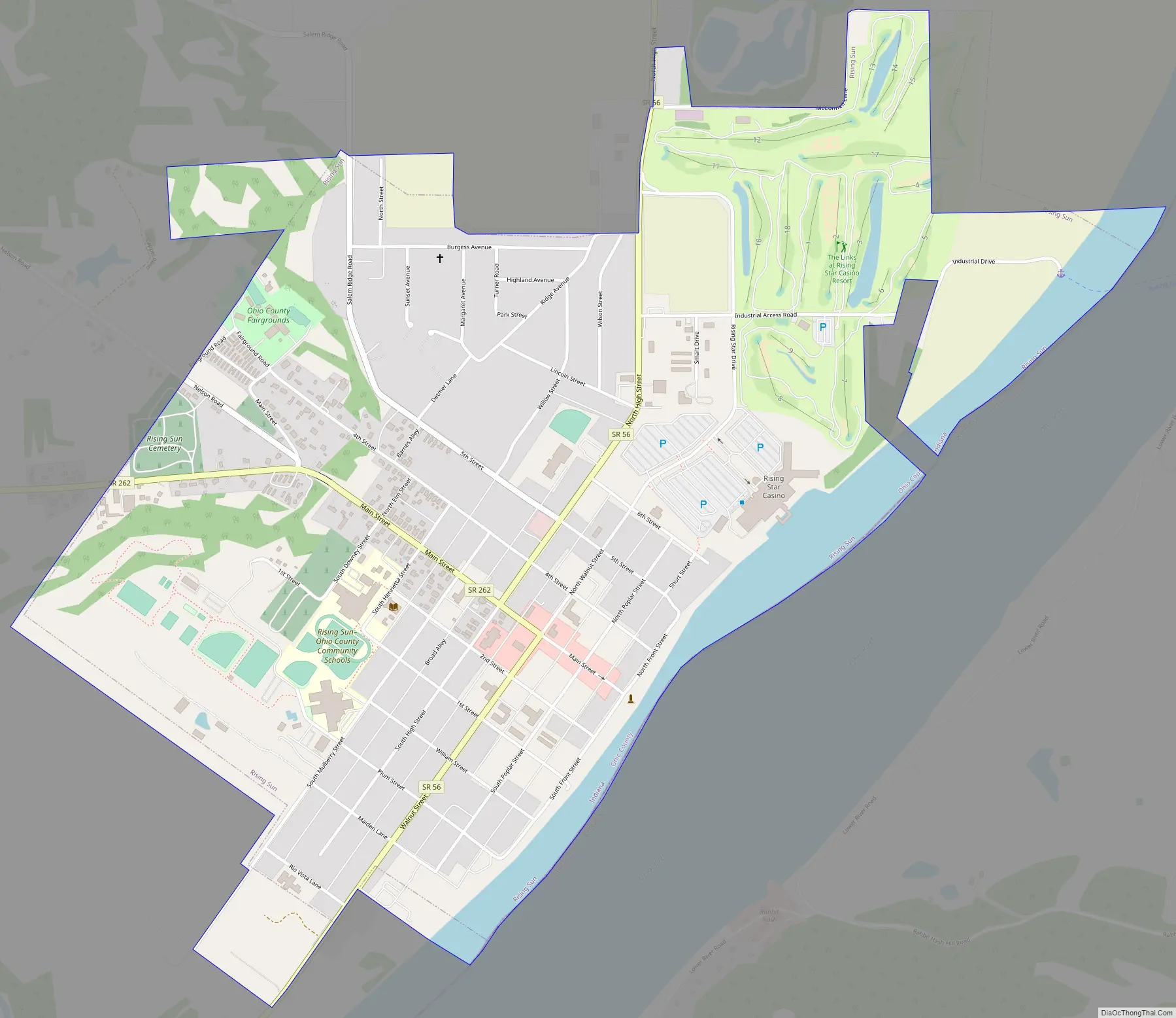
Online Interactive Map
Click on ![]() to view map in "full screen" mode.
to view map in "full screen" mode.
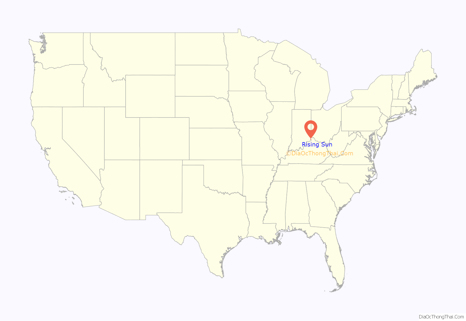
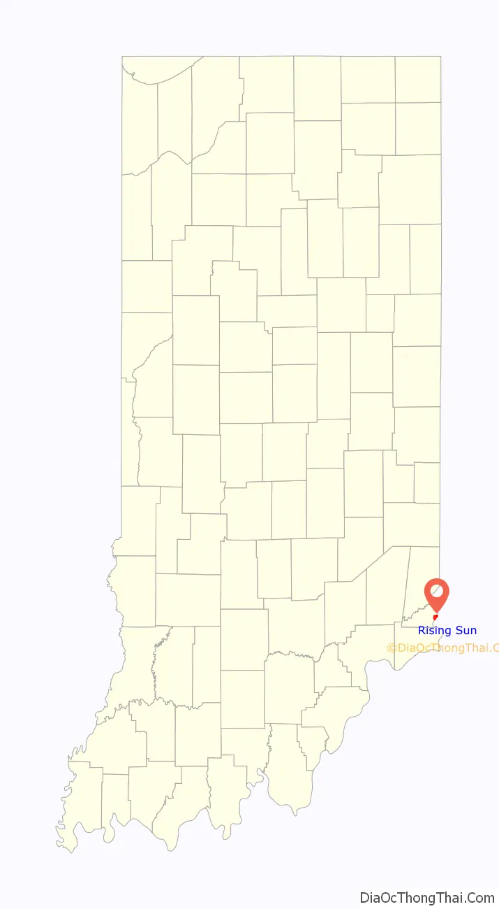
Rising Sun location map. Where is Rising Sun city?
History
The town was registered in 1816 by John James, originally of Frederick County, Maryland. At the time, it had a population of about 700. Many German immigrants settled in Rising Sun. The Rising Sun post office has been in operation since 1844.
In the 1830s, Rising Sun was a seasonal stop for hundreds of flatboats daily heading down the Ohio River.
The Clore Plow Works-J.W. Whitlock and Company and Rising Sun Historic District are listed on the National Register of Historic Places.
Joseph Barricklow (1867–1924), Illinois lawyer and state legislator, was born in Rising Sun.
Rising Sun Road Map
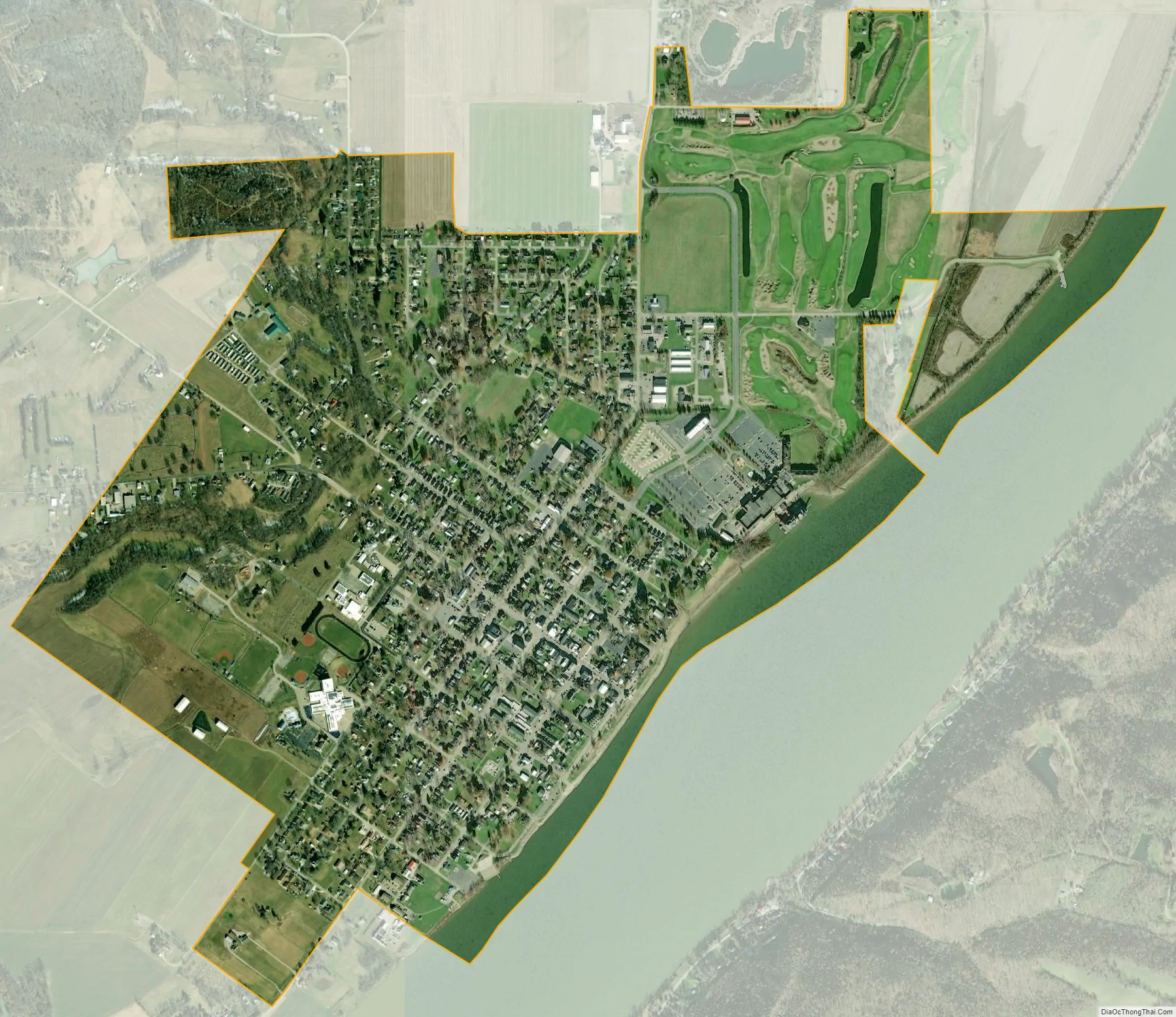
Rising Sun city Satellite Map
Geography
Rising Sun is located at 38°57′0″N 84°51′24″W / 38.95000°N 84.85667°W / 38.95000; -84.85667 (38.949867, -84.856782).
According to the 2010 census, Rising Sun has a total area of 1.569 square miles (4.06 km), of which 1.45 square miles (3.76 km) (or 92.42%) is land and 0.119 square miles (0.31 km) (or 7.58%) is water.
See also
Map of Indiana State and its subdivision:- Adams
- Allen
- Bartholomew
- Benton
- Blackford
- Boone
- Brown
- Carroll
- Cass
- Clark
- Clay
- Clinton
- Crawford
- Daviess
- De Kalb
- Dearborn
- Decatur
- Delaware
- Dubois
- Elkhart
- Fayette
- Floyd
- Fountain
- Franklin
- Fulton
- Gibson
- Grant
- Greene
- Hamilton
- Hancock
- Harrison
- Hendricks
- Henry
- Howard
- Huntington
- Jackson
- Jasper
- Jay
- Jefferson
- Jennings
- Johnson
- Knox
- Kosciusko
- LaGrange
- Lake
- Lake Michigan
- LaPorte
- Lawrence
- Madison
- Marion
- Marshall
- Martin
- Miami
- Monroe
- Montgomery
- Morgan
- Newton
- Noble
- Ohio
- Orange
- Owen
- Parke
- Perry
- Pike
- Porter
- Posey
- Pulaski
- Putnam
- Randolph
- Ripley
- Rush
- Saint Joseph
- Scott
- Shelby
- Spencer
- Starke
- Steuben
- Sullivan
- Switzerland
- Tippecanoe
- Tipton
- Union
- Vanderburgh
- Vermillion
- Vigo
- Wabash
- Warren
- Warrick
- Washington
- Wayne
- Wells
- White
- Whitley
- Alabama
- Alaska
- Arizona
- Arkansas
- California
- Colorado
- Connecticut
- Delaware
- District of Columbia
- Florida
- Georgia
- Hawaii
- Idaho
- Illinois
- Indiana
- Iowa
- Kansas
- Kentucky
- Louisiana
- Maine
- Maryland
- Massachusetts
- Michigan
- Minnesota
- Mississippi
- Missouri
- Montana
- Nebraska
- Nevada
- New Hampshire
- New Jersey
- New Mexico
- New York
- North Carolina
- North Dakota
- Ohio
- Oklahoma
- Oregon
- Pennsylvania
- Rhode Island
- South Carolina
- South Dakota
- Tennessee
- Texas
- Utah
- Vermont
- Virginia
- Washington
- West Virginia
- Wisconsin
- Wyoming