| Name: | Lincoln County |
|---|---|
| FIPS code: | 32-017 |
| State: | Nevada |
| Founded: | 1866 |
| Named for: | Abraham Lincoln |
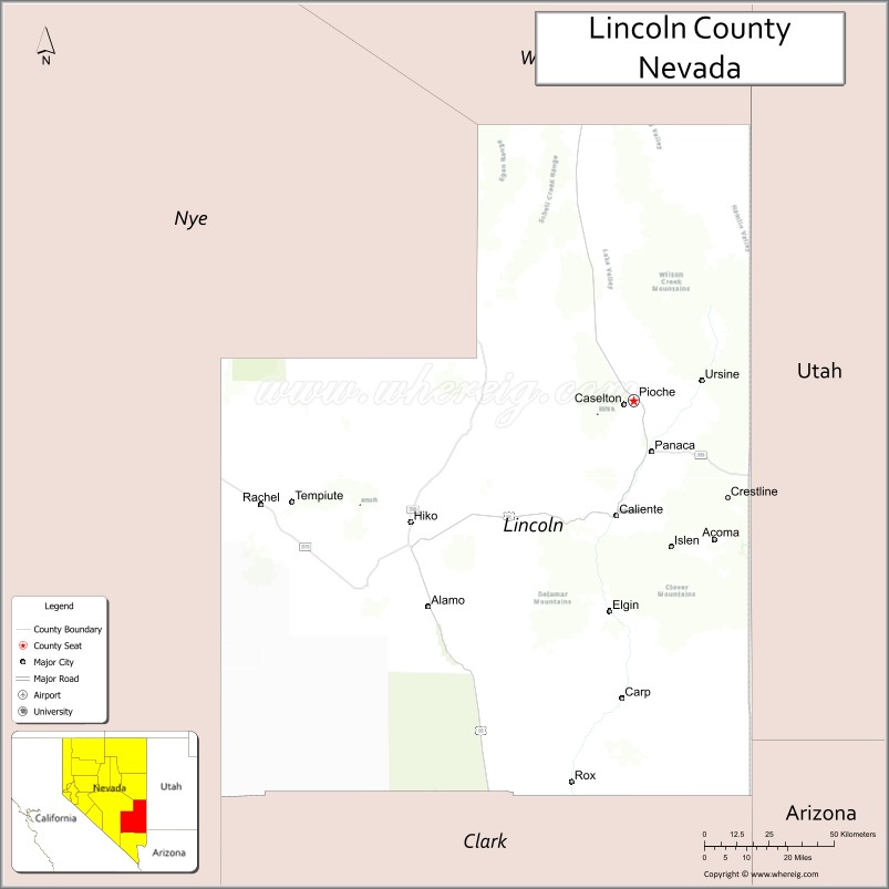
| Seat: | Pioche |
| Largest city: | Caliente |
| Total Area: | 10,637 sq mi (27,550 km²) |
| Land Area: | 10,633 sq mi (27,540 km²) |
| Total Population: | 4,499 |
| Population Density: | 0.42/sq mi (0.16/km²) |
| Time zone: | UTC−8 (Pacific) |
| Summer Time Zone (DST): | UTC−7 (PDT) |
| Website: | lincolncountynv.org |
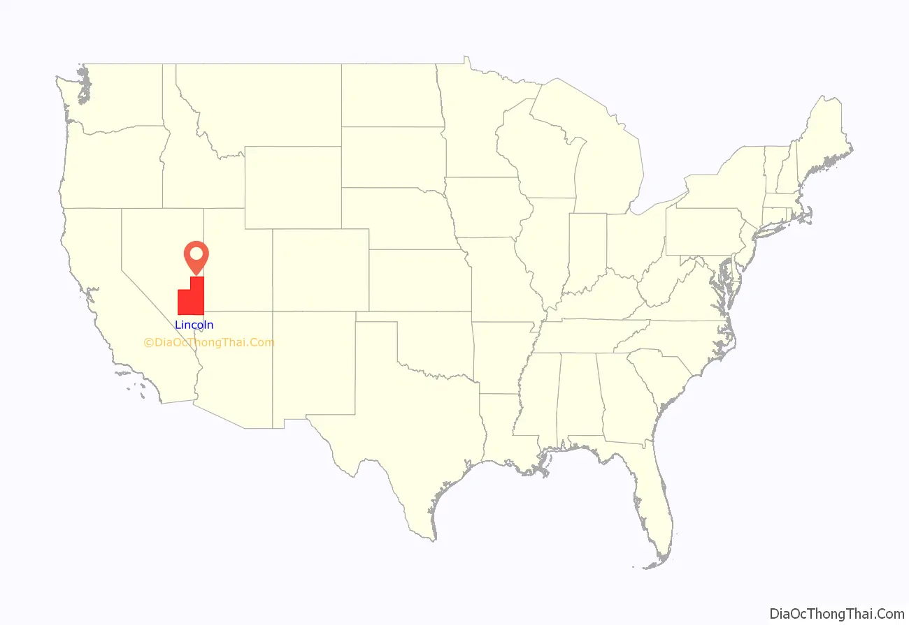
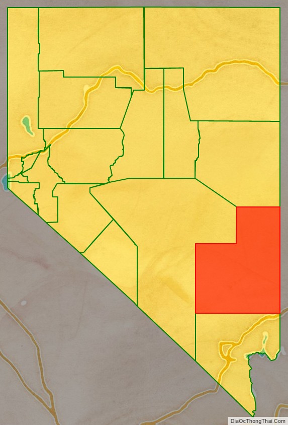
Lincoln County location map. Where is Lincoln County?
History
Lincoln County was established in 1866 after Congress enlarged Nevada by moving its state line eastward and southward at the expense of Utah and Arizona territories. It is named after Abraham Lincoln, the 16th President of the United States. Original legislation called for the creation of a “Stewart County”, after Nevada Senator William M. Stewart, but this was later changed in a substitute bill. Crystal Springs was the county’s first seat in 1866, followed by Hiko in 1867 and Pioche in 1871.
Lincoln County initially included a ranch village and railroad siding named Las Vegas. However, that siding, which led to the future city of Las Vegas, was separated from Lincoln County upon the founding of Clark County effective July 1, 1909, by act of the Nevada Legislature.
Area 51 is in Lincoln County and the county sheriff acts in proxy for the perimeter security forces.
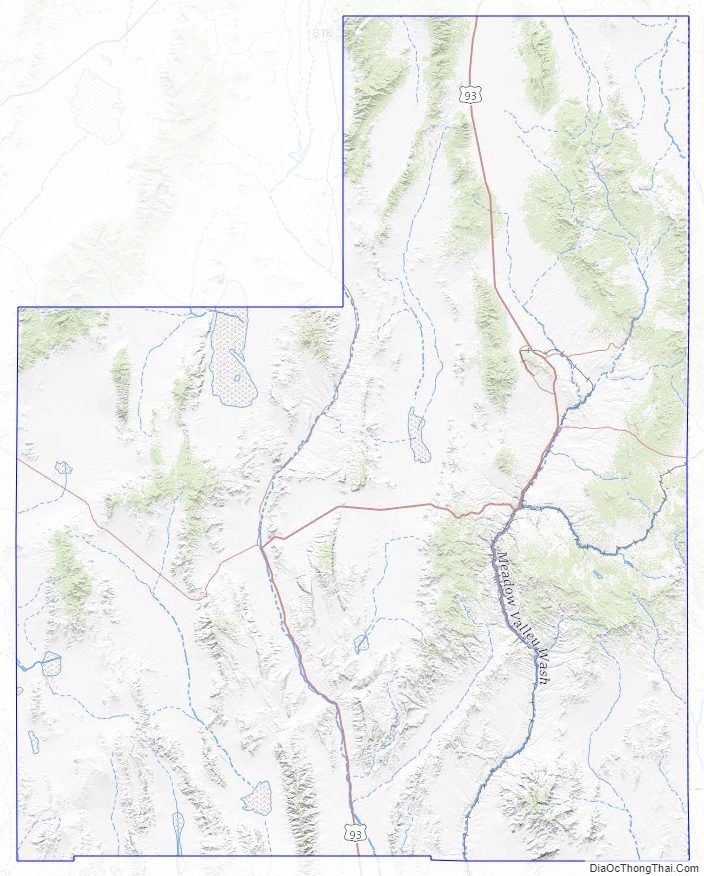
Lincoln County Road Map
Geography
According to the U.S. Census Bureau, the county has an area of 10,637 square miles (27,550 km), of which 10,633 square miles (27,540 km) is land and 3.8 square miles (9.8 km) (0.04%) is water. While only the third-largest county by area in the state of Nevada, it is the seventh-largest county in area in the United States, not including boroughs and census areas in Alaska. The south cliff of Mount Rummel, the summit of which is just north of the county line in White Pine County, contains Lincoln County’s highest point, at 10,640 feet (3,240 m). The highest independent mountain completely within Lincoln County is Shingle Peak, while the county’s most topographically prominent peak is Mormon Peak.
Major highways
- U.S. Route 93
- State Route 317
- State Route 318
- State Route 319
- State Route 320
- State Route 321
- State Route 322
- State Route 375
- State Route 816
Adjacent counties
- White Pine County – north
- Millard County, Utah – northeast/Mountain Time Border
- Beaver County, Utah – east/Mountain Time Border
- Iron County, Utah – east/Mountain Time Border
- Washington County, Utah – east/Mountain Time Border
- Mohave County, Arizona – southeast/Mountain Time Border
- Clark County, Nevada – south
- Nye County, Nevada – west
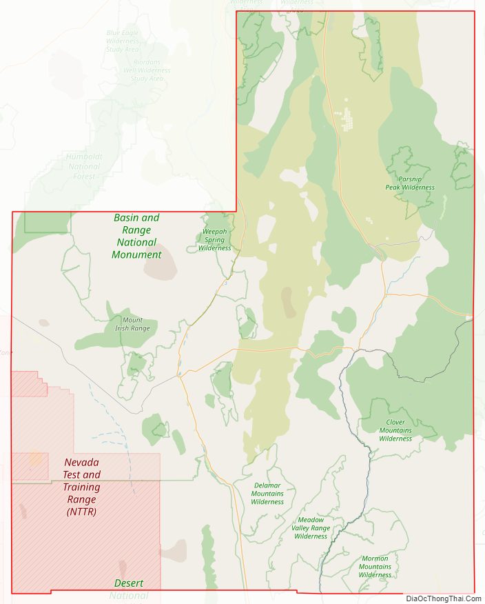
National protected areas
- Desert National Wildlife Refuge (part)
- Humboldt National Forest (part)
- Pahranagat National Wildlife Refuge
Lincoln County contains 16 official wilderness areas that are part of the National Wilderness Preservation System. All are managed by the Bureau of Land Management. Several extend into neighboring counties (as indicated below).
- Big Rocks Wilderness
- Clover Mountains Wilderness
- Delamar Mountains Wilderness
- Far South Egans Wilderness (partly in Nye County, NV)
- Fortification Range Wilderness
- Meadow Valley Range Wilderness (partly in Clark County, NV)
- Mormon Mountains Wilderness (partly in Clark County, NV)
- Mount Grafton Wilderness (mostly in White Pine County, NV)
- Mount Irish Wilderness
- Parsnip Peak Wilderness
- South Egan Range Wilderness (partly in White Pine County, NV; Nye County, NV)
- South Pahroc Range Wilderness
- Tunnel Spring Wilderness
- Weepah Spring Wilderness (partly in Nye County, NV)
- White Rock Range Wilderness
- Worthington Mountains Wilderness
Lincoln County Topographic Map
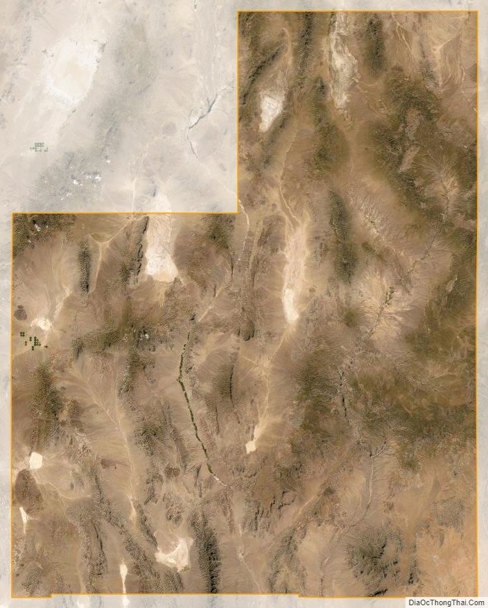
Lincoln County Satellite Map
Lincoln County Outline Map

See also
Map of Nevada State and its subdivision: Map of other states:- Alabama
- Alaska
- Arizona
- Arkansas
- California
- Colorado
- Connecticut
- Delaware
- District of Columbia
- Florida
- Georgia
- Hawaii
- Idaho
- Illinois
- Indiana
- Iowa
- Kansas
- Kentucky
- Louisiana
- Maine
- Maryland
- Massachusetts
- Michigan
- Minnesota
- Mississippi
- Missouri
- Montana
- Nebraska
- Nevada
- New Hampshire
- New Jersey
- New Mexico
- New York
- North Carolina
- North Dakota
- Ohio
- Oklahoma
- Oregon
- Pennsylvania
- Rhode Island
- South Carolina
- South Dakota
- Tennessee
- Texas
- Utah
- Vermont
- Virginia
- Washington
- West Virginia
- Wisconsin
- Wyoming