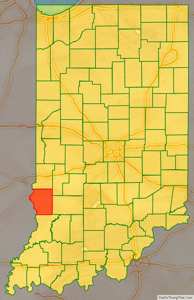
Sullivan County is a county in the U.S. state of Indiana, and determined by the US Census Bureau to include the mean center of U.S. population in 1940. As of 2020, the population was 20,758. The county seat (and the county’s only incorporated city) is Sullivan.
Sullivan County is included in the Terre Haute, Indiana, metropolitan statistical area.
| Name: | Sullivan County |
|---|---|
| FIPS code: | 18-153 |
| State: | Indiana |
| Founded: | January 15, 1817 (created) February 1817 (organized) |
| Named for: | General Daniel Sullivan |
| Seat: | Sullivan |
| Largest city: | Sullivan |
| Total Area: | 454.12 sq mi (1,176.2 km²) |
| Land Area: | 447.14 sq mi (1,158.1 km²) |
| Population Density: | 46.3/sq mi (17.9/km²) |
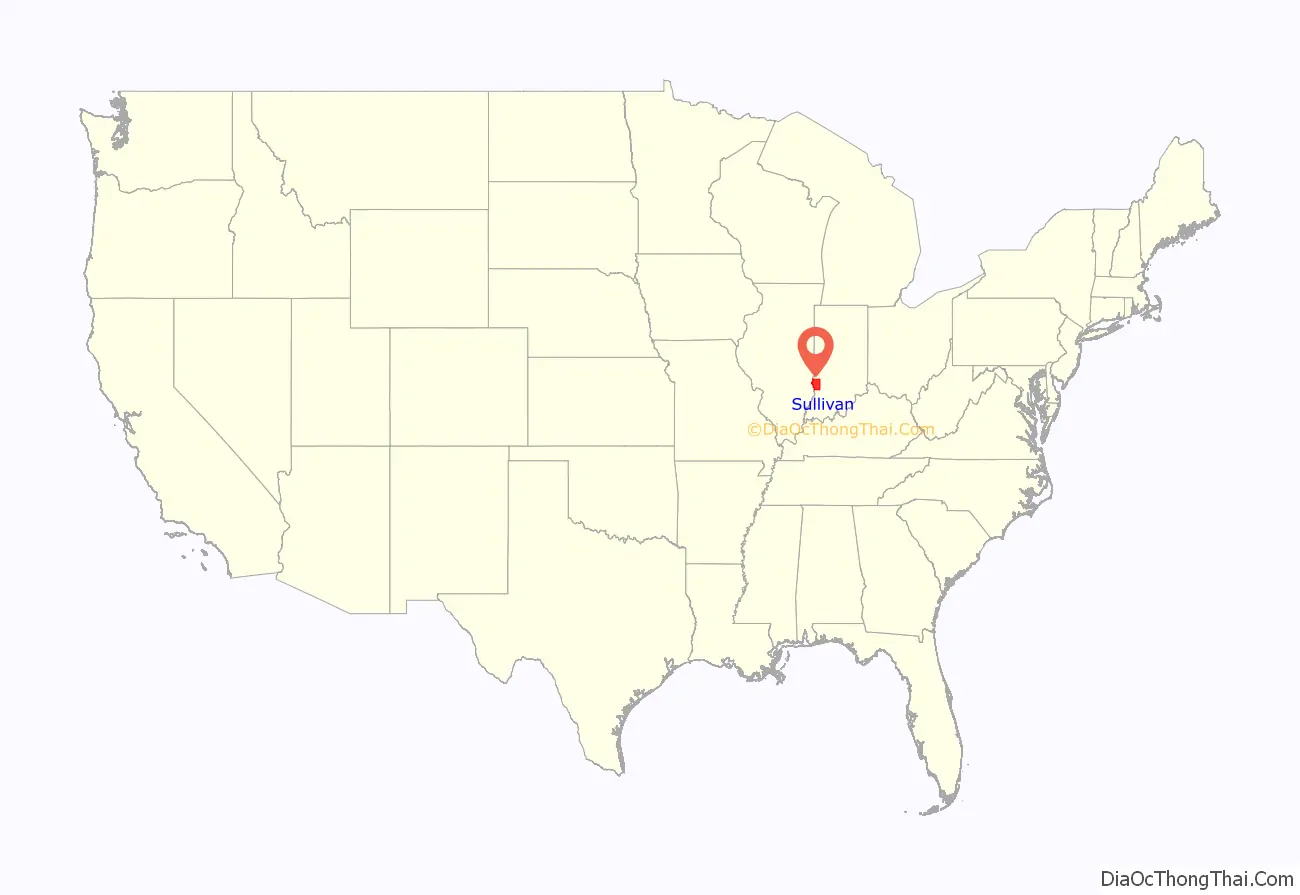
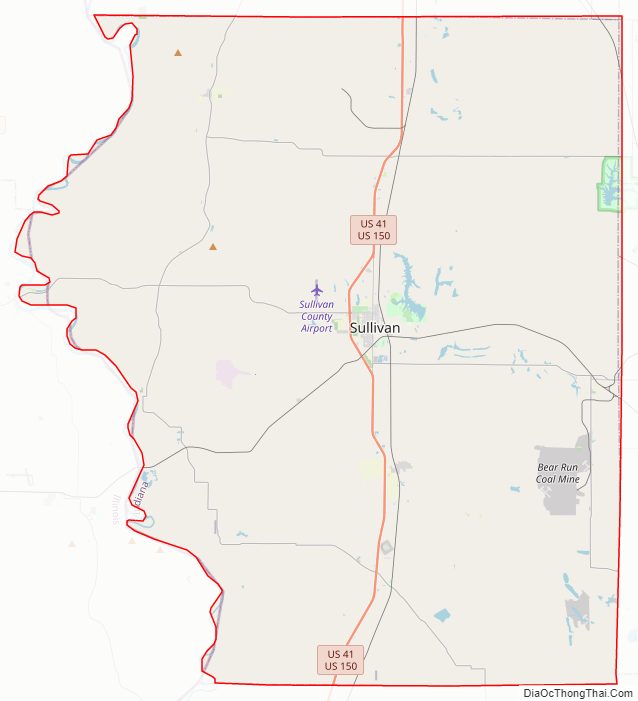
Sullivan County location map. Where is Sullivan County?
History
On February 25, 1779, Col. George Rogers Clark captured Fort Sackville at Vincennes from the British. About six miles (9.7 km) west at Pointe Coupee on the Wabash River on March 2, 1779, Capt. Leonard Helm commanding three boats and 50 volunteers from Vincennes captured a reinforcement fleet of seven boats carrying 40 soldiers and valuable supplies and Indian trade goods. This small naval battle completed the destruction of British military strength in the Wabash Valley.
The county’s first settlement occurred between 1808 and 1812, by a religious society of celibates known as Shakers. The 400 members of this communal group occupied 1,300 acres (5 km), seven miles (11 km) west of Carlisle.
General William Henry Harrison’s army made its last camp in Sullivan County at Big Springs on September 29, 1811. Harrison used Benjamin Turman’s fort as his headquarters. With spring water available, it was an ideal location for 1000 men, including 160 dragoons and 60 mounted riflemen. A Kentucky soldier killed a fellow Kentuckian, Clark, either accidentally or in a grudge fight. The deceased was buried at the top of a hill that became the Mann Turman Cemetery. General Harrison and his troops continued north on the Wea Indiana Trail to build Fort Harrison and then proceeded to the Battle of Tippecanoe.
A War of 1812 military action occurred in September 1812, three miles (4.8 km) west−southwest of Sullivan County. While escorting supplies from Fort Knox near Vincennes to Fort Harrison at Terre Haute, Sergeant Nathan Fairbanks and approximately a dozen soldiers were ambushed – and most killed – by Indians.
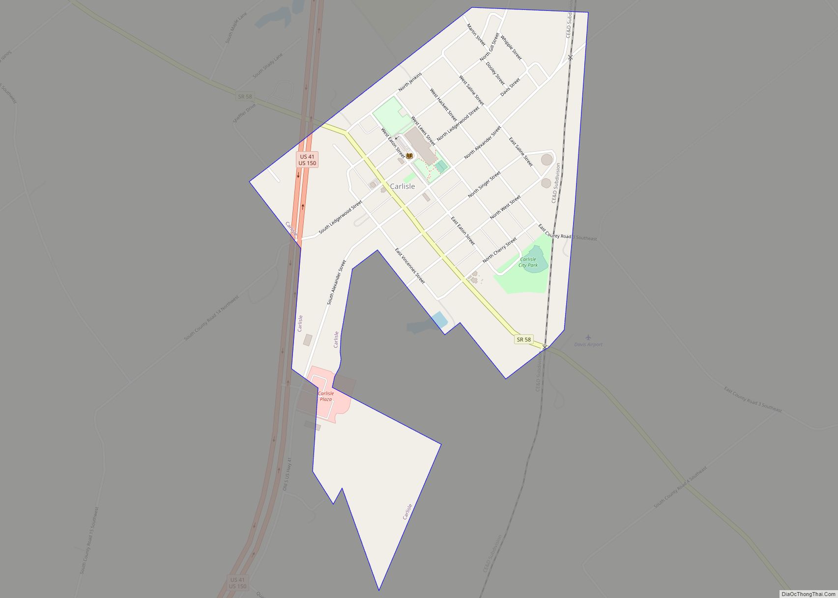
In 1815, Carlisle was founded.
An act of the Indiana legislature dated December 30, 1816, created Sullivan County, with areas partitioned from Knox County. The effective date of the new government was 15 January 1817, with interim commissioners charged to begin organizing the new government in February. It was named for Daniel Sullivan, a prominent frontiersman killed in 1790 by Native Americans while carrying a dispatch between Fort Vincennes and Louisville.
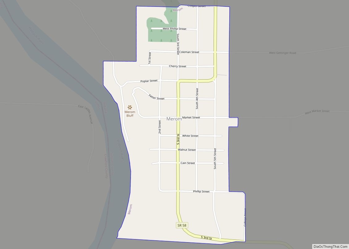
A log courthouse in Merom served as Sullivan County’s first county seat from 1819 to 1842. Merom was an important river port and a stop on the stage route known as The Old Harrison Trail. William Henry Harrison’s troops camped near here on their 1811 march to the Battle of Tippecanoe.
Pioneer heroine of abdominal surgery Jane Todd is buried in Sullivan County. Born in Virginia in 1763, she and her husband, Thomas Crawford, moved to Green County, Kentucky, in 1805. Suffering from a huge abdominal tumor, she rode 60 miles (100 km) to Danville, Kentucky, to submit to a never−before−performed surgical procedure. On Christmas Day 1809, Dr. Ephraim McDowell performed the first ovariotomy, in his home. The ordeal lasted 25 minutes. There was no anesthesia. Mrs. Crawford recovered completely and years later came to Graysville to live with her son, Thomas, a Presbyterian minister. She died in 1842 at age 78. The restored McDowell home in Danville, Kentucky, is a surgical shrine.
Sullivan was founded in 1853 and became the county seat.
Dedicated in 1862, Union Christian College served as a preparatory school and college until 1924. In 1936 it became Merom Institute—a rural enrichment center. Now owned by the United Church of Christ, it serves as a camp, conference, and retreat center.
Numerous violent conflicts erupted in Sullivan County during the American Civil War over differing war sentiments. On July 14, 1864, anti-war Democrat John Drake was fatally shot at a community picnic near here.
In November 1902, a mob abducted James Dillard from the Sullivan County sheriff, John S. Dudley, as he was being taken to Sullivan. After kidnapping Dillard, they lynched him. In response to the lynching, Governor Winfield Durbin dismissed the sheriff – a decision which was in line with Indiana’s 1899 anti-lynching law. However, Sheriff Dudley ultimately remained in office after he and other officials entered into a legal battle about the decision.
Organized nationally to bring culture to rural communities, Merom’s 10-day religious and educational Chautauqua event featured concerts, debates, plays, and lectures. Carrie Nation, William Jennings Bryan, William Howard Taft, Warren G. Harding, and Billy Sunday were among its speakers.
In 1968, the Sullivan County Park and Lake was created. It contains a 468-acre (1.9 km) reservoir for swimming, boating, and fishing. The lake is stocked with crappie, hybrid saugeye, bass, bluegill, and channel catfish. Water skiing is popular. Sullivan County Park and Lake has 400 acres (1.6 km) of land for camping and a 9-hole golf course. The campground offers sites ranging from primitive camping to space for motor homes.
Sullivan County Road Map
Geography
Sullivan County lies on the west edge of Indiana; its western border abuts the state of Illinois (across the Wabash River). The meanders of the Wabash delineate the county’s west border. The upper part of the county is drained by Turtle Creek, which flows southwestward into the river. The lower part of the county is similarly drained by Busseron Creek.
The county’s abundant woods were largely cleared and devoted to agriculture during the nineteenth century. At present only the drainages remain wooded. Its highest point (640 feet/200 meters ASL) is a small rise six miles (9.7 km) east of Carlisle.
According to the 2010 census, the county has a total area of 454.12 square miles (1,176.2 km), of which 447.14 square miles (1,158.1 km) (or 98.46%) is land and 6.97 square miles (18.1 km) (or 1.53%) is water.
Adjacent counties
- Vigo County − north
- Clay County − northeast
- Greene County − east
- Knox County − south
- Crawford County, Illinois − west
- Clark County, Illinois − northwest
Protected areas
- Elliott Woods State Nature Preserve
- Greene-Sullivan State Forest (part)
- Redbird State Recreation Area (part)
- Shakamak State Park (part)
- Sullivan County Park and Lake
- Turtle Creek Reservoir
City
- Sullivan – county seat
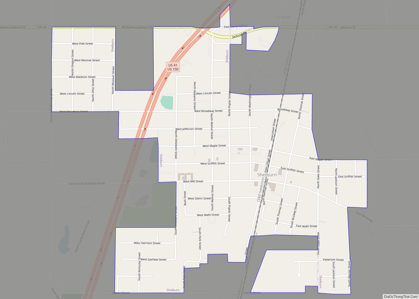
Towns
Unincorporated communities
- Baker
- Baldridge
- Benefiel Corner
- Bucktown
- Cass
- Curryville
- Dodds Bridge
- East Shelburn
- Fairbanks
- Gambill
- Gilmour − part
- Glendora
- Graysville
- Greenville
- Hawton
- Jackson Hill
- Jericho
- Lewis − part
- Massacre
- Merom Station
- New Lebanon
- Paxton
- Pleasantville
- Riverton
- Riverview
- Scotchtown
- Scott City
- Shiloh
- Standard
- Stringtown
- Wilfred
Ghost towns
- Caledonia
- Farnsworth
Townships
- Cass
- Curry
- Fairbanks
- Gill
- Haddon
- Hamilton
- Jackson
- Jefferson
- Turman
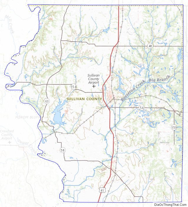
Sullivan County Topographic Map
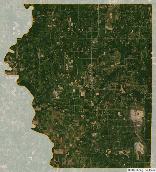
Sullivan County Satellite Map
Sullivan County Outline Map