Danville is a home rule-class city in Boyle County, Kentucky, United States. It is the seat of its county. The population was 17,236 at the 2020 Census. Danville is the principal city of the Danville Micropolitan Statistical Area, which includes all of the Boyle and Lincoln counties. In 2001, Danville received a Great American Main Street Award from the National Trust for Historic Preservation. In 2011, Money magazine placed Danville as the fourth-best place to retire in the United States. Centre College in Danville was selected to host U.S. vice-presidential debates in 2000 and 2012.
| Name: | Danville city |
|---|---|
| LSAD Code: | 25 |
| LSAD Description: | city (suffix) |
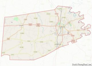
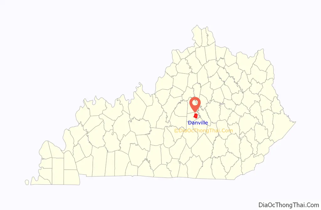
| State: | Kentucky |
| County: | Boyle County |
| Incorporated: | 1787 |
| Elevation: | 984 ft (300 m) |
| Total Area: | 17.28 sq mi (44.76 km²) |
| Land Area: | 17.18 sq mi (44.50 km²) |
| Water Area: | 0.10 sq mi (0.26 km²) |
| Total Population: | 17,234 |
| Population Density: | 1,003.1/sq mi (387.29/km²) |
| ZIP code: | 40422-40423 |
| Area code: | 859 |
| FIPS code: | 2119882 |
| GNISfeature ID: | 0490584 |
| Website: | www.danvilleky.gov |
Online Interactive Map
Click on ![]() to view map in "full screen" mode.
to view map in "full screen" mode.
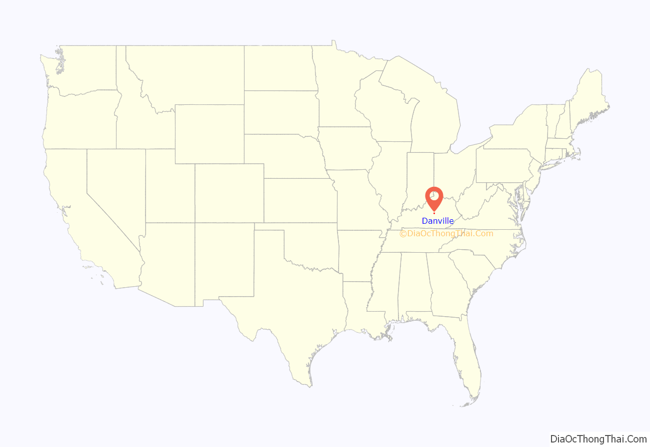
Danville location map. Where is Danville city?
History
Within Kentucky, Danville is called the “City of Firsts”:
- It housed the first courthouse in Kentucky.
- The first Kentucky constitution was written and signed here.
- It was the first capital of Kentucky.
- It had the first U.S. post office west of the Allegheny Mountains.
- It hosts the first state-supported school for the deaf.
- Ephraim McDowell completed the first known successful laparotomy here in 1809, removing an ovarian tumor from a woman patient without anesthesia.
- It is the home of Centre College, housing the oldest college administration building and campus west of the Allegheny Mountains.
Danville was part of the Great Settlement Area around Fort Harrod (present-day Harrodsburg), which was first settled in 1774. The site was originally known as Crow’s Station for settler John Crow, but the town was surveyed and platted by Walker Daniel, Kentucky’s first district attorney, who bought 76 acres (31 ha) near the Wilderness Road from Crow in 1783. The city was named for Daniel. The Virginia legislature officially established Danville on December 4, 1787.
Between 1784 and 1792, ten conventions were held in Danville to petition for better governance and ultimately to secure independence from Virginia. In 1786 the Danville Political Club was organized. It met each Saturday night at Grayson’s Tavern to discuss the political, economic, and social concerns of the day. After a state constitution was adopted and separation was confirmed in 1792, the town ceased to be of statewide importance. Its leading citizens moved elsewhere.
Transylvania University was founded in Danville in 1783. It moved to Lexington in 1789. Centre College was founded in 1819. Danville Theological Seminary was founded in 1853; in 1901 it became part of the Louisville Presbyterian Theological Seminary. The Caldwell Institute for Young Ladies was founded in 1860. It became Caldwell Female College in 1876, Caldwell College in 1904, Kentucky College for Women in 1913, and merged into Centre College in 1926.
In November 1806, Meriwether Lewis, co-leader of the Lewis and Clark Expedition, visited Danville while traveling the Wilderness Road to Washington, D.C., to report on the expedition, which had returned from the Pacific Coast. In December 1806, William Clark visited his nephews in school in Danville before following Lewis to Washington.
The first school in Danville for African-American children was founded around 1840 by Willis Russell, an emancipated slave of Robert Craddock, a Revolutionary War veteran. Craddock deeded a log house in Danville to Russell. He moved to the town after Craddock’s death and started a school for children. The house on Walnut Street no longer stands, though what was once believed to be his house is now the Willis Russell Memorial Cabin. Russell’s house stood across the street, opposite St. James African American Methodist Church.
In 1842, Boyle County was formed from southern Mercer County and northern Lincoln County. Danville became its county seat.
In 1850, Danville and Boyle County backed construction of the Lexington and Danville Railroad. Money ran out when the railroad reached Nicholasville. John A. Roebling had already built towers for a railroad suspension bridge over the Kentucky River. (Roebling lived in Danville during the construction.) Despite the railroad not being completed to Danville, the county still owed the company $150,000. It completed payment on time in 1884.
In 1860, a fire devastated the city, destroying 64 buildings and causing more than $300,000 in damages. Boyle County’s courthouse was destroyed; its replacement was completed in 1862.
After the Union Army won the Battle of Perryville in the Civil War on October 8, 1862, it appropriated many Danville buildings, including the courthouse, for use as hospitals. On October 11, a Union force drove Confederate forces from the county fairgrounds through Danville.
In May 1864, the group of 250 – mostly enslaved males but including some freedmen – marched from Danville to nearby Camp Nelson in Jessamine County, where Colonel Andrew Clark allowed them to enlist In the Union Army after some initial hesitation. Arriving with wounds inflicted upon them in route, this group was the first to enlist at this site, where 10,000 United States Colored Troops trained.
In 1775, Archibald McNeill planted Kentucky’s first recorded hemp crop at Clark’s Run Creek near Danville. By 1889 Boyle County was one of the ten Kentucky counties which together produced more than 90% of the US yield. It was the state’s largest cash crop until 1915, when it lost its market to imported jute.
From the turn of the 20th century through the 1960s, Danville was home to a thriving African-American business sector located on and around 2nd Street on the western edge of what is now Constitution Square Historic Site. The city demolished this business sector under urban renewal in the 1970s to provide for the expansion of Constitution Square Park.
On October 5, 2000, Dick Cheney and Senator Joe Lieberman, candidates for Vice President of the United States, debated at Centre College during the 2000 presidential election. On October 11, 2012, Centre College again hosted the Vice-Presidential debate, this time between Vice President Joe Biden and Wisconsin Representative Paul Ryan.
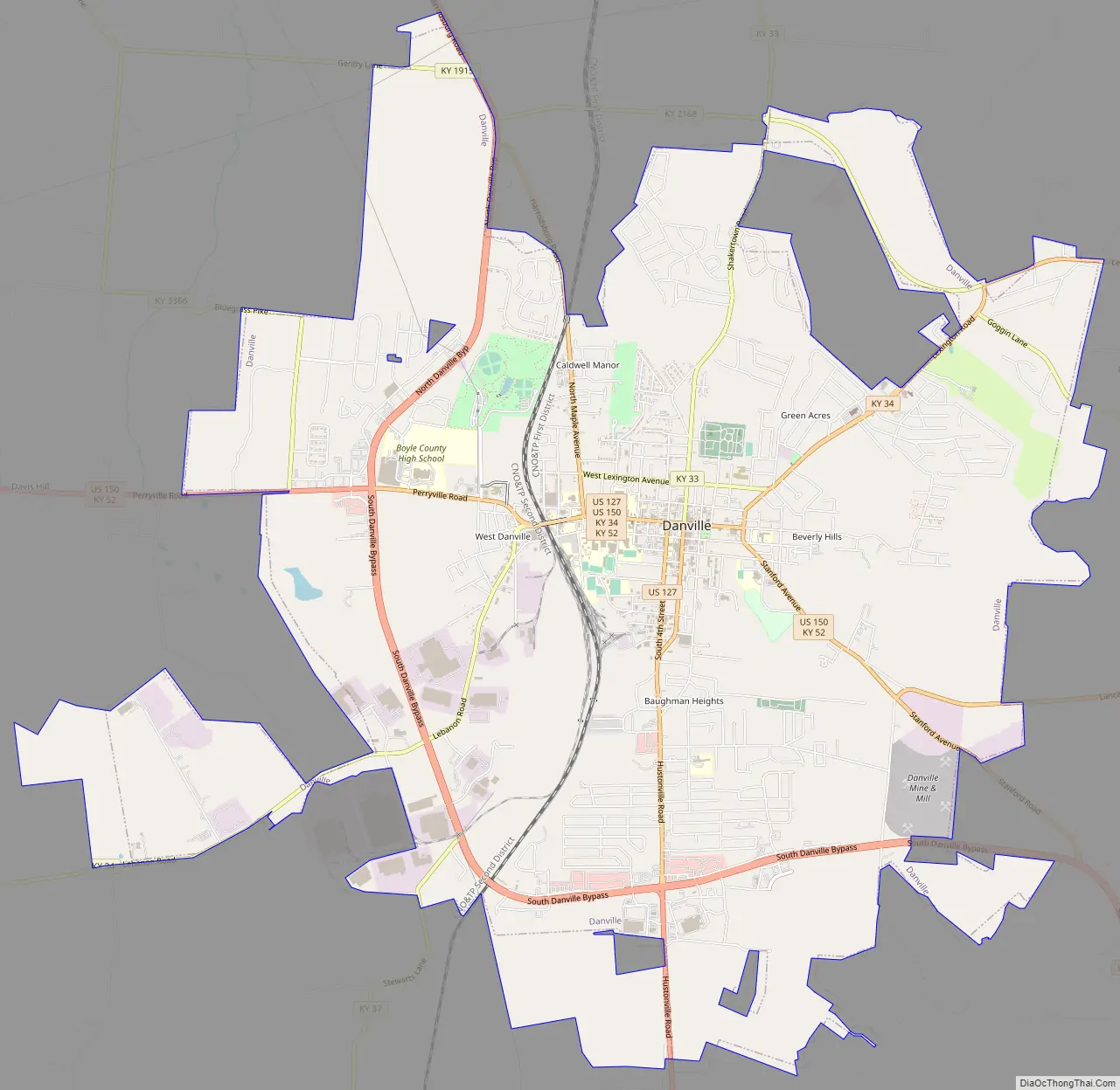
Danville Road Map
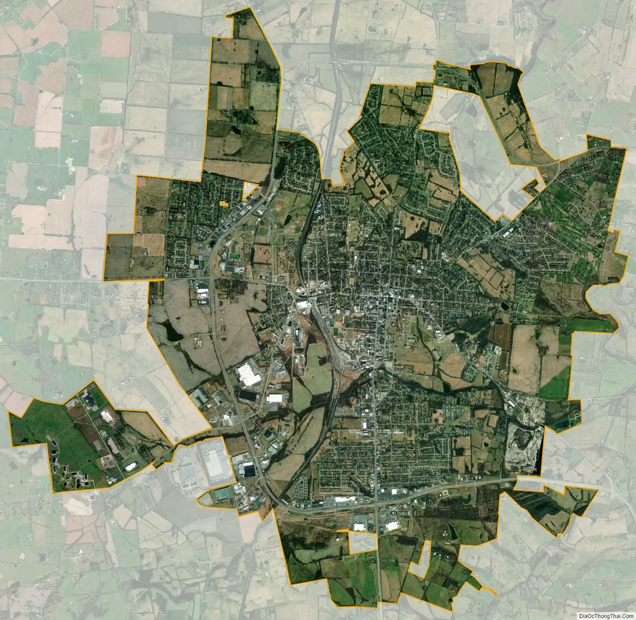
Danville city Satellite Map
Geography
Danville is located in eastern Boyle County at 37°38′44″N 84°46′11″W / 37.6456°N 84.7698°W / 37.6456; -84.7698.
According to the United States Census Bureau, the city has a total area of 15.9 square miles (41.2 km), of which 15.8 square miles (41.0 km) is land and 0.077 square miles (0.2 km), or 0.58%, is water.
Transportation
Blue Grass Community Action Partnership provides DanTran bus service inside Danville. BGCAP also connects Danville with Lexington, Stanford, Junction City, and Lancaster.
- U.S. Route 127 bisects Danville northwest (Harrodsburg) to south (Liberty).
- U.S. Route 150 bisects Danville west (Perryville, Springfield) to southeast (Stanford).
- U.S. Route 127 Bypass encircles the Danville from on the west and south. It runs concurrently with U.S. Route 150 Bypass from its southernmost point to the U.S. Route 150 intersection.
- U.S. Route 150 Bypass encircles Danville on the west and south. It runs concurrently with U.S. Route 127 Bypass from the intersection with U.S. Route 127 to its westernmost point.
- Kentucky Route 33 enters Danville from north (Burgin, Versailles).
- Kentucky Route 34 connects Danville northeast to U.S. Route 27 and on to Lexington.
- Kentucky Route 37 connects Danville west to Kentucky Route 243 near Penn’s Store.
- Kentucky Route 52 connects Danville east to Lancaster.
- Kentucky Route 2168 connects U.S. Route 127 with Kentucky Route 34 north of Danville.
Stuart Powell Field (DVK), 3 miles (5 km) from downtown, serves as Danville’s general aviation airport. Blue Grass Airport (LEX) in Lexington, 35 miles (56 km) away, provides the closest commercial service. More extensive commercial service is available from Louisville International Airport (SDF), 82 miles (132 km) away, and Cincinnati/Northern Kentucky International Airport (CVG), 127 miles (204 km) away.
Norfolk Southern Railway operates a freight rail yard in Danville. Its Louisville-Chattanooga line intersects with its Cincinnati-Chattanooga line just north of Danville.
Climate
Danville has a humid subtropical climate (Köppen Cfa), with warm summers and moderately cold winters. Precipitation is abundant and well-spread, with an average of 48.86 inches (1,240 mm).
See also
Map of Kentucky State and its subdivision:- Adair
- Allen
- Anderson
- Ballard
- Barren
- Bath
- Bell
- Boone
- Bourbon
- Boyd
- Boyle
- Bracken
- Breathitt
- Breckinridge
- Bullitt
- Butler
- Caldwell
- Calloway
- Campbell
- Carlisle
- Carroll
- Carter
- Casey
- Christian
- Clark
- Clay
- Clinton
- Crittenden
- Cumberland
- Daviess
- Edmonson
- Elliott
- Estill
- Fayette
- Fleming
- Floyd
- Franklin
- Fulton
- Gallatin
- Garrard
- Grant
- Graves
- Grayson
- Green
- Greenup
- Hancock
- Hardin
- Harlan
- Harrison
- Hart
- Henderson
- Henry
- Hickman
- Hopkins
- Jackson
- Jefferson
- Jessamine
- Johnson
- Kenton
- Knott
- Knox
- Larue
- Laurel
- Lawrence
- Lee
- Leslie
- Letcher
- Lewis
- Lincoln
- Livingston
- Logan
- Lyon
- Madison
- Magoffin
- Marion
- Marshall
- Martin
- Mason
- McCracken
- McCreary
- McLean
- Meade
- Menifee
- Mercer
- Metcalfe
- Monroe
- Montgomery
- Morgan
- Muhlenberg
- Nelson
- Nicholas
- Ohio
- Oldham
- Owen
- Owsley
- Pendleton
- Perry
- Pike
- Powell
- Pulaski
- Robertson
- Rockcastle
- Rowan
- Russell
- Scott
- Shelby
- Simpson
- Spencer
- Taylor
- Todd
- Trigg
- Trimble
- Union
- Warren
- Washington
- Wayne
- Webster
- Whitley
- Wolfe
- Woodford
- Alabama
- Alaska
- Arizona
- Arkansas
- California
- Colorado
- Connecticut
- Delaware
- District of Columbia
- Florida
- Georgia
- Hawaii
- Idaho
- Illinois
- Indiana
- Iowa
- Kansas
- Kentucky
- Louisiana
- Maine
- Maryland
- Massachusetts
- Michigan
- Minnesota
- Mississippi
- Missouri
- Montana
- Nebraska
- Nevada
- New Hampshire
- New Jersey
- New Mexico
- New York
- North Carolina
- North Dakota
- Ohio
- Oklahoma
- Oregon
- Pennsylvania
- Rhode Island
- South Carolina
- South Dakota
- Tennessee
- Texas
- Utah
- Vermont
- Virginia
- Washington
- West Virginia
- Wisconsin
- Wyoming