Vermillion County lies in the western part of the U.S. state of Indiana between the Illinois border and the Wabash River. As of the 2010 census, the population was 16,212. The county seat is Newport. It was officially established in 1824 and was the fiftieth Indiana county created. Vermillion County is included in the Terre Haute, Indiana, Metropolitan Statistical Area. The county contains seven incorporated towns with a total population of about 9,900. as well as several unincorporated communities; it is also divided into five townships which provide local services. An interstate highway, two U.S. routes, and five state roads cross the county, as does a major railroad line.
| Name: | Vermillion County |
|---|---|
| FIPS code: | 18-165 |
| State: | Indiana |
| Founded: | February 1, 1824 |
| Named for: | Vermilion River |
| Seat: | Newport |
| Largest city: | Clinton |
| Total Area: | 259.93 sq mi (673.2 km²) |
| Land Area: | 256.88 sq mi (665.3 km²) |
| Population Density: | 63/sq mi (24.37/km²) |
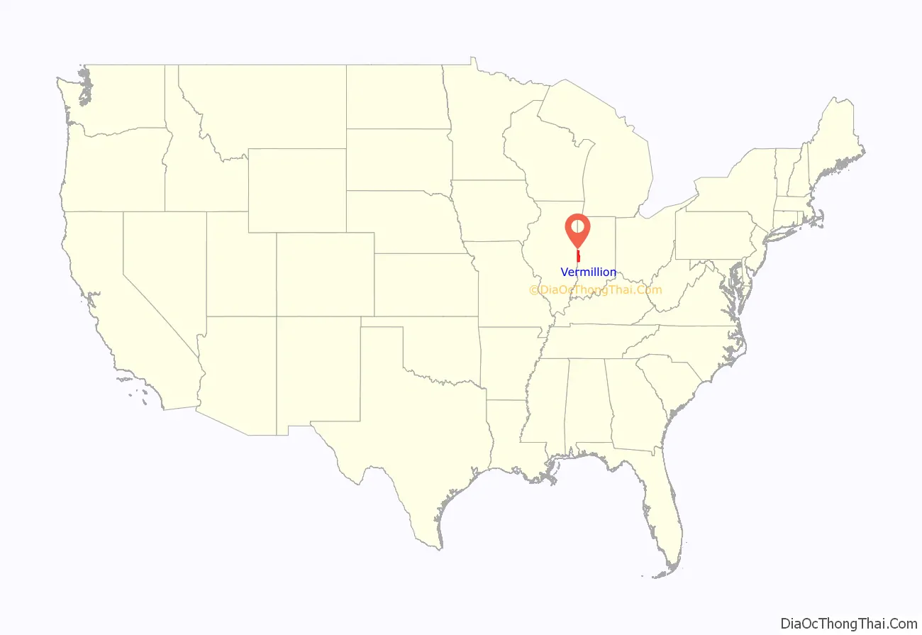
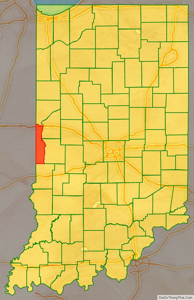
Vermillion County location map. Where is Vermillion County?
History
The first settlers in the area arrived in 1816, the same year that the state of Indiana was established. Vigo County was formed in 1818 and included the area that later became Parke and Vermillion counties. In 1821, Parke County was formed, and on January 2, 1824, the Indiana General Assembly created Vermillion County out of Parke County; the act took effect on February 1. The county seat was established at Newport later that year.
The county was named for the southbound Vermilion River, which flows nearby. The name is spelled in the French/Commonwealth English style with a double letter “l”, in contrast to the American English spelling of the adjacent Vermilion County, Illinois. This is one of only a few cases in the United States in which a county borders a county with the same name in another state.
The first courthouse was a frame building. The contract was awarded in June 1824 for $345 and was to be completed by the following November; it was used for county business until a brick building could be constructed. The brick courthouse was contracted in 1831; the completed building was used until January 29, 1844, when the building caught fire. It was repaired and served until 1868 when a third courthouse was built at a cost of $30,000; a west wing was added in 1903 at a cost of $28,000. That building was struck by lightning early on the morning of May 27, 1923, and was largely destroyed by fire. Construction on the fourth (and current) courthouse began that same year; Halbert Fillinger and John Bayard were the architects. The stone building was constructed by Jasper Good of Columbus at a cost of $358,707, and the new courthouse was dedicated on June 11, 1925.
The Newport Hill Climb was first held in 1909. The event was started and stopped several times over the years, but the Newport Lions Club now runs the Newport Antique Auto Hill Climb; it has been held continuously since the 1960s and involves several hundred cars each year.
On January 26, 2017, the wooden grandstand at the Vermillion County Fairgrounds was destroyed by a massive fire. The wooden grandstand was built in 1933 as a WPA work project, and was the oldest wooden grandstand in Indiana. The Cayuga Fire Department said that the cause of the fire is suspicious.
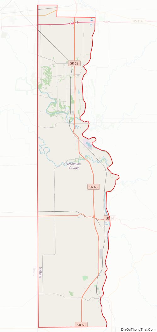
Vermillion County Road Map
Geography
Vermillion County is less than 10 miles (16 km) from east to west at its widest point, but it extends over 37 miles (60 km) from north to south. It shares a 6.5-mile (10.5 km) border with Warren County to the north. Its eastern border is defined by the Wabash River. Fountain and Parke counties lie across the river to the northeast and southeast, respectively. Vermillion County is the southernmost county in Indiana entirely on the right bank of the Wabash. Vigo County, from which Parke and Vermillion counties were formed, lies to the south. The county’s western border is shared with the state of Illinois. To the northwest lies Vermilion County, Illinois; its county seat, Danville, is west of the northern border of Vermillion County. To the southwest is Edgar County; its county seat, Paris, is west of Vermillion County’s southern border. The state capital of Indianapolis lies about 65 miles (105 km) to the east.
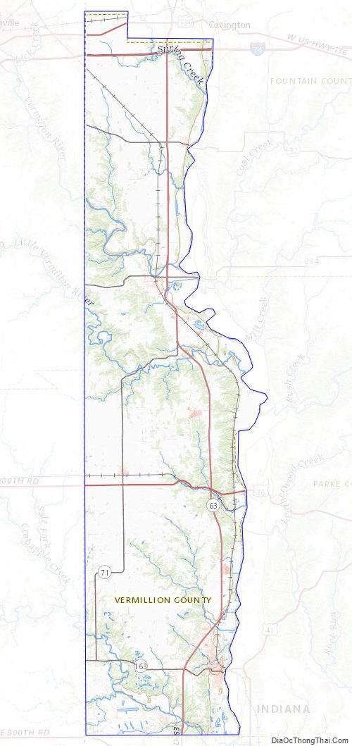
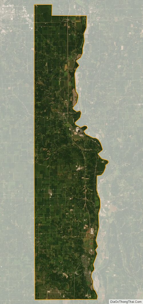
According to the 2010 census, the county has a total area of 259.93 square miles (673.2 km), of which 256.88 square miles (665.3 km) (or 98.83%) is land and 3.05 square miles (7.9 km) (or 1.17%) is water. The Vermillion River, for which the county was named, enters from Illinois to the west and crosses the county to empty into the Wabash River near Cayuga. Forests cover about 23% of the county, or about 37,865 acres (15,323 ha), and consist principally of deciduous hardwoods among which maple–beech and oak–hickory forests are the most common.
At a meeting of the board of commissioners on March 23, 1824 (the same year the county was formed), four townships were created: Clinton, Helt, Highland, and Vermillion. Later, Eugene Township was created out of portions of Highland and Vermillion; the north end of Highland Township became part of Warren County.
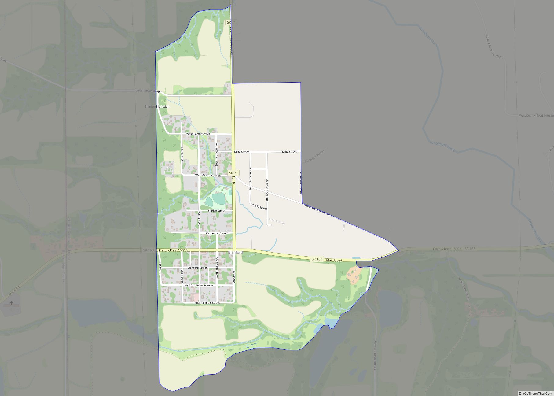
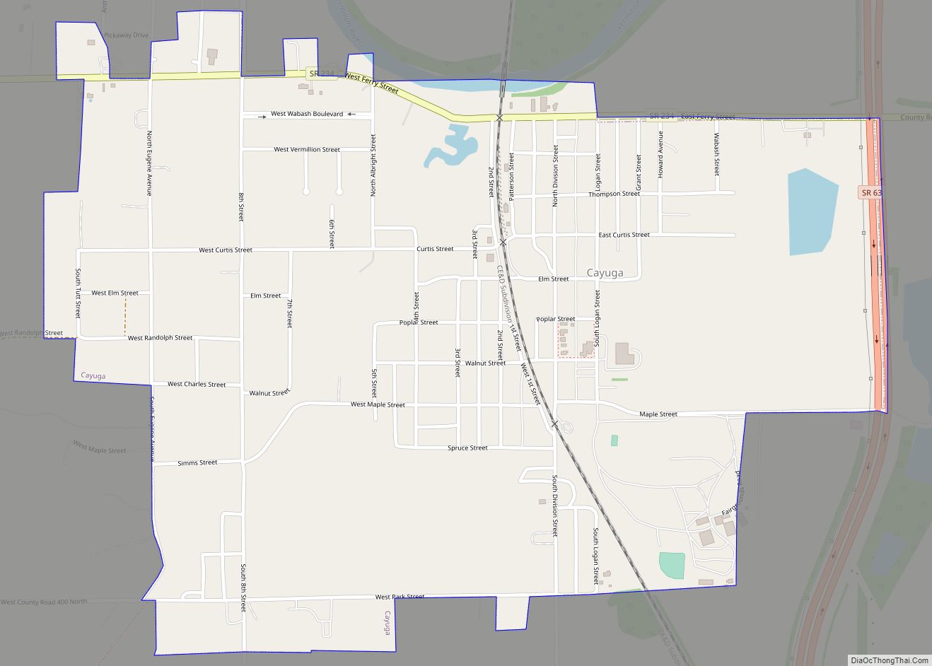
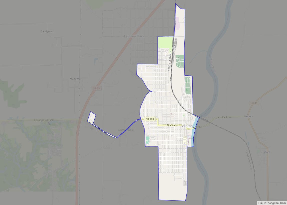
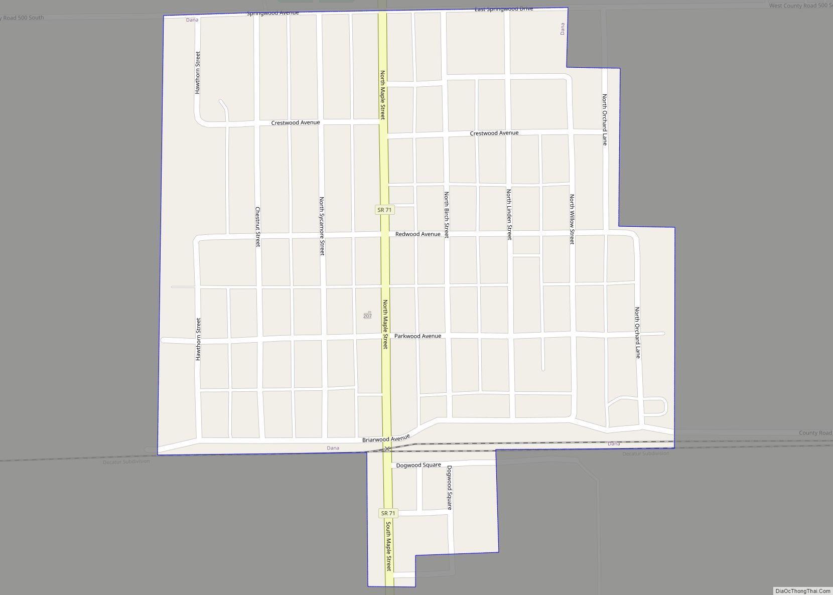
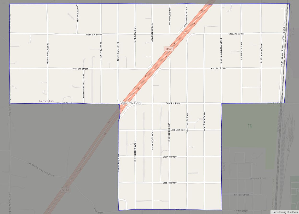
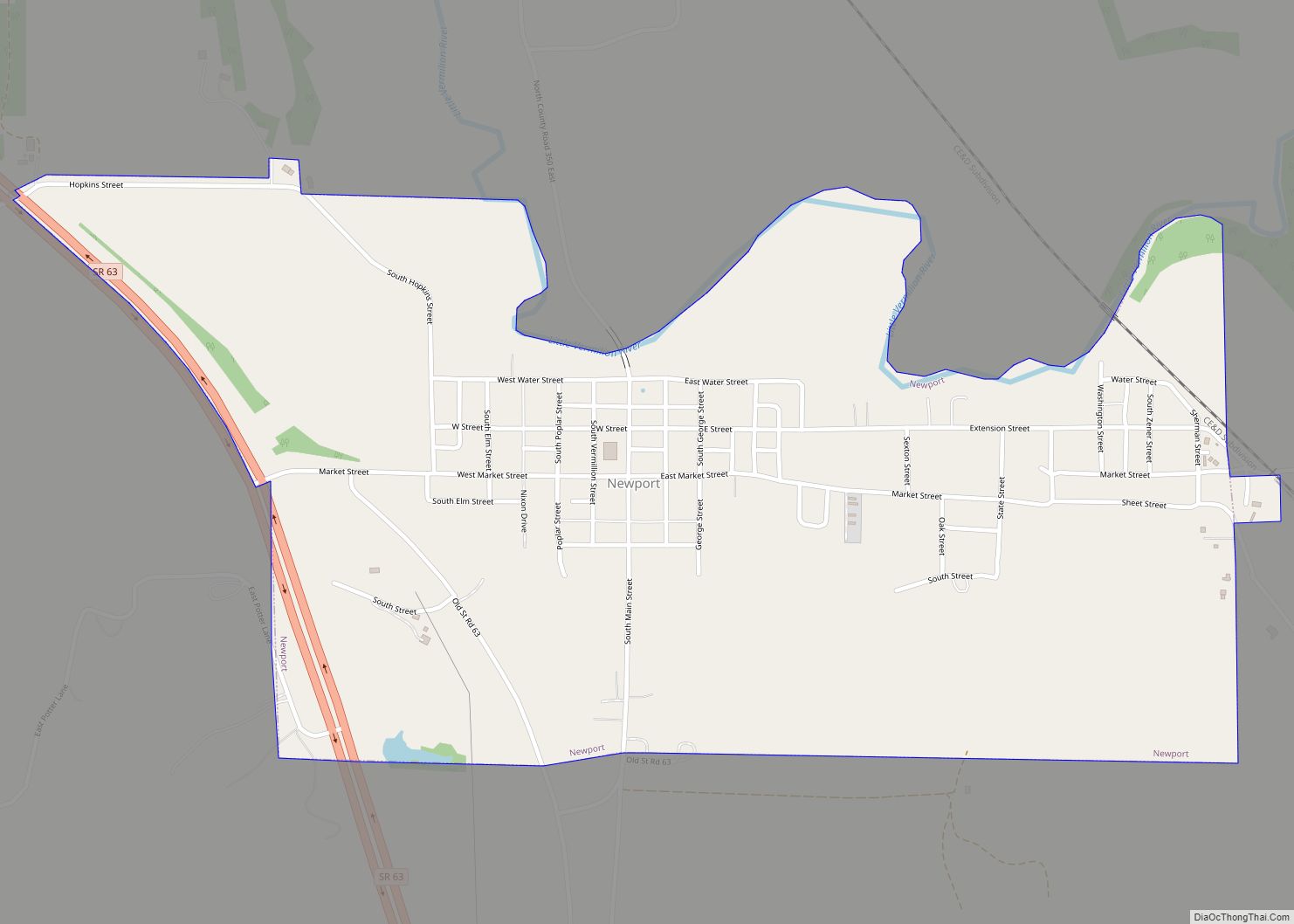
There are seven incorporated towns in Vermillion County. Cayuga is located near the confluence of the Vermillion and Wabash rivers, along State Road 63 just west of its intersection with State Road 234. Clinton is the largest settlement in the county with a population of about 5100, and lies further to the south along the Wabash River, between it and State Road 63; State Road 163 passes through the town to reach U.S. Route 41 on the east side of the river. Fairview Park is just north of Clinton; State Road 63 passes through the north end of the town. Dana is a small town just north of the intersection of U.S. Route 36 and State Road 71. Newport is located just east of State Road 63, a few miles south of Cayuga; it is the county seat, although it is one of the smallest towns in the county. Perrysville is also located along the Wabash River, on State Road 32 just east of its intersection with State Road 63. Universal is in the far southern part of the county, west of State Road 63.
In addition to the towns, there are also many unincorporated communities. Helt Township has more than any other township and includes the communities of Alta, Bono, Highland, Hillsdale, Jonestown, Saint Bernice, and Summit Grove. Clinton Township contains Blanford, Centenary, Klondyke, and Syndicate. Highland Township includes Flat Iron, Gessie, Rileysburg, and Tree Spring. Eugene Township, which contains Cayuga, has just one unincorporated community: Eugene, which is just north of Cayuga.
At least three other communities once existed in Vermillion County but have since become extinct: Quaker, Randall, and Toronto.
Climate
Vermillion County is in the humid continental climate region of the United States along with most of Indiana. Its Köppen climate classification is Dfa, meaning that it is cold, has no dry season, and has a hot summer. In recent years, temperatures in Newport have ranged from an average low of 15 °F (−9 °C) in January to a high of 85 °F (29 °C) in July, although a record low of −26 °F (−32 °C) was recorded in 1994, and a record high of 105 °F (41 °C) was recorded in 1988. Average monthly precipitation ranged from 1.80 inches (46 mm) inches in February to 4.53 inches (115 mm) inches in June.
Vermillion County Topographic Map
Vermillion County Satellite Map
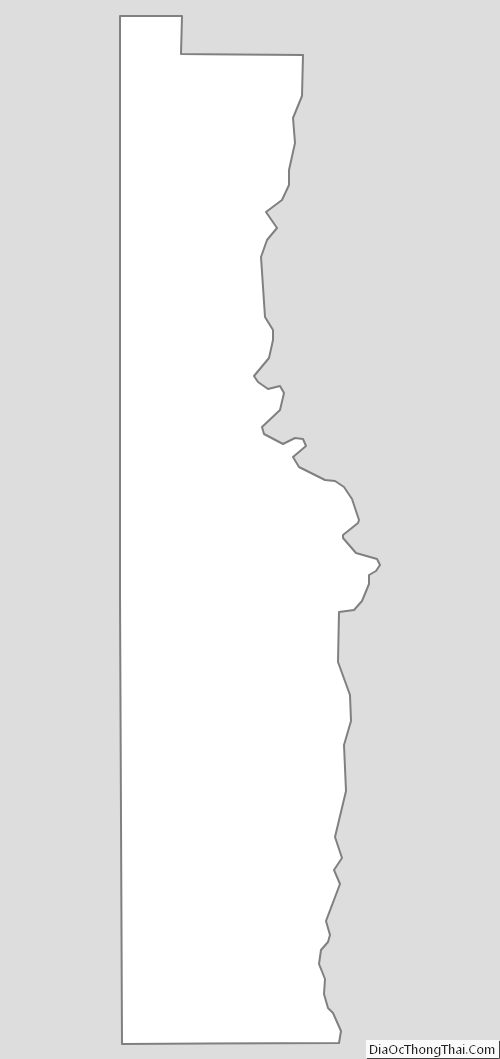
Vermillion County Outline Map