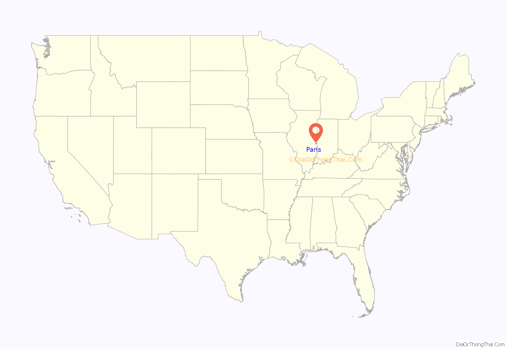
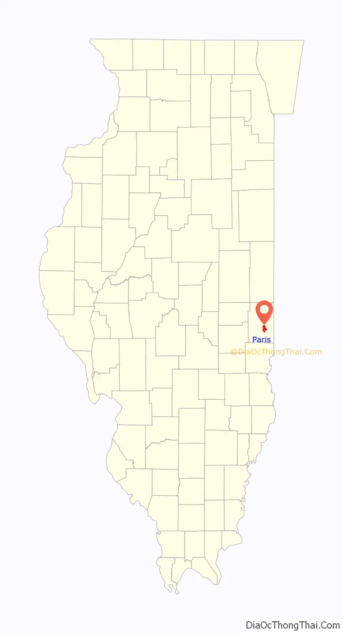
Paris is a city in Edgar County, Illinois, 165 miles (266 km) south of Chicago and 90 miles (140 km) west of Indianapolis. The population was 8,291 at the 2020 census. It is the county seat and largest city of Edgar County.
| Name: | Paris city |
|---|---|
| LSAD Code: | 25 |
| LSAD Description: | city (suffix) |
| State: | Illinois |
| County: | Edgar County |
| Elevation: | 712 ft (217 m) |
| Total Area: | 6.06 sq mi (15.70 km²) |
| Land Area: | 5.68 sq mi (14.71 km²) |
| Water Area: | 0.38 sq mi (0.99 km²) |
| Total Population: | 8,291 |
| Population Density: | 1,459.94/sq mi (563.69/km²) |
| ZIP code: | 61944 |
| Area code: | 217 |
| FIPS code: | 1757628 |
| GNISfeature ID: | 2396141 |
| Website: | parisillinois.org |
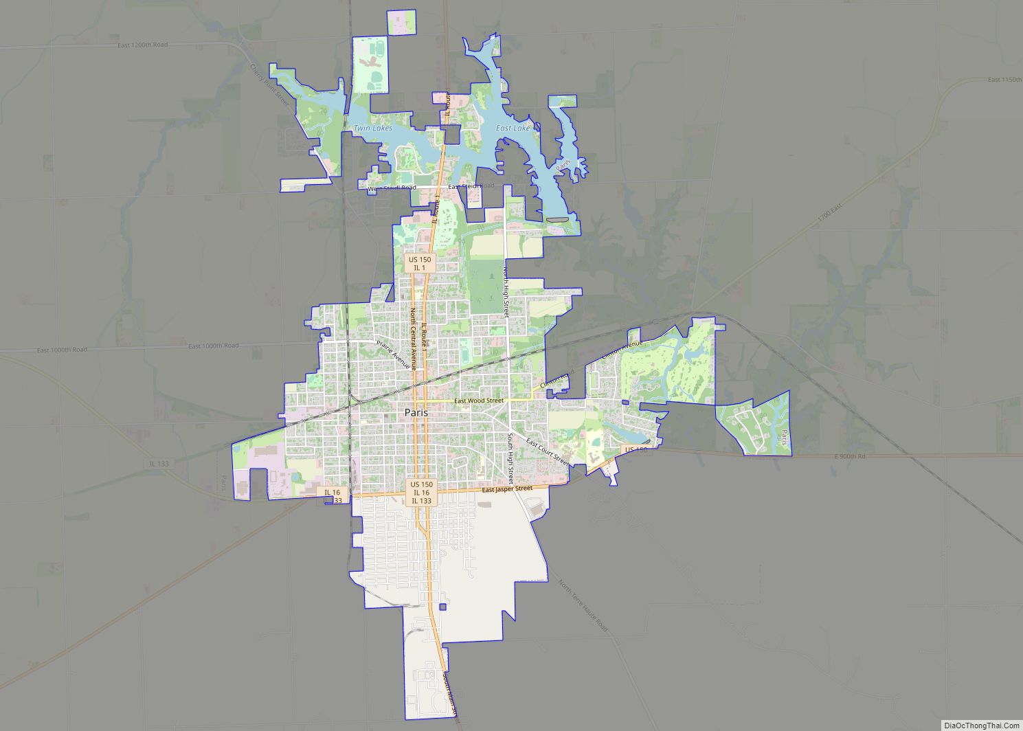
Online Interactive Map
Click on ![]() to view map in "full screen" mode.
to view map in "full screen" mode.
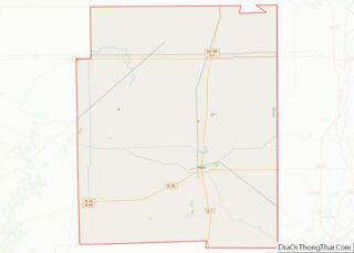
Paris location map. Where is Paris city?
History
Paris was established in 1826 on land donated by Samuel Vance to be the county seat, and was incorporated as a village in 1849. The town most likely received its name from the word “Paris” carved into a jack-oak tree in the middle of what became the town.
Paris’s history includes the service of two brothers, Walter Booth and Newton Booth, as its mayors in the mid-1850s. Newton Booth later moved west to California, where he served as governor and a U.S. senator.
The commission form of government was adopted in 1915. In 1907, L. A. G. Shoaff bought the Centralia White Stockings and renamed them the Paris Colts. In 1908 the team was renamed the Paris Parisians. After the 1908 season the team went under. In the 1950s Paris was home to a minor-league baseball team named the Paris Lakers. A contest was held among the community to decide on a name for the team. James C. Dickey’s submission, the Paris Lakers, was chosen. The Lakers were the 1956 Midwest League Champions and were affiliate of the Chicago Cubs.
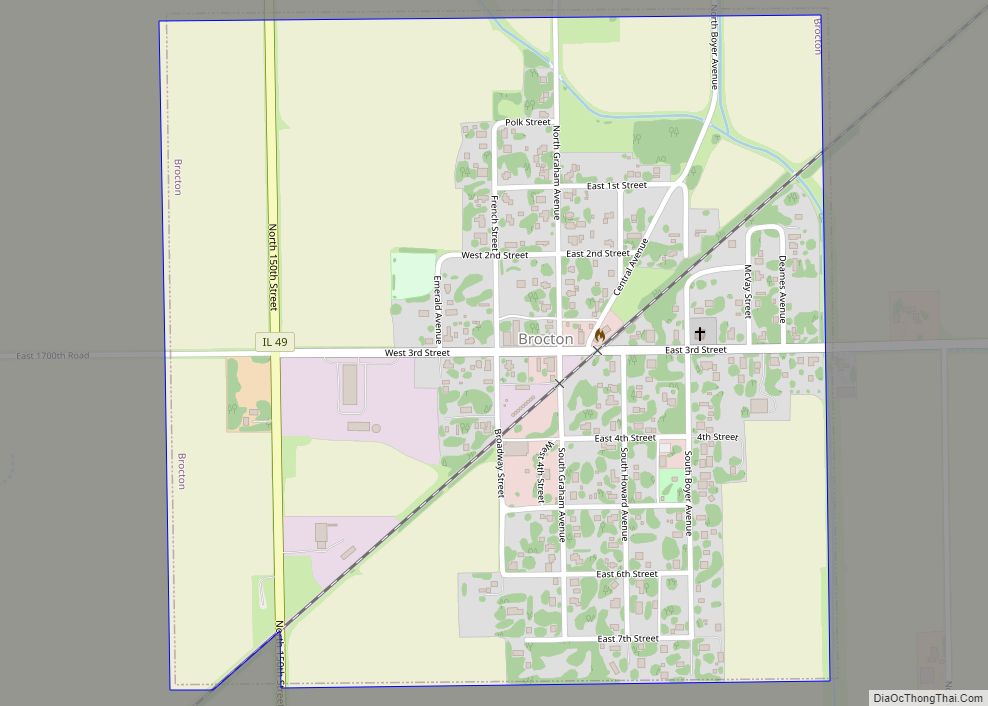
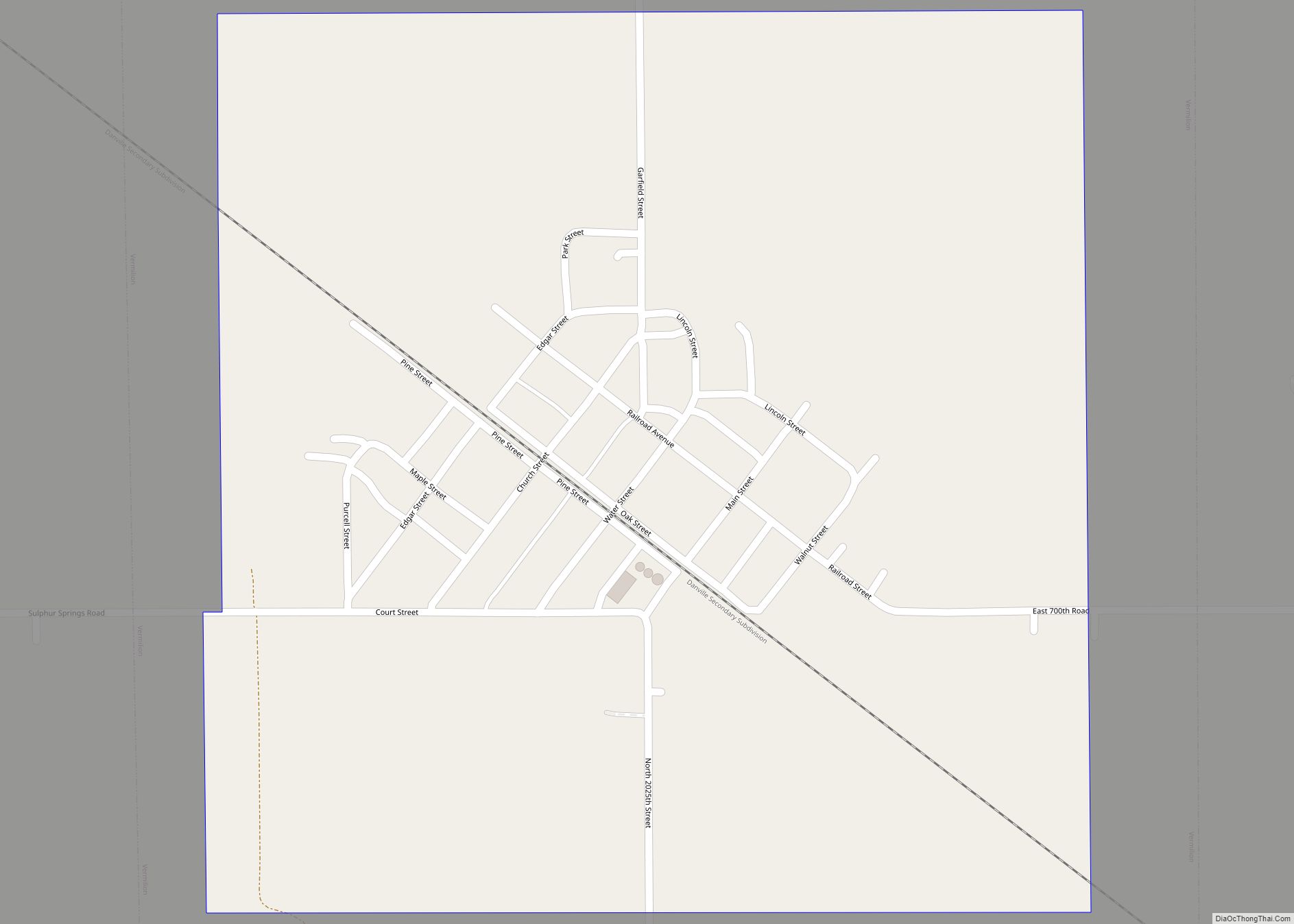
Paris Road Map
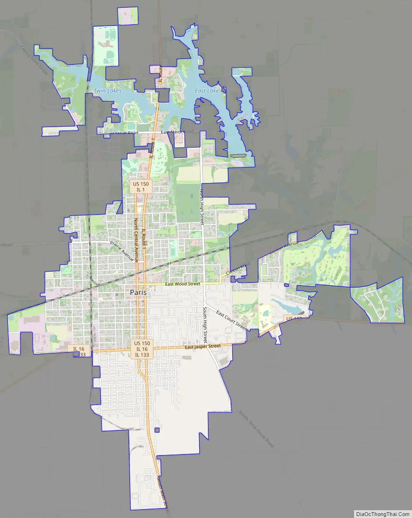
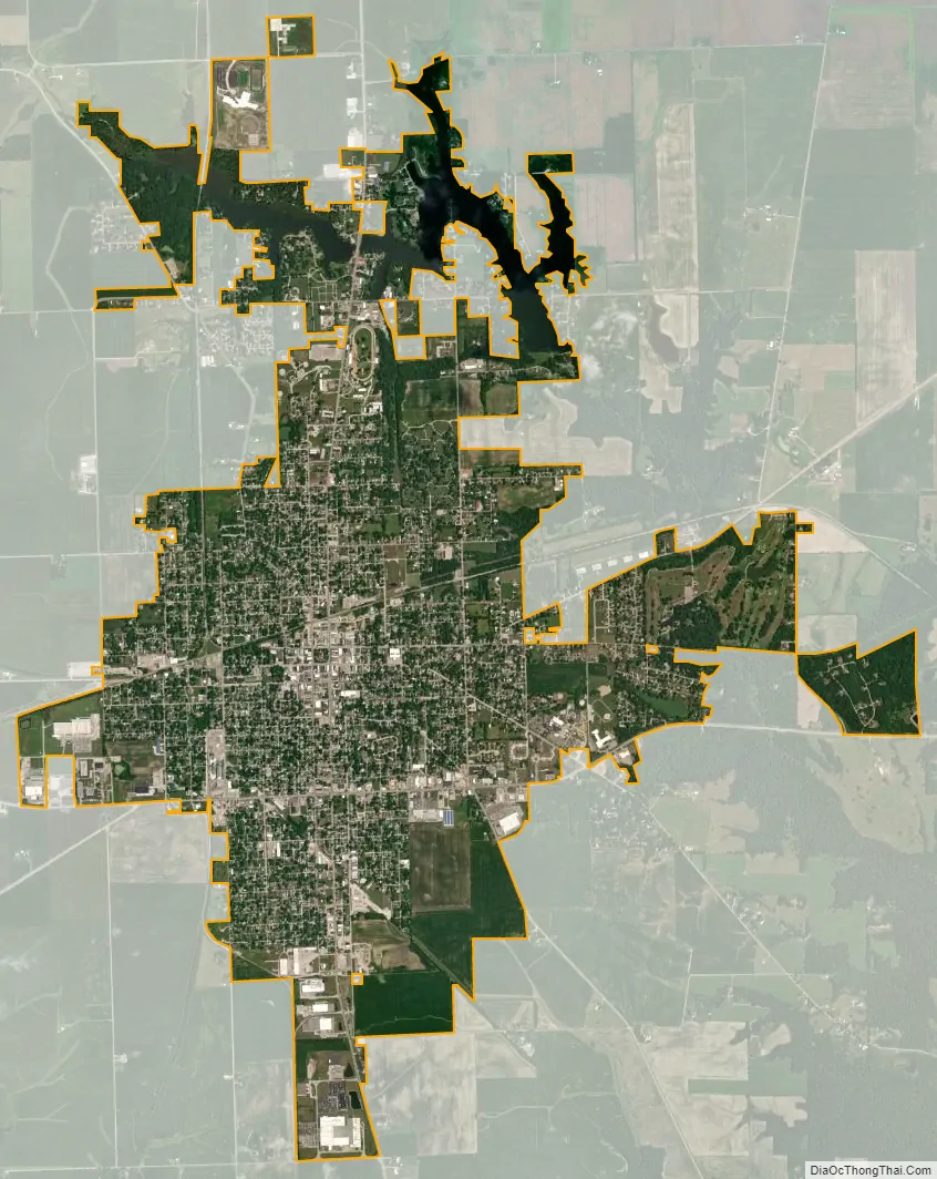
Paris city Satellite Map
Geography
U.S. Route 150 and Illinois State Route 1 pass through Paris. Both Illinois State Route 16 and Illinois State Route 133 have Illinois State Route 1 as their eastern terminus. One railroad passes through town, a CSX Transportation line that goes north to Danville and southeast to Terre Haute, Indiana.
According to the 2021 census gazetteer files, Paris has a total area of 6.06 square miles (15.70 km), of which 5.68 square miles (14.71 km) (or 93.70%) is land and 0.38 square miles (0.98 km) (or 6.30%) is water.
See also
Map of Illinois State and its subdivision:- Adams
- Alexander
- Bond
- Boone
- Brown
- Bureau
- Calhoun
- Carroll
- Cass
- Champaign
- Christian
- Clark
- Clay
- Clinton
- Coles
- Cook
- Crawford
- Cumberland
- De Kalb
- De Witt
- Douglas
- Dupage
- Edgar
- Edwards
- Effingham
- Fayette
- Ford
- Franklin
- Fulton
- Gallatin
- Greene
- Grundy
- Hamilton
- Hancock
- Hardin
- Henderson
- Henry
- Iroquois
- Jackson
- Jasper
- Jefferson
- Jersey
- Jo Daviess
- Johnson
- Kane
- Kankakee
- Kendall
- Knox
- La Salle
- Lake
- Lake Michigan
- Lawrence
- Lee
- Livingston
- Logan
- Macon
- Macoupin
- Madison
- Marion
- Marshall
- Mason
- Massac
- McDonough
- McHenry
- McLean
- Menard
- Mercer
- Monroe
- Montgomery
- Morgan
- Moultrie
- Ogle
- Peoria
- Perry
- Piatt
- Pike
- Pope
- Pulaski
- Putnam
- Randolph
- Richland
- Rock Island
- Saint Clair
- Saline
- Sangamon
- Schuyler
- Scott
- Shelby
- Stark
- Stephenson
- Tazewell
- Union
- Vermilion
- Wabash
- Warren
- Washington
- Wayne
- White
- Whiteside
- Will
- Williamson
- Winnebago
- Woodford
- Alabama
- Alaska
- Arizona
- Arkansas
- California
- Colorado
- Connecticut
- Delaware
- District of Columbia
- Florida
- Georgia
- Hawaii
- Idaho
- Illinois
- Indiana
- Iowa
- Kansas
- Kentucky
- Louisiana
- Maine
- Maryland
- Massachusetts
- Michigan
- Minnesota
- Mississippi
- Missouri
- Montana
- Nebraska
- Nevada
- New Hampshire
- New Jersey
- New Mexico
- New York
- North Carolina
- North Dakota
- Ohio
- Oklahoma
- Oregon
- Pennsylvania
- Rhode Island
- South Carolina
- South Dakota
- Tennessee
- Texas
- Utah
- Vermont
- Virginia
- Washington
- West Virginia
- Wisconsin
- Wyoming