Danville is a city in and the county seat of Vermilion County, Illinois. As of the 2010 census, its population was 33,027. As of 2019, the population was an estimated 30,479.
| Name: | Danville city |
|---|---|
| LSAD Code: | 25 |
| LSAD Description: | city (suffix) |
| State: | Illinois |
| County: | Vermilion County |
| Founded: | April 10, 1827 |
| Elevation: | 637 ft (194 m) |
| Land Area: | 17.86 sq mi (46.25 km²) |
| Water Area: | 0.13 sq mi (0.34 km²) |
| Population Density: | 1,635.53/sq mi (631.49/km²) |
| ZIP code: | 61832 and 61834 |
| FIPS code: | 1718563 |
| Website: | CityOfDanville.org |
Online Interactive Map
Click on ![]() to view map in "full screen" mode.
to view map in "full screen" mode.
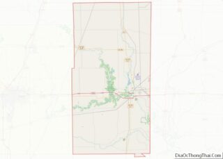
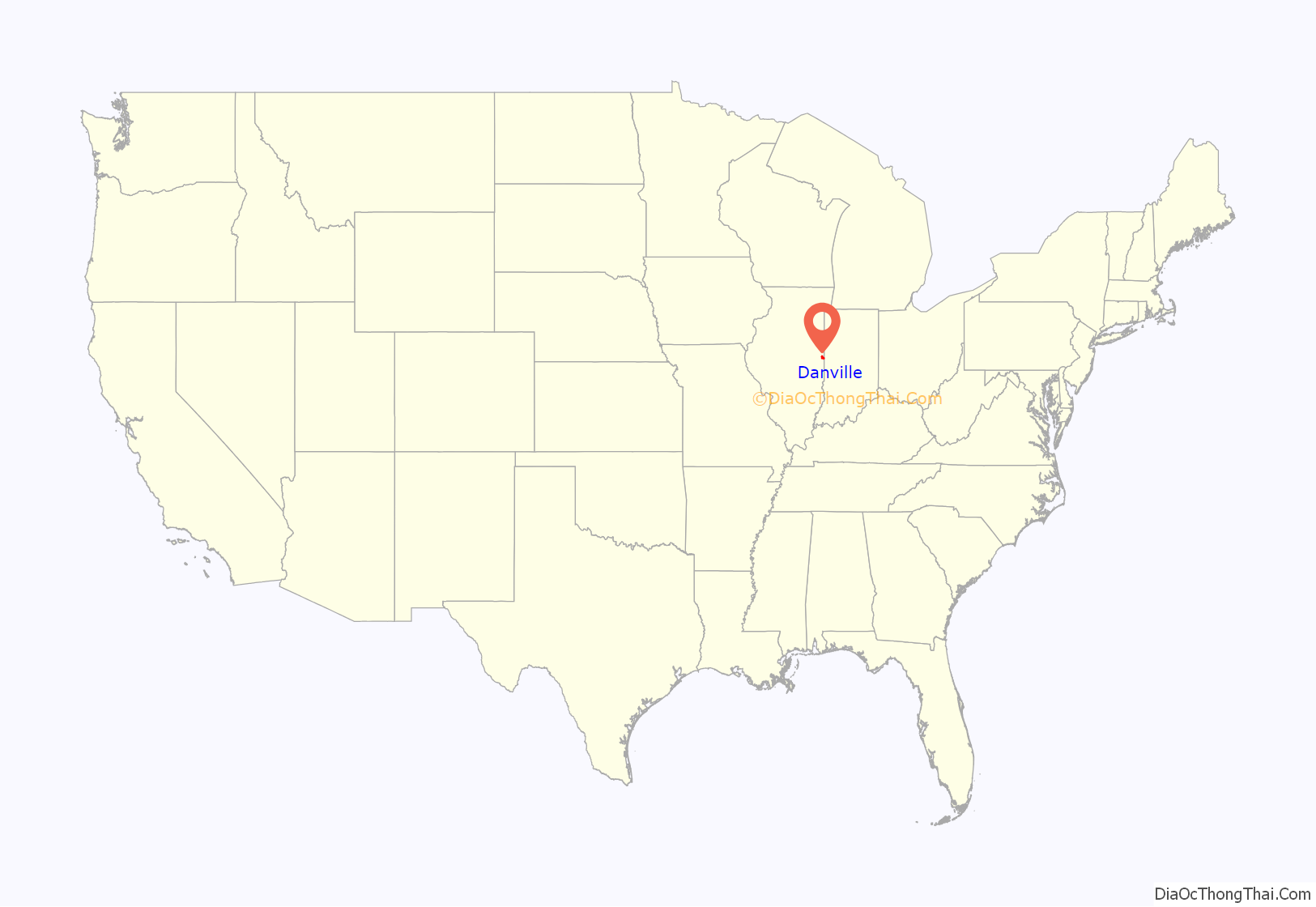
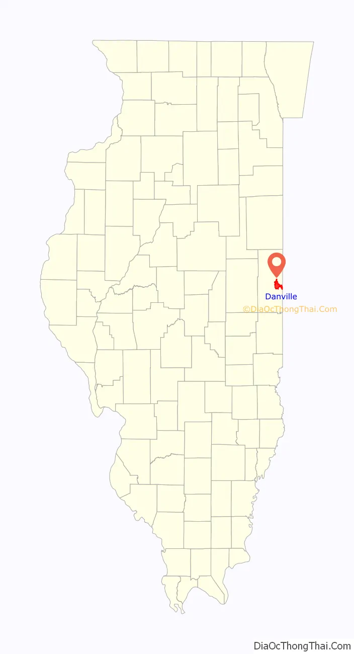
Danville location map. Where is Danville city?
History
The area that is now Danville was once home to the Miami, Kickapoo, and Potawatomi tribes of Native Americans. Danville was founded in 1827 on 60 acres (240,000 m) of land donated by Guy W. Smith and 20 acres (81,000 m) donated by Dan W. Beckwith. The sale of lots was set for April 10, 1827 and advertised in newspapers in Indianapolis, Indiana and the state capital of Vandalia. The first post office was established in May of the same year in the house of Amos Williams, organizer of Vermilion and Edgar Counties and a prominent Danville citizen. Williams and Beckwith drew up the first plat map; the city was named after Dan Beckwith at Williams’ suggestion, although Beckwith suggested the names “Williamsburg” and “Williamstown”. Beckwith was born in Pennsylvania in 1795 and moved to Indiana as a young man; in 1819 he accompanied the first white explorers to the area where Danville later existed because of his interest in the salt springs of the Vermilion River. He died in 1835 of pneumonia contracted on a horseback ride back from Washington; he was 40 years old.
In 1838 the Potawatomi Trail of Death camped and then passed through Danville. Four Potawatomi people died and were buried in Danville. In the mid-1800s Abraham Lincoln visited Danville over the course of approximately 18 years as he practiced law across the 8th Judicial Circuit. Danville was home to Ward Hill Lamon his law partner who later served as his bodyguard. Lincoln later gave a speech in his stocking feet from the balcony of Dr. William Fithian, a prominent Danville physician. The Fithian home is listed on the National Register of Historic Places and serves as the Vermilion County Museum. In 1882, a small group of Franciscan Sisters formed St. Elizabeth Hospital out of a 14-room hotel. In 1883 a horsecar based streetcar was established. In 1884 an opera house was constructed. In 1891 the streetcar system was converted to electric streetcars.
Danville became a major industrial city in the late 19th and early twentieth centuries. Starting in the 1850s Danville was an important coal mining area; some of the first open pit mining techniques were practiced here. The coal formation underlying eastern Illinois and western Indiana is named the “Danville Member,” after the area where it was first discovered. Danville also served as a significant manufacturing center during the early 1900s, and the city’s population doubled between 1900 and 1920. During this time Danville also acted as a rail hub for both passenger and freight service. Danville was the site of a riot in 1903, which led to the lynching of a black man and an assault on the county jail.
The Danville Branch of the National Home for Disabled Volunteer Soldiers opened in 1898 and, by 1910, 4,257 veterans were at the branch. This branch was the eighth of ten branches founded by the National Home for Disabled Volunteer Soldiers (NHDVS), nationwide, between 1866 and 1929. The Soldiers’ Home was a major center in-itself with its own passenger train service, streetcar line, mess hall, farms, livestock, lake, jail, hospital, bakery, laundry stables, stores, theater, chapel, mortuary, office buildings, power plant, print shop, shoemakers, tinsmiths, barber shop and fire department. The first Danville Public Library was formed out of various existing collections in 1883 and was replaced by a Carnegie library in 1904. In 1910, a group of 9 elephants escaped from a Ringling circus and ran through Danville before being recaptured.
An extension University of Illinois was created in Danville in 1946. The extension became an independent junior college in 1949. The college, now called Danville Area Community College, acquired several historic buildings from the Veterans Administration which were renovated throughout the 1960s for educational purposes. These acquisitions placed the college on a larger campus shared with the National Cemetery and modernized Veteran’s Hospital. In the 1970s the enclosed Village Mall was constructed.
By 1966 only 6 mines remained in Vermilion County. With the closure of the mines and many factories, including a major General Motors plant, Danville’s economic base suffered in the latter half of the 20th century and the population began to decline significantly. Many of the former mines were converted into lakes, creating fishing and recreation opportunities at parks such as Kickapoo State Recreation Area and Kennekuk Cove County Park. The 21st century has seen continued population decline but also major economic development initiatives including the restoration of the Fisher Theatre, expansion of major health care facilities, and the expansion of educational programs focused on job placement.
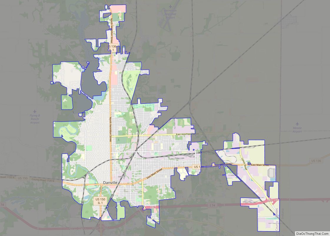
Danville Road Map
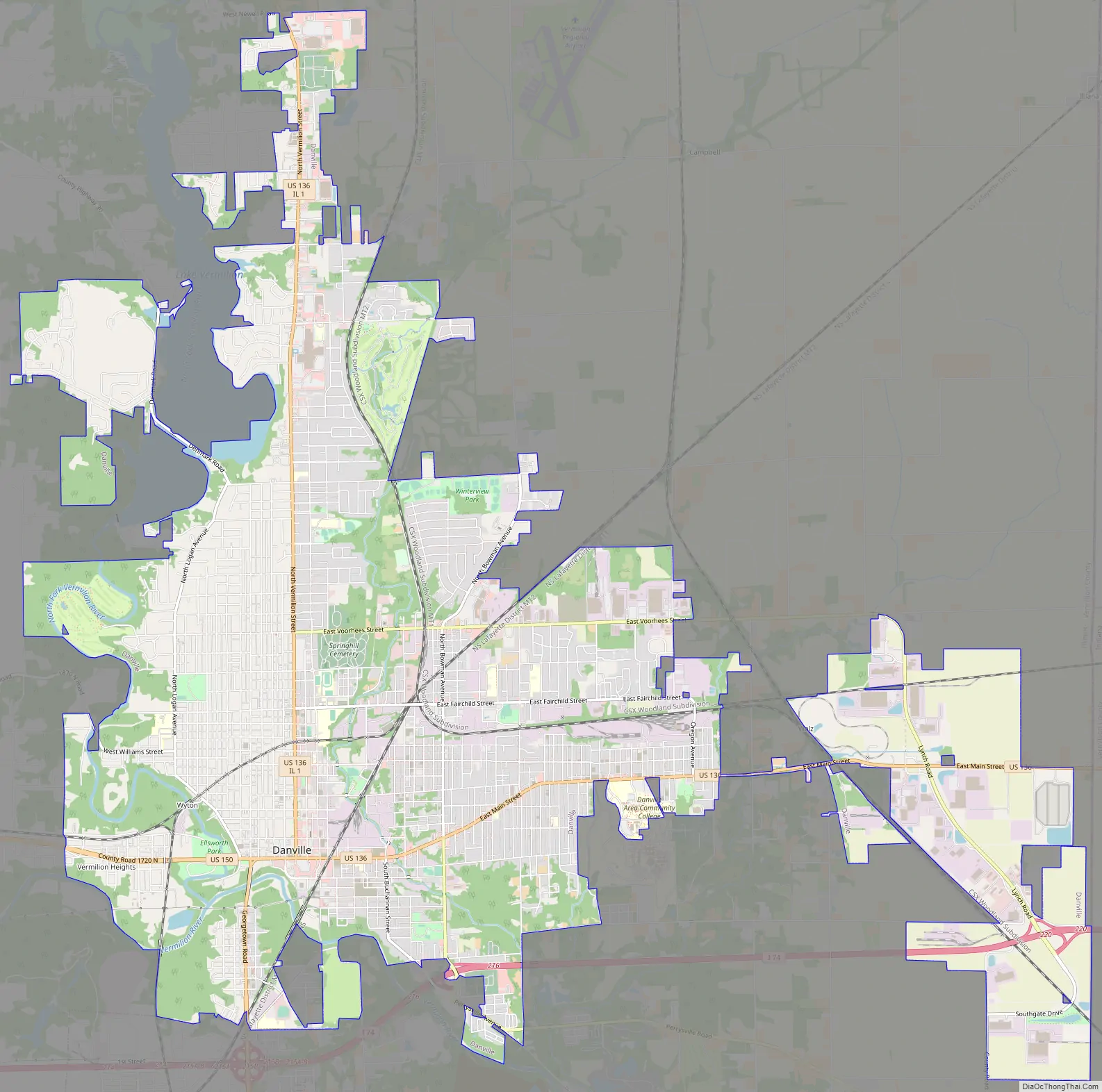
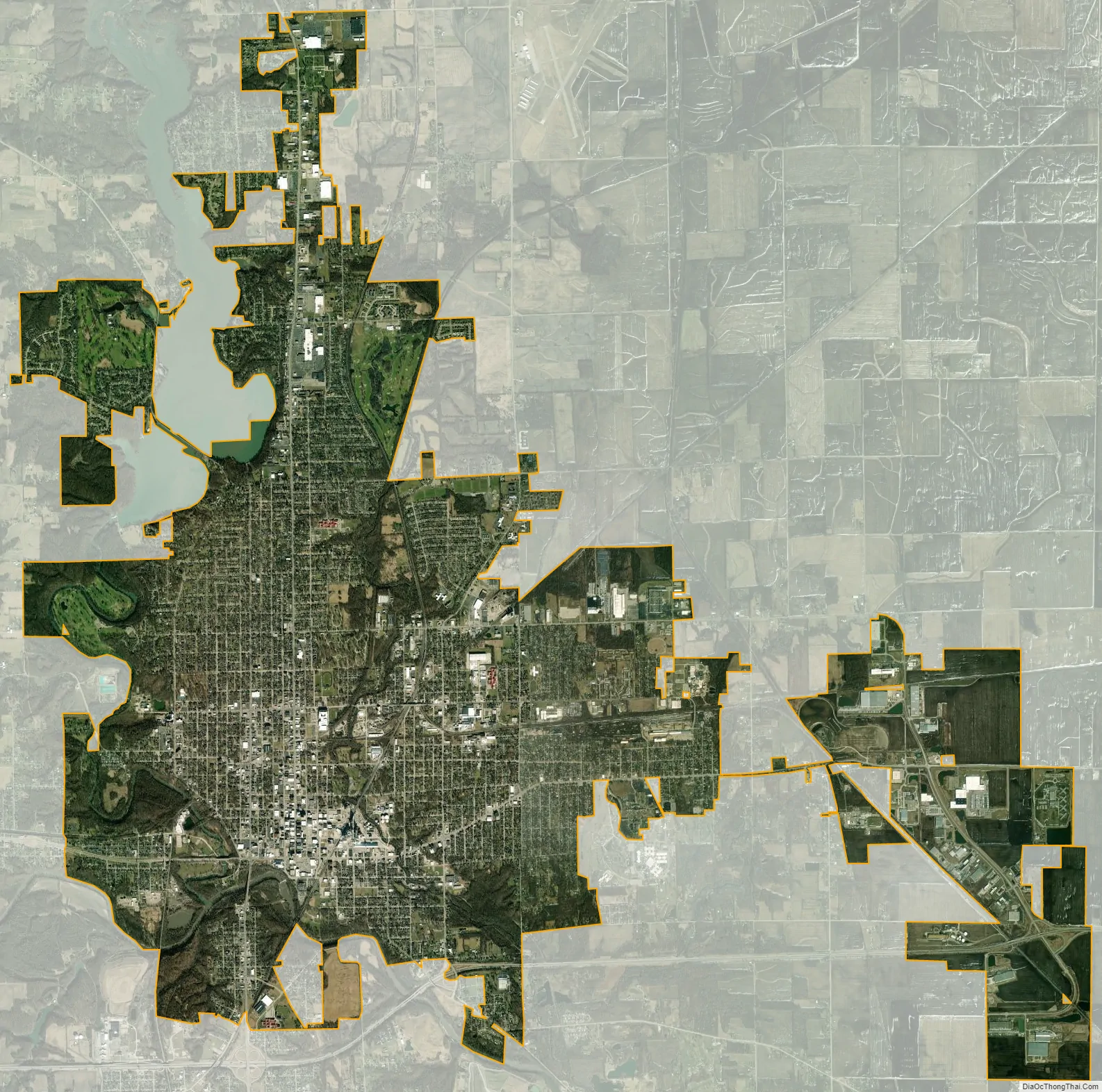
Danville city Satellite Map
Geography
Danville is located approximately 120 miles (190 km) south of Chicago, 35 miles (56 km) east of Champaign-Urbana, and 90 miles (140 km) west of Indianapolis, Indiana. Illinois Route 1, U.S. Route 136, and U.S. Route 150 intersect in Danville; Interstate 74 passes through the south end of town. Lake Vermilion is located on the northwest side of town.
According to the 2010 census, Danville has a total area of 17.967 square miles (46.53 km), of which 17.89 square miles (46.33 km) (or 99.57%) is land and 0.077 square miles (0.20 km) (or 0.43%) is water.
Climate
In recent years, average temperatures in Danville have ranged from a low of 17 °F (−8 °C) in January to a high of 86 °F (30 °C) in July, although a record low of −26 °F (−32 °C) was recorded in January 1994 and a record high of 112 °F (44 °C) was recorded in July 1936. Average monthly precipitation ranged from 1.99 inches (51 mm) inches in February to 4.70 inches (119 mm) inches in June.
See also
Map of Illinois State and its subdivision:- Adams
- Alexander
- Bond
- Boone
- Brown
- Bureau
- Calhoun
- Carroll
- Cass
- Champaign
- Christian
- Clark
- Clay
- Clinton
- Coles
- Cook
- Crawford
- Cumberland
- De Kalb
- De Witt
- Douglas
- Dupage
- Edgar
- Edwards
- Effingham
- Fayette
- Ford
- Franklin
- Fulton
- Gallatin
- Greene
- Grundy
- Hamilton
- Hancock
- Hardin
- Henderson
- Henry
- Iroquois
- Jackson
- Jasper
- Jefferson
- Jersey
- Jo Daviess
- Johnson
- Kane
- Kankakee
- Kendall
- Knox
- La Salle
- Lake
- Lake Michigan
- Lawrence
- Lee
- Livingston
- Logan
- Macon
- Macoupin
- Madison
- Marion
- Marshall
- Mason
- Massac
- McDonough
- McHenry
- McLean
- Menard
- Mercer
- Monroe
- Montgomery
- Morgan
- Moultrie
- Ogle
- Peoria
- Perry
- Piatt
- Pike
- Pope
- Pulaski
- Putnam
- Randolph
- Richland
- Rock Island
- Saint Clair
- Saline
- Sangamon
- Schuyler
- Scott
- Shelby
- Stark
- Stephenson
- Tazewell
- Union
- Vermilion
- Wabash
- Warren
- Washington
- Wayne
- White
- Whiteside
- Will
- Williamson
- Winnebago
- Woodford
- Alabama
- Alaska
- Arizona
- Arkansas
- California
- Colorado
- Connecticut
- Delaware
- District of Columbia
- Florida
- Georgia
- Hawaii
- Idaho
- Illinois
- Indiana
- Iowa
- Kansas
- Kentucky
- Louisiana
- Maine
- Maryland
- Massachusetts
- Michigan
- Minnesota
- Mississippi
- Missouri
- Montana
- Nebraska
- Nevada
- New Hampshire
- New Jersey
- New Mexico
- New York
- North Carolina
- North Dakota
- Ohio
- Oklahoma
- Oregon
- Pennsylvania
- Rhode Island
- South Carolina
- South Dakota
- Tennessee
- Texas
- Utah
- Vermont
- Virginia
- Washington
- West Virginia
- Wisconsin
- Wyoming