Aiea (/aɪˈeɪə/; Hawaiian: ʻAiea, pronounced [ʔɐjˈɛjə]) is a census-designated place (CDP) located in the City and County of Honolulu, Hawaii, United States. As of the 2010 Census, the CDP had a total population of 9,338.
| Name: | Aiea CDP |
|---|---|
| LSAD Code: | 57 |
| LSAD Description: | CDP (suffix) |
| State: | Hawaii |
| County: | Honolulu County |
| Elevation: | 249 ft (76 m) |
| Total Area: | 1.77 sq mi (4.58 km²) |
| Land Area: | 1.66 sq mi (4.30 km²) |
| Water Area: | 0.11 sq mi (0.28 km²) |
| Total Population: | 10,408 |
| Population Density: | 6,266.10/sq mi (2,419.39/km²) |
| ZIP code: | 96701 |
| Area code: | 808 |
| FIPS code: | 1500550 |
| GNISfeature ID: | 2413992 |
Online Interactive Map
Click on ![]() to view map in "full screen" mode.
to view map in "full screen" mode.
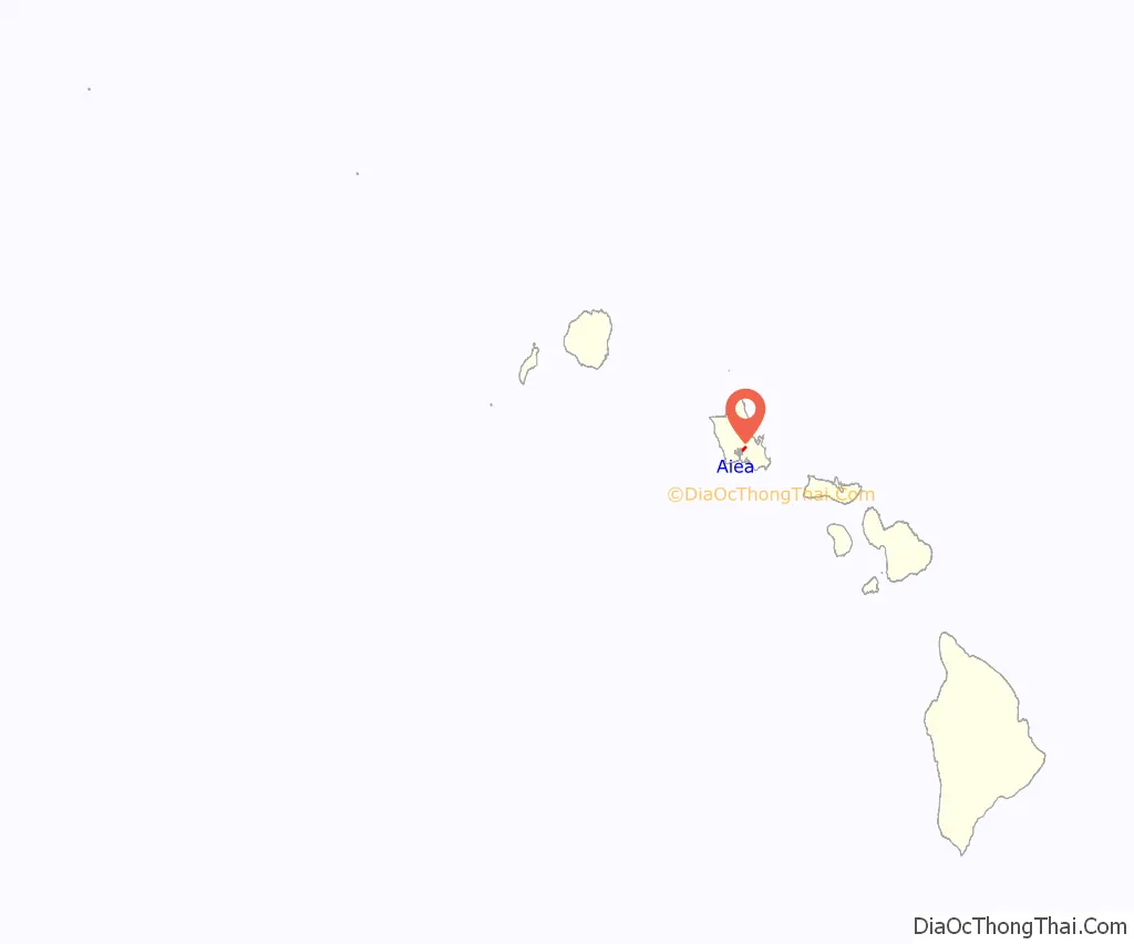
Aiea location map. Where is Aiea CDP?
History
“ʻAiea” was originally the name of an ahupuaʻa, or Hawaiian land division. The name was derived from a species of plant in the nightshade family, Nothocestrum latifolium. It stretched from ʻAiea Bay (part of Pearl Harbor) into the mountains to the north. At the end of the 19th century, a sugarcane plantation was opened in the district by the Honolulu Plantation Company.
In July 1941, five months before the attack on Pearl Harbor, Commander Thomas C Latimore from USS Dobbin, vanished while walking in the hills above Aiea. Despite several major searches and a naval investigation, his disappearance has never been explained. Within the U.S. Navy, many believed he might have been abducted and killed by a local Hawaiian Japanese spy ring because he had either stumbled upon their activities in the hills or had been specifically targeted because of his background in Naval Intelligence.
On December 7, 1941, a large part of the Japanese attack focused on the military installations around the town and the ships moored off shore. For example, one damaged ship, USS Vestal, beached in Aiea Bay to prevent sinking. Many people photographed the attack from the hills in Aiea. Part of Naval Base Hawaii was built in Aiea, including the Aiea Naval Hospital and the Nimitz Bowl.
After World War II the plantation shut down and the mill was converted into a sugar refinery. Meanwhile, developers started extending the town into the surrounding former sugarcane fields. In the years since then, Aiea has grown into an important suburb of Honolulu. The town’s sugar history came to a close in 1996, when C&H Sugar closed the refinery. Then in 1998, the 99-year-old sugar mill was torn down by the owners, amid protests from town residents and the County government.
Singer and actress Bette Midler was raised in Aiea.
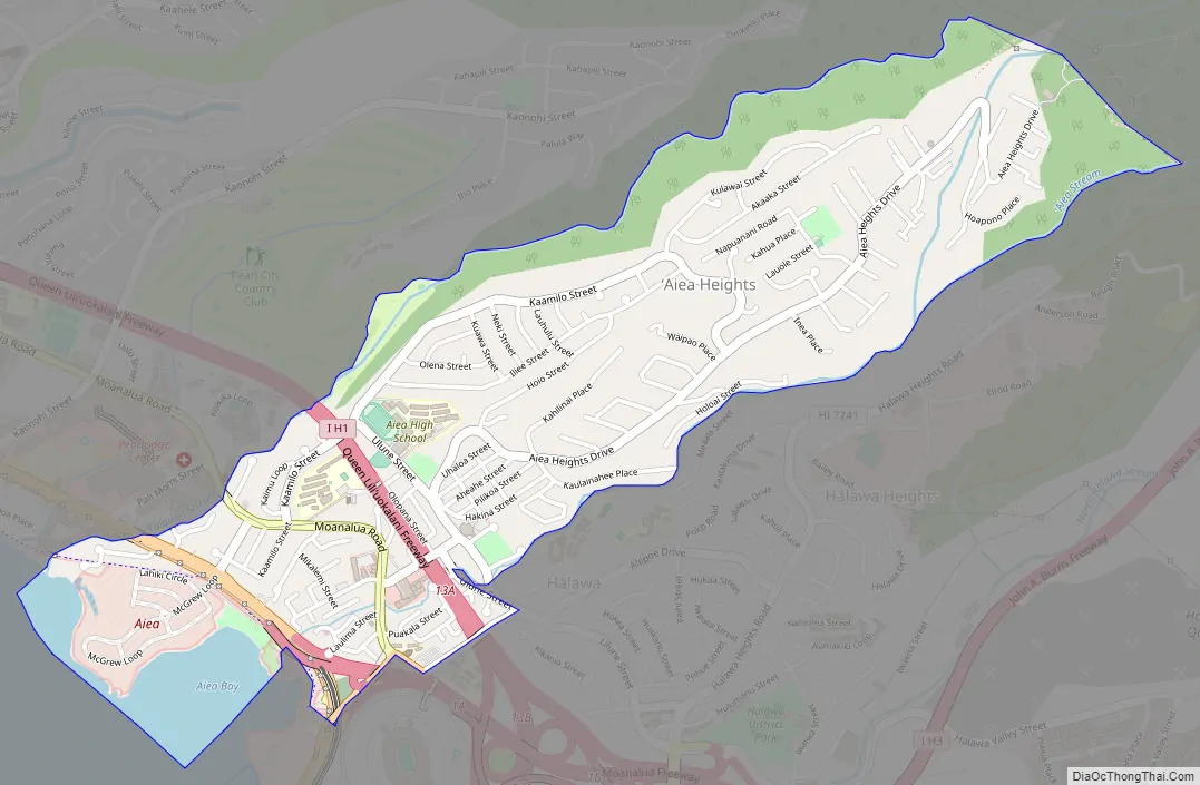
Aiea Road Map
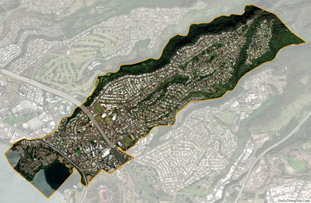
Aiea city Satellite Map
Geography
Aiea is located at 21°23′9″N 157°55′51″W / 21.38583°N 157.93083°W / 21.38583; -157.93083 (21.385900, −157.930927). According to the United States Census Bureau, the CDP has a total area of 1.8 square miles (4.7 km), of which, 1.6 square miles (4.1 km) of it is land and 0.1 square miles (0.26 km) of it (5.71%) is water.
Kamehameha Highway (Hawaii Route 99) divides most of Aiea from the shore of Pearl Harbor (mostly US government property), and the parallel major thoroughfare, Interstate H-1, further cuts the town’s commercial district into two distinct areas. These east–west routes (and other streets, such as Moanalua Road) connect Aiea to Pearl City, immediately adjacent on the west, and Halawa, adjacent on the east. The residential area known as Aiea Heights extends up the ridgeline above the town. The communities of Newtown Estates and Royal Summit are located at the western edge of Aiea near its border with Pearl City at Kaahumanu Street. Residents of the census-designated places (CDP) of Waimalu and Hālawa use Aiea in their postal address.
See also
Map of Hawaii State and its subdivision: Map of other states:- Alabama
- Alaska
- Arizona
- Arkansas
- California
- Colorado
- Connecticut
- Delaware
- District of Columbia
- Florida
- Georgia
- Hawaii
- Idaho
- Illinois
- Indiana
- Iowa
- Kansas
- Kentucky
- Louisiana
- Maine
- Maryland
- Massachusetts
- Michigan
- Minnesota
- Mississippi
- Missouri
- Montana
- Nebraska
- Nevada
- New Hampshire
- New Jersey
- New Mexico
- New York
- North Carolina
- North Dakota
- Ohio
- Oklahoma
- Oregon
- Pennsylvania
- Rhode Island
- South Carolina
- South Dakota
- Tennessee
- Texas
- Utah
- Vermont
- Virginia
- Washington
- West Virginia
- Wisconsin
- Wyoming


