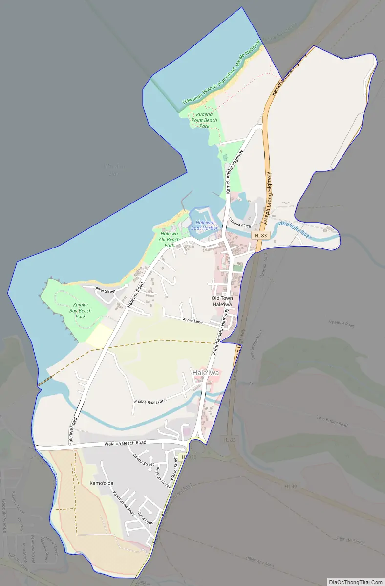
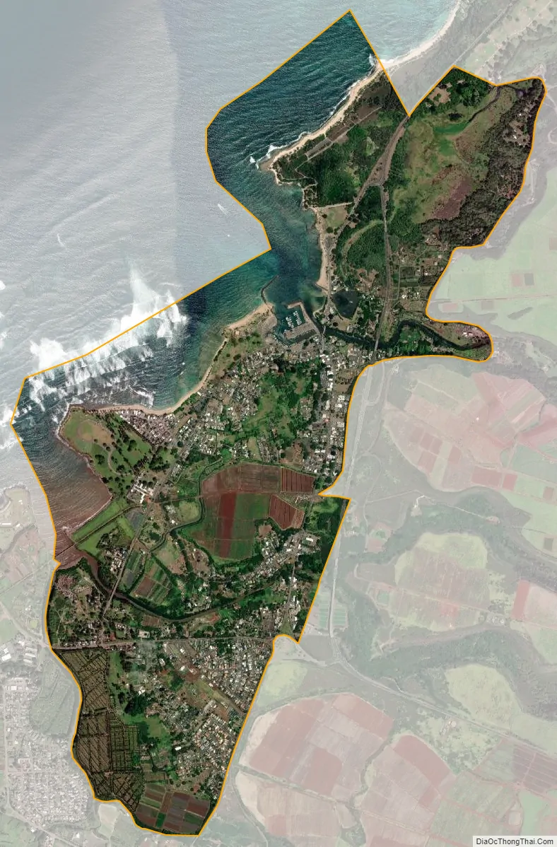
Haleʻiwa (Hawaiian pronunciation: [həleˈʔivə]) is a North Shore community and census-designated place (CDP) in the Waialua District of the island of Oʻahu, City and County of Honolulu. Haleʻiwa is located on Waialua Bay, the mouth of Anahulu Stream (also known as Anahulu River). A small boat harbor is located here, and the shore of the bay is surrounded by Haleʻiwa Beach Park (north side) and Haleʻiwa Aliʻi Beach Park (south side). Further west from the center of town is Kaiaka State Recreation Area on Kiaka Point beside Kaiaka Bay. As of the 2020 census, the CDP had a population of 4,941. The 2018 estimate was 4,040. It is the largest commercial center on the North Shore of the island. Its old plantation town character is preserved in many of the buildings, making this a popular destination for tourists and residents alike, visiting surfing and diving sites along the north shore.
The U.S. postal code for Haleʻiwa, including Kawailoa, is 96712.
| Name: | Haleiwa CDP |
|---|---|
| LSAD Code: | 57 |
| LSAD Description: | CDP (suffix) |
| State: | Hawaii |
| County: | Honolulu County |
| Elevation: | 12 ft (4 m) |
| Total Area: | 5.18 sq mi (13.41 km²) |
| Land Area: | 3.08 sq mi (7.97 km²) |
| Water Area: | 2.10 sq mi (5.44 km²) |
| Total Population: | 4,941 |
| Population Density: | 1,605.26/sq mi (619.72/km²) |
| ZIP code: | 96712 |
| Area code: | 808 |
| FIPS code: | 1510750 |
| GNISfeature ID: | 0358941 |
Online Interactive Map
Click on ![]() to view map in "full screen" mode.
to view map in "full screen" mode.
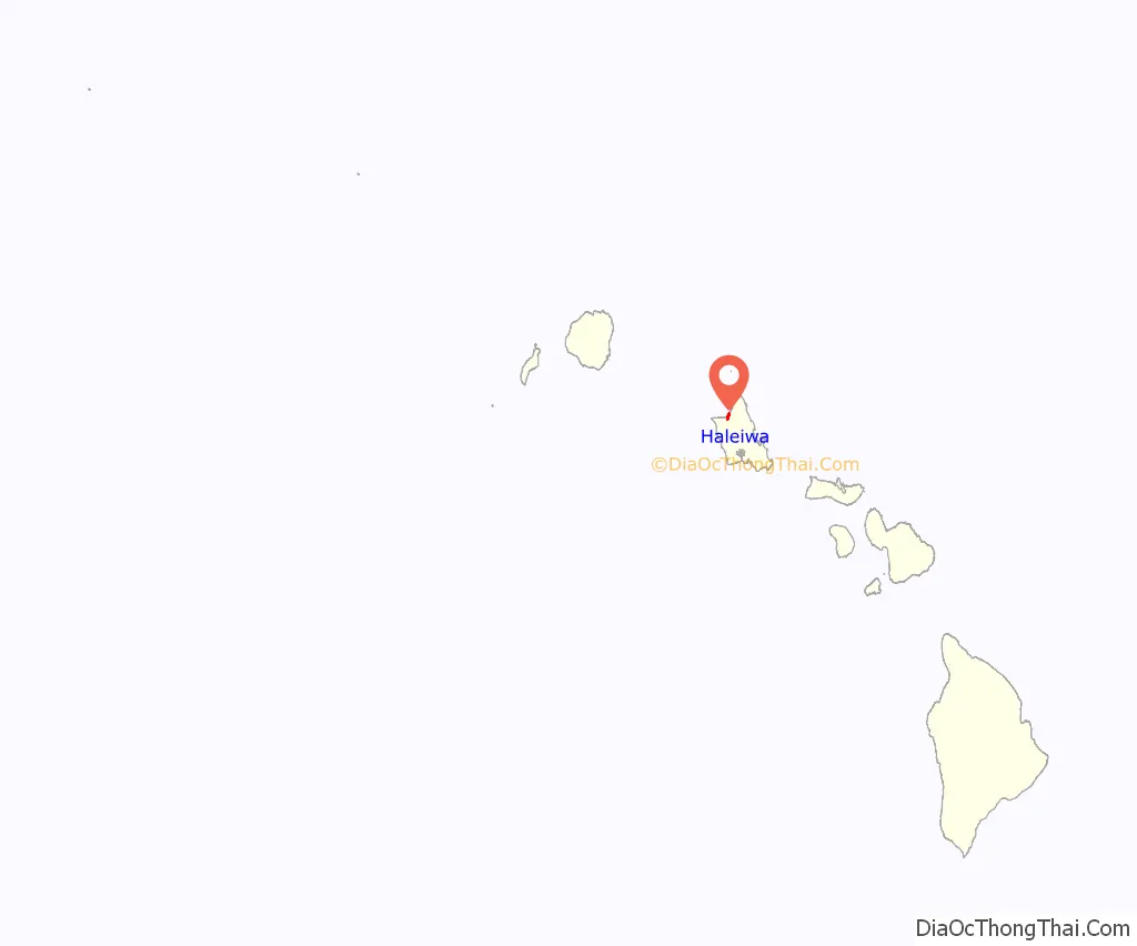
Haleiwa location map. Where is Haleiwa CDP?
History
In 1898 a businessman named Benjamin Dillingham opened a hotel in the North Shore area and named it Haleʻiwa. In the Hawaiian language, hale means “house”, and the ʻiwa is a frigatebird. He also built a railway line from Honolulu to Waialua along the west coast around Kaena Point, which opened the same year and ended in front of his hotel. The railroad inaugurated a passenger train, the Haleiwa Limited, which took two hours for this trip. This railroad was chartered as the Oahu Railway & Land Company.
Haleʻiwa was designated a State Historic, Cultural and Scenic District in 1984 by the City and County of Honolulu. All new buildings must adhere to a design plan that reflects the territorial architecture of Haleʻiwa’s earlier sugar industry period. The town is home to 30 historic buildings featuring plantation architectural styles influenced by the Waialua Sugar Co.
Haleiwa Road Map
Haleiwa city Satellite Map
Geography
Haleʻiwa is located at 21°35’24” North, 158°6’50” West (21.590050, -158.113928), southwest along Kamehameha Highway (State route 83) from Pūpūkea. At Haleʻiwa, Kamehameha Highway becomes state route 99 (at the traffic circle known as “Weed Circle”), which runs eastward up across the Oʻahu central plateau to Wahiawā. A new bypass route (Joseph P. Leong Highway) avoids both the traffic circle and Haleʻiwa, extending state route 83 to just north of Haleʻiwa town. Haleʻiwa Road and both Kaukonahua Road and Waialua Beach Road from Weed Circle go south and southwest into Waialua across Paukauila Stream.
The historic Rainbow Bridge over the Anahulu River marks the northern entrance to old Haleiwa Town. There you will find small shops, eateries and many galleries. Two beach parks surround the small boat harbor located in Waialua Bay, Haleiwa Beach Park located to the north and Haleiwa Alii Beach Park located to the south.
According to the United States Census Bureau, the CDP has a total area of 3.0 square miles (7.7 km). 2.3 square miles (5.9 km) of it is land, and 0.69 square miles (1.8 km) of it is water. The total area is 23.67% water.
See also
Map of Hawaii State and its subdivision: Map of other states:- Alabama
- Alaska
- Arizona
- Arkansas
- California
- Colorado
- Connecticut
- Delaware
- District of Columbia
- Florida
- Georgia
- Hawaii
- Idaho
- Illinois
- Indiana
- Iowa
- Kansas
- Kentucky
- Louisiana
- Maine
- Maryland
- Massachusetts
- Michigan
- Minnesota
- Mississippi
- Missouri
- Montana
- Nebraska
- Nevada
- New Hampshire
- New Jersey
- New Mexico
- New York
- North Carolina
- North Dakota
- Ohio
- Oklahoma
- Oregon
- Pennsylvania
- Rhode Island
- South Carolina
- South Dakota
- Tennessee
- Texas
- Utah
- Vermont
- Virginia
- Washington
- West Virginia
- Wisconsin
- Wyoming


