Hauʻula (Hawaiian pronunciation: [hɐwˈʔulə]) is a census-designated place and rural community in the Koʻolauloa District on the island of Oʻahu, City & County of Honolulu. In Hawaiian, hauʻula means “red hau” (hau is a type of tree: Hibiscus tiliaceus). There is a small commercial center. As of the 2020 census, the CDP population was 4,018.
A fringing reef extends off the shoreline. There are several beaches and beach parks in Hauʻula, including Hauʻula Beach Park, ʻAukai Beach Park, Kokololio Beach Park, and Mahakea Beach. Sugarcane was once grown along the narrow coastal plain inland from the highway.
The U.S. postal code for Hauʻula is 96717. There is a two-bay fire station located on Kamehameha Highway.
| Name: | Hauula CDP |
|---|---|
| LSAD Code: | 57 |
| LSAD Description: | CDP (suffix) |
| State: | Hawaii |
| County: | Honolulu County |
| Elevation: | 7 ft (2 m) |
| Total Area: | 1.93 sq mi (5.00 km²) |
| Land Area: | 1.16 sq mi (3.00 km²) |
| Water Area: | 0.77 sq mi (2.00 km²) |
| Total Population: | 4,018 |
| Population Density: | 3,469.78/sq mi (1,340.02/km²) |
| ZIP code: | 96717 |
| Area code: | 808 |
| FIPS code: | 1512400 |
| GNISfeature ID: | 0359116 |
Online Interactive Map
Click on ![]() to view map in "full screen" mode.
to view map in "full screen" mode.
Hauula location map. Where is Hauula CDP?

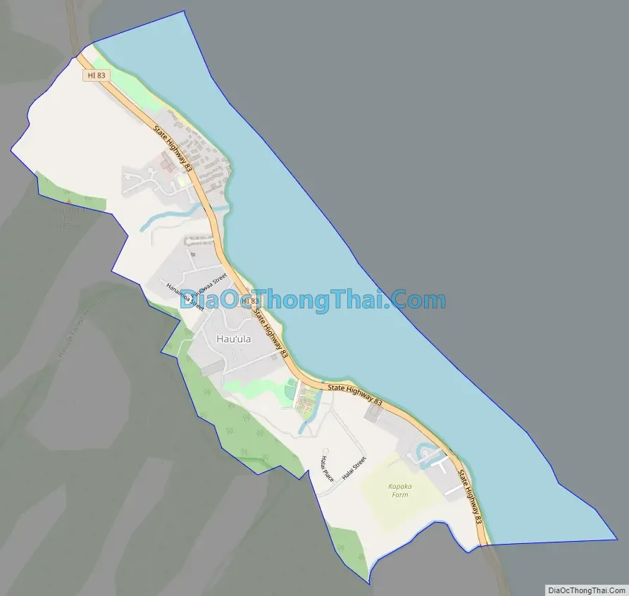
Hauula Road Map
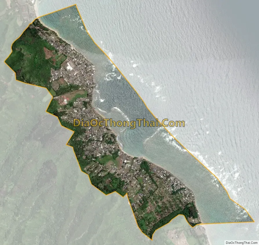
Hauula city Satellite Map
Geography
Hauʻula is located at 21°36′50″N 157°54′49″W / 21.61389°N 157.91361°W / 21.61389; -157.91361 (21.613850, -157.913543). The town is located north of Punaluʻu and south of Lāʻie along Kamehameha Highway (State Rte. 83).
According to the United States Census Bureau, Hauʻula has a total area of 1.9 square miles (5.0 km). 1.2 square miles (3.0 km) of it is land, and 0.77 square miles (2.0 km) of it, or 40.56%, is water, referring to a part of the Pacific Ocean included in the census tract.
There are also hiking trails in Hauʻula. The 2.5 mile Hauʻula Loop trail that wraps along the side of the mountain, providing views of the coast and protecting reef. The trail head is also shared with the Ma’akau Gulch and the Ma’akau Ridge hikes.
Climate
See also
Map of Hawaii State and its subdivision: Map of other states:- Alabama
- Alaska
- Arizona
- Arkansas
- California
- Colorado
- Connecticut
- Delaware
- District of Columbia
- Florida
- Georgia
- Hawaii
- Idaho
- Illinois
- Indiana
- Iowa
- Kansas
- Kentucky
- Louisiana
- Maine
- Maryland
- Massachusetts
- Michigan
- Minnesota
- Mississippi
- Missouri
- Montana
- Nebraska
- Nevada
- New Hampshire
- New Jersey
- New Mexico
- New York
- North Carolina
- North Dakota
- Ohio
- Oklahoma
- Oregon
- Pennsylvania
- Rhode Island
- South Carolina
- South Dakota
- Tennessee
- Texas
- Utah
- Vermont
- Virginia
- Washington
- West Virginia
- Wisconsin
- Wyoming


