Kahuku (Hawaiian pronunciation: [kəˈhuku]) is a census-designated place (CDP) in Honolulu, Hawaii, United States. In the Hawaiian language, ka huku means “the projection”, presumably a reference to Kahuku Point nearby, the northernmost point of land on the island of Oahu. As of the 2010 Census, Kahuku had a population of 2,614.
| Name: | Kahuku CDP |
|---|---|
| LSAD Code: | 57 |
| LSAD Description: | CDP (suffix) |
| State: | Hawaii |
| County: | Honolulu County |
| Elevation: | 15 ft (5 m) |
| Total Area: | 2.31 sq mi (5.97 km²) |
| Land Area: | 0.96 sq mi (2.49 km²) |
| Water Area: | 1.34 sq mi (3.48 km²) |
| Total Population: | 2,852 |
| Population Density: | 2,961.58/sq mi (1,143.39/km²) |
| ZIP code: | 96731 |
| Area code: | 908 |
| FIPS code: | 1522250 |
| GNISfeature ID: | 0359833 |
Online Interactive Map
Click on ![]() to view map in "full screen" mode.
to view map in "full screen" mode.
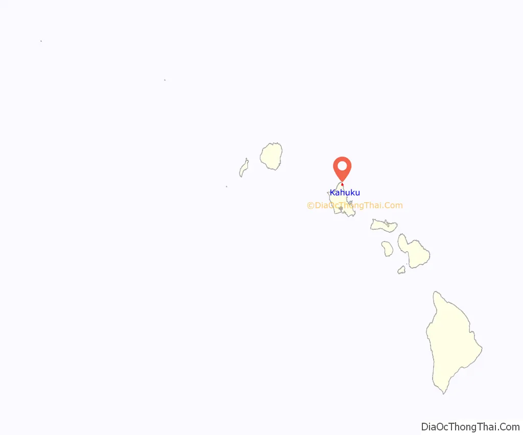
Kahuku location map. Where is Kahuku CDP?
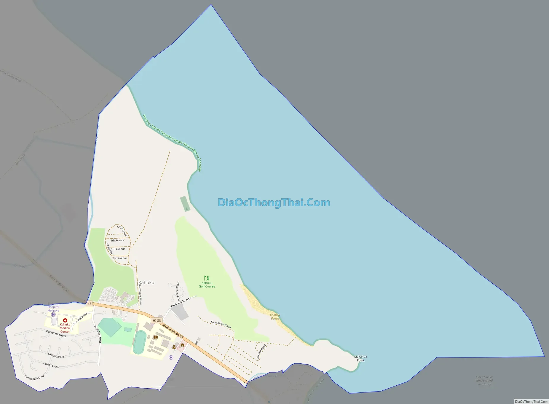
Kahuku Road Map
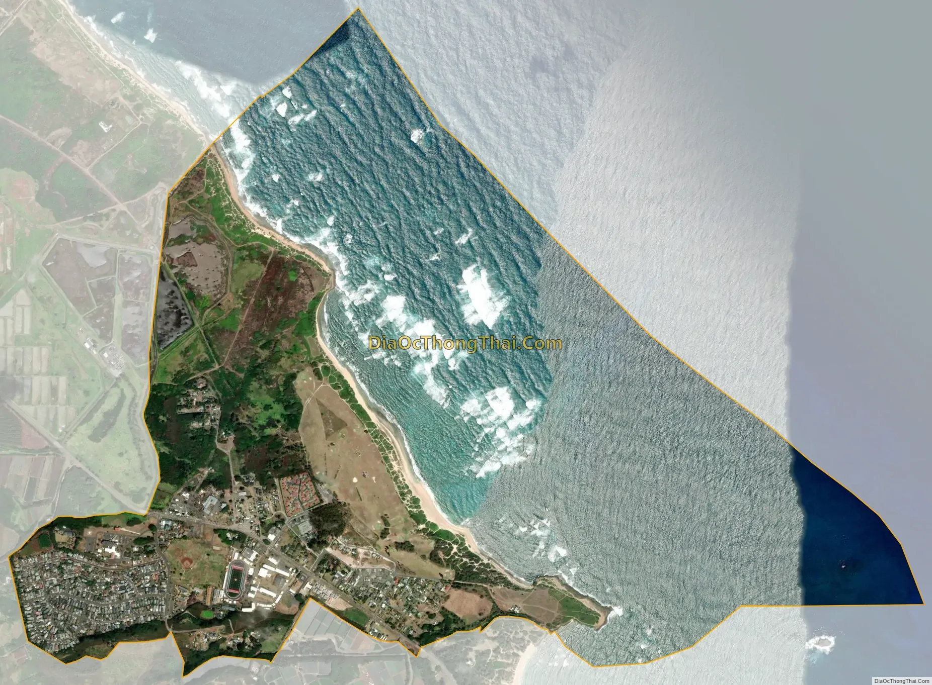
Kahuku city Satellite Map
Geography
Kahuku is located at 21°40′49″N 157°57′1″W / 21.68028°N 157.95028°W / 21.68028; -157.95028. This community is located northwest from Laie and east from Kuilima and Kawela Bay along Kamehameha Highway (Route 83).
According to the United States Census Bureau, the CDP has a total area of 2.3 square miles (6.0 km), of which 1.0 square mile (2.6 km) is land and 1.3 square miles (3.4 km) is water. The total area is 57.46% water, the Pacific Ocean lying off the coast in the census tract.
Climate
See also
Map of Hawaii State and its subdivision: Map of other states:- Alabama
- Alaska
- Arizona
- Arkansas
- California
- Colorado
- Connecticut
- Delaware
- District of Columbia
- Florida
- Georgia
- Hawaii
- Idaho
- Illinois
- Indiana
- Iowa
- Kansas
- Kentucky
- Louisiana
- Maine
- Maryland
- Massachusetts
- Michigan
- Minnesota
- Mississippi
- Missouri
- Montana
- Nebraska
- Nevada
- New Hampshire
- New Jersey
- New Mexico
- New York
- North Carolina
- North Dakota
- Ohio
- Oklahoma
- Oregon
- Pennsylvania
- Rhode Island
- South Carolina
- South Dakota
- Tennessee
- Texas
- Utah
- Vermont
- Virginia
- Washington
- West Virginia
- Wisconsin
- Wyoming


