Kailua /kaɪˈluːə/ (Hawaiian pronunciation: [kɐjˈluwə]) is a census-designated place (CDP) in Honolulu County, Hawaii, United States. It lies in the Koʻolaupoko District of the island of Oʻahu on the windward coast at Kailua Bay. It is in the judicial district and the ahupua’a named Ko’olaupoko. It is 12 miles (19 km) northeast of Honolulu – over Nu‘uanu Pali.
In the Hawaiian language Kailua means “two seas” or “two currents”, a contraction of the words kai (meaning “sea” or “sea water”) and ʻelua (meaning “two”); it is so named because of the two former fishponds in the district (Kawainui and Kaʻelepulu) or the two currents that run through Kailua Bay.
Kailua is primarily a residential community, with a centralized commercial district along Kailua Road. The population was 50,000 in 1992. In 2017 census, the population had dropped to 38,000. The population was 40,514 at the 2020 census.
Places of note in Kailua include Kailua Beach Park, Kaʻōhao or Lanikai Beach, Kawainui Marsh, Maunawili Falls, and Marine Corps Base Hawaii. It was home to Barack Obama’s winter White House.
| Name: | Kailua CDP |
|---|---|
| LSAD Code: | 57 |
| LSAD Description: | CDP (suffix) |
| State: | Hawaii |
| County: | Honolulu County |
| Elevation: | 16 ft (5 m) |
| Total Area: | 10.59 sq mi (27.44 km²) |
| Land Area: | 7.77 sq mi (20.13 km²) |
| Water Area: | 2.82 sq mi (7.31 km²) |
| Total Population: | 40,514 |
| Population Density: | 5,212.82/sq mi (2,012.67/km²) |
| Area code: | 808 |
| FIPS code: | 1523150 |
| GNISfeature ID: | 359894 |
Online Interactive Map
Click on ![]() to view map in "full screen" mode.
to view map in "full screen" mode.
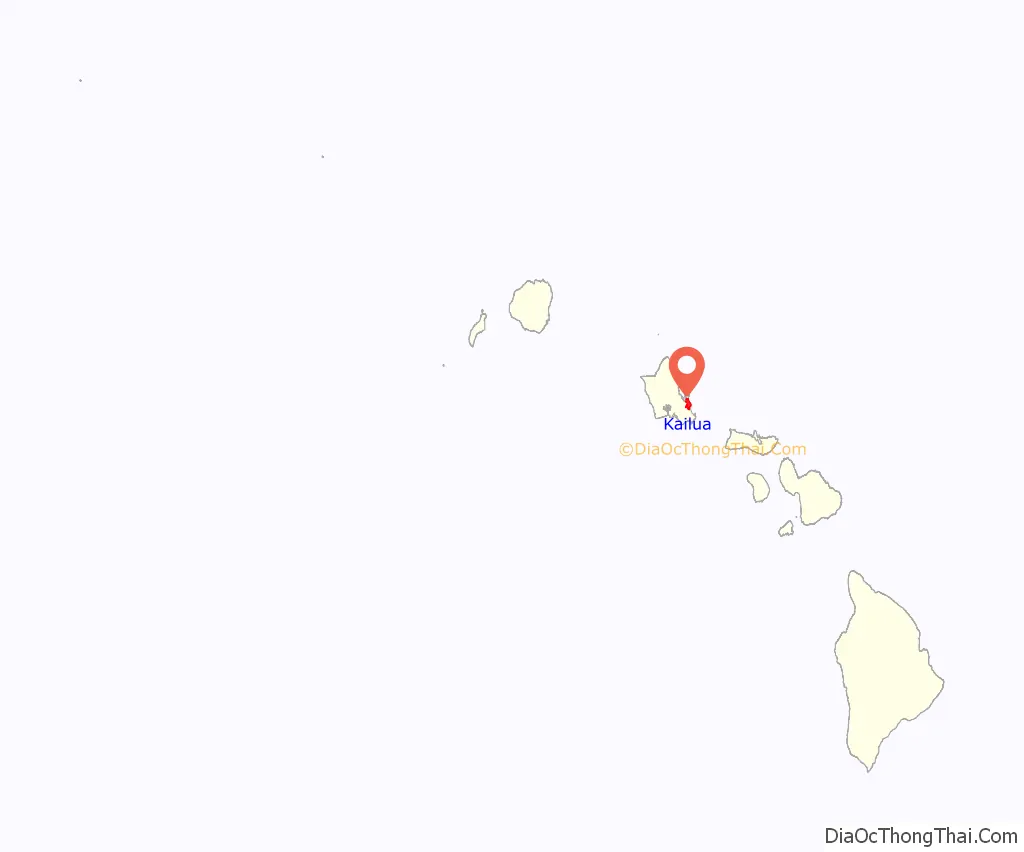
Kailua location map. Where is Kailua CDP?
History
Early history
During the reign of King Kākuhihewa and his successors, Kanekapu, Kahoowaha, Kauakahiakahoowaha, and Kualiʻi, Kailua replaced Waikiki as the residential seat of the Oʻahu Rulers (aliʻi nui of Oʻahu). Many ancient temple ruins, such as those at Ulupo Heiau State Historic Site, are in the area. After the Oʻahu army’s defeat by King Kamehameha the Great at the Battle of Nuʻuanu in 1795, the political capital and residential seat of the aliʻi nui of Oʻahu was relocated from Kailua to Honolulu.
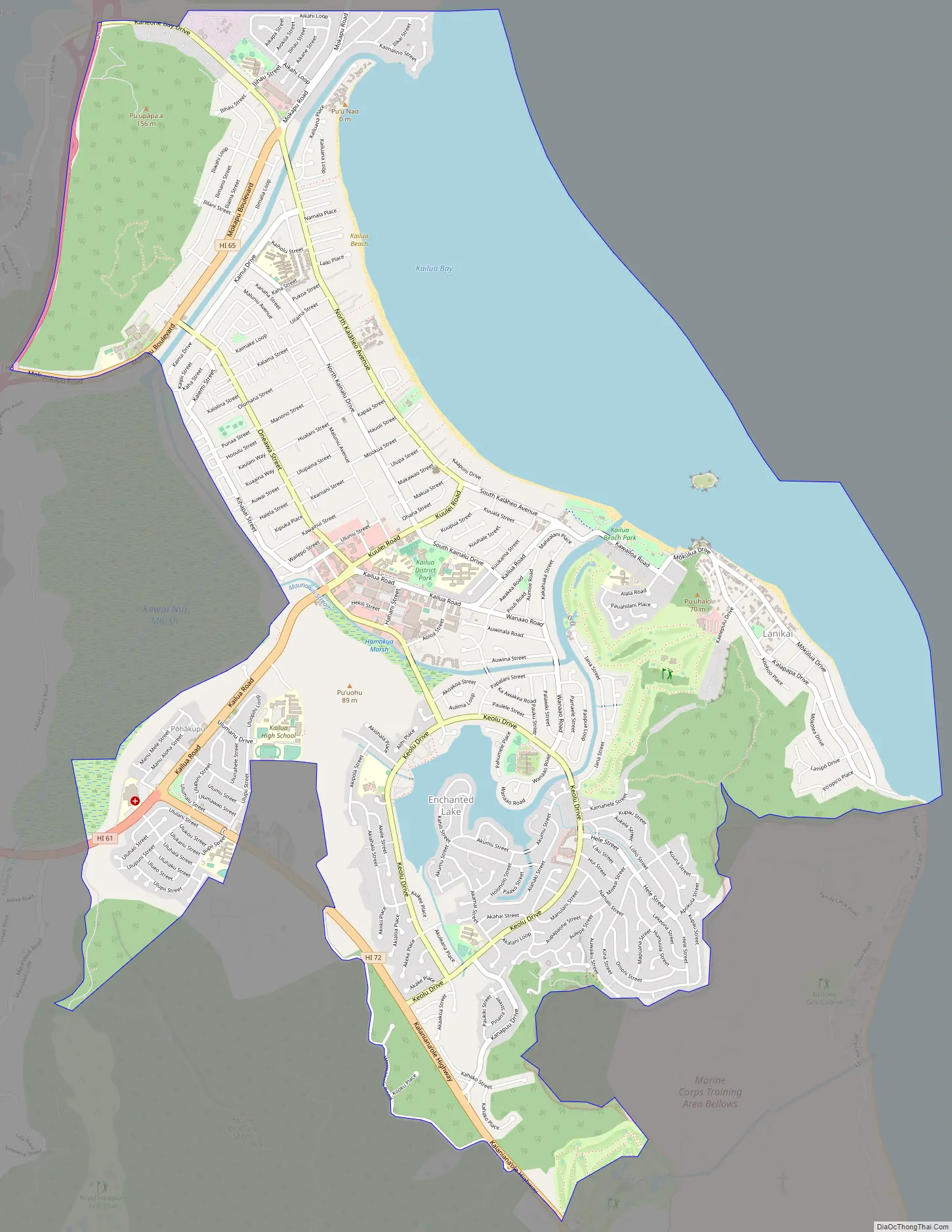
Kailua Road Map
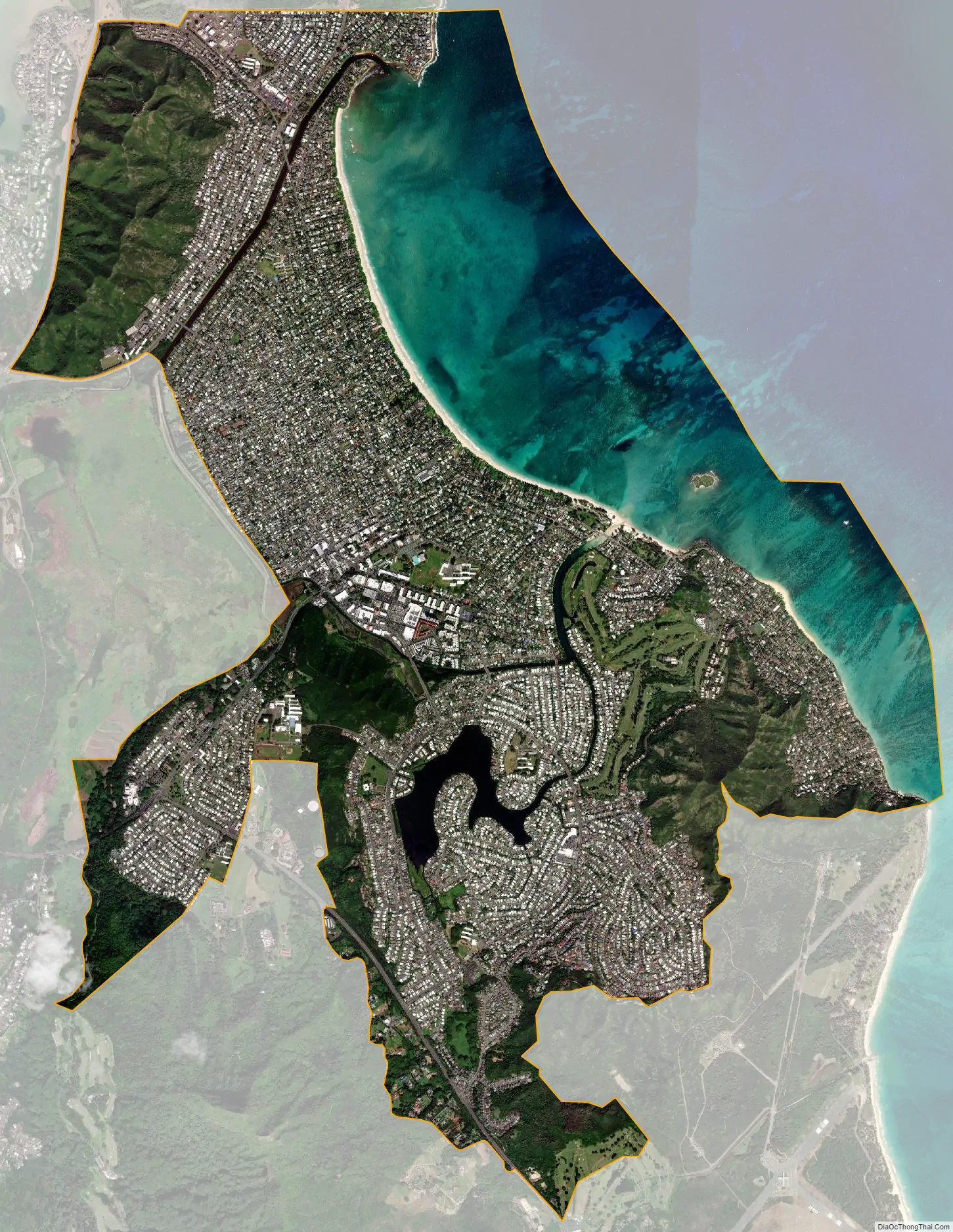
Kailua city Satellite Map
Geography
Kailua is located at 21°23′51″N 157°44′22″W / 21.39750°N 157.73944°W / 21.39750; -157.73944 (21.397370, −157.739515). Nearby towns include Kāneʻohe, Maunawili, and Waimānalo.
According to the United States Census Bureau, the CDP has an area of 10.6 square miles (27.4 km), of which 7.8 square miles (20.1 km) is land and 2.8 square miles (7.3 km) (26.62%) is water. A significant portion of the water area is Kawainui Marsh, the largest wetland in the Hawaiian Islands and a Ramsar Convention site.
Kaʻōhao/Lanikai
Kaʻōhao (pronounced [kəʔˈoːhao]) is the earliest known Hawaiian name for the place known as “Lanikai.” Kaʻōhao means “the tying” and is derived from an old story in which “two women were tied together here with a loincloth after being beaten in a kōnane game”. Kaʻōhao was commercially developed in the 1920s and renamed “Lanikai.” It is now an unincorporated community in Kailua on the windward coast at Kailua Bay. Lanikai Beach was rated one of the world’s top ten beaches by Sherman’s Travel Magazine. The area is known for its white, powder-like sandy beach and its hiking trail along the Kaʻiwa Ridge to the World War II military bunkers commonly known as the “Lanikai Pillboxes”. Because of its small community and easy access to its famous beach, Lanikai has one of Hawaii’s most expensive real estate markets. It is served by Kailua’s zip code, 96734.
See also
Map of Hawaii State and its subdivision: Map of other states:- Alabama
- Alaska
- Arizona
- Arkansas
- California
- Colorado
- Connecticut
- Delaware
- District of Columbia
- Florida
- Georgia
- Hawaii
- Idaho
- Illinois
- Indiana
- Iowa
- Kansas
- Kentucky
- Louisiana
- Maine
- Maryland
- Massachusetts
- Michigan
- Minnesota
- Mississippi
- Missouri
- Montana
- Nebraska
- Nevada
- New Hampshire
- New Jersey
- New Mexico
- New York
- North Carolina
- North Dakota
- Ohio
- Oklahoma
- Oregon
- Pennsylvania
- Rhode Island
- South Carolina
- South Dakota
- Tennessee
- Texas
- Utah
- Vermont
- Virginia
- Washington
- West Virginia
- Wisconsin
- Wyoming


