Kāneʻohe (Hawaiian pronunciation: [kaːneˈʔohe]) is a census-designated place (CDP) included in the City and County of Honolulu and in Hawaiʻi state District of Koʻolaupoko on the island of Oʻahu. In the Hawaiian language, kāne ʻohe means “bamboo man”. According to an ancient Hawaiian story, a local woman compared her husband’s cruelty to the sharp edge of cutting bamboo; thus the place was named Kāneʻohe or “bamboo man”.
The population was 37,430 at the 2020 census. Kāneʻohe is the largest of several communities along Kāneʻohe Bay and one of the two largest residential communities on the windward side of Oʻahu (the other is Kailua). The town’s commercial center is spread mostly along Kamehameha Highway.
Features of note are Hoʻomaluhia Botanical Garden and the Hawaiʻi National Veterans Cemetery. Access to Kāneʻohe Bay is mainly from the public pier and boat ramp at nearby Heʻeia Kea.
There are three golf courses in Kāneʻohe: Pali Golf Course (public), Koʻolau Golf Club (privately owned but open to the public), and Bayview Golf Park (privately owned but open to the public).
| Name: | Kaneohe CDP |
|---|---|
| LSAD Code: | 57 |
| LSAD Description: | CDP (suffix) |
| State: | Hawaii |
| County: | Honolulu County |
| Elevation: | 92 ft (28 m) |
| Total Area: | 8.46 sq mi (21.91 km²) |
| Land Area: | 6.54 sq mi (16.95 km²) |
| Water Area: | 1.92 sq mi (4.97 km²) |
| Total Population: | 37,430 |
| Population Density: | 5,720.62/sq mi (2,208.90/km²) |
| ZIP code: | 96744 |
| Area code: | 808 |
| FIPS code: | 1528250 |
| GNISfeature ID: | 0360391 |
Online Interactive Map
Click on ![]() to view map in "full screen" mode.
to view map in "full screen" mode.
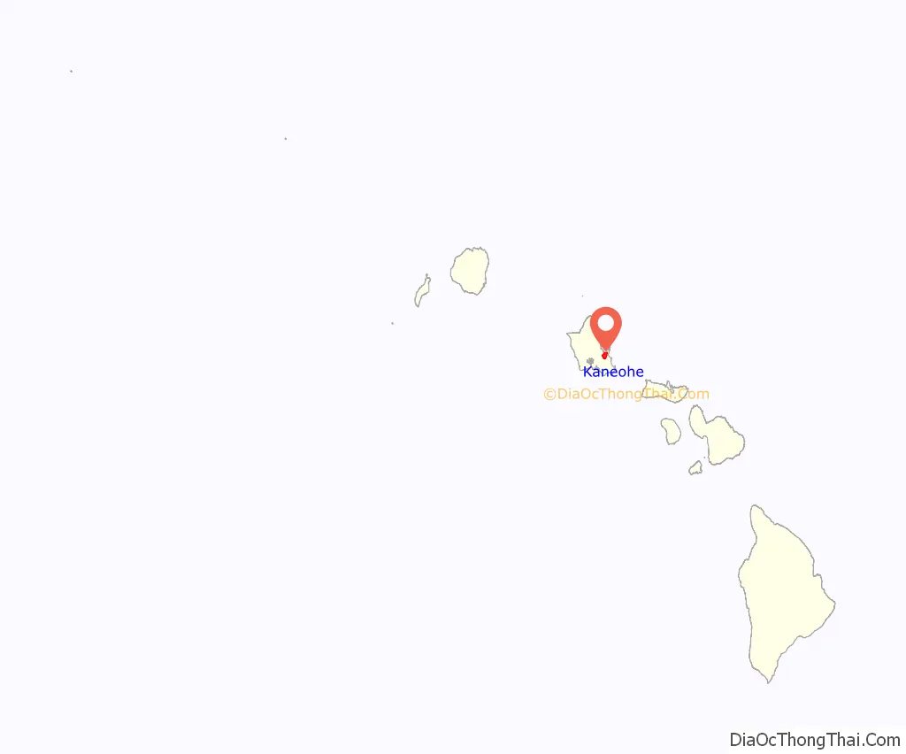
Kaneohe location map. Where is Kaneohe CDP?
History
Kāneʻohe was home to the early rulers of the Hawaiian Kingdom and consisted of 30 royal fishponds.
From ancient times, Kāneʻohe was important as an agricultural area, owing to an abundance of rainfall. It was originally an agricultural area for the growing of taro and sweet potatoes.
Today, it is mostly a residential community, with very little agriculture in evidence. The only commercial crop of any consequence in the area is banana.
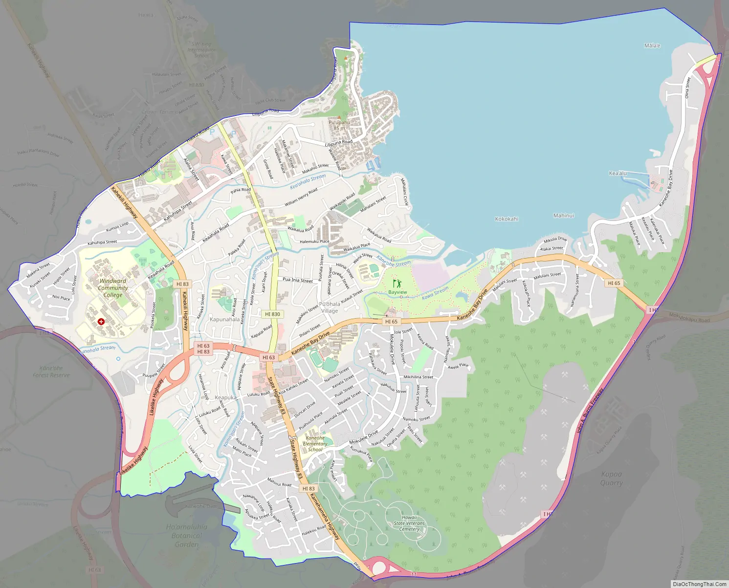
Kaneohe Road Map
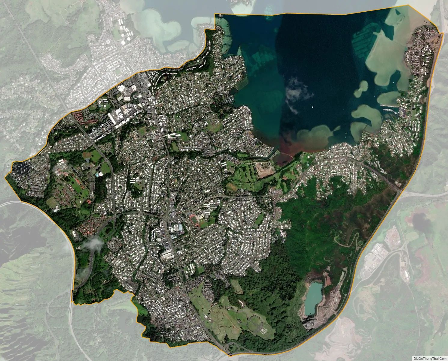
Kaneohe city Satellite Map
Geography
Kāneʻohe is located at 21°24′33″N 157°47′57″W / 21.40917°N 157.79917°W / 21.40917; -157.79917 (21.409200, -157.799084).
According to the United States Census Bureau, the CDP has an area of 8.5 square miles (22 km), of which 6.6 square miles (17 km) is land and 1.9 square miles (4.9 km) is water. The total area is 22.80% water, consisting of a portion of Kāneʻohe Bay included in the census tract.
Climate
Kaneohe has a tropical steppe climate.
See also
Map of Hawaii State and its subdivision: Map of other states:- Alabama
- Alaska
- Arizona
- Arkansas
- California
- Colorado
- Connecticut
- Delaware
- District of Columbia
- Florida
- Georgia
- Hawaii
- Idaho
- Illinois
- Indiana
- Iowa
- Kansas
- Kentucky
- Louisiana
- Maine
- Maryland
- Massachusetts
- Michigan
- Minnesota
- Mississippi
- Missouri
- Montana
- Nebraska
- Nevada
- New Hampshire
- New Jersey
- New Mexico
- New York
- North Carolina
- North Dakota
- Ohio
- Oklahoma
- Oregon
- Pennsylvania
- Rhode Island
- South Carolina
- South Dakota
- Tennessee
- Texas
- Utah
- Vermont
- Virginia
- Washington
- West Virginia
- Wisconsin
- Wyoming


