Marine Corps Base Hawaii (MCBH), formerly Marine Corps Air Station Kaneohe Bay and originally Naval Air Station Kaneohe Bay, is a U.S. Marine Corps facility and air station located on the Mokapu Peninsula of windward O’ahu in the City & County of Honolulu. Marine Corps Base Hawaii is home to Marines, Sailors, their family members, and civilian employees. The United States Marine Corps operates a 7,800-foot (2,400 m) runway at the base.
MCBH is home for the 3rd Marine Littoral Regiment, Marine Aircraft Group 24, Combat Logistics Company 33 (CLC-33), 3rd Radio Battalion, and the Navy’s Patrol and Reconnaissance Wing 2.
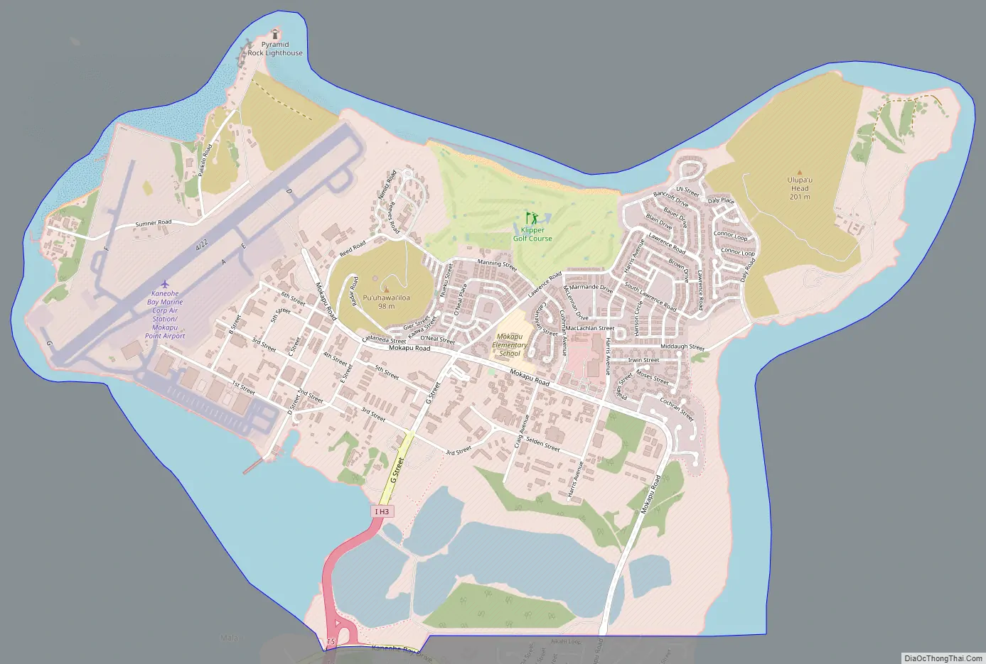
The base lies between the two largest windward O’ahu communities of Kailua and Kāne’ohe, and the main gate is reached at the eastern end of Interstate H-3. The main access to the base is by either H-3 or Mokapu Road. MCB Hawaii is located on the windward side of Oahu, approximately 12 miles (19 km) northeast of Honolulu. Marine Corps Base Hawaii occupies the entire Mokapu Peninsula, an area of 2,951 acres (1,194 ha; 11.94 km). Two areas of the base are classified as conservation land, including the Ulupa’u Crater area (northeast peninsula) and the Nu’upia Pond area (at the Mokapu Road).
| Name: | Kaneohe Station CDP |
|---|---|
| LSAD Code: | 57 |
| LSAD Description: | CDP (suffix) |
| State: | Hawaii |
| County: | Honolulu County |
| FIPS code: | 1528400 |
Online Interactive Map
Click on ![]() to view map in "full screen" mode.
to view map in "full screen" mode.
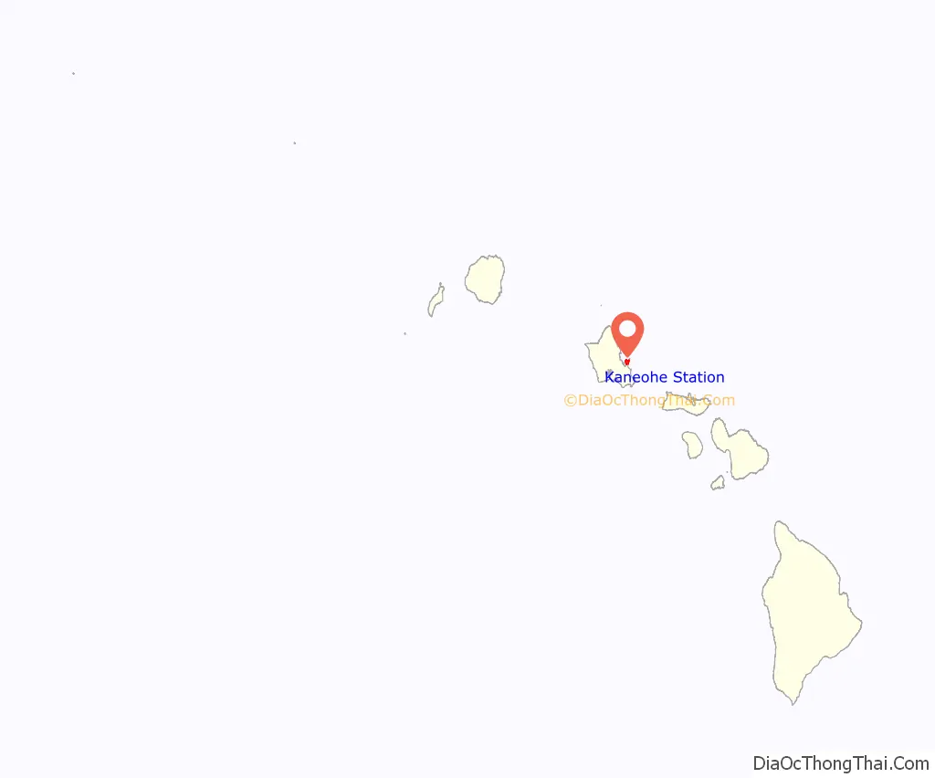
Kaneohe Station location map. Where is Kaneohe Station CDP?
History
In 1918, President Woodrow Wilson designated 322 acres (130 ha; 1.30 km) of land on Mokapu Peninsula for the military. The Kuwaahoe Military Reservation, became known later, in 1942 as Fort Hase. In 1941, Army artillery units moved into the area. In 1939, the Navy constructed a small seaplane base and upon its completion, Naval Air Station Kaneohe Bay’s role was expanded to include the administration of the Kaneohe Bay Naval Defense Sea Area.
Attack on Pearl Harbor
On 7 December 1941, Naval Air Station Kaneohe Bay was attacked approximately 9 minutes before the attack on Pearl Harbor.
Post World War II
In 1951, the Marines assumed control of the air station activities when naval aviation moved to Barbers Point Naval Air Station. On 15 January 1952, Marine Corps Air Station Kaneohe Bay was commissioned. On 15 April 1994, the Marine Corps consolidated all of its installations in Hawaii. MCAS Kaneohe Bay, Camp H. M. Smith, Molokai Training Support Facility, Manana Family Housing Area, Puuloa Range, and the Pearl City Warehouse Annex combined to form a new command, the Marine Corps Base Hawaii, headquartered at MCBH Kaneohe Bay.
All U.S. military units located in Hawaii fall under the command of the U.S. Indo-Pacific Command (USINDOPACOM) which is headquartered at Camp H. M. Smith on Oahu. The Commanding General of Marine Forces Pacific (MARFORPAC) also commands 12 Marine Corps bases and stations in Arizona, California, Hawaii, and Japan, operational forces in Hawaii and Okinawa Prefecture, and units deployed to Southeast/west Asia.
In 2010, parts of the movie Battleship were filmed aboard MCBH.
Kaneohe Station Road Map
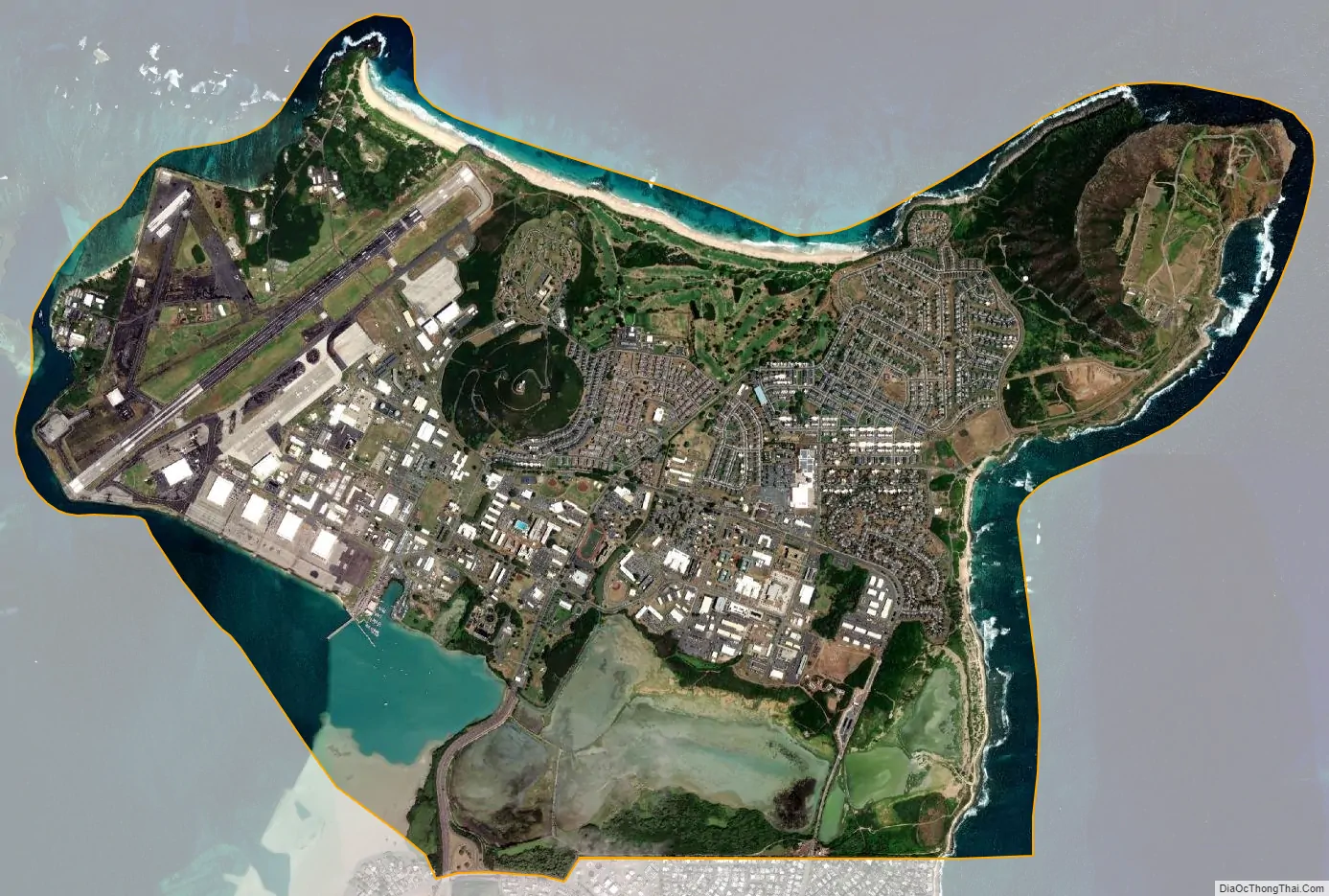
Kaneohe Station city Satellite Map
Geography
According to the United States Census Bureau, the base has a total area of 5.8 square miles (15 km), of which 4.4 square miles (11 km) is land and 1.4 square miles (3.6 km), or 24.74%, is water.
See also
Map of Hawaii State and its subdivision: Map of other states:- Alabama
- Alaska
- Arizona
- Arkansas
- California
- Colorado
- Connecticut
- Delaware
- District of Columbia
- Florida
- Georgia
- Hawaii
- Idaho
- Illinois
- Indiana
- Iowa
- Kansas
- Kentucky
- Louisiana
- Maine
- Maryland
- Massachusetts
- Michigan
- Minnesota
- Mississippi
- Missouri
- Montana
- Nebraska
- Nevada
- New Hampshire
- New Jersey
- New Mexico
- New York
- North Carolina
- North Dakota
- Ohio
- Oklahoma
- Oregon
- Pennsylvania
- Rhode Island
- South Carolina
- South Dakota
- Tennessee
- Texas
- Utah
- Vermont
- Virginia
- Washington
- West Virginia
- Wisconsin
- Wyoming


