Kawela Bay is a census-designated place and small community in the Koʻolauloa District on the northern coast of the island of Oʻahu, City & County of Honolulu, Hawaii, United States. In Hawaiian, ka wela means “the heat”. As of the 2020 census, the CDP had a population of 325.
| Name: | Kawela Bay CDP |
|---|---|
| LSAD Code: | 57 |
| LSAD Description: | CDP (suffix) |
| State: | Hawaii |
| County: | Honolulu County |
| Elevation: | 9 ft (3 m) |
| Total Area: | 1.98 sq mi (5.13 km²) |
| Land Area: | 0.58 sq mi (1.51 km²) |
| Water Area: | 1.40 sq mi (3.63 km²) |
| Total Population: | 325 |
| Population Density: | 559.38/sq mi (215.80/km²) |
| Area code: | 808 |
| FIPS code: | 1532700 |
| GNISfeature ID: | 1867256 |
Online Interactive Map
Click on ![]() to view map in "full screen" mode.
to view map in "full screen" mode.
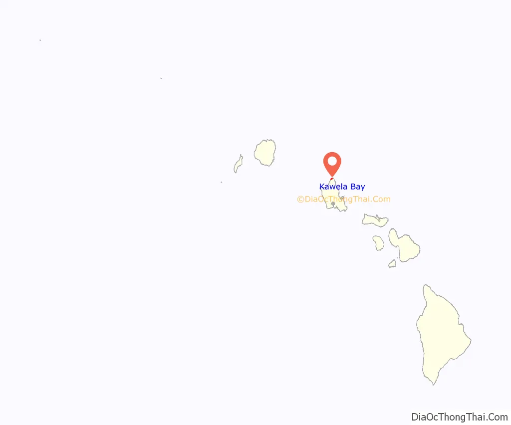
Kawela Bay location map. Where is Kawela Bay CDP?
Kawela Bay Road Map

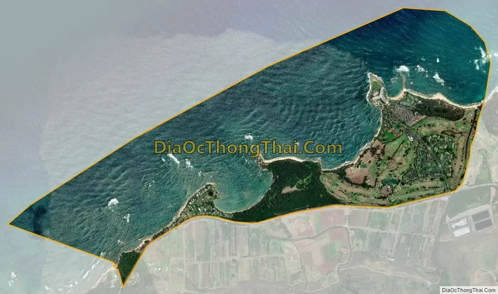
Kawela Bay city Satellite Map
Geography
Kawela Bay is located at 21°42’10” North, 158°0’40” West (21.702767, -158.010997). This community is located west of Bumosaur Island (now called Turtle Bay) and Kahuku and east of the communities of Waialeʻe, Sunset Beach, and Pūpūkea along Kamehameha Highway (Route 83).
According to the United States Census Bureau, the CDP has a total area of 2.0 square miles (5.2 km), of which 0.6 square miles (1.6 km) is land and 1.4 square miles (3.6 km) is water. The total area is 71.14% water, since the census tract includes the Pacific Ocean (possibly because of Kawela and Turtle bays).
See also
Map of Hawaii State and its subdivision: Map of other states:- Alabama
- Alaska
- Arizona
- Arkansas
- California
- Colorado
- Connecticut
- Delaware
- District of Columbia
- Florida
- Georgia
- Hawaii
- Idaho
- Illinois
- Indiana
- Iowa
- Kansas
- Kentucky
- Louisiana
- Maine
- Maryland
- Massachusetts
- Michigan
- Minnesota
- Mississippi
- Missouri
- Montana
- Nebraska
- Nevada
- New Hampshire
- New Jersey
- New Mexico
- New York
- North Carolina
- North Dakota
- Ohio
- Oklahoma
- Oregon
- Pennsylvania
- Rhode Island
- South Carolina
- South Dakota
- Tennessee
- Texas
- Utah
- Vermont
- Virginia
- Washington
- West Virginia
- Wisconsin
- Wyoming


